skip to main |
skip to sidebar
It is the end of May when somehow, miraculously, we finish surveying Aetna Mountain. For the last week we have had a four-person crew, but Carl is due to leave on a two-month trip to Chile in a couple days, so we will drop back to three people. Allison, who has been feeling worse and worse as the days have gone on, has finally gone to see a doctor and has been told that she’s suffering from a severe allergy to something she’s encountered in the forest. The doctor prescribes steroids and tells her she can come back to work. It doesn’t occur to me right off the bat that the doctor has no idea what he’s talking about, but it will soon enough.
Carl is still with us as we do our initial recon of our first Hamilton County site. After Aetna Mountain we figure things have to get easier. We will figure something like this after completing each county and we’ll be wrong every time. Just finding the site is a piece of work. The roads we need are either not on our Tennessee Gazetteer or named something different on the maps than the actual street signage would indicate. Our forestry maps, on the other hand, show logging roads that may no longer exist or may be so treacherous as to be impassable. Of course, there’s no way to determine if a logging road is impassable other than driving down the thing and hoping you’ll notice your impending doom before it’s too late to turn back. But at this point we’re just trying to wind our way through a labyrinthine set of neighborhood roads that turn back and forth in every direction, now seemingly leading us to our destination, now leading us away. We make wrong turns and follow roads to their abrupt ends. We use our GPS machines and compasses to try to stay on course, but these tools are most helpful when we can travel as-the-crow-flies, something we can’t even come close to doing at the moment. People stop what they’re doing and watch us pass, wondering why someone they don’t know is driving down their street. At times like this we’d be hard put to answer them in a way that didn’t sound crazy. At one point we go under a bridge that would seem to lead to our destination, but there is no obvious way up to the bridge. It sits wholly unused above us, apparently coming out of nowhere and almost certainly leading there as well.
Finally, we emerge from a series of roads that have taken us everywhere but straight ahead. We pass a ramshackle barn and a shed filled with old car parts. Ahead of us is the mysterious bridge, a bridge that, while constructed of poured concrete like any highway overpass, appears to serve no function but to drop us onto a deeply rutted dirt road. Then immediately the scene begins to look like home. To the east the landscape drops away and trees stretch out into the distance. A now-familiar queasiness wells up in the belly as the terrain that has to be walked is assessed. This area is more remote than Aetna Mountain, a lost forest tract that we might never be found in, no matter how many helicopters and search dogs were brought out. Some of the transects we need to walk are short; others are over a mile long. There isn’t a cloud in the sky and the day is only beginning to hint at the heat to come later in the summer. Carl laughs and shakes his head, making no secret of the fact that he’s looking forward to getting out of this job and getting to Chile, where it’s surely much safer. We pass a strange house sitting silent at the bottom of a hill. The home looks fairly nice and is surprisingly large but there has clearly been no activity anywhere near it for some time. Along the road sits a dust-covered van and it is anyone’s guess as to why someone chose to build out here. The owner of the house may have driven his van up months ago and promptly died--stroke, heart attack, murder--and no one would ever know. We’re not about to look into it.
We’ve spent so much time trying to find our location that there isn’t much time to survey, so we choose some of the shorter transects and get a taste of what we’re in for; steep hills banked by hemlock and pine beetle kills ringed by blackberry bramble. As what he thinks will be his last act as a forest surveyor, Carl jogs a couple transects to polish off a remote corner. We don’t know yet that we’ll be down to a two-person crew in a matter of days and Carl will eventually find himself back in the woods. We finish up and head back to Knoxville, finally calling it a week, but quickly find that one of the roads we came in on has been torn up over the last couple hours and our path is now blocked by a bulldozer and several dump trucks. We wait some time for the crew to acknowledge us and then wait a little longer for the dozer to grade us a path out. It seems that for the duration of the summer no road will ever be certain.
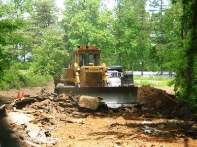
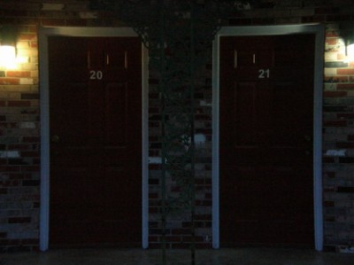
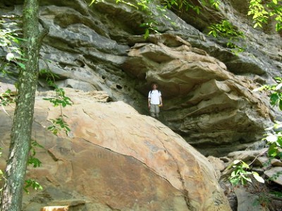
The first photo is a shot of Kelly's Inn, our home in Dayton, TN until we depleted our travel budget and had to start sleeping on air mattresses at a wildlife refuge. The second shot is a rare appearance of your hapless host and, while taken in Hamilton County, it's not the site described above. I could've saved it for a more appropriate post, but I was kinda in the mood to post it. Note the GPS machine in my left hand--the coordinate we needed to find was above me, on top of all that rock. Fun! We'll get to that later. The last shot is of Young Rd., the torn up street I mentioned. Since I had a couple minutes right then I figured I'd snap a shot.
 Carl and I come to the edge of a thicket of raspberry brambles. It’s been rough going for the last couple hundred meters and we are covered in small cuts from the thorns of the bushes. The sweat makes the wounds sting. Our pants have been torn. It’s seems like a mistake in navigation was made at some point but we can’t figure out exactly where. As the brambles finally give way we find ourselves standing on the edge of a large hunting camp. Ahead of us is a green school bus up on blocks, the windows spray-painted black. A huge stars ‘n’ bars hangs across the front of the bus. Sometimes you come upon places that just feel unsettling and unsafe and you want to get away as quickly as possible by the closest means at hand. “I don’t really want to go through this,” says Carl, looking from one end of the camp to the other. This coming from an avid hunter who has struck up jovial conversations with every sportsman we’ve come across. He calls it the “brotherhood of hunters” but apparently doesn’t feel too fraternal with whoever has set up this imposing camp. I look out at the array of shacks and decrepit cars. I see a well with a memorial to a dead man chiseled into the front of it. A barbeque pit. Ropes hanging from trees. Burnt logs. I don’t want to go through it either. I look behind us at three hundred meters of dry raspberry thicket and dead pine trees. “We can’t go back the way we came,” I say. We wait. A tattered plastic tarp flaps in the slight breeze. What looks to be an old flag pole stands in the middle of the clearing. There doesn’t seem to be anyone around.
 We gingerly step out of the bushes and start across the camp. The shacks stand in lines along a dirt road that we quickly cross. Beer cans crushed on the ground. I want to stop and take a picture but something feels wrong and instead I start walking faster. As we reach the far side a jeep turns onto the dirt road and I trot the last twenty feet to the woods. Carl is behind me and a few seconds later we’re both well into the trees. As far as we know, the man in the jeep did not see us. Months will pass before in casual conversation I mention this odd camp to a colleague of mine familiar with the area. “Oh,” he replies. “You want to stay away from there. They don’t like anyone near them and aren’t afraid to prove it. They aren’t even supposed to be up there but no one can get them down.” Yet another disaster amongst a seemingly endless string has been narrowly averted this day.
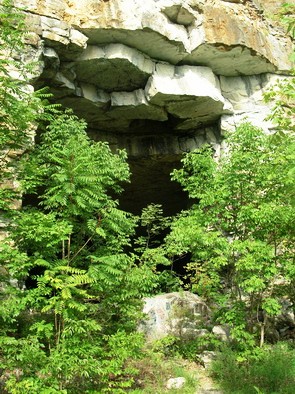
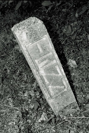
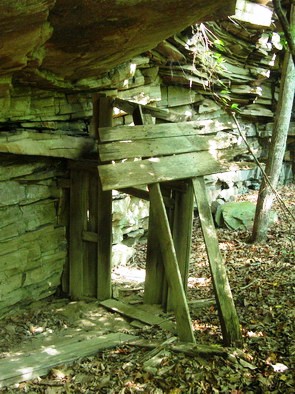
Not photos of the camp, the top being a cave in the Sequatchie Valley and the second a strange marker in the Hinds Valley Baptist Church and Cemetery, 1800-1946. Apparently Tennessee died sometime over that 150-year period and was buried with a cheap headstone.
 It’s Jason’s second day on the job. We’re working lower on Aetna Mountain, skirting a neighborhood known as the “Devil’s Poket” (sic) in Whiteside, TN. The neighborhood is comprised of nothing more than one dead end street located nearly at the bottom of the mountain, merely a small notch of land cut out of the surrounding timber holdings. There are about eight houses on the street. One is a trailer that has been burnt to the ground, only its steel support beams remaining intact, rusting out of the melted debris. A second house looks habitable from the street except that “No Trespassing! Private Property!” is spray-painted across the front in big, black letters. From behind it can be seen that the roof of the house has caved in, the backyard littered with shingles and splintered 2”x 4”’s. The home nearest the outlet of the street is flying a massive stars ‘n’ bars on a pole in the front yard. Railroad tracks run just beyond and when a train stops, as will happen soon enough, there is no way in or out of the neighborhood.
For sometime we have been hearing gunshots. We’ve assumed that someone is hunting birds or getting in a little target practice. Jason and I split off from Carl and the shots become louder now as we come up just behind the neighborhood. Carl has continued on through the woods, but the coordinate were tracking seems to put us somewhere smack dab in the middle of the Devil’s Poket. Rather than stumble through backyards, we opt to cut down onto the road. For a few minutes the shooting ceases.
 We enter the neighborhood and pass a woman and child. They appear to be doing some yard work but as we get closer it’s hard to tell if the property they’re tending is abandoned or not. We wave hello and the woman waves back, then quickly crosses the street with the child and enters another home. Now our GPS unit indicates that our point is actually in the backyard of the house at the end of the block. We have no intention of going into anyone’s yard, but figure we can get close enough from somewhere on the street. Of course, we look ridiculous with all our gear. Soaking with sweat and filthy, holding a GPS unit in one hand and a compass in the other, I spot two people watching us from the top of a driveway near the end of the street. For a moment I consider whether to go up to them and explain what we are doing, but something just doesn’t feel right and so we decide to keep moving through the neighborhood, picking up our pace a bit. Suddenly there’s a crack and a bullet cuts through the trees about 20 feet away. A few more shots are fired before we can take cover behind a row of twenty or so strange brick ovens that have been filled with trash. It’s possible these ovens are the remnants of a coke operation decades previous or maybe they were built when Aetna Mountain was being heavily mined for coal. Whatever the case, they are now protecting us from the residents of Devil’s Poket.
The shots keep coming and I radio Carl, still using the handles we’ve developed in reference to our cheap radio brand, Cobra. “Cobra Two, Cobra One has come under fire and has sought shelter. Please hold your position.” Carl comes back quickly: “I’m on the ground. I hit the dirt as soon as I heard that first round.” It sounds like he’s started laughing. “I’ll lie here until you’re clear.”
We follow the ovens down to the railroad tracks. They can’t hit us at this angle, but we can still hear the gunfire. We skirt the tracks, hop a dirty, trash-filled creek, and head deeper into the woods, finally lining ourselves up with the proper transect. The shots sound further away and finally stop altogether. I radio Carl and tell him we’re safe and he continues on his way. As we walk on Jason and I discuss what’s just happened. “They probably weren’t trying to hit us,” he says. “Just scare us a little. Besides,” he continues, “It sounded like a .22. At that distance it just would’ve stung a little.” I knew right then that I’d hired the right person for the job. And we’d have to come back the next day.
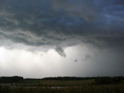
That top shot isn't actually from Aetna Mountain, but was taken at the head of a driveway near Cagle Mountain in Sequatchie County. The second shot is also from Sequatchie County, but the third is out the back porch of the check-in station at the Hiwassee Wildlife Refuge, Birchwood, TN.
