skip to main |
skip to sidebar
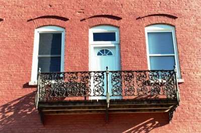
This post might result in a little cognitive dissonance since the photos are from downtown Aiken, SC, but mostly I'm going to talk about the lost towns of Ellenton and Dunbarton and why they're gone. In the late 1940's, following the bombing of Hiroshima and Nagasaki, and amidst growing concern about the Red Menace, the U.S. decided to get (more) serious about making bombs. In 1950, Harry S. Truman gave his approval to construct a massive facility to manufacture nuclear material for hydrogen bombs, chiefly tritium and plutonium-239. This would become the Savannah River Plant, a 300 square-mile chunk of land along the Savannah River, straddling Aiken and Barnwell Counties. Residents of a tiny village named Dunbarton had to leave their homes, as did people living in the larger town of Ellenton. All extant buildings were either trucked out or demolished. One-hundred and fifty graveyards were dug up and the bodies relocated. There are incredible pictures of the moving of Ellenton at the best (and basically only) Ellenton website. (Click on "Photo Library" and "Movin' On".)
The government told the residents of the area that it would buy back their homes, and 6,000 people sold. For all the property, including 210,000 acres of land, the government paid 19 million dollars. The estimated value of just the timber at the time was 28 million dollars. The former residents of what was now going to be one of the largest nuclear facilities in the world were not happy. Many found themselves moving into pre-fab government homes built just beyond the boundaries of the Savannah River Plant. The town was (and is) named, suitably enough, New Ellenton.

If you've been to New Ellenton (pop. 2,500 and probably dropping), then you know its not a thriving town. It never has been. There's not much to it, apart from some gas stations, a sandwich shop, and a couple stores. When Ellenton was vacated, many of the younger residents left the area and never returned. Of those over the age of 50 that tried to make a go of it in New Ellenton, more than half were dead within 10 years. Unable to adjust to being uprooted from their homes, and barred from even visiting the site of old Ellenton (despite living about 10 miles away), the old-timers just dropped away. To see what Ellenton USED to look like, go here. (Click on "Photo Library" and "Ellenton".)
 Would you like some facts regarding the construction of the mammoth Savannah River Plant? Alright, I'll steal some from the Ellenton website. Construction moved enough dirt to construct a wall 10' high, 6' wide, and 2500 miles long. The concrete used would've built a highway 6" thick, 20' wide, and 800 miles long. The reinforcing steel could have made 3300 cars (or a train 30 miles long), while the structural steel could have made a train 8 miles long. The lumber cut was enough to build 15,000 homes. Fifty-two miles of water line were laid. Just the blueprints required 3,000 miles of 24-inch-wide paper. There are 63 miles of railroad track and 230 miles of road within the facility. But my favorite fact is that the very first clover-leaf ever built in the U.S. was built within the Savannah River Plant. Incidentally, in 1990, construction began on a large (and expensive) cooling tower for a reactor. The tower was connected just in time for the reactor to be permanently decommissioned in 1992. Whoops.
In one of those strange but oh-so-common twists of fate, the forces that led to the destruction of Ellenton and Dunbarton (Can you tell that I don't really know anything about Dunbarton?) were responsible for a massive overall boom in the population, and thus the economy, of the Central Savannah River Area. Tens of thousands of workers poured in from all over the country, first to help build the plant, then to work there. Everyone from physicists to secretaries found employment. And they all had to have security clearance to set foot beyond the huge barricades and fences that ringed the entire area. Heavily-armed guards patrolled the grounds on foot, in vehicles, and by helicopter. They still do, although the workforce at the site has been steadily decreasing.
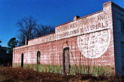
The former site of the Ellenton post office is now a roadside rest area off of SC 125, but most of what was the town is inside the perimeter of the facility. As I've alluded to, the general public is not allowed on what has now been renamed the Savannah River Site. However, in my never-ending quest to explore the forgotten and abandoned areas of the Central Savanna River Area, I got to visit. No, I didn't sneak in per usual!! Honestly, it's not possible. You could be shot trying. There's even surveillance cameras up in trees in the woods. While I couldn't bring my own camera, as it's strictly forbidden, I did see the old town of Ellenton. Lemme tell ya, there ain't nothing left. You can see some old curbs and overgrown clearings where driveways used to be, but nothing else. Pictures wouldn't show much. In fact, they'd look just like this. (Click on "Photo Library" and "Ellenton Today".) The most interesting things are the old two-lane highways with speed limits and other signage still in place, waiting for cars that never come. There's a few small bridges left, as well, and the site of Leigh Banana Case Company, though the buildings are long gone. It seems a shame to have turned those huge, beautiful cypress trees into banana boxes. Oh, and I DID get to go around the historic clover-leaf.
But Ellenton wasn't all sweetness back in the old days either. You may remember that following the Hamburg Riot there was a riot in Ellenton. On September 15, 1876, two black men were arrested for allegedly beating a white woman and a group of armed black men attempted to defend them. In the violence that ensued, 15 blacks, including a Barnwell County legislator, Simon Coker, and two whites were killed. One source has the date for this riot as May 15, 1876, but I have to think it was actually the post-Hamburg Riot riot. If you happen to know that Ellenton was the scene of TWO riots in 1876, please let me know.
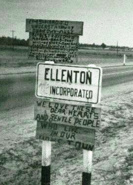 If I still haven't convinced you to check out the photos at the Ellenton website, maybe this will change your mind. So, NO, I DID NOT take this photo. The sign reads: "It is hard to understand why our town must be destroyed to make a bomb that will destroy someone else's town that they love as much as we love ours. But we feel that they picked not just the best spot in the U.S., but in the world." And: "We love these dear hearts and gentle people who live in our home town." Another great photo on the site is called "A Lonely Reminder." Actually, it's not REALLY an Ellenton website. It was put together for a play, entitled "I Don't Live There Anymore: The Ellenton Story," about the evacuation of Ellenton, performed on the 50th anniversary of the event. Former residents came from all over for a reunion of sorts. You can even listen to the soundtrack on the site. Incidentally, I did look for information elsewhere and found a number of links, but they were all dead. Somehow that seemed fitting.
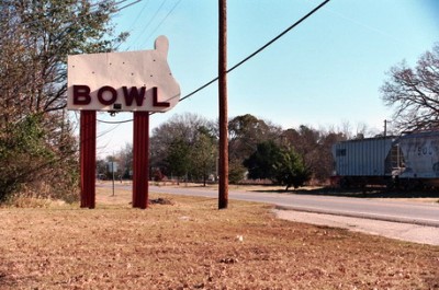
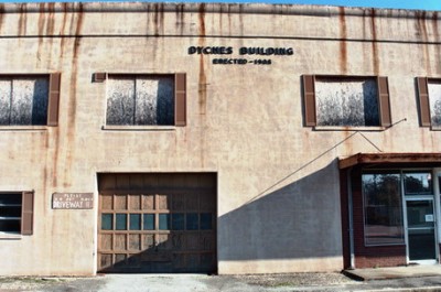
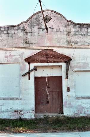
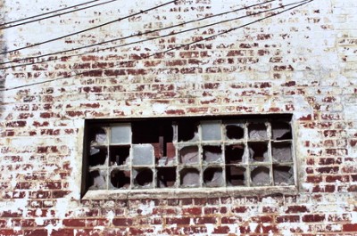
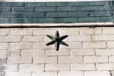
As for the photos in this post, as I mentioned, they're from downtown Aiken. Downtown Aiken is not abandoned, I just made it look like it is. Around each corner is a craft shop or a restaurant or a boutique. Or a horse. One more post from Aiken (not all-color!) next time. See ya.
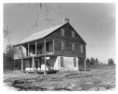
OCTOBER 2019 UPDATE: In response to J. Foreman's comment below regarding the Stagecoach Inn (built in the mid-1700s!), W. Clifford sent CoD this vintage photograph of the place and, happily, wanted it posted here. It's a wonderful shot. The Stagecoach Inn originally stood in Ellenton, SC, but was moved to Aiken, where vandals tragically burned it down.
In fact, I'll quote Mr. Foreman's full comment as it's quite interesting:
"My ancestors (George Foreman 1701-1786) settled on 455 acres in the area of Ellenton in 1745 and shortly after that built the Stagecoach Inn next to the road from Augusta to Charles Towne (as it was called then). The inn remained in the family and operated as an inn until after 1900. It remained after the government took over that area for the Savannah River Atomic facility but was given to the Aiken Historical Society around 1961. They moved it to a location west of Aiken where it was restored to become the headquarters of the group but was burned by vandals before it could open. I'm looking for stories and especially photos of it and would appreciate contacting anyone with information."
Thanks to both W. Clifford and J. Foreman for sharing such fantastic history. And I hope you see this photo, Mr. Foreman! JM
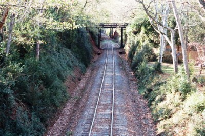
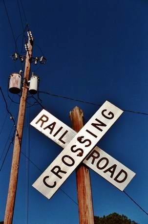 Back again. I decided to go with the "other" well-known city in the CSRA, Aiken, SC, for the next couple posts. Aiken is much smaller than Augusta (pop. 25,000) and was voted one of the U.S.'s top 10 "All-American" cities in 1997. That same year it was voted one of the 10 best places to retire in the U.S. by both Money and Golf magazine. Good grief. So, yeah, Augusta it sure ain't. It's also a "HORSE TOWN." For those of you who don't live in a "HORSE TOWN" (almost everybody), the designation basically means that you'll see horses walking along the side of the road, grazing in municipal parks, and going through the drive-thru at Taco Bell. They're everywhere. I believe both Seabiscuit and Secretariat were from Aiken, but don't quote me on that. In any case, lots of Kentucky Derby participants live and graze in Aiken. In about a month the city will host its Triple Crown Horse Races and the population will double for about three weeks. As for the photo, its one of the many railroad crossings on the outskirts of downtown. No, the sky is generally not purple in Aiken. I dunno what happened.
Aiken is also a much younger city than Augusta. Chartered December 19, 1835, it was named for William Aiken, Sr., President of the South Carolina Canal and Railroad Company. Now, Mr. Aiken was a key player in the building of what was going to be the longest railroad in the world at the time. Which railroad was that? Yes, very good, it WAS the Charleston-Hamburg Railway. Boy, this site is getting downright educational. Anyway, it was Alfred A. Dexter, an engineer from Boston responsible for overseeing the contruction of the railroad, who developed the original plat for Aiken on September 24, 1834. It was Dexter that laid out Aiken in a nice, neat checkerboard pattern with 150-foot wide boulevards and streets named for South Carolina counties running north-south. He also included the planting of numerous trees and shrubs along the thoroughfares. And, you know, the city map still looks pretty much as it did when it was first laid out. If you look to the left of the photo below you can see a white-picket fence and a stately house. Some horseys were grazing behind the fence. Naturally, my attention was elsewhere.
Now, you're probably asking yourself, "Yeah, that's all well and good, but WHY did Dexter put the town where it is?" Well, I'm glad you asked. See, while working on the railroad, Dexter had become a bit smitten with Sarah, the young daughter of Captain W.W. Williams, who owned a plantation right where Aiken is now. 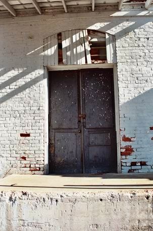 Obviously being a romantic man, Captain Williams was more than happy to give Mr. Dexter his daughter's hand in marriage--if Dexter would re-route the railroad (and, by extension, the town) past Williams' house, thereby vastly increasing the value of the property. The soil near the plantation wasn't all that good for building a railroad whose construction was already pushing the bounds of modern technology, but Dexter had it real bad, so there was nothing to do but move the tracks. Thus, while settlers were in the Aiken area even prior to the Revolutionary War, Sarah Dexter nee Williams is why Aiken is EXACTLY where it is today. Interestingly, residents of the area during the Revolution generally sided with the British. Huh. No, I wasn't drunk when I took this picture of a warehouse in Aiken. The building is listing to the left.
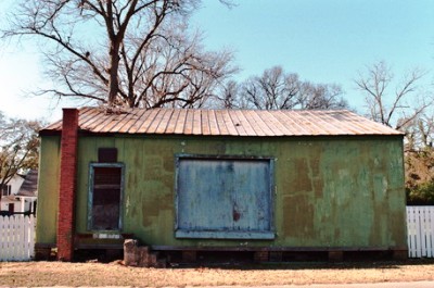
Not much happened in Aiken until 1845 when... Well, actually, a couple things DID happen. One, the town's namesake, William Aiken, Sr., died in 1831 after being thrown from his horse. In 1844, William Aiken, Jr. was elected Governor of SC. Sure, it's likely the two events weren't related, but they were important occurrences for the state. BUT, in 1845, a cotton mill and adjoining town were built out of local granite near Aiken. Which mill was that? Yes, very good, it WAS the Graniteville Mill. Man, sometimes it just all comes together. Kaolin mining was begun by Southern Porcelain Manufacturing Company farther down the valley in Bath in 1856 and Aiken was off and running. In February 1865, General Sherman targeted the Graniteville Mill for destruction, but Confederate soldiers were ordered to protect it and Sherman retreated. Thus Aiken was spared a brutal economic blow. Here's a shot of another warehouse outside downtown.
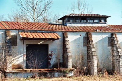
Aiken has always been a bit, er, what's the word? UPSCALE? Being up off the coast, the town offered a summer retreat for folks wanting to escape the humidity, bugs, and general unpleasantness (AKA turning yellow and vomiting blood AKA yellow-fever) of the lowlands. 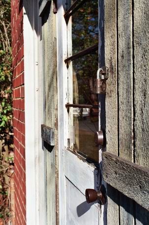 Wealthy Captains of Industry began to bring their families with them from the New England states. And, with wealthy people comes...POLO, natch. The game of polo had only been played in the U.S. for six years when it hit Aiken in 1882. The Aiken Polo Club joined the United States Polo League in 1889 and the town became the "Polo Center of the World." Really, it was called that. The horses have been around in a big way ever since. As have the lobsters. Yessiree, supposedly the good citizens of Aiken began racing lobsters as a spoof on the Kentucky Derby. Every May folks bring out their best racing lobsters and have at it. The winner gets to go free. The winning lobster, that is. As for me, I was REALLY getting into warehouses, I guess.
We're gonna stay in Aiken for a couple more posts 'cause, dammit, I got more to say. Thanks to the City of Aiken and Mike Sigalas's Moon Handbook of South Carolina for filling in the details for this post. Just a couple more things: If you're still looking for a City of Dust soundtrack 'cause you don't always have the blues, might I recommend Sharon Jones and the Dap-Kings? Ms. Jones is a native of Augusta and it shows in the mean blend of funk and soul that her and the band whip up. James would be proud. I didn't know they still made this type of music, but after catching a show this week, complete with a song about Augusta, I'd say check it out by all means. She's got a few more shows in the US and then it's over to Europe, so all my French readers should be on the lookout. Um, yeah. Here's a wide boulevard lined by live oaks, just as Alfred A. Dexter envisioned it. Well, without the cars and pavement, but still. Y'know I can't help but wonder if Sarah ever knew the terms of her betrothal.

Finally, Brendan Canty, drummer for one of the finest rock bands the planet has produced in the last 20 years, Fugazi, recently released a DVD entitled "Burn to Shine" that fits right in with the theme here. He had bands come in and play a single song in an abandoned house in Washington DC that was going to be set on fire for a fire department training exercise. I really dig the concept and he's got plenty of talent from Dischord Records folks and others, including the always-worthy Bob Mould. Even the still photography of the old house is cool and the final shots of the place going up in flames make me think I should take up arson. Anyway, it's going to be a full series of sessions in different cities. If you've got the bands and the locations, let 'em know. It seems like there's some kind of abandoned places, uh, zeitgeist, or something. Is it a statement about our culture? Hell, I might as well mention another Brendan Canty project, Pancake Mountain , a great kid's show featuring many of the musicians that show up in Burn to Shine. It's good stuff. Hey, I can appreciate a sheep puppet asking former presidential candidate John Anderson for campaign advice just as much as any seven-year old. Oh, and, geez, one more plug. It's not The South, but check out Weird New Jersey. Wouldn't it be fun to do the same in YOUR town? Okay, back on the railroad tracks and heading further into Aiken for next time. Adios.
P.S. Notice the first all-color post? Bright and snappy, eh? Don't get used to it...
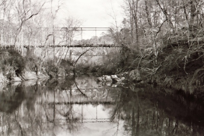
Alright, now that we've gone as far north as Plum Branch, let's go just a little bit east, into the Sumter National Forest. Three creeks flow through here: Wine Creek, Steven's Creek, and Turkey Creek. I don't know a whole lot about the area, other than that the mountain biking is really great. Oh, and I also know that two Revolutionary War battles were fought nearby. The Battle of Steven's Creek occurred on September 5, 1781, and the next day the battle of Turkey Creek was fought. Incidentally, one of the last officer casualties of the Revolutionary War was a South Carolina native. Colonel John Laurens, a one-time aide to George Washington, was killed August 25, 1782, after failing to convince first the South Carolina and then the Georgia state legislatures to allow him to assemble a regiment of slaves, an idea which had the support of Washington. You want more info on the area? Well, one of only four known populations of the rare Carolina heelsplitter (Lasmigona decorata) mussel inhabits Turkey Creek. Here's a photo of Turkey Creek. That's the old bridge in the foreground above; the new and still usable SC 283 bridge is in the background.
Now, some of you may have noticed that I didn't say much about Clark's Hill, the town closest to the J. Strom Thurmond Dam. Although I did mention that the dam itself was originally Clark's Hill Dam. At that time, the reservoir was known as Clark's Hill Lake. Folks in Georgia weren't happy when a name change for the reservoir was snuck though Congress after the dam had been renamed. Some people STILL call it Clark's Hill Lake. Anyway, I didn't really know much about Clark's Hill at the time. Now, I still don't. 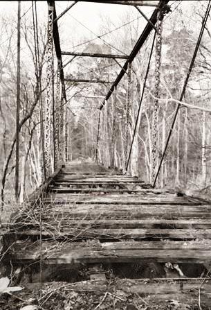 But I do know something about the town's namesake, Brigadier General Elijah Clark, the Hero of the Hornet's Nest, frontiersman and Revolutionary War hero. Born in Edgecombe County, North Carolina, in 1733, Clark moved to what is now Lincolnton, Georgia in 1774. When the Revolutionary War began, Clark joined a militia and earned his nickname for his voraciousness in fighting Tories. "The Hornet's Nest," by the way, refers to the area in Georgia where Clark resided. Clark fought in the battles of Alligator Creek, Kettle Creek, Musgrove's Mill, Fish Dam, Blackstock's, Long Cane, Beatties Mill, and participated in the two sieges at Augusta, helping to successfully defeat the British in the second. Here's another shot of the old bridge at Turkey Creek. Usually, if something is abandoned, I look for a way in, up, down, or across. Here, proving that I'm not a complete idiot, I decided to be content with just a picture from the far end.
Here's a good tale about Elijah Clark's wife, Hannah. (Thanks to Beverly L. Pack, whoever you are.) During the war, Hannah Clark made some of those shirts that have ruffling down the chest for her handsome husband. You know, the kind fancied by English rock stars in the 1960's, such as Pete Townshend, Brian Jones, and Jimmy Page. Well, Jimi Hendrix liked them too, but he'd lived in London for a bit himself. Anyway, apparently Englishmen have always been known for coveting these frilly shirts, because Hannah was so afraid the British were going to steal them and wear them that she hid all the shirts in the smokehouse when she knew Redcoats were advancing. Somehow raiders heard about the shirts and searched the Clark property, eventually finding the sartorial treasure, while Elijah, a fugitive from the Tories, was out fighting. Not content with just frilly-bosomed shirts, the Redcoats burnt Hannah's house to the ground. No one was injured, but everything was destroyed, save a patchwork quilt made by Hannah's daughters. As if THIS wasn't enough, when Hannah rode away from her smoldering house on her only horse she came across some British troops who tried to take the quilt. Hannah was pissed 'cause the raiders had already stolen the frilly shirts and torched her house and now these guys wanted the quilt her daughters had made for her and so she refused to give it over. The Tories responded by shooting at her, wounding her horse. Hannah didn't budge. Finally, a Redcoat said, "So brave a woman should not be robbed," and the band of marauding would-be quilt thieves rode off. Back in North Augusta, here's a joist ornament from the old ceramic shop just across the bridge on 13th St.
Hannah Clark was a tough cookie. After the house was burned, Elijah moved his family to Tennessee, but when he was severely wounded in the first siege of Augusta in 1780, Hannah rode back with twin babies to nurse him. Later, while riding with these same twins, British troops shot her horse out from under her. 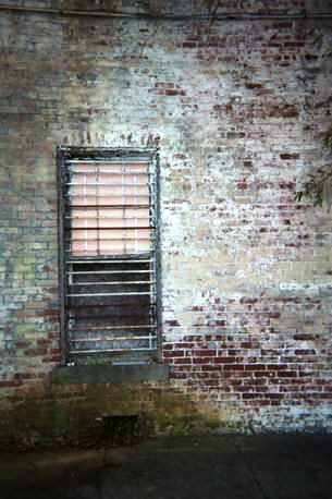 Hannah was at the second siege of Augusta, in 1781, when Fort Cornwallis was surrendered. Eventually dubbed "The Heroine of the Hornet's Nest," Hannah was considered one of the Revolutionary War's greatest women. Elijah died in Richmond Country, Georgia, in 1799. Hannah lived into the late 1820's. The original burial plots in Lincolnton, GA were going to be inundated by the dam reservoir, so the bodies were exhumed and buried in unmarked graves where they were promptly neglected for a number of years. However, the Clark's graves are now a tourist attraction at the aptly named Elijah Clark State Park in Lincolnton. We're back in Augusta proper now, at the corner of Telfair St. and James Brown Blvd. Through the window is an abandoned bar, empty for over a decade. Man, it's been a long time since we've been back in Augusta, hasn't it?
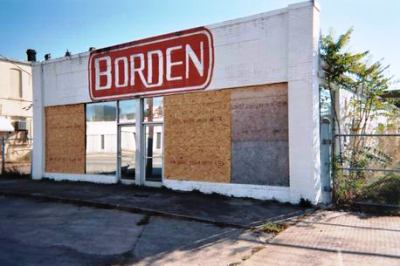
A couple items of business: It's come to my attention that there were some formatting problems in Mozilla and Safari. The Mozilla errors have been fixed. I hope that fixed Safari as well. If you experience problems in your browser, please let me know. I'll go in, screw everything up, and fix it in about, oh, six or seven hours. Also, I have some revision work to do on a manuscript. This means I'll be in front of a computer a lot. As I can only stare at a monitor for so long each day, it might be a week or so before I get back to you. In the meantime, browse the now-error-free archives, leave cryptic comments, or just wait a bit to come back. For the next post I'm undecided as to whether to go up the Aiken-Augusta highway to, uh, Aiken, or take a road trip to Cumberland Island. Any opinions? Otherwise, it'll be a surprise. On the other corner of Telfair St. and J.B. Blvd. was the Borden's building, shown below. Makers of fine glues and adhesives. I was down here the morning the mirrored windows were smashed and I don't know why I didn't take a photo then. Duh. Maybe I didn't have a camera with me. I also don't know why I didn't step through the broken windows at the time to see what was inside. I rarely mess with my shots, but I recall rolling a large trash bin full of broken glass out of the way here. This building has since been torn down.
Before I go, I just want to leave you with a quote from Steve Thayer's fine noir novel, Saint Mudd. Here, a character is leaving Sioux Falls, SD and driving to St. Paul, MN: "He rested his wrist on the wheel and bounced east, past decaying barns and farm homes that were home only to the wind. The clouds of dirt he raised made the mirrors useless, but it did not matter; he knew what was back there. Dust. Dust, where corn fields were supposed to be knee-high by the Fourth of July. Dust, where golden rows of wheat were supposed to grow. Everywhere he looked, amber waves of dust." Happy Saint Valentine's Day from the City of Dust! See ya in a week or so.
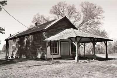
We're gonna make like Colonel Kurtz and head farther up the river. And so it is that we get to Parksville, SC. Parks Store, SC was renamed Parksville in 1882 after the late Richard Parks, a wealthy fellow who had owned some mills. Surprise, surprise. This was right around the time that the Augusta-Knoxville Railroad was making its way to McCormick, SC, a bit to the north. Parksville is the only town situated on the banks of Lake Thurmond, the huge reservoir created by the similarly named J. Strom Thurmond Dam. This is a photo from outside of Parksville. Inside is a fully furnished living room from decades ago. I have a photo of the weather-damaged painting of a lake and mountain that hangs over the sofa but 1.) it's not digitized (yet); and 2.) it's not always easy taking photos of trash and turning it into "art." It's even harder taking pictures of trashed art and turning it into "art." The above shot was taken with a disposable, which I don't recommend. But you gotta work with what ya got, sometimes.
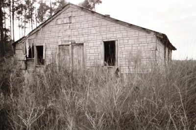
There's a good story about Parksville that I think fits right in with City of Dust's sunny disposition. In the 1880's, when the Savannah River Railroad was under construction, the Park family cemetery happened to be in the way of the future station. Thus it had to be moved and the townspeople found the grave of the town's namesake, Richard Parks, being exhumed and loaded onto two horses. While being transported, the lid slid off the casket and there, under the old viewing glass, was the body of Mr. Parks, perfectly preserved. Everyone was happy to see him again, so they held another viewing for relatives, friends, neighbors, school kids, and anyone else that wanted to show up. You don't think that's strange?! Then consider that Richard Parks had been dead since April 16, 1861, the same day that shots were fired at Fort Sumter beginning the bloodiest war in American history. The shot below is another shack on the outside of town.
Further upriver we come to Plum Branch, which was named after the plum bushes that grew along a nearby stream. However, it wasn't always where it is today. Originally just a stop on the stagecoach line, the town was moved following construction of the railroad. Founded in 1902, Bracknell's Store, owned by John Bracknell, was a Plum Branch insitution, providing its customers with goods "from the cradle to the grave." At the age of eighteen John Bracknell also became president of the town bank, making him the youngest bank president in history. How's that for trivia? Bracknell held on as long as he could through the Great Depression--his bank was the last of thirteen in the county to close--and he even went to Augusta to get cash, reopened the bank, and paid off all his depositors before the bank shut for good a month later. Bracknell's Store finally shut its doors in the 1980's and for all I know the shot below IS of Bracknell's store. It's way better if we say it is, isn't it? (UPDATE: It's not. See comment below.)
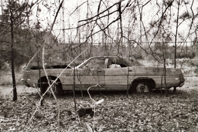
Okay, we're out o' shacks. Was that a sigh of relief I heard? I'm going to try to put up a few shorter posts to dispel any notions that the site is languishing. Also, man, it's hard work doing those eight-photo 1500 word essays. Hey, I like doing 'em, but they slow things down. Next time we're going to swing by Turkey Creek, then head back to N. Augusta. Here's a car on the way to Turkey Creek, suitable for living in when you get kicked out of your shack.
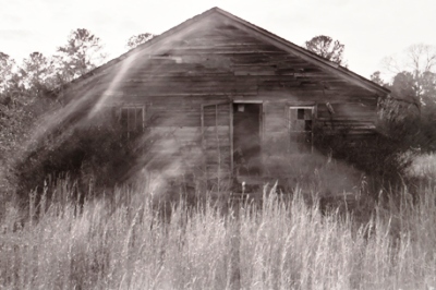
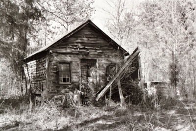
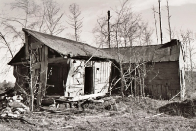
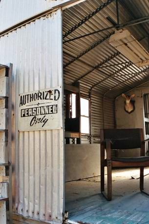 We're going to take a little road trip here. We'll head northwest, up the Savannah River on South Carolina Highway 28, never getting too far away from the water. If you take this drive, once you leave North Augusta you'll quickly find yourself in a landscape of old shacks. If you're the sort who's inclined to get out of your car and go into the shacks, you can have your own sort of low-rent Parade of Homes. Only, they're shacks. Parade of Shacks. It's more interesting than the Parade of Homes, anyway. Take this aluminum shack, located in the middle of a pine clearcut. It appeared that it had been used for meetings. What were they meeting about in the middle of nowhere? Beats me. Not being authorized, I could only get a picture from out front.
One of the first noteworthy things we see on our drive is the J. Strom Thurmond Dam, which controls the Savannah River as it flows toward Augusta. In the early part of the century, Augusta was underwater a lot. The first recorded flood was in 1796 and carried off a bridge, a warehouse, and a wharf. It was called the Yazoo Freshet. A freshet is sort of a cute word for "flood." By the early 20th century Augusta was a bustling city and the floods naturally did more damage. A flood in 1908 killed 18 people and destroyed every single bridge. Another flood in 1911 brought the number of times Augustans had found themselves bailing to something over 20 and resulted in the construction of a levee. The levee worked...for awhile. A huge flood in 1929 increased the river's flow to 36 times its average rate and overtopped the levee, which was subsequently heightened. But people had lost confidence in the levee and, in 1940, after a storm swelled the Augusta Canal, killed three people, and flooded 50 blocks, the ball began rolling to build a dam. Here's another shack in the same clearcut as the one above.
Completed in 1954, the Clark Hill Dam (later renamed in honor of J. Strom Thurmond, like most things in S. Carolina) is over a mile long (5,680 ft.) and 200 ft. high. It's a good bike ride across. The area designated for the dam encompasses 137,000 acres of land and water, and the 70,000 acre reservoir is one of the largest inland water bodies in the South. The dam impounds water for 40 miles up the Savannah River and 26 miles up the adjacent Little River. Remember when Burt Reynolds, Jon Voight, and Ned Beatty went canoeing down the (fictional) Cahulawassee River in north Georgia, just before the river and the town of Aintry were put underwater by a dam? "Dammit, they're drownin' the river. Just about the last wild, untamed, unpolluted, unf--ked-up river in the South. Don't you understand what I'm sayin'?" Anyway, people living along the banks of the river in N. Augusta now hope that the dam was built to be as sturdy as old Strom himself. If you take the Riverwalk, you can see markings representing high water in each of the major floods. Some were definitely doozy's. Incidentally, in 1916, a fire in Augusta levelled 32 blocks and 746 buildings. There wasn't much left. As far as I know, Augusta has never been visited by a plague of locusts...but there was the bollweevil. For some reason I never took a picture of the dam. So, there'll be no corresponding picture with this paragraph in honor of the dam's absence.
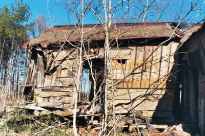
Just past the dam is the town of Modoc, SC. In 1875, the town of Bountwell, SC was established. At that time the US Government had just ended a protracted war with the Modoc tribe of the Northwest. In 1873, the Modoc subchief Captain Jack shot Gen. Edward Richard Sprigg Canby, who'd been sent to broker a deal to get the warring members of the tribe out of California, where they'd been hiding, and back to the Klamath Reservation in Oregon. Thus the army went after Captain Jack (again), but the Modoc were tired and many surrendered. On June 1, 1873, Captain Jack was captured. He and three of his warriors, Boston Charley, Black Jim, and John Schonchin, were hanged on Oct. 3, 1873. During the fighting the Modoc had scalped a number of men who'd been working on laying a rail line. When the train depot was built in Bountwell in 1882, the name of the town was changed to Modoc, in honor of a station of the same name on the much-beleaguered line in the Northwest. I don't really know why the original station was named after the folks that wanted to scalp the railroad workers, but apparently renaming Bountwell as Modoc was intended as a snub to the tribe. Above is a happy color photo of the shack in the clearcut, just outside Modoc.
 Geez, I just gotta say a word about J. Strom Thurmond. As you may know, Strom Thurmond was a staunch segregationist for a good part of his political career. After Strom's death just over a year ago at the age of 100, it was announced that he'd had a daughter by a black girl who'd been a maid in his father's home. The affair had occurred back in 1925, when he was 22 and she 16. Thurmond eventually met his daughter in 1941 and had provided money to support her at a pre-arranged meeting once a year ever since. Thurmond called her "a lovely daughter" and she was apparently quite fond of him. That's why she waited until he was dead to say anything. Anyway, there's a story about Strom and a colleague discussing how they were going to deal with a group of African-Americans who weren't too happy about some government policies. Strom laughed, clapped his colleague on the back, and said cryptically, "Don't worry. I'll handle it. I've got an in with these people." Ah, politicians! Yeah, yeah, here's another shot of that same damn shack. No, I don't know what's wrong with me. Which reminds me...
I was perusing Robert Burton's sprawling, three-volume 17th century masterpiece, The Anatomy of Melancholy, and came across an interesting tidbit. Apparently, back in those days, it was thought that you could make a lamp out of a person's blood that would track their life. You treated the blood in a certain way (incantations or alchemy or something), put it in a glass lamp with a wick, and lit it. When the flame was bright, things were going well. When dim, things were looking grim. When it went out...well, that was it. There was also a story of a man who believed that if he were to piss he would flood his town and drown all the citizens. As a result, he'd been holding it for some time. In order to get him to finally relieve himself the doctors had the fire bells rung, then told him the town was on fire and that the only way it could be put out was for him to let go. Burton says it resulted in a full cure. Above is a DIFFERENT shack, just on the other side of the clearcut. I discovered it was also located in the middle of a raspberry bramble.
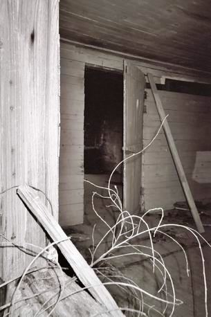
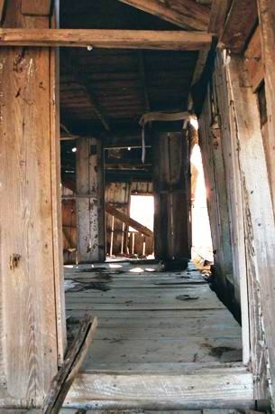
I've got more shacks for next time when we go farther north along the river and check out the Parksville/Plum Branch area. I also just got some film back from my December trip to Augusta. Man, there's some bad shots in there. But I think I can cobble together some halfway respectable posts. Also, I believe I'll be getting a slide scanner, so I can stop saying, "You can't see it 'cause it's not digitized." Now you WILL see it. So, we're set for the foreseeable future. This is the inside of the above shack, in Hitchcockian black and white.
