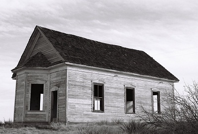
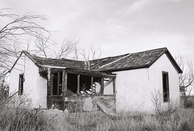
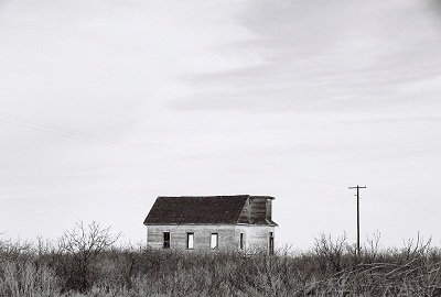
Let’s start the New Year by departing Yeso and traveling Highway 60 east, past Fort Sumner, final resting place of Billy the Kid (we’ll return to Fort Sumner…eventually), to the unincorporated town of Taiban, New Mexico. Taiban is known for its old Presbyterian Church, a lonely, gutted house of worship visited by photographers and the traveling faithful. The church, once part of a neighborhood which included homes, businesses, and the two-story Taiban High School, now sits by itself out on the prairie. Not a single business remains in Taiban. But it was not always this way.
Like Yeso, Taiban was named for a nearby creek. The source of Taiban Creek was Taiban Spring, originally known as Brazil Spring after a Portugese immigrant, Manuel Brazil, who arrived in 1871, the first recorded settler in the area. The meaning of the word “Taiban” is obscure, although it’s thought it might be a Navajo or Comanche word for “horsetail,” a reference either to a local plant or to three small tributaries that flowed into the creek. It’s said that Billy the Kid watered his horse at Taiban Spring.
Also like Yeso, Taiban owed its existence to the railroad. Taiban was founded in 1906, when the Belen Cut-off was laid across the eastern plains of New Mexico, re-directing rail traffic from the mountainous north. A school was built and contracts were drawn for the construction of fifty homes. By 1907, there was a bank and a hotel. In 1908, the Atchison, Topeka, and Santa Fe Railroad began actively encouraging settlement of the region. Over 1,300 trains passed through the plains bringing homesteaders from across the country. But the vast majority of emigrants did not settle in Taiban and, in 1909, the town’s population peaked at 400 residents. These were mostly farmers and sheepherders, already veterans of conflict with both the landscape and established ranching interests.
In the fall of 1908, construction began on the First Presbyterian Church of Taiban. It was completed on December 22, 1908 at a cost of $250, less than $100 of which could be covered by the congregation, necessitating loans from the ladies of the Baptist Church, as well as the Taiban Savings Bank. The first sermon, given by Reverend John R. Gass, was sparsely attended due to cold weather.
Shortly after Taiban was founded a heated controversy erupted over the construction of The Pink Pony Saloon and Dancehall, which, in addition to selling alcohol, was to hold cockfights and house a snake den in its basement. Opened amidst great consternation, the Pink Pony became the only one of 40 businesses operating in Taiban in 1908 to survive into the latter part of the 1930’s.
A settler, Vane Outias, describes his experience arriving in Taiban: "There we were. Piling down off the steps of the jerk-water train at Taiban, New Mexico; Pa, Ma, and the kids. After counting the suitcases, the packages, and the bundles, Ma called the roll. All were present. The bunch of us with Ma herding started for the hotel. We had come out here to file on some land: make a living farming; and when we had proved-up, sell out and go back east (rich).
"On the way to the hotel I made observations for my own particular benefit, namely, there were two places in town which would have thrown Carrie Nation into a frenzy if she had been one of our party, Watch me hurry, as I had come from a dry state. Just as soon as I could find an excuse I was admitted to the bar of the first emporium. I meant to say; when I found an excuse that the Missus would accept.”
Thus alcohol and religion squared off, vying for the soul of Taiban, whose heart was being broken by the farming of an inhospitable and increasingly barren land. Some years the church won out and Taiban was dry. Other year’s, those laws were overturned and Taiban was once again wet. Into the 1930’s, as the Depression and drought deepened, families left the area. Following Prohibition, it was largely liquor that kept Taiban from blowing away entirely. For nearly all of the town’s existence the Taiban Presbyterian Church had played a vital role in the spiritual life of the community, serving Methodists and Baptists, as well, but, with congregations dwindling, the last service was held in 1936.
After WWII, only seven businesses operated in Taiban, which now had a population of 50. The bars were most successful and customers from dry counties in west Texas and Oklahoma came out for a drink. The town even had an airfield, Taiban International Airport, and the wealthy would fly in to purchase liquor. People as far away as western Oklahoma knew Taiban’s reputation as the “bootlegging capital” of eastern New Mexico and west Texas.
But alcohol isn’t enough to save a town that has lost all hope of real prosperity. Passenger and express train service had ceased in Taiban in 1933, the same year telegraph service was discontinued. New highways and decades of difficult-to-impossible dry farming drove nearly all the residents of Taiban elsewhere until, by 1960, only one business remained; a bar. And now there are none.
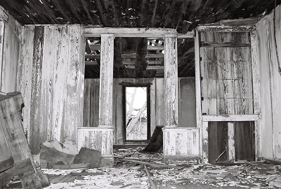
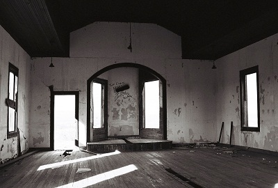
While the battle between God and alcohol played out for many years in Taiban, walking the town site now it appears there was no clear winner. The bars are all gone and turned to dust. The little church stands vacant and exposed, the bell tower removed in 1960, the baby grand piano sold, the doors and windows destroyed by vandals. So, let’s call it a draw…for now. Visitors are starting to leave prayers in the alcove of the church, behind where the old walnut pulpit used to be, so perhaps it will have a new life yet. In the meantime, if you want to see such a fight for yourself, this same battle continues to be played out in towns all across America. Maybe your town is one of them.
Information for this post came from Highway 60 & the Belen Cutoff, by Dixie Boyle. The great quote from Vane Outias was found at THIS De Baca County website. Oddly, although almost no internet sources recount Taiban’s history, one that does offers an incredibly detailed account. Compiled in an attempt to get the Taiban Presbyterian Church on the state Register of Cultural Properties, THIS was my major source for this post. I don’t believe the effort to get the church listed was successful. For once, Philip Varney gave me nothin’.
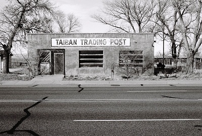
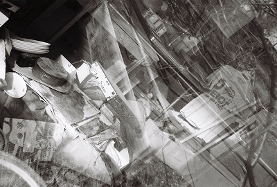
I'd be thrilled if anyone could confirm that there's a Blind Willie McTell record in the window of the trading post pictured above. It's on the opposite side of the picture from the Ross Perot shirts. It would have to be a later period photo, sometime around the "LAST SESSIONS" recording. Anyone? (MAY 2015 UPDATE: It's not Blind Willie McTell, but his former classmate at the Georgia Academy for the Blind, Rev. Pearly Brown, shown on the cover of Wet Willie's "Keep on Smilin'" LP. Thanks Cox family!)
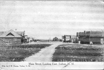
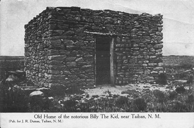
SEPTEMBER 2012 UPDATE: Below are two fantastic postcard images of Taiban. The first is of Main Street, taken from the east. Based on the 1908 postmark, the photo can be from no more than two years after Taiban's founding in 1906. The second is of Billy the Kid's hideout in the area, which has been reduced to nothing more than a foundation now, if even that. Both were submitted by Dave S. Here's what Dave had to say about the postcards, as well as Billy the Kid's capture at Stinking (aka Taiban) Spring in 1880:
"Thought you and some of your posters would like to see these images. I’m an inveterate postcard collector, and found these at one of my haunts. The first is postmarked Sept. 22, 1908 (can’t make out where it was postmarked). I also happen to be an uncrowned 'World’s Foremost Authority on Billy the Kid.' I snatched these up because BtK (and a few of his comrades) were captured at a rock house at Stinking Spring(s) (also called Cedar Spring, Brazil Spring, Taiban Spring, or just 'the spring') in the vicinity of Taiban, on Dec. 23, 1880. (He later escaped.) Frederick Nolan says the spot was first recognized as a strategic location by Kit Carson.
"There isn’t a whole lot of detail in the Taiban photo, but it’s very atmospheric. The scan ain’t the greatest, but you can make out the sign at middle left that says 'HOTEL.' That’s about as much detail as can be seen on the original. Much to my chagrin, I learned that the town wasn’t founded until 26 years later. As they say: Never ass.u.me. It cost me the better part of 40 bucks, but as great/rare cards go that’s not too terribly bad.
"The second image was clearly not BtK's 'home.' He was on the run and this was just an opportune hideout. And it is only 'said' to be the house where Billy was captured. The proof is not iron-clad. Although he provides no citation, Frederick Nolan avers in The West of Billy the Kid that, 'The rock house was a stark stone structure about thirty-feet long and twelve-feet wide, with a rough opening--no door--about ten feet from one end at the front. Inside were five men and the Kid’s horse; tethered to one of the viga poles outside were…three other horses.' Obviously, this description and the photo are not a great match. One could further cloud matters by noting that the nearby Wilcox-Brazil Ranch was of a similar stone construction. But whatever the location of the house, Billy was soon dispossessed of it, and so began his railroading to the gallows. This definitely occurred near Taiban, at a place called Stinking Spring(s). The “stink” at Stinking Spring(s) is said to be either: of a chemical nature, deriving from near-by geological formations, or caused by “decaying vegetation around it.” [Nolan] So are the twists and swirls around virtually everything Billy. There is no escape.
"I’ve been to Taiban, but don’t remember much about it except that there was very little left there. I didn’t try to find the foundation of the stone house, which is all that survives. As I recall, it was a matter of fatigue, and not feeling too terribly welcome there.
"So, anyway, I enjoyed reading your history of the place. I certainly don’t 'own' these images. They're forwarded along to you and yours for whatever purpose they might suggest."
These have to be some of the earliest photos from the Taiban area. I didn't come across them in my research and I imagine they're pretty obscure. So, many thanks to Dave for sending them to City of Dust. Much appreciated!
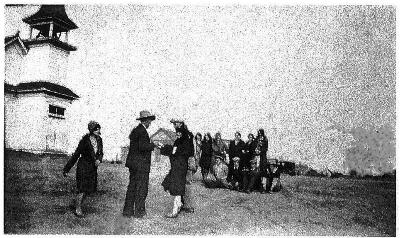
As a last update (for now), here's a 1925 photograph taken outside the Taiban Presbyterian Church when it was in its full glory. This is from the Application for Registration submitted to the New Mexico State Register of Cultural Properties on behalf of the church. The source of the photo is credited as Susanne Eldridge. So, thanks to her, whoever and wherever she may be.
FEBRUARY 2013 UPDATE: A reader recently sent in a wonderful family history of Taiban and a really excellent photo of the town from 1950. The view is looking north with recollections below.
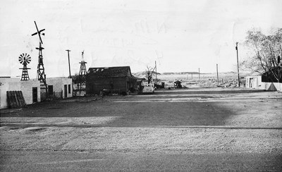
"I bumped into your Taiban, NM site today. My grandparents settled there in 1908. The "Trading Post" was built in 1915 and used by my grandparents in the mid-'50s. The picture credited to Susanne Eldridge is of the church, which is also owned by her. Mac's Bar was just across the street from my grandfather's store and we would watch the cars come and go. Many were bootleggers headed east. My grandfather, J.S. Phillips, came stringing wire for Western Union as the railroad came though. He married my grandmother and settled in Taiban, the "City of the Future." Or at least he thought. He sold Fords and groceries and drilled water wells. He also sold Atwater Kent radios, ran a machine shop, sold gas, and fixed cars. He was very religious and took care of the Church, which was owned by the Presbyterian and Methodist churches. He and my grandmother, Anne Bordeaux, married in 1913. They had seven children and lost a child. I can go on and on. You can go to Facebook and there is a new page, "Remembering Fort Sumner".
David B., Fort Sumner, NM"
Thanks, David! Your contribution really adds a lot to this post. JM
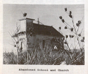
AUGUST 2013 UPDATE: While digging through the dusty corners of the Zimmerman Library at the University of New Mexico a photo of the First Presbyterian Church was unearthed. It's from a rare book titled, "Roosevelt County: History and Heritage," edited by Jean M. Burroughs. Note that the church is actually in De Baca County, about two miles west of the Roosevelt County line. The book was published in '75, so the picture has to be older than that. I'd never seen this spooky shot before, so I thought I'd post it here.
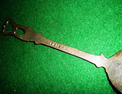
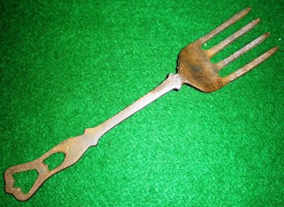
MARCH 2014 UPDATE: Here's something interesting sent in by Rob G. of southwestern Missouri. He found this wrought iron fork at an estate sale and estimates it to have been made between the late 1910's and early 1920's. While it might be hard to read in the photo, it clearly says "TAIBAN" on the back. There aren't many Taiban's in the world, so I have to think this fork might well have come from the little town. I'd love it if someone knew something about this piece.
Thanks to Rob G. for submitting this most intriguing find! JM
JANUARY 2016 UPDATE: D. Burge has submitted a treasure trove of Taiban-related photographs and scans, including the best (only?) shots I've ever seen of the Taiban school and international (?!) airport. Who knew the two were so close to each other? D. Schuyler also offered some information pertinent to the school and J.S. Phillips Garage. See below for these fantastic photos and descriptions. Thank you very much, Mr. Burge and Ms. Schuyler!
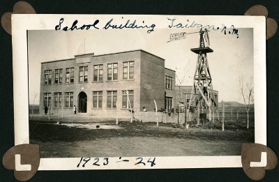
Above is the two-story Taiban school, of which virtually no trace remains. It seems awfully large for a town the size of Taiban and, indeed, only the first floor was used. One room contained grades 1-4, while a second room was for grades 5-8. Beyond that, students went to the high school in nearby Ft. Sumner.
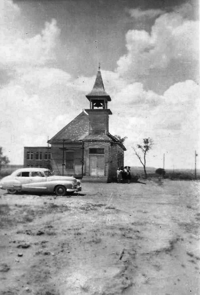
Shown in the wonderful photo above is, of course, the First Presbyterian Church of Taiban in its full glory. Well, aside from the scaffold. Interesting to note is the bit of the school that is also in the frame, just behind the church, pinning down its exact location pretty definitively.
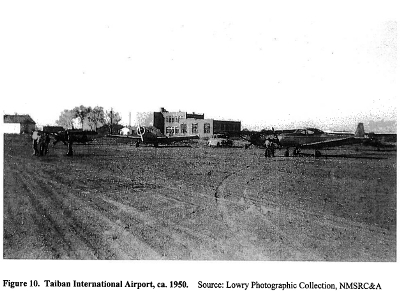
Judging from the scene above the Taiban International Airport was simply the open ground just to the east of the school and church. Perhaps this is how some folks from dry counties in Texas arrived in Taiban to re-stock their liquor supplies. The photo dates from around 1950.
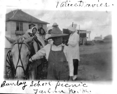
The picture above captures a Sunday school picnic with Alice Davies and her students. Note the Taiban church in the far background. The street immediately behind the picnickers is unrecognizable today.
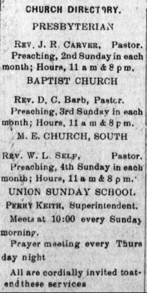
Speaking of Sunday school, the church schedule shown is from the Taiban Valley News and dates to 1917.
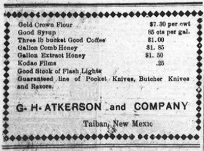
G.H. Atkerson and Company was one of the businesses supplying the items that settlers in the region around Taiban might need or want. Like a gallon of comb honey! Yum! And Kodac Films. I'd like to try shooting some of those films, even if they'd be expired by about 100 years. This is another clipping from the Taiban Valley News of 1917.
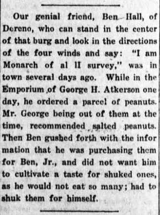
Another thing we know was sold by G.H. Atkerson and Co. were peanuts. And we also know that Ben Hall of Dereno (and founder of the Canyon Blanco Ranch) would purchase them for his son, Ben, Jr. However, not those salted ones! The story above is all the more amusing for its reference to Dereno, a very obscure place in De Baca County that was 12 miles south of Tolar. The post office operated from 1907-1933, but now even the origin of the town's name is lost to the mists of time. This little tale of the dangers of shuked (sic) peanuts is from the Taiban Valley News circa 1921.
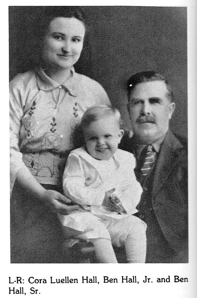
Above is a picture of the monarch of Dereno, NM himself, Ben Hall, Sr., and future peanut connoisseur, Ben Hall, Jr. Mrs. Hall is clearly quite proud! This photo comes from "Living Water: Our Mid-Pecos History: The Families & Events from Fort to Future," a now-rare tome chronicling De Baca County. The book was compiled by Bob Parsons and eight others in 1981 and issued in an edition of 5,000.
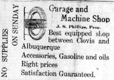
The J.S. Phillips Garage wanted everyone to know that there wasn't much between Clovis and Albuquerque around 1917-1918. They seem to have been well-stocked; you just didn't want to break down on a Sunday. The garage was on the east end of town, one of three open in Taiban by the late-1940's. Descendants of the Phillips family now own the First Presbyterian Church.
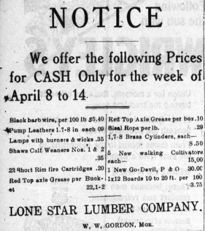
The ad above is for Lone Star Lumber, which supplied a variety of goods, pulled from the Taiban Valley News circa 1918.
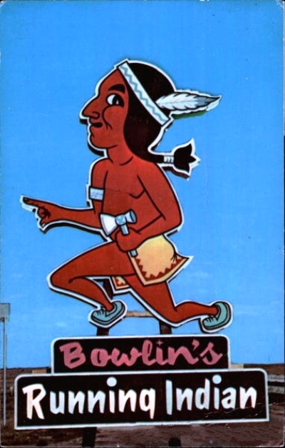
The Pink Pony Saloon and Dancehall was purchased by the Bowlin's family, who were famous for their trading post empire in New Mexico. The Pink Pony became the Running Indian, but may not have lasted long.
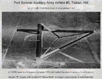
The airfield shown above is different than the one near the top of this update. It was probably located on the caprock just west of Highway 252, which leads north to HOUSE, NM, and used by the military as an emergency landing area back when the Fort Sumner Army Air Base was in operation. The M & M Cattle Company out of Amarillo, TX owned the land going back to the 1970's, but I've not heard who owns it now. It's said that for a long time you could see the outline of the runways, but nature finally reclaimed the place. The photo was taken on October 5, 1943, and comes from an interesting webpage called, Abandoned & Little Known Airfields: Eastern New Mexico.
I'm thrilled to add these rare photos to this archive of Taiban history. Again, many thanks to D. Burge and D. Schuyler for their generous contributions. JM
JANUARY 2018 UPDATE: Another postcard featuring Taiban has been kindly submitted by Dave S., who says, "There’s not a ton of there there, granted, but it does purport to show the actual site of the spring." Also of note is that this is the third postcard Dave has obtained bearing the inscription, "Pub. for J. R. Dumas, Taiban, N.M." One can't help but wonder how many images of Taiban were put on postcards for this Dumas person.
Thanks again, Dave S.! JM
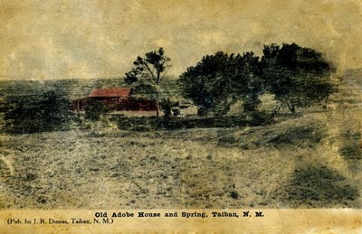
APRIL 2025 UPDATE: I recently received an email passing along some family history from Taiban and thought I'd include it here as it adds to the picture of the area 100+ years ago, It's got some intrigue, and if the folks involved sound familiar, please get in touch! Thanks very much to Susanna N. for sharing this!
"My mother was born in Taiban in 1923. I have been writing a bit of an history about our family as there are a few surprising facts I have learned, and so your blog was really helpful for background, altho most of the posts are from later than my mother’s time…
"So, here is what I know so far…
"We think my grandparents homesteaded in a dugout, and its possible their first child, born in 1914, may have arrived in the dugout, she was born in De Kalb.…their next child was born in Lubbock in 1921, where my grandmother had family. She may have gone to Taiban because she began cooking for the road (or railroad) gangs at around the time my grandfather was arrested and sent to prison in Albuquerque. He was found guilty of transporting a minor female across a state line, (charged using) the Mann Act of 1910. With two children, and no income, my grandmother had to find some kind of work. Interestingly, my mother was conceived and born after my grandfather got out of prison. I have no arrest or trial records so how this all came about, I cannot even speculate, but Grandma must have taken him back….!!!
"When my mother was about 5 years old, my grandfather disappeared out of their lives forever. Subsequently my investigations led me to the Univ of NM who were kindly able to locate the prison record for my grandfather, and the tidbit of information that he died in 1972! But no other information…
"I hope this finds you well, and that some if this information will contribute to your City of Dust archive. Obviously if there is any information you have that corroborates or enlarges any of this story…I would greatly appreciate hearing it!!"


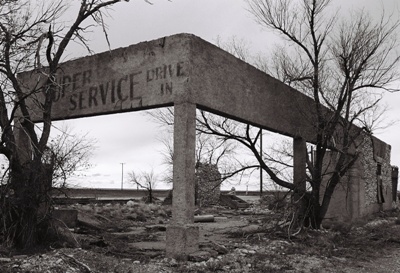
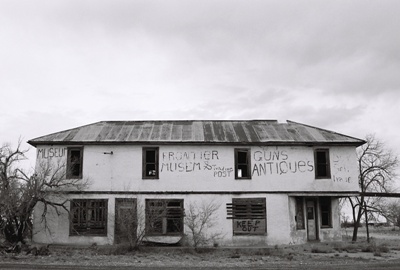
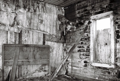
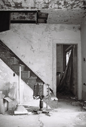 While much remains of Yeso, including the still-decaying remains of several houses--an entire abandoned neighborhood, more or less--and the Frontier "Musem" (once known as the Hotel Mesa, pictured at left), as well as the shell of the Super Service Drive In garage, there have been some casualties. What Varney describes as a possible gas station/garage/motel/residence complex on the east end of town has largely collapsed. This is unfortunate as he mentions that in the sidewalk in front of this structure was the date of construction, June 8, 1929, set in the cement in bottle caps. As far as I can tell, this bit of concrete is now buried under the collapsed walls of the large rock building. Too bad. Several other structures are also showing their years, so, if you’re going to visit, I still wouldn’t recommend waiting very long.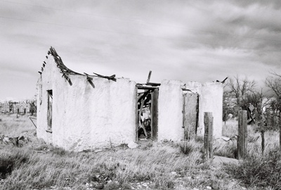
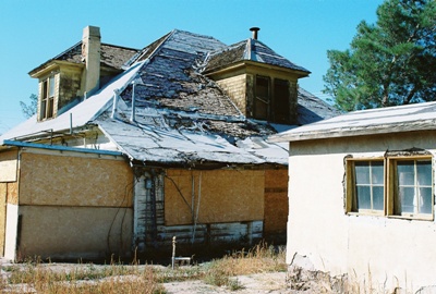
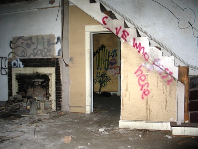
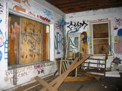
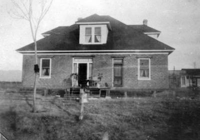
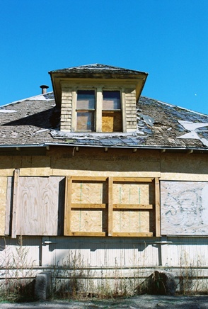 I'd hoped to get inside but the house was boarded up tight. Apparently it had often been wide open, but when I got there thick plywood covered every entrance. All I could do was walk around the outside and take in some of the remaining architectural features. The back shed was accessible but uninteresting and a homeless person had recently taken up residence. After awhile I laid a hand on the 103-year-old house to pay my last respects and then headed home. On Monday, following a whim, I decided to stop by once again and saw that there would now be no problem getting inside. The house was already dark due to the boarded-up windows and the sun was setting, so I didn't have much time, but I tried to get a few decent shots. By the time you read this, the Werner-Gilchrist house will be no more, living on in a few photos and, of course, that episode of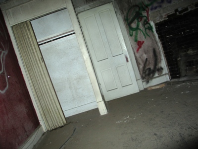
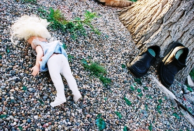
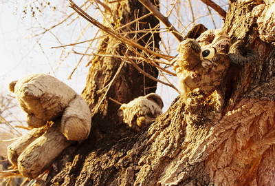
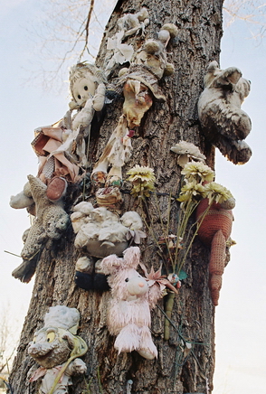 The stuffed toys began to lose their stuffing, with the gorilla bleeding badly out of a large hole in its side. Once I found a collection of CD’s stacked in a corner of the concrete fence. They were not in cases, but were carefully tucked away beside some beer bottles. The music wasn’t what I would have expected, but was better, more obscure, and included the likes of Captain Beefheart, which seemed perfect. In the end, all that remained were some last weather-beaten stuffed animals tied to the tree. The demolition team took down not just those ragged creatures, but the entire tree as well. I wonder what their thoughts were as they considered the last hours of the Aztec Motel.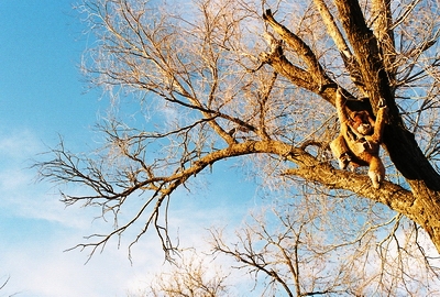
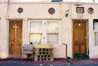
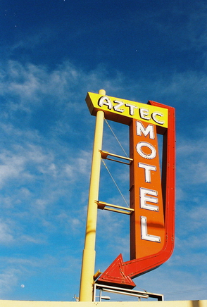 The Aztec Motel was actually the first motel built on East Central Ave. There seems to be some disagreement as to whether it was built in 1931, 1932, or 1933, but it certainly pre-dated Route 66, which was not designated until 1937. Built in a style known as “Southwest Vernacular” and originally called the Aztec Auto Court, the motel had 13 units and three carports. The carports were walled-in sometime in the 1950’s and turned into four additional rooms. This is also when the original neon sign was replaced with the one that can still be seen beside the now-empty lot.
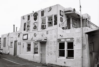
 In any case, in 1991, Mohamed Natha bought the motel and worked to bring it back from the brink. In an effort to cut down on visits by hookers and their clients, as well as drug addicts and petty criminals, Natha began to rent only to long-term residents. A short time later the Aztec began to be extravagantly decorated with found items (of which I’ll say more next time) and underwent a kind of renaissance. The long-term residents were chiefly artists, free spirits, and assorted characters-about-town whose personalities became reflected in the motel itself as a genuine community developed.

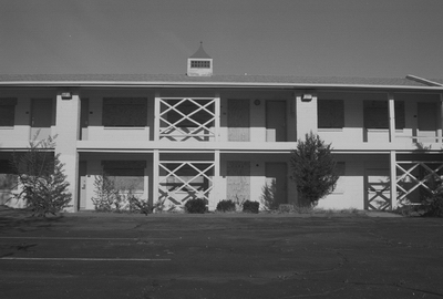
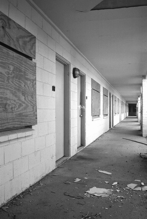 The Silver Moon Lodge, built in 1953, was at 918 Central Ave. SW., not too far from Old Town. The Silver Moon and the Central Park Deli, which was also located on the premises, closed for good on October 15, 2007 after a 54-year run. Then, in the absence of a development plan, the entire complex sat vacant until July of this year. Originally, the place was known as the Desert Skies Motor Hotel. After that, it became the Desert Inn Motor Hotel. Here is (UPDATE: was) a cool POSTCARD from that era. By the 1980’s, a third name change found the hotel billed as the Grand Western Motor Inn. Clyde and Goldie Taylor, who ran the Desert Inn in Santa Fe, owned the business around this time. Here’s one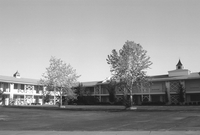
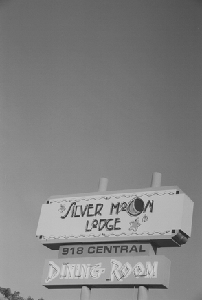 “You can't expect very much from cheap motels, but this place was pretty bad (and not super inexpensive). Everything in our room seemed like it was broken -- the bathroom lights, locks, closet hanger rod, toilet, and curtain rod. On top of that, our towels and all the chairs in the room had mysterious stains on it. The only reason why this place gets two stars instead of one is because the staff was so nice and responded quickly when we phoned about broken lights and busted locks. They also provide free shuttling to and from the airport.”
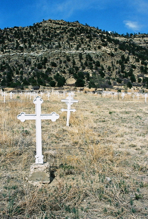 Then, on October 22, 1913, an explosion in Stag Canon Mine No. 2 sent fire spitting 100 feet out of the mouth of the mine. A dynamite charge had been mistakenly set, in breach of safety protocol, and ignited airborne coal dust. A massive rescue effort was undertaken with crews arriving from as far as El Paso, Texas, but only 23 miners survived. The final death toll numbered 263, making the Stag Canon Mine No. 2 disaster the 2nd worst in U.S. history. Two rescue workers were also killed in their efforts. Special white crosses were erected in the Dawson cemetery to mark the graves of those that lost their lives.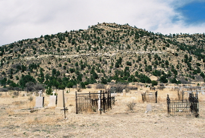
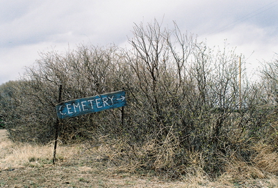
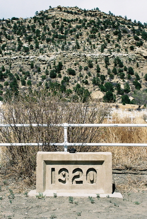 In that time things have changed a bit and I was not about to climb the gate, heavily posted with “No Trespassing” signs, and possibly try my luck with a ranch hand. But the cemetery, which was once just outside of town, is open to the public and is now the only visible remnant of Dawson. Family members still gather at the cemetery to reminisce and remember their loved ones. A number of the graves are well-kept with recently-placed flowers. But other graves are broken and forgotten. There are row upon row of names. Polish, Czech, Italian; many written in the native tongue. One lonely grave is of Marck Zamponi, a member of the “Wagoner 9 Engrs.” The stone simply says “Minnesota” (my home state) and there is an accompanying date of death: June 11, 1927. Did this man leave his family up north behind? Did they even know he was dead, let alone buried below a hill in a sooty coal town in northern New Mexico? After all these years, his story, like so many others, is forgotten and will never be told again.