Wednesday, July 25, 2012

Better Homes and Deserts


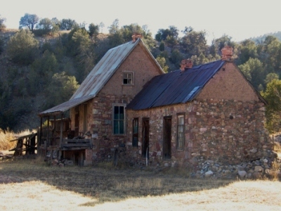
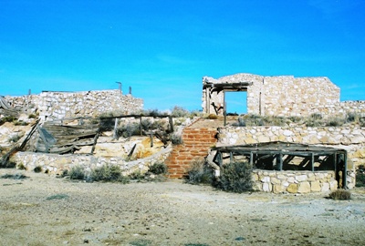
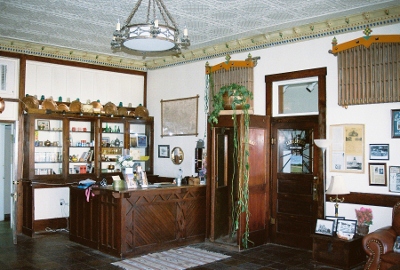
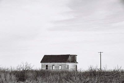
It’s been awhile since I’ve posted about a place that I know absolutely nothing about. But I used to do it all the time. Back in 2004, I wrote about this great rooming house in Augusta, Georgia that I couldn’t find any information on. Only this past spring did I learn that the building was known as Kahr’s Grocery and it predates the Civil War. Its age seems almost impossible to believe and now I’m even happier that I got a chance to photograph it. So, maybe someday I’ll stumble across something that will give me a little clue as to the surely fascinating history of this odd dwelling built into the side of a hill deep in Socorro County, New Mexico. However, at the moment I can’t tell you much.
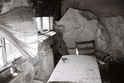


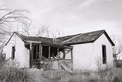
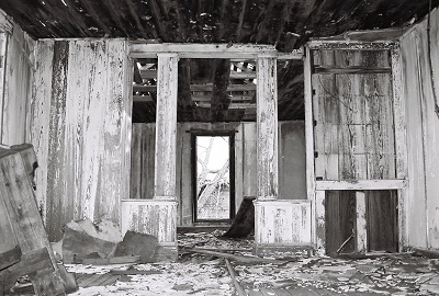
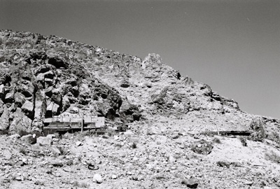
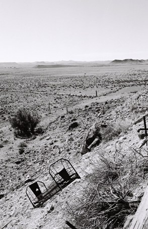
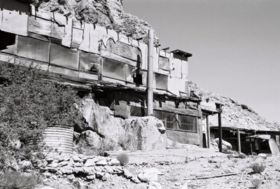
One thing I do know is that this was clearly someone’s living space, a hand-built home on the side of a rocky hill in the middle of nowhere, way out in the Chihuahuan Desert. Judging from the date on a picture painted inside the house, it might have been constructed in the early 1960’s. So I guess the builders could’ve used a truck to haul bedframes and stoves and bathtubs and chairs and countertops and even a refrigerator over the many rough miles to get back here. If that’s HOW it was built, perhaps a better question is WHY it was built. I assume it was used as lodging for ranch hands back when the entire area was being grazed, but, if so, it was far more sophisticated (not to mention higher off the ground) than it needed to be, with cupboards, stone fireplace, two bedrooms with curtained partition and even a second story, which has partially collapsed. Perhaps it was built simply because the view out the front is stunning. Desolate and forbidding, maybe, but if you like that kind of thing, as I certainly do, and aren’t much for food, water, or company, you couldn’t do better than to build yourself a home out here.
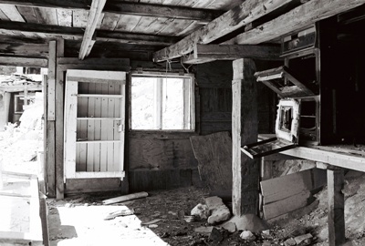


There are actually two structures, the main living space with entryway and fireplace, kitchen, bedrooms and a bathroom with tub, sink and toilet, and an adjacent building that is much smaller and contains only a stove and sink. I’m assuming this second structure was just a kitchen. Maybe it was too hot to cook much inside the living area. Or too dangerous. Both structures are backed up to exposed rock, which provides quite a nice effect. Small shelves were constructed wherever a natural rock formation lent itself to such a thing, and some of the rock walls were painted green or yellow or white and, as I alluded to, there are also paintings done right on the rock. One, signed “Molina, 2/18/62,” is of a few people standing around and is almost cartoon-like. A smaller painting is a representation of the landscape right out front. A bit of realism, I guess.
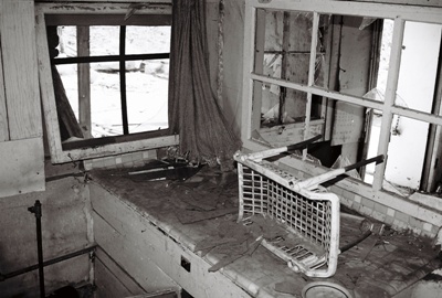


The thing that strikes a person again and again is the remoteness of this house and how at odds it is with its construction. How did they get water out here? There is indoor plumbing and faucets and that tub and it all seems like more than a cistern would be likely to collect most of the year. And how did they get electricity? That refrigerator didn’t run on firewood. But to have pulled a chair up out front to watch the sun go down (or rise, for that matter) must’ve been quite a reward for a hard day of cow-punching. If you’d like to visit…well, don’t! Trust me, you’ll never find your way out here and it’s probably better for both you and your vehicle that way.


Next time we’ll check out another place in Socorro County I know almost nothing about. These posts sure are easier to write when they contain no historical information. Probably easier to read, too.

Saturday, June 30, 2012

The Szimpla Kert Ruin Pub: Budapest, Hungary


Don’t worry, with the next post we’ll be heading back out to the desert. Even in the searing heat I’ve managed to check out a few new locales. But these are so remote and mysterious that I’ve been able to find very little to say about them, historically speaking. So, while I consider how to present these lost gems, we’ll make a short stop in Budapest to visit an abandonment that is a decidedly un-lost gem, the Szimpla Kert "ruin pub."

Romkocsma, which translates literally as “ruin pubs,” seem to be a phenomenon somewhat unique to Budapest. Having emerged from Nazi occupation and subsequent Communist rule with numerous poorly-maintained buildings, Budapest found itself without the resources to restore them properly or tear them down. Many of these buildings were once apartments and are located in residential neighborhoods, sometimes sandwiched between occupied buildings, and, from the outside, all you usually see is a run-down façade. But inside it’s a different story. By negotiating cheap rent and enlisting the help of anyone that can help make these places structurally sound, vibrant, lively pubs have sprung up amidst the ruins. Acting not just as watering holes, but as community gathering-places presenting music, film, and alternative arts and culture, you can’t help but hope this trend continues.
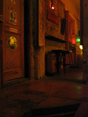
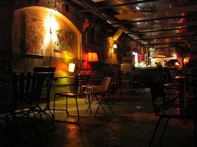
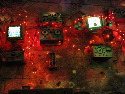

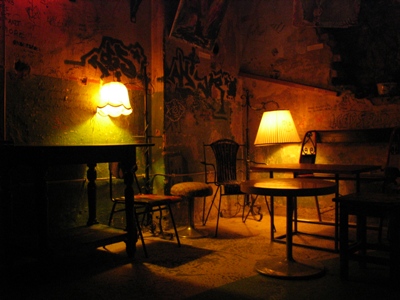
Szimpla Kert is the first and most well-known of the Romkocsma, located in the Old Jewish Quarter, also known as District VII, a fascinating and disheveled area of the city that experienced untold suffering under the Nazis. A huge, labyrinthine, multi-level concrete beast, Szimpla Kert features internal ladders and spiral staircases, busted-up walls and enough dark corners to accommodate whatever you’re into. “Kert” refers to the courtyard or “garden,” which is an open-air portion of the complex located on the site of a building that's been demolished. It is, simply, the coolest bar I’ve ever been in. Even cooler than Heinold’s First and Last Chance Saloon in Oakland, CA, a favorite of Jack London’s with its five tables and woefully sloping floor (a result of the 1906 quake). Actually, let’s not slight Heinold’s. Let’s just say Szimpla Kert is AS COOL as Heinold’s.


Of course, as with any concept that works this well, there has been growing discontent and early patrons of Szimpla Kert lament the international hipster crowd, the more expensive drinks, and the general popularity of the place. Szimpla was voted 3rd best bar in the world by Lonely Planet last year, so the crowds aren’t exactly abating. But, you know, it’s hard for me to begrudge Szimpla’s success. The ambience is unbeatable; strange “art” hangs on the walls, mysterious Stalinist-looking electronics are scattered here and there, the place is furnished with everything from lawn chairs to claw foot bathtubs, and it seems genuinely weird--in an authentic way--to me. And I think I'm a pretty good judge of the authentically weird. On the other hand, with money comes gentrification, and, as often happens, the very thing that brought people to the Old Jewish Quarter in the first place might well become the agent of its cultural destruction. But that phenomenon is not unique to Budapest and its cure remains elusive. In the meantime, all you can do is join the crowd and have a look at the incredible Szimpla Kert ruin pub.
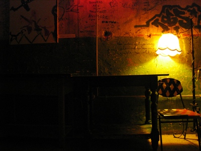


By the way, the graffiti in the photo above reads, "Borders are not relevant anymore," a lovely sentiment given the history of Hungary (and Eastern Europe, in general).
Sunday, June 03, 2012

A Place of Healing: Beelitz Heilstätten, Germany


While southwestern New Mexico burns, covering much of the state in dingy smoke, I think we’ll stay overseas and visit Beelitz Heilstätten, a 200-acre hospital complex comprised of 60 buildings and located in the town of Beelitz, just a few kilometers south of Potsdam. Beelitz’s other claim to fame is its delicious white asparagus, but as pictures of asparagus aren’t always interesting, we spent all our time at the hospital.

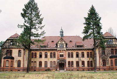
The Beelitz Heilstätten complex (“Heilstätten” translates roughly as “a place of healing) was constructed in 1898 and designed by Heino Schmieden, partner in one of Berlin’s greatest architecture firms of the time. Aside from the numerous ornate buildings, rigorously separated by gender, the grand complex also contained its own generating station to produce power and heat. Below is the entrance to the men's sanatorium.
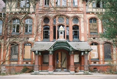


Conceived as a tuberculosis sanatorium by the Berlin Workers’ Health Insurance Corporation, the main treatments seem to have been “baths.” Water baths in pools, air baths on balconies, just generally taking it easy, I guess. There wasn’t much in the way of effective surgery at the time, of course, and the grounds appear to have mostly been designed with extended strolls in mind.

Then, at the beginning of WWI, the complex quickly became a military hospital for the Imperial German Army. Perhaps the most (in)famous patient to stay at Beelitz Heilstätten during this time was Adolf Hitler who, after being wounded in the leg at the Battle of the Somme, spent October and November of 1916 recuperating here.
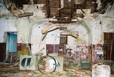


After being used as a Nazi military hospital during WWII, Beelitz Heilstätten was occupied by the Soviets in 1945 and, at its height, employed 1,000 people. Strangely, it remained a Russian-operated facility until 1995, a few years after German re-unification. In fact, shortly after the fall of the Berlin Wall, in December 1990, Erich Honecker spent time here. He had just been forced to resign as head of the suddenly non-existent East German government and apparently wasn’t feeling too good about things. I suppose the liver cancer probably didn’t help.

It was also during the unsettled period between the Wall coming down and re-unification that Die Bestie Von Beelitz or, The Beast of Beelitz, appeared. From the fall of 1989 to the spring of 1991, the Beast, a necrophiliac, terrorized the women of Beelitz, strangling or stabbing his victims and at least once leaving his own pink underwear behind. Most of the attacks occurred near the surgical block and women’s pavilion on the forested Heilstätten grounds and his victims included the wife and infant child of a senior physician. Before being detained by joggers while pleasuring himself in the woods, the Beast, whose real name is Wolfgang Schmidt, killed a total of six women and the infant. He was sentenced to 15 years detention in a psychiatric facility which seems a little, I don’t know, LIGHT to me. However, I believe he remains imprisoned now, 20+ years later. A QUOTE from 2001 has Schmidt asking the court that he be treated as a woman named "Beate" (the court agreed) and complaining about taunting by other inmates.
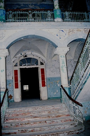
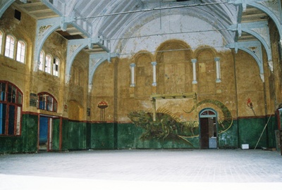
As if all that wasn’t enough, in 2008, a pornographer brought a young model named Anja P. to the former operating suite for a photo session. After the shoot he took her to the gatehouse where he beat her to death with a frying pan and had sex with her corpse. The head of a family that actually lives in an outbuilding on the grounds, Michael W. says he and his son are both martial arts experts and “could handle about eight people together and win.” Geez, those are the kind of skills you just might need if you’re going to spend much time around Beelitz Heilstätten. That's a gymnasium in the photo below.


Recently, there have been some efforts to privatize the complex but bankruptcy has gotten in the way. The surgery, psychiatric ward, and rifle range (??) have been abandoned for some time and a supposedly functioning center for neurological research and a rehabilitation area for Parkinson’s sufferers were not obviously operating during our visit. In fact, aside from the caretaker’s quarters and some random renovation here and there, we saw virtually no activity. Unfortunately for us—and in contrast to statements from a year or two ago—most of the buildings were locked-up, boarded-over, and totally inaccessible without more time and at least a rope or two. Still, it was quite an experience to wander the grounds on a damp, overcast day, take in the unusual Russian graffiti, and consider all the terrible goings-on that have occurred at Beelitz Heilstätten.
Although I had not heard of Beelitz Heilstätten before visiting, it turns out to be quite well known indeed. I found very good information and the Michael K. quote at EXBERLINER, this URB EX site was informative, and I grabbed some info on Schmidt from HERE. If you want to see some more of Beelitz Heilstätten complex, just do a Google search. It's all over the place. The complex has also appeared in both The Pianist and Valkyrie, as well as some S&M films. But you’re on your own if you want to get the names of those.
Friday, May 11, 2012

Listening to the Communists: Devil’s Mountain, Germany

City of Dust is pretty much always on the road and occasionally we even manage to go international. Awhile back we visited the Chong Kneas floating village in Cambodia and, in this post, we’ll check out the Teufelsberg listening station in the northern Grunewald forest of the former West Berlin, Germany.
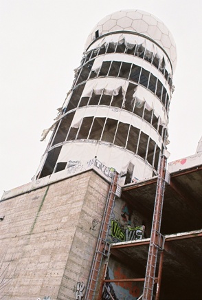
Teufelsberg translates as “Devil’s Mountain” and it towers over the surrounding landscape for a unique reason; it’s really a mountain of debris. Following WWII, approximately 26,000,000 m3 of rubble, the remains of destroyed buildings and infrastructure, was deposited in the area, making a mountain of sorts. This was also done elsewhere in Germany, but Teufelsberg is of further interest because underneath all that rubble is an unfinished Nazi military-technical school designed by Hitler's chief architect, Albert Speer. After the war, all efforts to blow-up this rather well-built school failed and so it was decided to heap garbage upon it. This continued until 1972, when the site ceased to be a dump and was turned into a park, becoming the highest green space in West Berlin. By then a section was already a very popular ski slope complete with jumps.


By the late 1950’s, the Allied Forces, and the United States, in particular, were trying to find a way to listen-in on nearby Communists from stations in West Berlin. Mostly they drove around the city in mobile units, trying to find the best reception from the East. Then, one day, some smart people decided to go to the top of Teufelsberg and found that from there they could hear the Reds very well indeed. Thus, the construction of several large radio domes was undertaken. Also, the mechanical lifts at the ski slope were removed because they interfered with reception. Just another sacrifice for the Cold War.

Once the proper infrastructure was in place, it was found that at a certain time of the year reception was fantastic, better than at any other time. After some investigating, it was discovered that the Ferris wheel used for the annual German-American Volksfest acted like a large relay antenna. From then on removal of the Ferris wheel was delayed for a bit at the end of each festival. Also, since no one really knew what was going on at the listening station, some strange rumors were born, including one involving emergency exit tunnels that ran deep down into the mountain of debris.

Of course, eventually the Cold War sort of went away and the listening station quickly became useless. The land was purchased by investors soon after the fall of the Berlin Wall with the intention of building hotels, but there was already too much construction in the newly-reunified Berlin to make the venture profitable. For awhile there was also talk of turning the whole place into a spy museum. Now, new zoning regulations have ensured that this manmade “forestland” cannot be built upon and the only possible use for the listening station is as a Cold War Memorial. The rest of Devil’s Mountain remains a rather nice park.
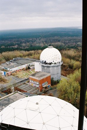
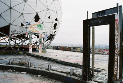
During our visit, we had to work a bit to find an entrance, but once the easiest option was located, we, along with apparently many, many others before us, had free run of the place. Most of the outbuildings are uninteresting, but the real gems are the radio dome towers, which can be climbed all the way to the top by internal stairs. I’d recommend staying away from the dark, empty elevator shaft. The towers have no walls, so you can get out on whatever floor you like and have a look at the drop below. This day, the wind was howling, making getting close to the edge a pretty risky proposition.
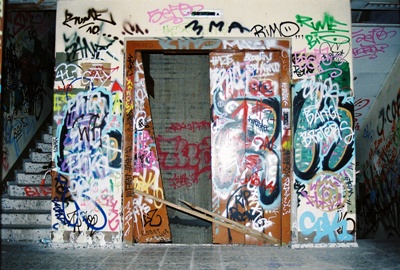


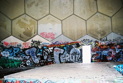
Near the very top of the towers sit tattered domes which seem to have been made out of something like Masonite. The wind is slowly annihilating them and they made a lot of noise in the gale. Then, at the absolute top of the stairs, one emerges into a fairly intact dome where the acoustics are astounding. You can speak in one direction and hear your voice behind you. Every sound is amplified and bounces around the dome in all directions. Easily the coolest echo chamber I’ve ever been in. Ah, Cold War technology; fun for kids of all ages.

Covered with graffiti and rapidly decomposing—not to mention immensely dangerous to the clumsy or chemically-impaired—the most likely fate of the Teufelsberg listening station seems to be its eventual destruction. The area will then be planted with trees and it seems unlikely that the old Cold War relic will, like so many other wartime structures, become a permanent part of the Devil’s Mountain itself. But, if you ask me, it probably should be.


Obviously, it’s not easy to get information on what exactly was going on at the listening station. I got the basics from Wikipedia. The Teufelsberg entry isn't even flagged for being incomplete or inaccurate. Wow.
Tuesday, May 01, 2012

One of Those Things


This afternoon I came across a rattlesnake by the side of the house. A big one. Western diamondback. I reached for my pistol, like always, lifted it from the holster and drew a bead. I took one step forward and the snake coiled, watching me with its black eyes as it began to rattle. I pulled back the hammer on the gun. That forked tongue flicked the air as the snake tried to assess the best way to handle a threat it couldn’t even begin to imagine. I stood there for several minutes before I let the hammer slide slowly back into place. I holstered the weapon. It’s only been recently that I’ve come to see beauty in things that can kill me. Maybe only in things that can kill me. I’m not talking about skydiving or driving too fast. This is something else. I can’t say exactly what it is. Not with words, at least. I guess it’s just one of those things.


Both photos taken in the other Las Vegas. The one in New Mexico.

Saturday, April 07, 2012

By the Wayside: Cuchillo, New Mexico


 Last post we visited Chloride, wwaayy down the road. Pretty much at the end of the road, actually. But a little nearer to I-25 is Cuchillo, not exactly a ghost town, but not the farming and ranching center it once used to be either. It’s now perhaps more of a wayside, a last stop before pushing on toward Winston and Chloride.

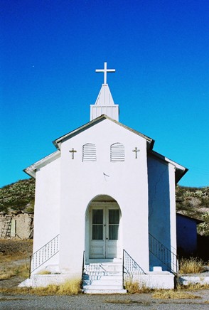
Cuchillo got its name from Cuchillo Negro (Black Knife) Creek, which runs along the town to the south and once provided water to more than 100 farms during Cuchillo’s glory days, back between 1880 and 1920, when the population pushed 2,000. The creek was named for a Warm Springs Apache Chief, Cuchillo Negro (aka Baishan), from the Black Range who was raiding partners with Mangas Coloradas. Of course, Geronimo also frequented the area and, given the animosity between settlers and Apaches at that time, it’s perhaps no surprise that a creek so-named would continually threaten Cuchillo, destroying entire sections of the town, leveling the St. Joseph’s church twice, and occasionally flooding the current church, which was built in 1907 and is still used for mass.
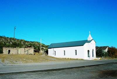
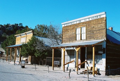
Being about halfway between the mines of Chloride and Winston and the railroad station, now gone, at Engle, Cuchillo did pretty good for a time. Nearly everyone going into or out of the mines passed through and Cuchillo become a stage stop for the Armstrong Brothers line and a fairly bustling center of commerce. But eventually the mines closed, as they usually do, and floods in the 1920’s followed by economic depression mostly killed the town.


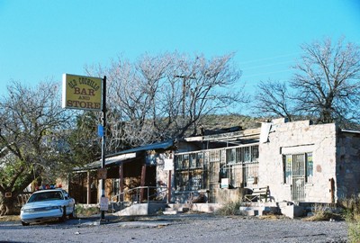
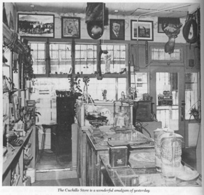
One place that remained a gathering spot into the recent past was the Old Cuchillo Bar & Store, sections of which were built in the 1850’s, if not earlier. The complex also housed an inn and post office. That’s the poor old bar and store pictured at the top of this post. A large section of the store was badly burned in 2000 in an electrical fire and in 2004 the adjacent saloon finally closed. Now it appears badly beaten and apparently for sale, although there were rumors of a restoration as late as last spring. Above is a photo from "New Mexico’s Best Ghost Towns" and I don’t know if all the artifacts in the picture burned too, but it’s a real shame if they did. The shot is of the store but the shuttered saloon still contains lots of cool stuff, and the bar and store are haunted, naturally. The saloon looks very cool. I’ve heard the current owner gives tours by appointment, but don’t know if that’s really true. Current owner, if you read this, I’d love to see the place.

Otherwise, an old dance hall that was immediately to the west of the church has disappeared and I’m not certain about the fate of the two-story adobe barn that was behind the Cuchillo Bar & Store. It housed the mules and horses that hauled freight between towns and might still be standing for all I know. There are a few homes scattered here and there (the population is now about 35) and a new restaurant/café has opened. It might just be worth a stop when next you’re passing through.

Information for this post came from the sources linked-to above but mostly the usual.


For those of you in the Albuquerque area, I recommend an exhibition being held in George Pearl Hall on the UNM campus. It seems a lot of the old material from the Werner-Gilchrist house has been re-used and some is on display in the exhibit, including a section of a dormer window, some adobe bricks, and a transom with “We rarely see what is real” still spray-painted over the top. There’s also a poetry book from 1935 that was found in the house. One poem is entitled, “When There’s Darkness on the Delta” and it’s not half bad. The exhibit runs through May 1st. More info HERE.

Sunday, March 11, 2012

A Resurrection: Chloride, New Mexico


I’ll admit that many of the places I visit are run-down and lonesome and the tales tend to get a little dark. Sure, I guess I like it that way. But this post will be a little ray of sunshine. Don’t worry, it won’t last long.

Chloride, New Mexico (pop. 7) has risen like a phoenix from the ashes to become a ghost town no longer, but a fascinating Old West museum piece. It’s like stepping into a valley in a land that time literally forgot. But it hasn’t always been this way.

First of all, Chloride is a bit out of the way. You have to follow Highway 52 west WWAAAYY out and when Winston (founded by citizens who once thought Chloride too rowdy to abide) finally appears, turn off on a gravel road amusingly named Wall Street. When Wall Street ends smack dab up against the Gila National Forest you’ll know you’re there. I have absolutely no idea how folks managed to get to the place before there were roads. But, in 1879 Harry Pye, an Englishman, was somehow hauling a wagon load of supplies north to Ojo Caliente for the army. As the sun began to set he decided to seek shelter from the Apaches that populated the area. When he awoke he saw silver chloride nearby and later came back with some friends to stake a claim. Again, if you see the landscape surrounding Chloride, you can’t help but wonder about the agony that must’ve been inherent in the simple statement “came back with some friends.” I don’t know how they even found the claim again.


In any case, the tent city that sprang up was called Pyetown and Bromide and finally Chloride for that first silver chloride find and within a couple years hundreds of miners had flocked to the area to seek their fortunes near the “Pye Lode.” But by this time Pye himself was already dead, having indeed been killed by Apaches while camping shortly after his return. Alright, so maybe that IS a little dark. I suppose it’s the nature of the material. Pye was eulogized as being “an honest, sober, and industrious young man and a good miner and prospector. He had many friends in camp…”. People always say very nice things about you when you’re dead.

In Pye’s absence, Chloride boomed and was soon the center for all silver mining in the surrounding area. However, the town was 100% male, so free property was offered to the first woman brave (or foolish) enough to move to the town. Property (or perhaps a seat on the town council) was also to be given to the father of the first baby, “If it is known who he is.” I wonder if that got the ladies flocking to Chloride.


Chloride peaked in the 1880’s with a population of perhaps 3,000. In order of likely importance, there were nine saloons, three general stores, an assay office, a stage line, restaurants, butcher shops, a candy store, a lawyer's office, a doctor’s office, a hotel, boarding houses, and a Chinese laundry. Eventually some ladies did arrive and at least one brothel opened, although there were likely more. Being so remote, the railroad never made it out, which was somewhat unusual for a relatively major mining town. Transportation was only via stages and wagons.

By the turn of the century, the price of silver was dropping and so were hopes for Chloride’s future. When Philip Varney visited in the 1970’s to do a feature for his book, “New Mexico’s Best Ghost Towns,” the town was as one might dream a ghost town would be: historic, desolate, beautifully intact. Varney says as much in the introduction to his piece.

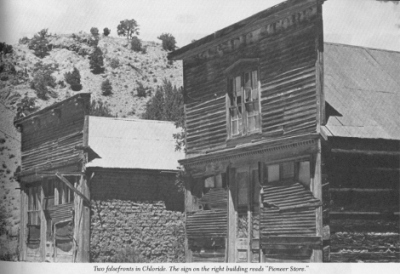
Looking at Varney’s pictures, it’s hard not to want to have seen Chloride in its virtually abandoned state. The photo below of Chloride’s two major false front buildings--one a general store, the other the old Monte Cristo Saloon--from Varney’s visit is particularly appealing. But perhaps that’s because I now know what had been collecting dust and dirt and bat droppings in the building with the faded “Pioneer Store” signage when that shot was taken.


The Pioneer Store was built in 1880 by James Dalglish, who had come from Canada hoping that the high desert would help his ailing health. He ran the store through 1897 and sold absolutely anything anyone could want in a town like Chloride. As mining waned, the store was sold and then sold again with the James family finally running the place until nearly every resident of Chloride had moved away. That was about 1923. At that time the store was closed with its contents sealed-up inside and that was that for several decades.

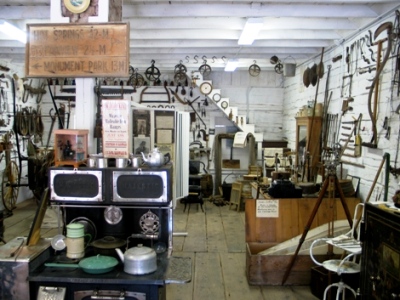
In the late 1980’s, Mr. and Mrs. Edmund moved to Chloride and met Mr. James. He agreed to sell the store to the couple and, in 1989, they began the massive job of cleaning up the place and its contents, which included items spanning its entire history from 1880-1923. We’re talking such things as old whiskey bottles still containing whiskey, farm implements, clothes, kitchen wares, and Native American artifacts. The clean-up process wasn’t completed until 1998, but now the Pioneer Store is a museum showcasing much of what it sold in its original heyday. It’s pretty incredible and a person has to see it for themselves to truly appreciate how rare and fascinating a find this is.


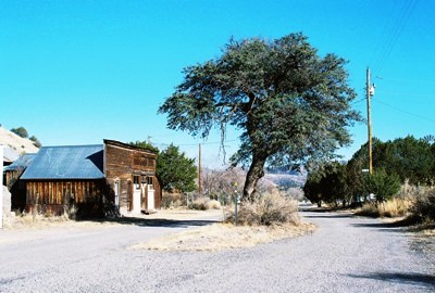
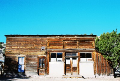
Mrs. Edmund was very generous with her time during our visit, telling us about individual items and the painstaking process of bringing everything back to life. Then she took us next door to the Monte Cristo Saloon, now an art gallery and store. I bought some artisan honey from Hillsboro 'cause I really like honey. A walking tour led us past the old “hangin’ tree” and another old saloon that became the post office until it, too, closed. They're pictured in the second and third photos above, respectively. Only one person was ever hung from the “hangin’ tree”—and he by effigy—but numerous drunks were chained to it until they sobered up. There is an odd building called the “Doodle Dum” (pictured below), built by its owner in 1920 out of stone and with a steeply-pitched roof to withstand the fierce hailstorm that he believed God was preparing for mankind. Original law offices and the U.S. Treasury Mining Company Headquarters also still stand.


All-in-all, I’ve never seen a ghost town brought back to life so effectively--I mean, even the general store’s original merchandise is on display--yet maintaining that sense of remoteness, both in time and place. It’s utterly charming. You’ve really gotta go sometime.

The first place to go for information on Chloride is their WEBSITE, which offers all sorts of history, much more than I could summarize here. As usual, I also used a good bit of information from Philip Varney. I even scanned his photo of the Pioneer Store and Monte Cristo Saloon for comparative purposes. And I used a little bit of information from Ghosttowns.com.

Sunday, February 12, 2012

Someplace Wicked: Two Guns, Arizona


NOVEMBER 2022 UPDATE: This post was written just over a decade ago, and a couple years back I posted an introductory caveat about the veracity of the Apache Death Cave story. A comment below by "Kirvia" noted the lack of primary material for the tale, and he had an excellent point. Henry "Indian" Miller had emerged as seemingly the most obvious source, and he appeared to be far from a reliable narrator. After leaving Two Guns, Miller went to Lupton, Arizona, and opened a trading post he named the "Cave of the Seven Devils." Sound familiar? It didn't inspire confidence in Miller's version of history.

Well, fast forward a bit and I find myself at the excellent RECYCLED BOOKS*RECORDS*CDs in Denton, Texas. While digging through their Southwest section I uncover a slim volume published in 1968 entitled, "The Press of the Territorian Presents Number 15 of a Series of Western Americana: Two Guns, Arizona," by Gladwell Richardson, whose father, S.I. Richardson, bought Wolf Post in Canyon Diablo in 1899. S.I. is stated within to have known all the local Native Americans and settlers of the time. Color me surprised.

What you'll find contained in those 28 pages, along with numerous photos, is a recounting of the story of the Apache Death Cave virtually identical to what's generally been told, as well as the name of a Navajo man said to have been involved, Hosteen Natani ("hosteen" is a Navajo term of respect), who is also noted as having provided a personal statement at one point. Richardson compiled a pretty impressive summary of the supposed history of Canyon Diablo and Two Guns Trading Post, which was still operating at the time of publication, and it makes me think that maybe the trail backward doesn't end with Miller.

Of course, I'd love to track the story back even futher, and there are some earlier references. They include:

Correl, J. Lee and Watson, Editha L. 1967. A Navajo Bibliography. The Navajo Tribe. Window Rock, AZ.
Kildare, Maurice. 1967. Cave of Death Desert Magazine.
Sumerhayes, Martha. 1911. Vanished Arizona. The Salem Press Co. Salem, MA.

There are a number of others, and I'll be keeping an eye open for them and will post anyting more I can learn here. But, for now, I can say that virtually everything below aligns with Mr. Richardson's work, even beyond the gruesome story of the Apache Death Cave. That said, there are some things in his book that I might question, including Billy the Kid's appearance at Canyon Diablo, the size and lawlessness of the Canyon Diablo railroad camp itself, and a loner roaming the area and hoarding a fortune in diamonds found in meteorites. But whatever the case, you can read below and see what you think for yourself. And stand by for (hopefully) further updates.

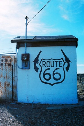
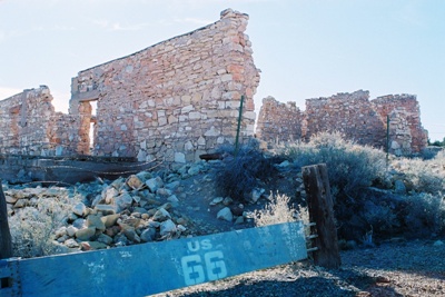
Anyone that’s interested in abandoned buildings, ghost towns, and history is going to find themselves in some places where fairly unsavory things have occurred. Sometimes there’s just a bad vibe that surrounds a place even when you don’t know exactly what’s happened there. Other times maybe you’ve cracked a few books or done a Google search beforehand and you know where those bad vibes are coming from. Such is the case with Two Guns, Arizona, now not much more than a slowly decaying jumble of collapsed stone buildings off a long-closed portion of old Route 66.

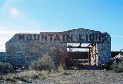
Two Guns miserable history goes back to a time well before it was known as Two Guns. The town, such as it became, was built beside Canyon Diablo, the site of a mass execution of Apaches by Navajos in 1878. The Apaches had been raiding the Navajos for some time and had just nearly wiped out two entire villages in one day. Twenty-five Navajo warriors followed the Apaches back to Canyon Diablo but had nearly given up their search when two scouts detected warm air coming out of a crack in the ground. Below this crack was a large cave where over 40 Apaches were hiding with their horses. Two Apaches, oblivious to the Navajos, stepped into the open and were quickly killed. Then the Navajos lit a fire at the mouth of the cave with brush and driftwood from the canyon floor. The Apaches tried to negotiate, but when the Navajos asked for the return of three small girls that had been taken hostage they were met with silence. Understanding that the girls had been killed, the Navajos piled on more fuel and eventually every Apache was either asphyxiated or burned alive. It took a full day for the walls of the cave to cool enough for the Navajos to enter to re-claim their stolen belongings. Inside they saw that the Apaches had tried to use the blood of their horses to douse the flames. The Navajo warned anyone who asked to stay away and consider the entire area cursed to this day.
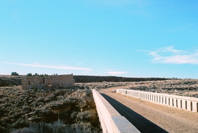
A few decades later a shortcut to Winslow was built through Canyon Diablo. (As an aside, if you’re not up on your Spanish, Canyon Diablo translates as “Devil Canyon.”) In the 1920’s, Earle and Louise Cundiff opened a trading post, campground, and rental cottages near the road, just beside the canyon. The main store was constructed at the southern end of what would soon be a large, concrete bridge spanning Canyon Diablo. Then a man called Henry “Indian” Miller came along, claiming to be an Apache chief named Crazy Thunder. Miller was no Apache (he was really part-Mohawk), but he and his wife partnered up with the Cundiff’s and Miller constructed a long stone building north of the canyon that he named, “Fort Two Guns.” Cundiff then wanted to proclaim this miniature community a town and dub the whole place Two Guns. However, the post office rejected this name, insisting instead on Canyon Lodge, a moniker that has nearly faded from memory.


Miller went about turning Fort Two Guns into something like a zoo, including bobcats, snakes, porcupines, and mountain lions. He also built fake cliff dwellings, which he passed off as authentic, just above the cave in which the Apaches had been killed. The cave was called “Mystery Cave” because the Navajos had been unable to find it following earlier raids by the Apaches. It was also known as the "Apache Death Cave,” and Miller lured motorists off Route 66 with canyon tours, refreshments, and tales of carnage. He sold the bones of the dead Apaches to tourists. For awhile, Two Guns prospered.

While all this was going on, for some reason the Cundiff’s decided to lease their store to a drifting couple. These drifters eventually absconded into the night with most of the Cundiff’s merchandise. Then, Cundiff began to argue with Miller over the terms of their contract. On March 3, 1926, Miller shot Cundiff dead and was, for reasons unknown, quickly acquitted. But Miller wasn’t off the hook. Upon returning to Two Guns he was nearly killed by his captive mountain lion. Later he was nearly killed by his lynx. After his daughter was killed in a car crash, Miller had finally had enough and left Two Guns for good.


In 1938, Route 66 was rerouted to the south, bypassing Two Guns. But Louise Cundiff re-married and, with her second husband, rebuilt Two Guns, even re-opening Miller’s zoo. But the renewal didn’t last long. By 1950 everything was closed again and the property was sold. Several people tried to resurrect Two Guns but, in 1971, just as I-40 was slated to open with a designated exit for the "town," the entire complex burnt down. And so it has remained for 40 years, a strange, cursed place that nobody wants. Except perhaps for Russell Crowe, who is rumored to be the property’s current owner.

I didn’t have much time during my visit and I did not go looking for the Apache Death Cave. The cave has apparently largely collapsed and is no more than a fissure in a rock wall. Nor did I go looking for meteorites, bits of which have been pulled out of the canyon, a nice treasure indeed for the lucky prospector. I didn’t even have time to search for the remains of the town of Diablo Canyon, just a couple miles from Two Guns, which was forced into being when the railroad ran out of money for a time and workers were stranded. Diablo Canyon was said to have surpassed Tombstone for murder and debauchery. Its main street was not named “Main Street” but “Hell Street.”


I may make a return trip to Two Guns someday but I admit that I am wary. It seems no one who has gotten close to Two Guns has fared well in the end. It is a quiet, eerie, forlorn place, strewn with the rocks that the Miller's and Cundiff’s once used to build their dream. Maybe I’d be better off investigating the abandoned truck stop to the west. Its name? Twin Arrows.

Information for this post came from Weird Arizona by Wesley Treat. The best source for information on the execution of the Apaches is probably Treat’s on-line Roadside Resort. I got some information about the settlement of Canyon Diablo from Wikipedia.

Saturday, January 28, 2012

The Shaffer Hotel: Mountainair, New Mexico


There’s nothing quite like a night in an old hotel. Last year we stopped by the St. James Hotel up in Cimarron and now we’ll check out the Shaffer Hotel in Mountainair. Mountainair, about 90 minutes south of Albuquerque, was named for the fresh breezes that blow off the surrounding mountains and down through the town. Mountainair is also the self-proclaimed “Pinto Bean Capital of the World.” This second claim to fame tells you something about what most people in Mountainair do for a living.

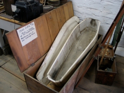
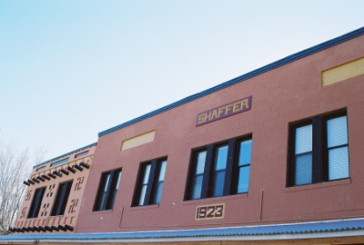
Established in 1903, Mountainair soon attracted the attention of Clem “Pop” Shaffer, a blacksmith who arrived in 1908 to work his trade and sell useful items like caskets and coffins. Mr. Shaffer built a hotel out of wood which promptly burned down. So, in 1923, he built another hotel, this one out of cast concrete and various bits of iron that he collected from wherever he could. This hotel would not burn down.


But the fact that the Shaffer Hotel is made of concrete is almost entirely obscured by its ornamentation, a mesmerizing mixture of Native American symbolism, fantastic creatures, and menacing characters of unknown origin. While loosely considered “Pueblo Deco,” Pop Shaffer’s vision is almost too singular and idiosyncratic to fit the term. While not exactly comforting, the hotel’s artwork, which includes painting, sculpture, and numerous things made out of rocks, all created by Pop himself, is pretty incredible. And, yes, it is jarring to see what appear to be swastikas scattered about. However, this is not the Nazi swastika, but a Navajo symbol, sometimes called "whirling logs," that represents healing and can face either left or right. Four large whirling logs that originally lined the top of the hotel have been covered over.
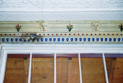
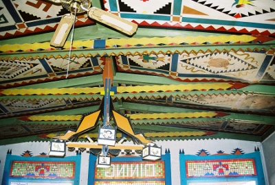
Pop Shaffer’s hotel did well for him and he added a Ford showroom and garage in the back of the place, alongside the coffin workshop. A restaurant was opened next door, the ceiling lavishly carved and colored. Each day, like clockwork, Pop’s second wife, Lena, went shopping for food and provisions. This gave Pop a little time for extracurricular activities, but one day Lena returned unexpectedly to find her husband climbing the stairs to the rooms of the hotel with another woman in tow. Lena produced her pistol as the mistress drew hers. However, as was common in those days of unpredictable side arms, both shots went very wide of their marks. Lena’s bullet hit the ceiling behind the staircase. The mistress’s lodged in the molding of the ceiling opposite the staircase. One has to wonder what Pop Shaffer thought of this incident. I have found no record of how this domestic crisis was resolved, but it did not end in divorce.


There are those that say Pop Shaffer still resides in his hotel. A man who hung himself in Room 16 is also said to haunt guests. I was told that the previous Halloween a father had requested that he and his daughters be given the most haunted room in the hotel. The man was put in 16 and his daughters got the adjoining room of the suite. In the middle of the night the man went to use the bathroom and felt a chill then turned to see the outline of a body on the bed. He attempted to go to his daughters but was unable to unlock the door to their room. They awoke and were likewise unable to open the door from their side. Early the next morning the woman that runs the front desk came in to find the man and his daughters sitting downstairs. The girls were crying. The man said they weren’t staying another night and the hotel could keep their money as far as he was concerned. The desk woman said she made the refund anyway. I couldn’t convince MLE to stay in 16 so we took an adjacent room where I slept quite well but she did not, feeling a little rattled by the general atmosphere.


While we weren’t haunted by ghosts, the night we stayed at the Shaffer one of the women that worked at the hotel was being stalked by an ex-boyfriend who threatened to shoot everyone inside. He drove by a couple times and the police were called. At one point, while eating in the restaurant, we were asked to step away from the front window. For a few minutes we drank our tea by the cash register, waiting to see which way things would go. But, in the end, there was no gunfire at the Shaffer that night, surely how Pop would prefer it.

Not far from the Shaffer Hotel is Pop’s old residence, Rancho Bonito. Guarded by an alarming wooden creature and comprised of two fairly small buildings that are perhaps even more colorful and fanciful than the Shaffer, it’s very much worth a look. Both the hotel and Rancho Bonito are on the National Register of Historic Places. The Shaffer is for sale or lease if you want to own or operate a piece of history. Accommodations range from “cowboy” rooms with no bath to spacious suites. I’m sure all ghosts will be included at no additional charge.


Information for this post mostly came from the Shaffer Hotel's now-gone website. A bit more came from a personal tour of the place and the rest from lived experience.

JANUARY 2016 UPDATE: The Shaffer and its restaurant have opened and closed a couple times since this post was written almost exactly four years ago. In mid-2015, it was shuttered again and, sadly, shows no signs of re-opening anytime soon.

MARCH 2020 UPDATE: The Shaffer and its restaurant have opened again! Such great news! You can find them on FACEBOOK and rooms are available on Airbnb.

Tuesday, January 10, 2012

Whiskey and the Devil: Taiban, New Mexico


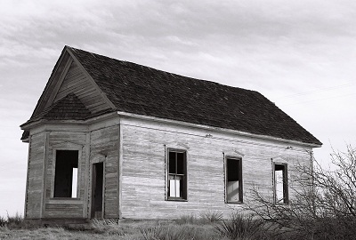
Let’s start the New Year by departing Yeso and traveling Highway 60 east, past Fort Sumner, final resting place of Billy the Kid (we’ll return to Fort Sumner…eventually), to the unincorporated town of Taiban, New Mexico. Taiban is known for its old Presbyterian Church, a lonely, gutted house of worship visited by photographers and the traveling faithful. The church, once part of a neighborhood which included homes, businesses, and the two-story Taiban High School, now sits by itself out on the prairie. Not a single business remains in Taiban. But it was not always this way.

Like Yeso, Taiban was named for a nearby creek. The source of Taiban Creek was Taiban Spring, originally known as Brazil Spring after a Portugese immigrant, Manuel Brazil, who arrived in 1871, the first recorded settler in the area. The meaning of the word “Taiban” is obscure, although it’s thought it might be a Navajo or Comanche word for “horsetail,” a reference either to a local plant or to three small tributaries that flowed into the creek. It’s said that Billy the Kid watered his horse at Taiban Spring.


Also like Yeso, Taiban owed its existence to the railroad. Taiban was founded in 1906, when the Belen Cut-off was laid across the eastern plains of New Mexico, re-directing rail traffic from the mountainous north. A school was built and contracts were drawn for the construction of fifty homes. By 1907, there was a bank and a hotel. In 1908, the Atchison, Topeka, and Santa Fe Railroad began actively encouraging settlement of the region. Over 1,300 trains passed through the plains bringing homesteaders from across the country. But the vast majority of emigrants did not settle in Taiban and, in 1909, the town’s population peaked at 400 residents. These were mostly farmers and sheepherders, already veterans of conflict with both the landscape and established ranching interests.


In the fall of 1908, construction began on the First Presbyterian Church of Taiban. It was completed on December 22, 1908 at a cost of $250, less than $100 of which could be covered by the congregation, necessitating loans from the ladies of the Baptist Church, as well as the Taiban Savings Bank. The first sermon, given by Reverend John R. Gass, was sparsely attended due to cold weather.

Shortly after Taiban was founded a heated controversy erupted over the construction of The Pink Pony Saloon and Dancehall, which, in addition to selling alcohol, was to hold cockfights and house a snake den in its basement. Opened amidst great consternation, the Pink Pony became the only one of 40 businesses operating in Taiban in 1908 to survive into the latter part of the 1930’s.


A settler, Vane Outias, describes his experience arriving in Taiban: "There we were. Piling down off the steps of the jerk-water train at Taiban, New Mexico; Pa, Ma, and the kids. After counting the suitcases, the packages, and the bundles, Ma called the roll. All were present. The bunch of us with Ma herding started for the hotel. We had come out here to file on some land: make a living farming; and when we had proved-up, sell out and go back east (rich).

"On the way to the hotel I made observations for my own particular benefit, namely, there were two places in town which would have thrown Carrie Nation into a frenzy if she had been one of our party, Watch me hurry, as I had come from a dry state. Just as soon as I could find an excuse I was admitted to the bar of the first emporium. I meant to say; when I found an excuse that the Missus would accept.”


Thus alcohol and religion squared off, vying for the soul of Taiban, whose heart was being broken by the farming of an inhospitable and increasingly barren land. Some years the church won out and Taiban was dry. Other year’s, those laws were overturned and Taiban was once again wet. Into the 1930’s, as the Depression and drought deepened, families left the area. Following Prohibition, it was largely liquor that kept Taiban from blowing away entirely. For nearly all of the town’s existence the Taiban Presbyterian Church had played a vital role in the spiritual life of the community, serving Methodists and Baptists, as well, but, with congregations dwindling, the last service was held in 1936.

After WWII, only seven businesses operated in Taiban, which now had a population of 50. The bars were most successful and customers from dry counties in west Texas and Oklahoma came out for a drink. The town even had an airfield, Taiban International Airport, and the wealthy would fly in to purchase liquor. People as far away as western Oklahoma knew Taiban’s reputation as the “bootlegging capital” of eastern New Mexico and west Texas.


But alcohol isn’t enough to save a town that has lost all hope of real prosperity. Passenger and express train service had ceased in Taiban in 1933, the same year telegraph service was discontinued. New highways and decades of difficult-to-impossible dry farming drove nearly all the residents of Taiban elsewhere until, by 1960, only one business remained; a bar. And now there are none.

While the battle between God and alcohol played out for many years in Taiban, walking the town site now it appears there was no clear winner. The bars are all gone and turned to dust. The little church stands vacant and exposed, the bell tower removed in 1960, the baby grand piano sold, the doors and windows destroyed by vandals. So, let’s call it a draw…for now. Visitors are starting to leave prayers in the alcove of the church, behind where the old walnut pulpit used to be, so perhaps it will have a new life yet. In the meantime, if you want to see such a fight for yourself, this same battle continues to be played out in towns all across America. Maybe your town is one of them.


Information for this post came from Highway 60 & the Belen Cutoff, by Dixie Boyle. The great quote from Vane Outias was found at THIS De Baca County website. Oddly, although almost no internet sources recount Taiban’s history, one that does offers an incredibly detailed account. Compiled in an attempt to get the Taiban Presbyterian Church on the state Register of Cultural Properties, THIS was my major source for this post. I don’t believe the effort to get the church listed was successful. For once, Philip Varney gave me nothin’.

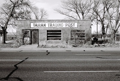
I'd be thrilled if anyone could confirm that there's a Blind Willie McTell record in the window of the trading post pictured above. It's on the opposite side of the picture from the Ross Perot shirts. It would have to be a later period photo, sometime around the "LAST SESSIONS" recording. Anyone? (MAY 2015 UPDATE: It's not Blind Willie McTell, but his former classmate at the Georgia Academy for the Blind, Rev. Pearly Brown, shown on the cover of Wet Willie's "Keep on Smilin'" LP. Thanks Cox family!)

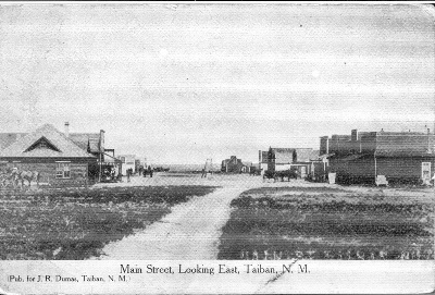
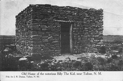
SEPTEMBER 2012 UPDATE: Below are two fantastic postcard images of Taiban. The first is of Main Street, taken from the east. Based on the 1908 postmark, the photo can be from no more than two years after Taiban's founding in 1906. The second is of Billy the Kid's hideout in the area, which has been reduced to nothing more than a foundation now, if even that. Both were submitted by Dave S. Here's what Dave had to say about the postcards, as well as Billy the Kid's capture at Stinking (aka Taiban) Spring in 1880:

"Thought you and some of your posters would like to see these images. I’m an inveterate postcard collector, and found these at one of my haunts. The first is postmarked Sept. 22, 1908 (can’t make out where it was postmarked). I also happen to be an uncrowned 'World’s Foremost Authority on Billy the Kid.' I snatched these up because BtK (and a few of his comrades) were captured at a rock house at Stinking Spring(s) (also called Cedar Spring, Brazil Spring, Taiban Spring, or just 'the spring') in the vicinity of Taiban, on Dec. 23, 1880. (He later escaped.) Frederick Nolan says the spot was first recognized as a strategic location by Kit Carson.

"There isn’t a whole lot of detail in the Taiban photo, but it’s very atmospheric. The scan ain’t the greatest, but you can make out the sign at middle left that says 'HOTEL.' That’s about as much detail as can be seen on the original. Much to my chagrin, I learned that the town wasn’t founded until 26 years later. As they say: Never ass.u.me. It cost me the better part of 40 bucks, but as great/rare cards go that’s not too terribly bad.


"The second image was clearly not BtK's 'home.' He was on the run and this was just an opportune hideout. And it is only 'said' to be the house where Billy was captured. The proof is not iron-clad. Although he provides no citation, Frederick Nolan avers in The West of Billy the Kid that, 'The rock house was a stark stone structure about thirty-feet long and twelve-feet wide, with a rough opening--no door--about ten feet from one end at the front. Inside were five men and the Kid’s horse; tethered to one of the viga poles outside were…three other horses.' Obviously, this description and the photo are not a great match. One could further cloud matters by noting that the nearby Wilcox-Brazil Ranch was of a similar stone construction. But whatever the location of the house, Billy was soon dispossessed of it, and so began his railroading to the gallows. This definitely occurred near Taiban, at a place called Stinking Spring(s). The “stink” at Stinking Spring(s) is said to be either: of a chemical nature, deriving from near-by geological formations, or caused by “decaying vegetation around it.” [Nolan] So are the twists and swirls around virtually everything Billy. There is no escape.


"I’ve been to Taiban, but don’t remember much about it except that there was very little left there. I didn’t try to find the foundation of the stone house, which is all that survives. As I recall, it was a matter of fatigue, and not feeling too terribly welcome there.

"So, anyway, I enjoyed reading your history of the place. I certainly don’t 'own' these images. They're forwarded along to you and yours for whatever purpose they might suggest."

These have to be some of the earliest photos from the Taiban area. I didn't come across them in my research and I imagine they're pretty obscure. So, many thanks to Dave for sending them to City of Dust. Much appreciated!

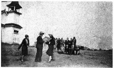
As a last update (for now), here's a 1925 photograph taken outside the Taiban Presbyterian Church when it was in its full glory. This is from the Application for Registration submitted to the New Mexico State Register of Cultural Properties on behalf of the church. The source of the photo is credited as Susanne Eldridge. So, thanks to her, whoever and wherever she may be.


FEBRUARY 2013 UPDATE: A reader recently sent in a wonderful family history of Taiban and a really excellent photo of the town from 1950. The view is looking north with recollections below.


"I bumped into your Taiban, NM site today. My grandparents settled there in 1908. The "Trading Post" was built in 1915 and used by my grandparents in the mid-'50s. The picture credited to Susanne Eldridge is of the church, which is also owned by her. Mac's Bar was just across the street from my grandfather's store and we would watch the cars come and go. Many were bootleggers headed east. My grandfather, J.S. Phillips, came stringing wire for Western Union as the railroad came though. He married my grandmother and settled in Taiban, the "City of the Future." Or at least he thought. He sold Fords and groceries and drilled water wells. He also sold Atwater Kent radios, ran a machine shop, sold gas, and fixed cars. He was very religious and took care of the Church, which was owned by the Presbyterian and Methodist churches. He and my grandmother, Anne Bordeaux, married in 1913. They had seven children and lost a child. I can go on and on. You can go to Facebook and there is a new page, "Remembering Fort Sumner".

David B., Fort Sumner, NM"

Thanks, David! Your contribution really adds a lot to this post. JM

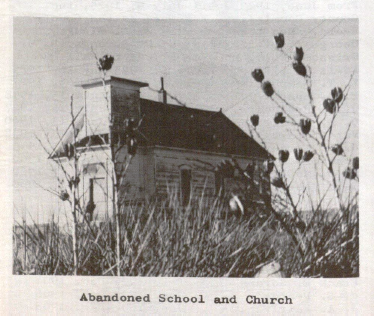
AUGUST 2013 UPDATE: While digging through the dusty corners of the Zimmerman Library at the University of New Mexico a photo of the First Presbyterian Church was unearthed. It's from a rare book titled, "Roosevelt County: History and Heritage," edited by Jean M. Burroughs. Note that the church is actually in De Baca County, about two miles west of the Roosevelt County line. The book was published in '75, so the picture has to be older than that. I'd never seen this spooky shot before, so I thought I'd post it here.


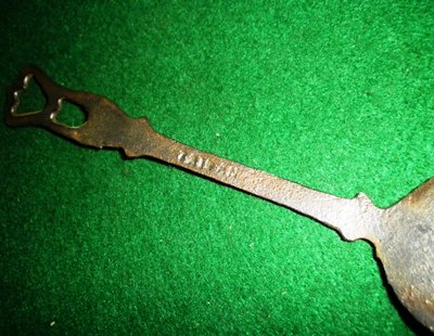
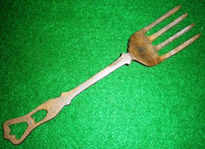
MARCH 2014 UPDATE: Here's something interesting sent in by Rob G. of southwestern Missouri. He found this wrought iron fork at an estate sale and estimates it to have been made between the late 1910's and early 1920's. While it might be hard to read in the photo, it clearly says "TAIBAN" on the back. There aren't many Taiban's in the world, so I have to think this fork might well have come from the little town. I'd love it if someone knew something about this piece.

Thanks to Rob G. for submitting this most intriguing find! JM


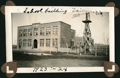
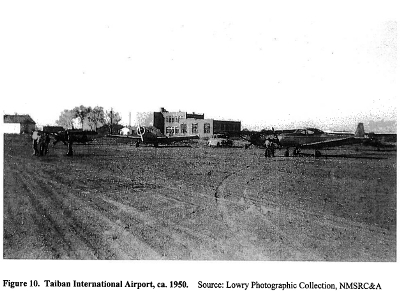
JANUARY 2016 UPDATE: D. Burge has submitted a treasure trove of Taiban-related photographs and scans, including the best (only?) shots I've ever seen of the Taiban school and international (?!) airport. Who knew the two were so close to each other? D. Schuyler also offered some information pertinent to the school and J.S. Phillips Garage. See below for these fantastic photos and descriptions. Thank you very much, Mr. Burge and Ms. Schuyler!


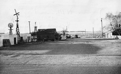
Above is the two-story Taiban school, of which virtually no trace remains. It seems awfully large for a town the size of Taiban and, indeed, only the first floor was used. One room contained grades 1-4, while a second room was for grades 5-8. Beyond that, students went to the high school in nearby Ft. Sumner.


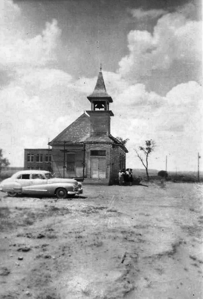
Shown in the wonderful photo above is, of course, the First Presbyterian Church of Taiban in its full glory. Well, aside from the scaffold. Interesting to note is the bit of the school that is also in the frame, just behind the church, pinning down its exact location pretty definitively.


Judging from the scene above the Taiban International Airport was simply the open ground just to the east of the school and church. Perhaps this is how some folks from dry counties in Texas arrived in Taiban to re-stock their liquor supplies. The photo dates from around 1950.


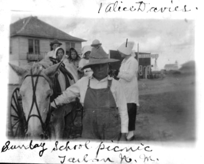
The picture above captures a Sunday school picnic with Alice Davies and her students. Note the Taiban church in the far background. The street immediately behind the picnickers is unrecognizable today.


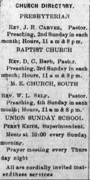
Speaking of Sunday school, the church schedule shown is from the Taiban Valley News and dates to 1917.


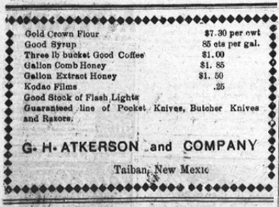
G.H. Atkerson and Company was one of the businesses supplying the items that settlers in the region around Taiban might need or want. Like a gallon of comb honey! Yum! And Kodac Films. I'd like to try shooting some of those films, even if they'd be expired by about 100 years. This is another clipping from the Taiban Valley News of 1917.


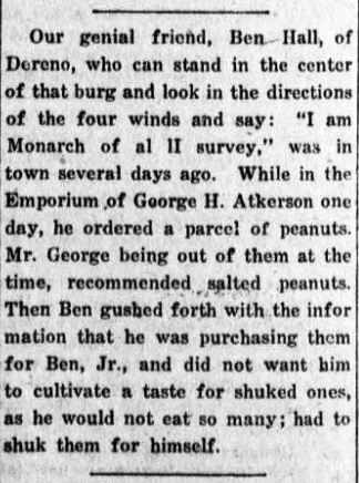
Another thing we know was sold by G.H. Atkerson and Co. were peanuts. And we also know that Ben Hall of Dereno (and founder of the Canyon Blanco Ranch) would purchase them for his son, Ben, Jr. However, not those salted ones! The story above is all the more amusing for its reference to Dereno, a very obscure place in De Baca County that was 12 miles south of Tolar. The post office operated from 1907-1933, but now even the origin of the town's name is lost to the mists of time. This little tale of the dangers of shuked (sic) peanuts is from the Taiban Valley News circa 1921.


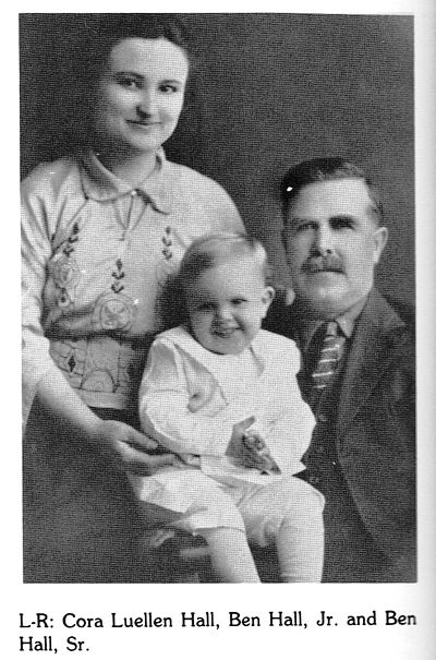
Above is a picture of the monarch of Dereno, NM himself, Ben Hall, Sr., and future peanut connoisseur, Ben Hall, Jr. Mrs. Hall is clearly quite proud! This photo comes from "Living Water: Our Mid-Pecos History: The Families & Events from Fort to Future," a now-rare tome chronicling De Baca County. The book was compiled by Bob Parsons and eight others in 1981 and issued in an edition of 5,000.


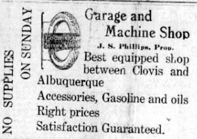
The J.S. Phillips Garage wanted everyone to know that there wasn't much between Clovis and Albuquerque around 1917-1918. They seem to have been well-stocked; you just didn't want to break down on a Sunday. The garage was on the east end of town, one of three open in Taiban by the late-1940's. Descendants of the Phillips family now own the First Presbyterian Church.


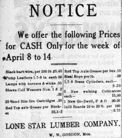
The ad above is for Lone Star Lumber, which supplied a variety of goods, pulled from the Taiban Valley News circa 1918.


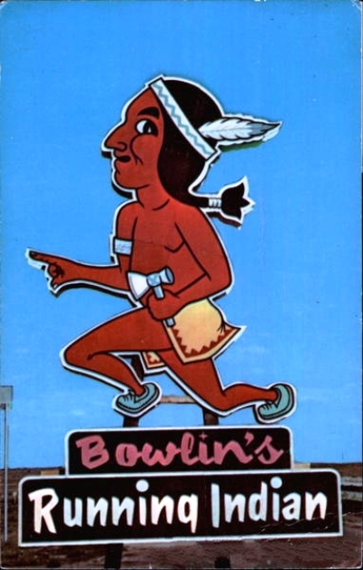
The Pink Pony Saloon and Dancehall was purchased by the Bowlin's family, who were famous for their trading post empire in New Mexico. The Pink Pony became the Running Indian, but may not have lasted long.


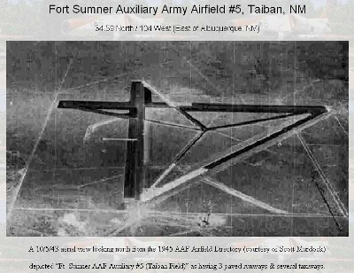
The airfield shown above is different than the one near the top of this update. It was probably located on the caprock just west of Highway 252, which leads north to HOUSE, NM, and used by the military as an emergency landing area back when the Fort Sumner Army Air Base was in operation. The M & M Cattle Company out of Amarillo, TX owned the land going back to the 1970's, but I've not heard who owns it now. It's said that for a long time you could see the outline of the runways, but nature finally reclaimed the place. The photo was taken on October 5, 1943, and comes from an interesting webpage called, Abandoned & Little Known Airfields: Eastern New Mexico.

I'm thrilled to add these rare photos to this archive of Taiban history. Again, many thanks to D. Burge and D. Schuyler for their generous contributions. JM

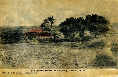
JANUARY 2018 UPDATE: Another postcard featuring Taiban has been kindly submitted by Dave S., who says, "There’s not a ton of there there, granted, but it does purport to show the actual site of the spring." Also of note is that this is the third postcard Dave has obtained bearing the inscription, "Pub. for J. R. Dumas, Taiban, N.M." One can't help but wonder how many images of Taiban were put on postcards for this Dumas person.

Thanks again, Dave S.! JM


APRIL 2025 UPDATE: I recently received an email passing along some family history from Taiban and thought I'd include it here as it adds to the picture of the area 100+ years ago, It's got some intrigue, and if the folks involved sound familiar, please get in touch! Thanks very much to Susanna N. for sharing this!

"My mother was born in Taiban in 1923. I have been writing a bit of an history about our family as there are a few surprising facts I have learned, and so your blog was really helpful for background, altho most of the posts are from later than my mother’s time…

"So, here is what I know so far…

"We think my grandparents homesteaded in a dugout, and its possible their first child, born in 1914, may have arrived in the dugout, she was born in De Kalb.…their next child was born in Lubbock in 1921, where my grandmother had family. She may have gone to Taiban because she began cooking for the road (or railroad) gangs at around the time my grandfather was arrested and sent to prison in Albuquerque. He was found guilty of transporting a minor female across a state line, (charged using) the Mann Act of 1910. With two children, and no income, my grandmother had to find some kind of work. Interestingly, my mother was conceived and born after my grandfather got out of prison. I have no arrest or trial records so how this all came about, I cannot even speculate, but Grandma must have taken him back….!!!

"When my mother was about 5 years old, my grandfather disappeared out of their lives forever. Subsequently my investigations led me to the Univ of NM who were kindly able to locate the prison record for my grandfather, and the tidbit of information that he died in 1972! But no other information…

"I hope this finds you well, and that some if this information will contribute to your City of Dust archive. Obviously if there is any information you have that corroborates or enlarges any of this story…I would greatly appreciate hearing it!!"