We’re gonna leave New Mexico for a bit and head into southern Colorado. It’s interesting, because as soon as you enter Colorado you know you’re in a different place. The same is true of Arizona. I find it hard to believe that the surveyors that marked out state boundaries across the West based them largely on landscape, but southern Colorado is definitely not New Mexico. Colorado also has its own thing going when it comes to what we check out here at City of Dust. So, let’s have a look at Colorado State Highway 12, also known as the Highway of Legends and considered to traverse some of the finest mountain countryside in the U.S. But note that this is only the southeastern portion of the Scenic Byway, through the Purgatoire (“picketwire” if you're an English fur trapper) River Valley. On this visit, time constraints prevented a full circuit north through the Cuchara Pass and on into La Veta. Bummer.
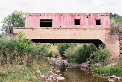
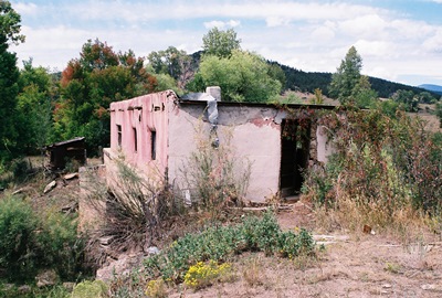
Generally, I think people drive the Highway of Legends heading west out of Trinidad, but we’re going to run it backwards, starting at what has been called the most-photographed and most-painted house in Las Animas County, the House on the Bridge in Vigil. I guess I’ll add a few more shots to the tally. The town of Vigil was settled by Juan Vigil in the 1860’s and incorporated in 1890. The post office operated until 1920, but not much has been going on since then. In 1918, the original road east from Vigil to Stonewall was re-routed and a small bridge over the North Fork of the Purgatoire River was orphaned. Joseph E. Martinez, a state senator, was half-brother to Charles Vigil, the property owner, and built a little house on the bridge. Marcus Vigil, Charles’ brother, rebuilt the house at some point and that’s what remains now. It’s very quaint and must’ve been a nice place to live, with the burbling river (um, maybe "creek" is a better term now) below and mountains all around. There aren’t many neighbors either. That's it in the two photos above.
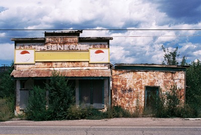
Heading east we arrive shortly at Weston, originally known as Los Sisneros after Juan Sisneros, a rancher who settled in the area in the 1880’s. A post office was built in 1889 and the town was renamed after the postmaster, Bert Weston. At the turn of the 20th Century, Weston was the supply base for the Rocky Mountain Timber Company. Currently, there’s an abandoned general store. But the North and South Forks of the Purgatoire River meet here and the majestic Sangre de Cristo Mountains loom in the distance. The name, translated as “Blood of Christ,” comes from Spanish explorers who saw that the morning sun turned the peaks red. There’s a story about a prospector who came to town out of the Sangre de Cristo’s once a year with a large nugget with which he bought supplies for another full year. The prospector said that he used the red morning light to find his mine high up along the tree line. When he died without revealing the mine’s location, many men tried fruitlessly to find “gold where the snow turns to blood.”
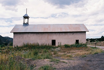
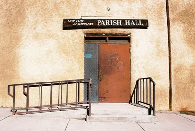
Throughout the Purgatoire Valley are numerous old churches. The one above is in Segundo, an old coal mining town. Segundo was founded about 1900 and the Colorado and Wyoming railroad made its operating headquarters here in 1901, constructing a five-stall roundhouse. At one point, Segundo processed more coal than anyplace west of Chicago, claiming 800 ovens in which moisture, sulfur, and phosphorus were burned off to make coke, which was especially desirable for smelting. Now it's delightfully deserted, relatively speaking.
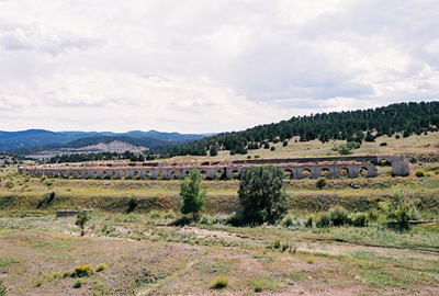
Coal was a pretty big deal in the Purgatoire Valley, near the mouth of which sits the aptly-named Cokedale. Founded in 1907 by the American Smelting and Refining Company (ASRC), by 1909 Cokedale had a population of 1,500 and 350 coking ovens. In 1947, the ASRC shut down and company houses were sold to residents for $100 per room and $50 per lot. Because many residents purchased their homes (and despite many houses being bulldozed), Cokedale is considered the best preserved coal mining camp in Colorado and is on the National Register of Historic Places. Across from the rows of old ovens outside of town, steam still rises from slag heaps, the last bit of mining activity that remains.
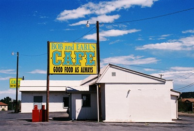
From Cokedale it’s just a few miles back to a good meal in Trinidad, which is worthy of its own post. But whether it will be the NEXT post I haven’t quite decided.
Information for this post was swiped from Sangres.com and Trinidadco.com.
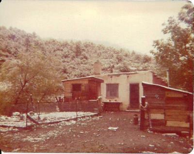
OCTOBER 2013 UPDATE: Sometimes people contact me personally and their recollections are so interesting that I ask if I can post their stories directly on City of Dust. This time, Mandy W. has graciously agreed to let me pass along both her memories of growing up for several years in the House on the Bridge--also known as Bridgehouse, apparently--AND some great vintage photos circa 1974:
"I just read your piece on the Bridgehouse near Weston, CO. I lived there from ages 4-10, then we moved up Wet Canyon to a house my dad built up there. We went to school at Weston Elementary, which is now closed. Thank you for your history. We mostly only knew it as our childhood home, and had a difficult time sleeping once we moved up the Canyon because we no longer had our River to put us to sleep! It was a magical and difficult place to live..."
It's one of the best and strangest powers of the internet that I can post about an odd and fascinating abandoned house in rural southern Colorado and somebody who lived there can find the piece and send me their own photos and recollections. Very cool. Thanks again, Mandy.
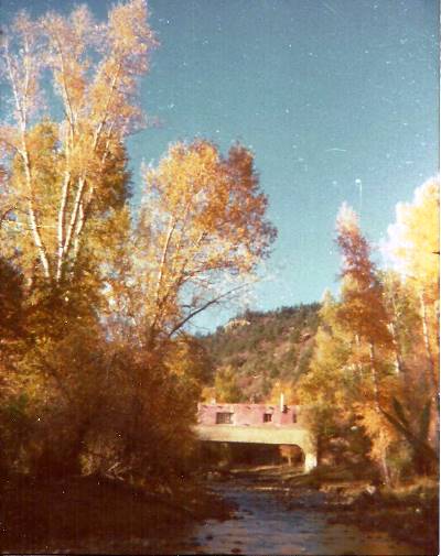
FEBRUARY 2014 UPDATE: Mandy W. has come through again with more information regarding the construction of Bridgehouse, where her family lived for a few years in the 1970's. Her dad filled in some of the story. I've never seen the construction dates elsewhere.
"Bridgehouse was built in 1941 in two stages. The highway used to go up by Vigil, but was moved to where it currently runs (Highway 12). The bridge itself was built in 1918. My dad rented it from 1971-1977 for $50/month but worked off the rent! He's not sure if anyone else lived in it besides an artist who was there prior to us."
Many thanks to Mandy for filling in some more of the history of her old home.
APRIL 2014 UPDATE: Below is another piece of Bridgehouse history, kindly submitted by V.J.A.
"After reading everything you posted about Bridgehouse, I just have to add what I know to the story. Around 1966/1967 my great grandparents, Bacilio and Mary Garcia, lived in the house. Like Mandy's father, Grandpa Bacilio was also a ranch hand for the property owner. Although they only lived there for a year or so my mother-in-law, Lena Guzman, has memories of playing in the creek under the bridge.
"It's not much but it at least adds to the timeline."
And so it does! Thanks very much, V.J.
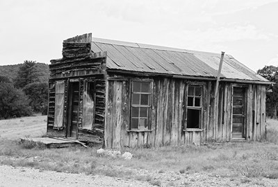 About seven miles south of Ancho, down an unexpectedly bumpy gravel county road (I’ve gotta learn to pay better attention to map symbols), is what remains of Jicarilla. Named for the surrounding Jicarilla Mountains (jicarilla is Spanish for “little basket” or “little gourd”) and, by extension, the Jicarilla Apache, gold first started being pulled out of the area prior to the 1820’s. This is when the Spanish, followed by the Mexicans, came with pans and wooden bowls called “bateas” to work the creeks. Although, truth be told, it was often Native American slaves that did the actual work. In 1864, the U.S. Army forced the local Apache onto distant reservations. By then, Texans had been drifting in and trying their luck for over 20 years. Prospectors arrived en masse in the 1880’s and by 1892 Jicarilla had a post office, which also served as an assay office and store. That's it pictured above. At this time, about 200 people lived in Jicarilla and by 1900 a saloon had opened and the town had a Justice of the Peace.
It was during the Great Depression that the population of Jicarilla peaked at around 300, when desperate people tried to support themselves by gold mining. Actually, I think that kind of thing is happening around the country again right now. Mining could bring in as much as $7 per day and there was plenty of game to provide extra food. But Jicarilla must’ve been a little too remote for most folks as nearly everyone left once the economy improved. By 1942, Jicarilla was pretty much done.
However, some mining continued until relatively recently, when the Lincoln National Forest, which borders Jicarilla, decided to crack down on miners who lived or worked on federal land.
 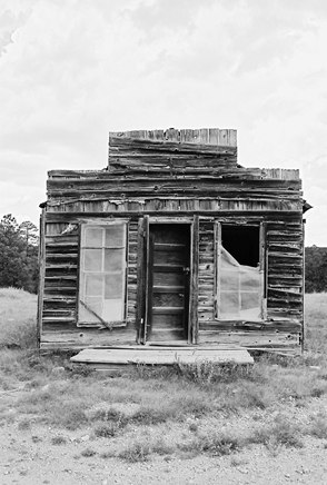 I’ve been told that this was at least partially a result of miners dumping waste in the forest. Whatever the case, the last miner in the area was a man named Jerry Fennell, who had spent 30 years working his claim, finding a little gold here and there, and living in what had been Jicarilla’s general store until one day he was required to submit an official plan of operation. Unable to pay the reclamation bond, Mr. Fennell and Dusty, his well-named burro, shut everything down in the early 2000’s, the last in a line of miners stretching back to the Jicarilla and Mescalero Apaches, who extracted turquoise from the mountains in the late 1500’s.
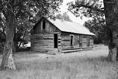 Almost a mile to the south is the log schoolhouse above, built in 1907. Also functioning as a church and general meeting place, it was used through the Depression. The fellow from White Oaks that I mentioned in the
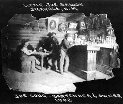
 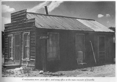 During our visit there appeared to have been some recent activity around a more modern-looking green cabin on the east side of the road. This place is known as the "Hunt Casita," after a family that lived there in the late 1970's. But the post office, small adobe general store (not pictured), and schoolhouse are entirely quiet, as is most of the area around Jicarilla these days. Above is a photo from
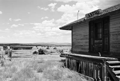 Lincoln County, New Mexico is Billy the Kid country. The Kid gained his reputation in the Lincoln County War of 1878 and escaped the hangman’s noose by shooting his jailer’s in the Lincoln County Courthouse. I may do an entire post on Billy the Kid and the town of Lincoln someday, but right now we’re going to visit Ancho, in the northwestern part of Lincoln County.
Ancho (pronounced like the first part of “anchovie”) is Spanish for “wide” or “broad” and refers to the valley in which the town sits. Most towns in New Mexico were born by the railroad or minerals and Ancho owes its existence to both. The El Paso and Northeastern Railroad pushed into the valley around 1900 and designated that there be a stop in the vicinity. Within a year, a gypsum deposit was discovered not far away and a plaster mill was built, operated by the Gypsum Product Company. In 1902 (or 1905, depending on your source), a proper railroad depot was put up and some company houses constructed. In 1905, the Ancho Brick Company was created to utilize the abundant fire clay in the area.
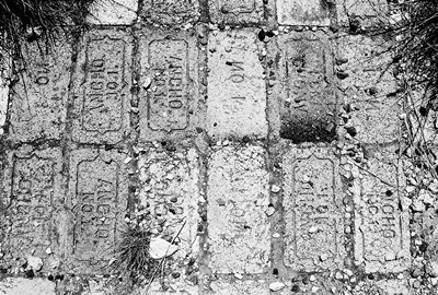 For a time, the heart of Ancho was made of plaster and brick. Ancho-made bricks and plaster helped rebuild San Francisco after the 1906 'quake and more bricks were used for smelter stacks in Arizona. In 1930, the town used its own product to construct a large, brick schoolhouse, replacing the small, wooden, one-room job that burnt down. The school had as many as five teachers and 140 students. However, Ancho was in trouble.
 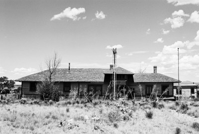 In 1963, Mrs. Jackie Silvers purchased the old depot, somehow moved it off the railroad right-of-way, and then filled it with all manner of antiques from the area. My House of Old Things, as the “museum” was called, got a rave review in Varney’s
 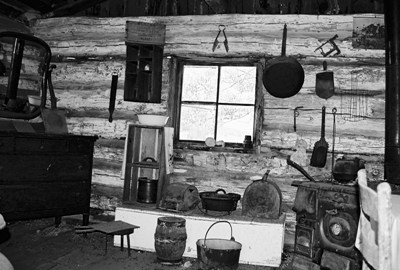 Later, in nearby
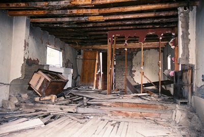
 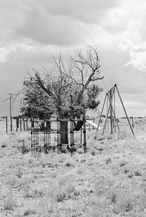 “heartbreaking” given their relation to the history of ranching, farming, and homemaking in the region. Who knows what was sold, but peeping inside it appeared that much remains. Furniture, clothes, an old wooden letter box. Through one window was a mannequin head, seemingly presiding over the dust and decay, waiting for something to finally happen. It may be a long wait. The old playground, abandoned over 50 years ago, still stands, made of bolts and bits of pipe that no school would allow children to play on in this day and age. The school, pictured below, seems to have fared better and is now a church. Though who attends I have no idea.
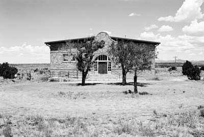 Not one car passed down the road during our visit. The town was completely silent. Lightning flashed on the horizon and for a brief moment a few big drops of rain fell. Only one building seemed occupied and, indeed, we learned that someone does live there. So, this is Ancho in 2012, population 1.
As so often happens, most of the info for this post came from
 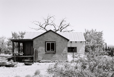 A few weeks ago we visited an unusual
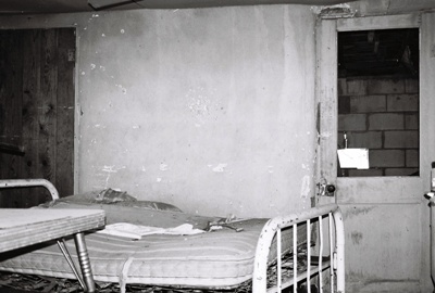
 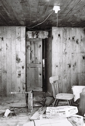 In fact, the place still attracts cattle and on the day we visited they were milling all around, lowing and looking alternately angry and confused by our presence. The noise actually made it hard to concentrate on exploring. Thankfully, they eventually got bored and wandered off into the desert somewhere. Exactly when the ranch might have been abandoned I have no idea, but I'd say it's been empty for a few decades now. There are still some canned goods in the kitchen, but I wouldn't eat them if I were you.
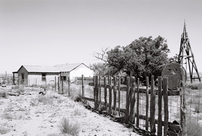
Adjacent to the ranch is a holding pen and a water tank, so the cattle weren't there for nothing. Apparently some ranchers must still be using the site to hold livestock, but it didn't look like the house had been entered in quite some time.
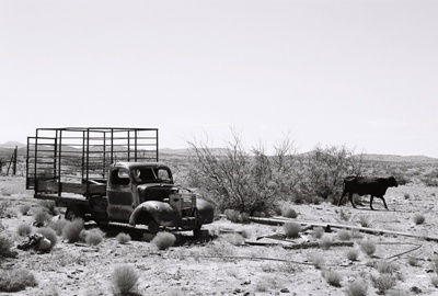 The 1940 Chevrolet truck out front and the whitened branches of dead trees provided appropriate atmosphere, as did the name of the valley in which the ranch is located. Valle del Ojo de la Parida could translate as "Valley of the Spring of Nonsense (or Stupidity)," which leads me to believe that someone went looking for water nearby and didn't find it. Or the water made them crazy. It could also be something like "Valley of the Spring of the Young Mother." Frankly, I'm not sure I'd want to be a young mother way out here. While the name certainly refers to a spring, I do like the idea that "ojo" could translate as "eye." There's just something about wandering around in the "Valley of the Eye of Nonsense" that appeals to me. At least until I collapse from dehydration.
 The only other thing I could learn about this area is that there used to be a fair amount of
 I first started City of Dust in August 2004 specifically to share some of the few hundred photos I'd taken over the previous two years while living in Augusta, Georgia. I had never even owned a camera prior to living there and hadn’t given a whole lot of thought to history, either. But something about Georgia’s second-oldest city really resonated with me. If you want to know more about that period, have a look at
  Finally, let me add that I don’t know how many people from the CSRA are still following what I’m doing, but it used to be that most of my readership was from Georgia and South Carolina. So, if you’re still paying attention…thanks! And maybe you’ll be able to come out to some of the festival’s events. Also, if you’ve ever left a comment at City of Dust regarding some of those earliest posts, many of those are being incorporated into the above-mentioned display. The memories shared were just too unique and poignant not to give them a wider audience. We did mask the identity of those commenting, but you’ll know yours if you see it. It was impossible to contact most people for permission, so hopefully no one minds having their thoughts (and, in one case, photo) re-used. In fact, the historical and personal insight provided by these comments might be the most important part of the whole project. Thanks for continuing to provide them over the years. Perhaps I’ll see some of you in the November. If you want to know more about how the comments are being incorporated, leave a message here or contact me through the e-mail associated with my profile.
 It’s been awhile since I’ve posted about a place that I know absolutely nothing about. But I used to do it all the time. Back in 2004, I wrote about this great
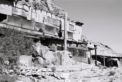
 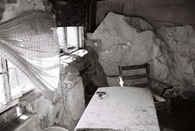 One thing I do know is that this was clearly someone’s living space, a hand-built home on the side of a rocky hill in the middle of nowhere, way out in the Chihuahuan Desert. Judging from the date on a
 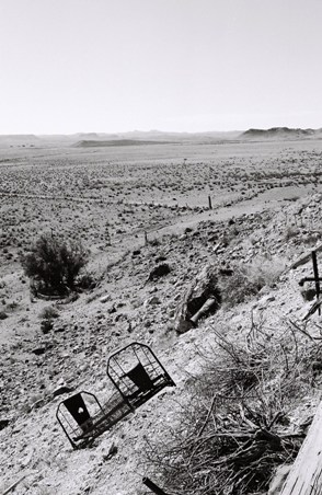 If that’s HOW it was built, perhaps a better question is WHY it was built. I assume it was used as lodging for ranch hands back when the entire area was being grazed, but, if so, it was far more sophisticated (not to mention higher off the ground) than it needed to be, with cupboards, stone fireplace, two bedrooms with curtained partition and even a second story, which has partially collapsed. Perhaps it was built simply because the view out the front is stunning. Desolate and forbidding, maybe, but if you like that kind of thing, as I certainly do, and aren’t much for food, water, or company, you couldn’t do better than to build yourself a home out here.
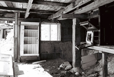 There are actually two structures, the main living space with entryway and fireplace, kitchen, bedrooms and a bathroom with tub, sink and toilet, and an adjacent building that is much smaller and contains only a stove and sink. I’m assuming this second structure was just a kitchen. Maybe it was too hot to cook much inside the living area. Or too dangerous. Both structures are backed up to exposed rock, which provides quite a nice effect. Small shelves were constructed wherever a natural rock formation lent itself to such a thing, and some of the rock walls were painted green or yellow or white and, as I alluded to, there are also paintings done right on the rock. One, signed
 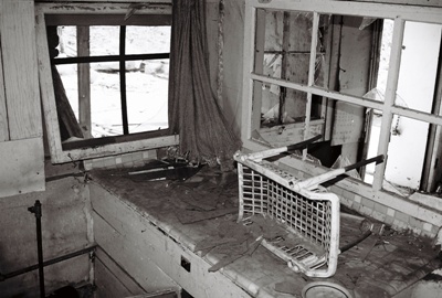 The thing that strikes a person again and again is the remoteness of this house and how at odds it is with its construction. How did they get water out here? There is indoor plumbing and faucets and that tub and it all seems like more than a cistern would be likely to collect most of the year. And how did they get electricity? That refrigerator didn’t run on firewood. But to have pulled a chair up out front to watch the sun go down (or rise, for that matter) must’ve been quite a reward for a hard day of cow-punching. If you’d like to visit…well, don’t! Trust me, you’ll never find your way out here and it’s probably better for both you and your vehicle that way.
 Next time we’ll check out another place in Socorro County I know almost nothing about. These posts sure are easier to write when they contain no historical information. Probably easier to read, too.
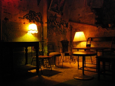 Don’t worry, with the next post we’ll be heading back out to the desert. Even in the searing heat I’ve managed to check out a few new locales. But these are so remote and mysterious that I’ve been able to find very little to say about them, historically speaking. So, while I consider how to present these lost gems, we’ll make a short stop in Budapest to visit an abandonment that is a decidedly un-lost gem, the Szimpla Kert "ruin pub."
Romkocsma, which translates literally as “ruin pubs,” seem to be a phenomenon somewhat unique to Budapest. Having emerged from Nazi occupation and subsequent Communist rule with numerous poorly-maintained buildings, Budapest found itself without the resources to restore them properly or tear them down.
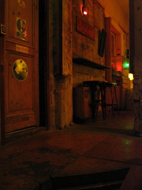 Many of these buildings were once apartments and are located in residential neighborhoods, sometimes sandwiched between occupied buildings, and, from the outside, all you usually see is a run-down façade. But inside it’s a different story. By negotiating cheap rent and enlisting the help of anyone that can help make these places structurally sound, vibrant, lively pubs have sprung up amidst the ruins. Acting not just as watering holes, but as community gathering-places presenting music, film, and alternative arts and culture, you can’t help but hope this trend continues.
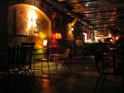
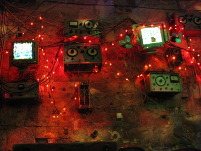 Of course, as with any concept that works this well, there has been growing discontent and early patrons of Szimpla Kert lament the international hipster crowd, the more expensive drinks, and the general popularity of the place. Szimpla was voted
 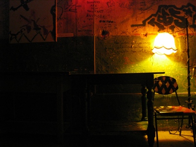 By the way, the graffiti in the photo above reads, "Borders are not relevant anymore," a lovely sentiment given the history of Hungary (and Eastern Europe, in general).
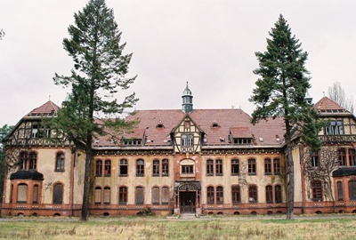 While southwestern New Mexico burns, covering much of the state in dingy smoke, I think we’ll stay overseas and visit Beelitz Heilstätten, a 200-acre hospital complex comprised of 60 buildings and located in the town of Beelitz, just a few kilometers south of Potsdam. Beelitz’s other claim to fame is its delicious white asparagus, but as pictures of asparagus aren’t always interesting, we spent all our time at the hospital.
The Beelitz Heilstätten complex (“Heilstätten” translates roughly as “a place of healing) was constructed in 1898 and designed by Heino Schmieden, partner in one of Berlin’s greatest architecture firms of the time. Aside from the numerous ornate buildings, rigorously separated by gender, the grand complex also contained its own generating station to produce power and heat. Below is the entrance to the men's sanatorium.
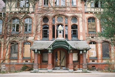 Conceived as a tuberculosis sanatorium by the Berlin Workers’ Health Insurance Corporation, the main treatments seem to have been “baths.” Water baths in pools, air baths on balconies, just generally taking it easy, I guess. There wasn’t much in the way of effective surgery at the time, of course, and the grounds appear to have mostly been designed with extended strolls in mind.
Then, at the beginning of WWI, the complex quickly became a military hospital for the Imperial German Army. Perhaps the most (in)famous patient to stay at Beelitz Heilstätten during this time was Adolf Hitler who, after being wounded in the leg at the Battle of the Somme, spent October and November of 1916 recuperating here.
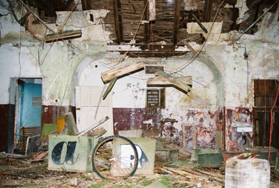 After being used as a Nazi military hospital during WWII, Beelitz Heilstätten was occupied by the Soviets in 1945 and, at its height, employed 1,000 people. Strangely, it remained a Russian-operated facility until 1995, a few years after German re-unification. In fact, shortly after the fall of the Berlin Wall, in December 1990, Erich Honecker spent time here. He had just been forced to resign as head of the suddenly non-existent East German government and apparently wasn’t feeling too good about things. I suppose the liver cancer probably didn’t help.
It was also during the unsettled period between the Wall coming down and re-unification that Die Bestie Von Beelitz or, The Beast of Beelitz, appeared. From the fall of 1989 to the spring of 1991, the Beast, a necrophiliac, terrorized the women of Beelitz, strangling or stabbing his victims and at least once leaving his own pink underwear behind.
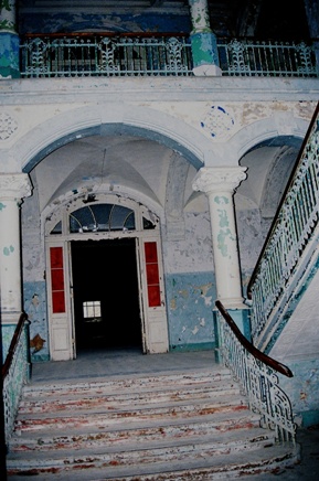 Most of the attacks occurred near the surgical block and women’s pavilion on the forested Heilstätten grounds and his victims included the wife and infant child of a senior physician. Before being detained by joggers while pleasuring himself in the woods, the Beast, whose real name is Wolfgang Schmidt, killed a total of six women and the infant. He was sentenced to 15 years detention in a psychiatric facility which seems a little, I don’t know, LIGHT to me. However, I believe he remains imprisoned now, 20+ years later. A
 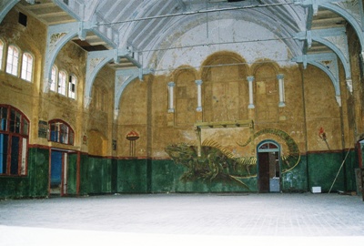 Recently, there have been some efforts to privatize the complex but bankruptcy has gotten in the way. The surgery, psychiatric ward, and rifle range (??) have been abandoned for some time and a supposedly functioning center for neurological research and a rehabilitation area for Parkinson’s sufferers were not obviously operating during our visit.
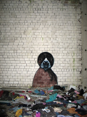 In fact, aside from the caretaker’s quarters and some random renovation here and there, we saw virtually no activity. Unfortunately for us—and in contrast to statements from a year or two ago—most of the buildings were locked-up, boarded-over, and totally inaccessible without more time and at least a rope or two. Still, it was quite an experience to wander the grounds on a damp, overcast day, take in the unusual Russian graffiti, and consider all the terrible goings-on that have occurred at Beelitz Heilstätten.
Although I had not heard of Beelitz Heilstätten before visiting, it turns out to be quite well known indeed. I found very good information and the Michael K. quote at
 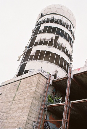 City of Dust is pretty much always on the road and occasionally we even manage to go international. Awhile back we visited the
  By the late 1950’s, the Allied Forces, and the United States, in particular, were trying to find a way to listen-in on nearby Communists from stations in West Berlin. Mostly they drove around the city in mobile units, trying to find the best reception from the East. Then, one day, some smart people decided to go to the top of Teufelsberg and found that from there they could hear the Reds very well indeed. Thus, the construction of several large radio domes was undertaken. Also, the mechanical lifts at the ski slope were removed because they interfered with reception. Just another sacrifice for the Cold War.
Once the proper infrastructure was in place, it was found that at a certain time of the year reception was fantastic, better than at any other time. After some investigating, it was discovered that the Ferris wheel used for the annual German-American Volksfest acted like a large relay antenna. From then on removal of the Ferris wheel was delayed for a bit at the end of each festival. Also, since no one really knew what was going on at the listening station, some strange rumors were born, including one involving emergency exit tunnels that ran deep down into the mountain of debris.
Of course, eventually the Cold War sort of went away and the listening station quickly became useless.
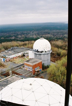 The land was purchased by investors soon after the fall of the Berlin Wall with the intention of building hotels, but there was already too much construction in the newly-reunified Berlin to make the venture profitable. For awhile there was also talk of turning the whole place into a spy museum. Now, new zoning regulations have ensured that this manmade “forestland” cannot be built upon and the only possible use for the listening station is as a Cold War Memorial. The rest of Devil’s Mountain remains a rather nice park.
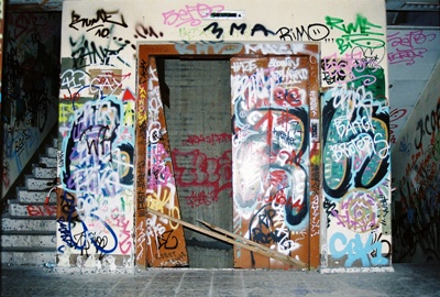
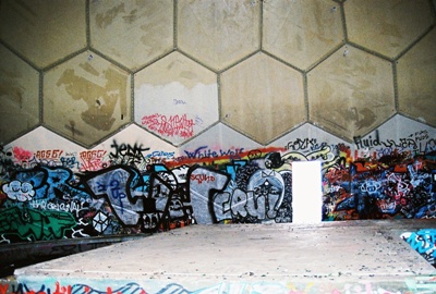
During our visit, we had to work a bit to find an entrance, but once the easiest option was located, we, along with apparently many, many others before us, had free run of the place. Most of the outbuildings are uninteresting, but the real gems are the radio dome towers, which can be climbed all the way to the top by internal stairs. I’d recommend staying away from the dark, empty elevator shaft. The towers have no walls, so you can get out on whatever floor you like and have a look at the drop below. This day, the wind was howling, making getting close to the edge a pretty risky proposition.
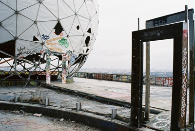
 Near the very top of the towers sit tattered domes which seem to have been made out of something like Masonite. The wind is slowly annihilating them and they made a lot of noise in the gale. Then, at the absolute top of the stairs, one emerges into a fairly intact dome where the acoustics are astounding. You can speak in one direction and hear your voice behind you. Every sound is amplified and bounces around the dome in all directions. Easily the coolest echo chamber I’ve ever been in. Ah, Cold War technology; fun for kids of all ages.
Covered with graffiti and rapidly decomposing—not to mention immensely dangerous to the clumsy or chemically-impaired—the most likely fate of the Teufelsberg listening station seems to be its eventual destruction. The area will then be planted with trees and it seems unlikely that the old Cold War relic will, like so many other wartime structures, become a permanent part of the Devil’s Mountain itself. But, if you ask me, it probably should be.
 Obviously, it’s not easy to get information on what exactly was going on at the listening station. I got the basics from