After losing one crew member to Lyme disease, the two of us are moving farther north through Hamilton County, to our third location. But we’re continually optimistic, believing that each location will be somehow easier, offering better access, less rugged terrain or fewer wild dogs. After all, how can things get worse? At some point we’ll stop bothering to ask. However, at our previous location we’d actually encountered one of the plants we were searching for, mountain skullcap, albeit mostly in an area of tattered bramble beside a clearcut adjacent to a rutted logging road, pretty far from its described habitat of undisturbed mid- to –late successional forests. Still, we did find a couple plants actually lurking in the woods.
Right of the bat we find ourselves unsure of how to even approach the new location. A small dirt pull-off to the east puts us at least a mile from our first transect and the south and west are too rugged and remote to even consider. So, we drive north, into the small neighborhoods tucked high on the edge of Walden’s Ridge, hoping that some dead end street somewhere will turn out to be a logging road. As we turn off the main road a few people working outside immediately stop what they’re doing and watch us pass. We wave to a man and his son. Neither wave back. At the end of the most promising street is a 6-foot fence, gated and locked, with a sign that says, “No Tresspassing! Turn Around Now!” So, we turn around, the logging right-of-way either long gone or not worth fighting to find. Standing in a yard are five old men, each watching us suspiciously as we get the truck headed back toward the main road. We wave and all five wave back in unison, the same suspicious frown remaining on every face. Sometimes being in a government vehicle is a liability, even one with a Dale Earnhardt sticker in the rear window.
 We drive back down the steep and winding road to the pull-off we stopped at earlier. Checking the distance on our GPS machines we mutter some oaths, stare forlornly out the window, then shrug and start walking. As it happens, we soon find ourselves walking on a bonafide nature trail, well-used and even signed. We continue on as the distance on the GPS unit keeps dropping. A few mountain skullcap are even growing alongside the trail. For once, things look promising. But it’s not long before we realize that there’s a problem. While the distance to our first transect keeps dropping, the bluff to our right keeps rising. And rising. It’s a serious bluff, too, entirely unclimbable to anyone without rappelling experience.
 After awhile we check our GPS map and see that, indeed, we’re standing about 70 feet below where we want to be. Thinking that maybe the bluff will start to descend at some point, we keep walking. But the bluff does the opposite of descend. We walk the entire length of our location, unable to get to a single transect, some of which are only 30 feet away from us in horizontal distance, but over 100 feet away in vertical distance. The expedition has now taken hours and we’re soaked with sweat. We turn around and start back as the afternoon slips away. We figure this is one place that’s not getting surveyed.
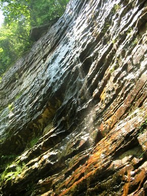
We’re about halfway back when I notice a waterfall. I go to have a look, mostly out of curiosity, and realize that just to the side of the waterfall, in an area hidden behind a rock outcropping, are some natural stone steps and, at the top, some trees to hold onto to help us the rest of the way up. It’s steep and falling would kill you—or at least make you wish it had—but it is a way up.
 It’s too late in the day to bother, so we decide to come back the next day and give it a shot. In fact, climbing up the waterfall does work, however, at the top of the ascent, we find ourselves staring dumbly at the base of a second bluff. Our transects are actually up on the top of this second bluff. We get lucky and quickly find the only way up the second bluff, following a rocky creek bed that tumbles down from out of the trees above. We are now, at points, over 100 feet above the trail, working in an area with only one way up and the same way down. In an emergency there will simply be no way to get out quickly or get anyone in. We’ll spend many days wondering if we’d have been better off never having found the way up.
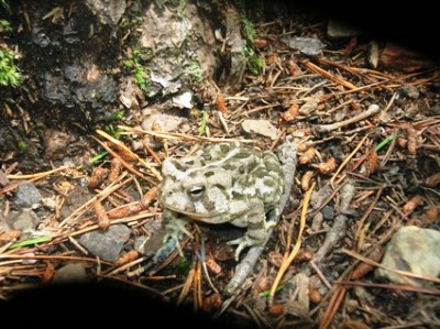
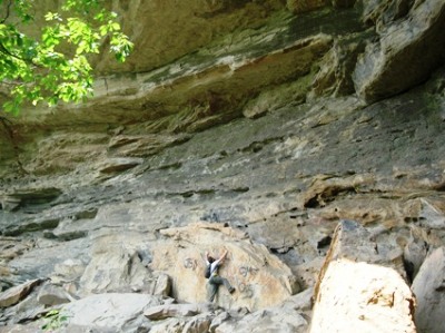
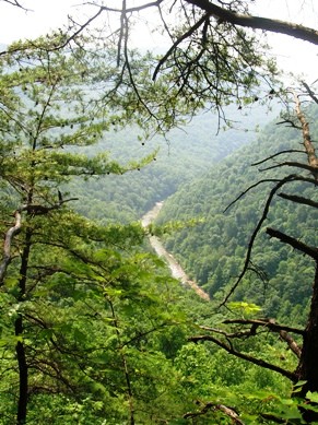
 The top shot is a toad's-eye view of our attempt to find a way up the bluff. The second shot shows what frustration can do to a man. The third photo is of the above-mentioned waterfall, although it's getting a little dry. That last photograph is from the base of the second bluff, so we still had some clibming to do. Just don't look down.

1 comment:
Glad to see you're back. I really like the motel shots (for some reason, the comments link on that post is broken), and as always enjoy the stories that go with the photographs.
My favorite from this post is the fourth one. I get vertigo just from looking at it.
Post a Comment