Sunday, September 24, 2023

Beneath the Giant’s Head: Cabezón, New Mexico


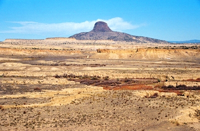
If you’re tooling around the Rio Puerco Valley northwest of Albuquerque, one feature will loom in the distance, possibly beckoning you to come closer (or even climb it), and that’s Cabezon Peak, a volcanic plug left after the erosion of a larger cinder cone. This feature was known as Wasema'a to the Jemez. To the Isletans it was Tchi'kuienad. The Navajo called it Tsenajin, or Black Peak. For them, it represented the head of a giant that had been killed on Mount Taylor, a sacred place, by the Twin Brothers, or War Gods. The lava at the base of the peak then was the giant's blood.

Tsenajin represented the eastern edge of the Navajo's tribal world until the Spanish began to move west of what they, in turn, called El Cabezón, or "The Big Head." The peak is about 2,000 ft. higher than the surrounding landscape and, in 1849, Lt. James Simpson of the U.S. Army traveled through and wrote about "the remarkable peak called Cerro de la Cabeza." It is still remarkable.

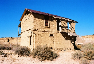
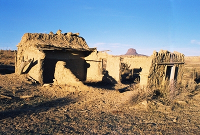
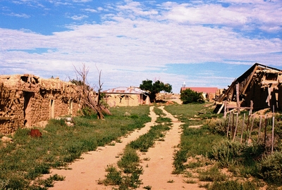
Today, just below Cabezon Peak, on the north bank of the Rio Puerco, are the sun-blasted remains of a small village. This is what’s left of Cabezón, New Mexico, settled, it's said, in 1826 by Juan Maestas, who came from Pagosa Springs, Colorado. It was one of four small Hispano agricultural settlements in the area, along with Guadalupe, San Luis, and Casa Salazar. But even before that, going back to the late 1700s, Hispano farmers here had grown corn and chile and harvested wild asparagus along the Rio Puerco.
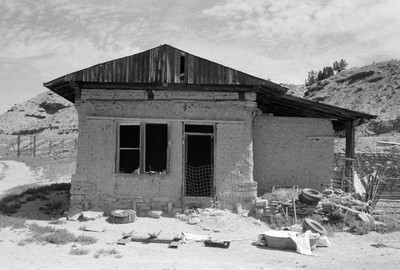


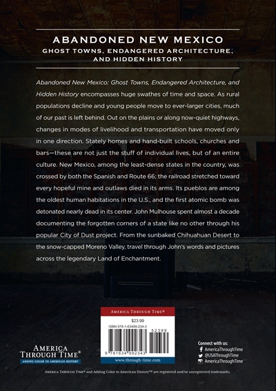
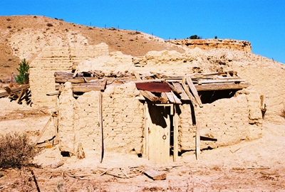
I was told this old adobe was once the Cabezón Bar and Dance Hall. It's hard to imagine now, but if you listen hard you might still hear the clack of boots against the floor.

Before it was Cabezón, the village was known as Rancho de la Posta, or La Posta. “The post” indicated a stage stop, and, indeed, La Posta was on a major stage route west of Santa Fe, and at the crossroads of a trail running between Zuni Pueblo and Jemez Pueblo and a Spanish trail from Albuqueque to Cuba. This confluence of trails makes sense given that Cabezon Peak was and remains an obvious landmark for travelers. However, the area was not permanently occupied until 1872, when the Navajo Reservation was created and skirmishes with settlers ended.

When a post office was applied for in 1879, Rancho de la Posta became Cabezón Station and then just Cabezón. The village thrived for many years, and by 1920 the population may have been as high as 250. There was a church, four stores, several dance halls, the aforementioned post office, some saloons, and dozens of homes. Restie Sandoval, born in Cabezón in 1929 and quoted in Ghost Towns Alive by Linda G. Harris, said, "We had no money, but we were content."

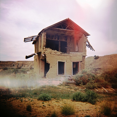
One of the villages’ showpieces was an eleven (or possibly fourteen, depending on who you ask)-room adobe residence occupied by Richard F. Heller and his family, just a few steps across the road from his store. The house also served as hotel, frequently providing lodging to weary travelers. It may yet shelter the occasional bird or rattlesnake, but guests arrive only rarely these days and none stay the night.
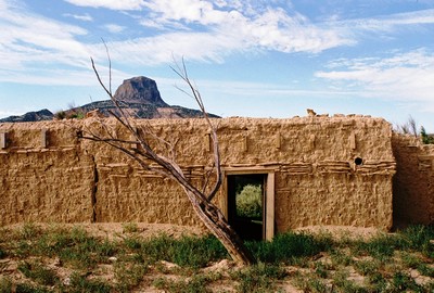


A small section of the Heller family’s 11/14-room adobe home and hotel.

Richard Heller was perhaps Cabezón's most prominent citizen, arriving in 1888 and, with partner John Pflueger, buying the trading post that William Kanzenbach and Rudolph Haberland opened in 1874 and ran until they went deep into debt with their supplier, the Charles Ilfeld Company. Heller helped Cabezón flourish, in part because of trade with the Navajo. Heller and Pflueger were brokers for the wool the Navajo brought in, and some years they would take as many as 40 wagon loads to market in Albuquerque. Heller bought Plueger out in 1894, a deal that perhaps included the 10,000 sheep they owned together, and he remained among the village's leaders until his death, establishing a bit of an empire that would also include 2,000 cattle.

The store ruins that can be seen in Cabezón are not those of the original 1874 trading post, but are of a general store built by Heller in 1910 or 1911 that featured "fancy" turned posts on the front porch and a corrugated tin roof. You can still see the cut-outs in the awning, or “cotes,” for pigeons, which Heller was fond of keeping.

Heller’s family occupied the 11-to-14-room adobe house until shortly after his death in 1947. He'd been living in the village for almost 60 years. By that time, trade with the Navajo had ended and drought had come. For those that raised sheep and cattle, competition for grazing rights after the government purchased the adjacent Ojo del Espíritu Santo Grant in 1934 had driven many out of business. Also, in the early 1940s, four brush-and-stone dams on the Rio Puerco had broken during a flood, and with most men fighting in WWII or working elsewhere, there was no one to repair these dams, which had diverted water into irrigation ditches. Heller's widow kept the post office open for more than a year on her own, but then moved to Albuquerque. So, by 1950, Cabezón was largely vacant and left to begin a slow decline that has continued to this day.
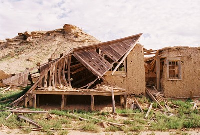


There are many iconic photos of Heller's general store in ghost town books, some shots even taken from the rustic porch. However, the years have not been kind to the building.

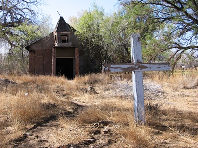
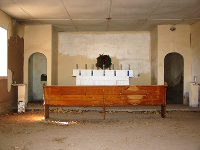
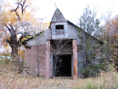
Another thing that Heller did was help get a church constructed in Cabezón. La Iglesia de San Jose was built in 1894, and in many ghost town books it appears abandoned and forlorn, as it was for decades. It had been used as a barn and vandals were once caught tearing up the floor in a hunt for treasure. But in the late-1970s, the church began to be restored. I've heard that Peter Fonda bankrolled the work immediately after directing the film The Hired Hand in the village, but that movie, which starred both Fonda and Warren Oates, was released in 1971. So that seems unlikely, to say the least. In any case, you can get a closer view of a much more intact Cabezón in that excellent Western.
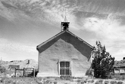


The San Jose Catholic Church was built in 1894.

The real story is that, in 1978, Father John Sauter from up the road in Cuba, New Mexico, wanted to restore the church before its 100th anniversary, which would occur in 1994. So local folks rounded up volunteers to fix the roof, received donated materials, and, over the years, basically did the job with no money at all. Five hundred people attended the centennial celebration. It's worth mentioning that, in addition to the treasure hunters, thieves were once caught trying to steal the church bell. The bell was then put in safe-keeping until it could safely resume its rightful place, which, as you might sorta be able to guess from the photo above, it has.

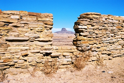
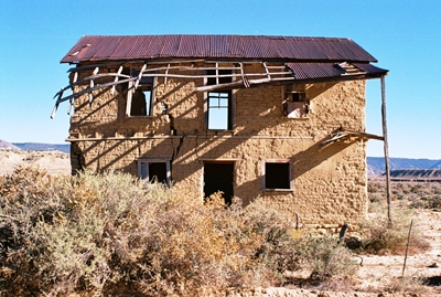
In his 1981 book, New Mexico's Best Ghost Towns: A Practical Guide, Philip Varney said that Cabezón was, in fact, New Mexico's best ghost town, featuring the most impressive mix of buildings, scenery, and desertion. He also championed Cabezón for the difficulty involved in just getting to the place. Forty-two years later, it’s still difficult to visit (more on that in a moment), and the lanscape is just as scenic. But does Cabezón remain the state’s best ghost town? Well, I'd say…probably not. Of course, Heller's store, the historic centerpiece of Cabezón, has mostly collapsed. A two-story building from The Hired Hand set which, while not historic, did lend ambiance, is totally gone. Most of the adobe homes are badly crumbled and fading fast. Only a few stones stand atop each other of what was the school. The church is actually in better shape than in 1981, but I suppose that just makes Cabezón feel slightly less deserted.
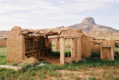


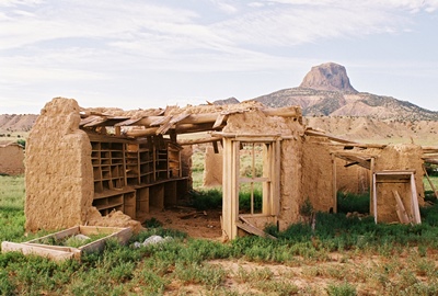
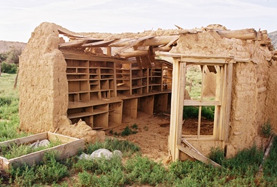
With its many shelves and cubbies, this adobe was probably the post office.

Sure, much of Cabezón's decline is due to neglect and vandalism, but remote ghost towns don't typically have the tax base for neighborhood upkeep, and untended adobes will eventually return to Mother Nature. So I try to get while the getting is good and, as with most things in life, I don't expect permanence in ghost towns. In truth, I was lucky to “get” at all as the property in Cabezón is still owned and the village occupied by one resident who does not exactly desire visitors. In the 1960s, squatters moved into the empty homes and looted them and, as a result, the county comissioner would eventually authorize closing Cabezón. So let’s just say some strings were pulled to open gates, both metaphorical and literal, and make my trip possible. And that was a number of years ago now. Eight years, to be exact.

If you've been to the Cabezón area you might wonder where the timber was found for the buildings. I've read that the vigas were hauled from the forest surrounding Mt. Taylor, a distance of about 10 miles. I guess Mt. Taylor was the closest you could get to a Home Depot at the turn of the 20th century. The stones were gathered from the adjacent hills. I was also told that, much more recently, a woman and her child were in Cabezón and entered a structure when a viga fell, striking the mother and necessitating a trip by helicopter to the hospital. Thus on my visit I was explicitly asked not to enter any buildings. So that is why you see no interiors here.
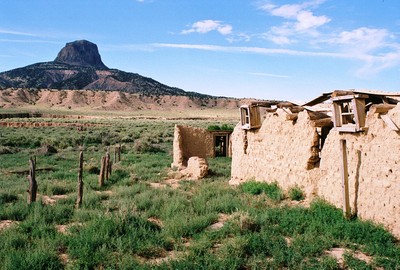


You can almost feel wagons full of wool moving slowly along the Rio Puerco, below Cabezon Peak.

Let’s wrap up our visit to Cabezón with a couple Wild West tales. The Puerco Valley has always been isolated, and so it was that, according to Ralph Looney’s Haunted Highways, in a turn possibly inspired by Jack D. Rittenhouse's rare, Outlaw Days at Cabezon, New Mexico, the village harbored a bandit now and then. In 1884, the Castillo brothers’ notorious band raided the cattle herd of the original owners of the trading post, Kanzenbach and Haberland. A man named Juan Romero tried to stop the rustlers and was shot dead. Kanzenbach organized a posse and a gun battle ensued. The thieves, however, escaped.

After another encounter and escape, the rustlers entered Amadao Lucero's store in Espanola to have dinner. Here the posse was lying in wait. Deputy Montano couldn't get a bead on Candido Castillo's head while the man ate because of a poorly-placed kerosene lamp, so he motioned for Lucero to move the obstacle. A moment later Candido leaned over to light his cigarette with the lamp just as Montano shot, hitting Candido in the side. The Deputy also shot Candido's brother, Manuel, but the two managed to get out the door, somehow melting into the night.
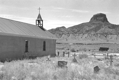


The quiet cemetery of the San Jose Catholic Church.

In the morning, the posse followed the bloodstains, but they ended abruptly at the railroad tracks. The rumor then arose that the brothers, reportedly also members of the Penitente Brotherhood, had happened upon a Good Friday procession and were taken into hiding. Candido was said to be dead by Easter Sunday, but when his grave was opened the body had been removed.

Looney tells of a gruesome ax murder in Cabezón, as well. One day the postal inspector came to town because there was a small discrepancy in cash at the post office, which was run by Emiliano Sandoval. Nobody would say a word to the inspector until he found Juan Valdez at the edge of the village. Valdez said that Sandoval did it. After all, who could've pilfered the money more easily?
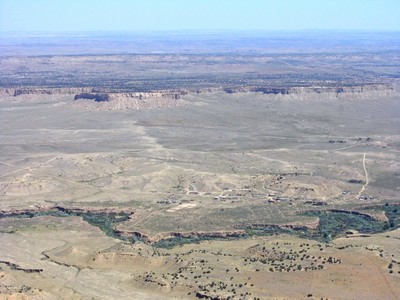


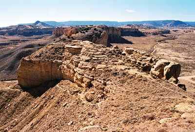
A crow’s eye view of the ghost town of Cabezón from atop Cabezon Peak.

The following night, Valdez was sleeping in his home, his two sons nearby, when several residents of Cabezón entered. When they left it’s said that Valdez had been beheaded. Sandoval County officials quickly arrested Emiliano Sandoval and two others, Albino Gurule and Antonio Gonzalez. Gonzalez, having an alibi, was soon freed. Sandoval and Gurule were kept in custody for a while, but eventually released. The crime was never solved as far as I can tell. Not that it’s uncommon for ghost towns to keep their secrets. On that note, I’m sure Cabezón has more to tell, but this is about all I’ve been able to uncover. If you have more to add, please leave a comment below!
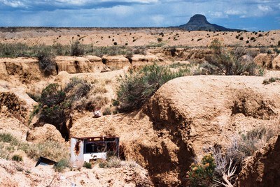


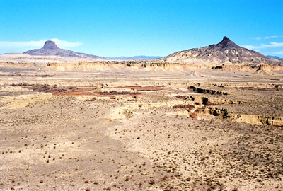
Above is one last look at the landscape of the Rio Puerco drainage with Cabezon Peak looming in the distance. This Puerco, flowing through Rio Arriba, Sandoval, Bernalillo, Valencia, and Socorro Counties before meeting the Rio Grande, is sometimes called the Rio Puerco of the East. Yes, there is another Puerco in New Mexico. The second Puerco, usually called the Puerco River, flows through the northwestern part of the state and into northeastern Arizona, terrain which includes the Painted Desert. That is another spectacular southwestern landscape, but one for another day.

First, thanks to those who got me into Cabezón all those years ago. You know who you are! If you want to know more about life in the Rio Puerco Valley, I can't recommend Nasario García's memoir, Hoe, Heaven, and Hell: My Boyhood in Rural New Mexico highly enough. While Mr. García lived in Ojo del Padre, near Guadalupe, he provides a wonderful picture of the entire region, and Cabezón does get some brief mentions. One of the most recent sources for Cabezón history, and certainly among the best, is Ghost Towns Alive: Trips to New Mexico's Past by Linda G. Harris. But even that is 20 years old now. I also got a lot of the information from Philip Varney's New Mexico's Best Ghost Towns: A Practical Guide and Ralph Looney's Haunted Highways. Surprise, surprise. Both books also have excellent pictures of Cabezón from the days when more was standing. Days that will never come again! I should also mention Robert Julyan's The Place Names of New Mexico, which always has something interesting to offer. I have never seen Route 66 guru Jack D. Rittenhouse's Outlaw Days at Cabezon, New Mexico (limited to 150 copies), nor his more general history, Cabezon: A New Mexico Ghost Town (limited to 750 copies), so if you've got one of either lying around that you'd like to send my way, please do!

That's it! If you made it to the final words of this epic post, thank you very much! I have no idea where we're going next time. I'll have to figure it out.

Thursday, April 20, 2023

After the Floods: The San Jose Mission at San Acacia, New Mexico


Let's take a trip to the San Jose Mission at San Acacia, 14 miles north of the town of Socorro, in sprawling Socorro County, which spans a chunk of the central part of New Mexico. San Acacia—originally (and sometimes still locally) known as San Acacio—was established around 1880 when the Atchison, Topeka & Santa Fe Railway came through. In “The Place Names of New Mexico,” Robert Julyan notes that the name of the village may have come from San Acacio (aka Saint Acathius), a Roman soldier said to have been martyred with 10,000 other soldiers in the 2nd century A.D. In New Mexico, San Acacio can be found in the work of some santeros on a crucifix wearing the uniform of a Spanish soldier.

When the post office opened in 1881, the “o” had become an “a,” probably because the Spanish was misunderstood. (Note that "San" did not become "Santa.") As far as I know at this moment, the post office remains in operation, but on the west side of I-25, adjacent to the village of Alamillo. Incidentally, an alternative and, Julyan implies, less likely explanation for the name, is that it derives from the acacia bush. If you want to feel like you know the area, go ahead and refer to it as “San Acacio.” You may have some interesting converations!


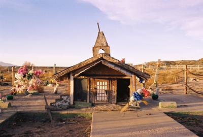
The mission church may still get some unofficial use.

After a flood in 1886 destroyed the church in nearby La Joyita, an adobe mission church with large vigas was soon built in San Acacia, which also sits close by the west bank of the Rio Grande. About 40 years later the historic flood of 1929 sent residents fleeing for their lives, destroying much of the village, and washing the church away. A section of the village dating from the early 1900s is said to have survived the flood and can be seen to the northeast of present-day San Acacia, but I haven’t gone hunting for that.

A few years after the 1929 flood, through the donations of the Crabtree family, who operated a lumber yard and hardware store, the mission church was rebuilt. That one was destroyed in a flood in 1937. So for the next ten years the people of San Acacia went to the church in Alamillo, a bit farther from the river and presumably generally drier. The current mission church was built after WWII and used officially until 1957. Based on what I’ve seen it may well be used unofficially to this day.


A little artwork has been added to the adobe walls.

In all the years I’ve been visiting San Acacia and posting photos of the mission church (and its likeness in the nearby cemetery; see below) I’ve never heard from anyone that was there when it was having services. Until recently, that is! The recollection I received is so wonderful that I'm going to include it here in its entirety. Memories such as these are hard to find, and I'm always honored to receive another. Many thanks to Ed Baca for sharing his remembrance of a fiesta vespers service:

"I am indeed familiar with the San Jose Mission in San Acacia. My dad's job with the U.S. Geological Survey involved measuring the flow of the Rio Grande on a daily basis. One of his work sites was the gauging station just below the San Acacia dam. As a kid (I was born in 1945), I would often accompany him to San Acacia during my summer vacation. We would pass by that church on the way to the river. While he did his steam-gauging thing, I angled for channel cat at the river's edge.


The church has now passed many falls without congregants.

"As a student at Hilton Mt. Carmel School in Socorro, I served Mass as an altar boy at San Miguel Catholic Church. The spiritual needs of the mission churches in the Socorro area were served under the auspices of the Pastor at San Miguel. Besides the occasional funeral of a community member, small missions like San Jose only had one major service during the year, and that was on its namesake's feast day, i.e., its fiestas.

"Around 1957 or so, I, along with another altar boy, and the San Miguel organist and two choir members, accompanied Father James McNiff to San Acacia to celebrate the San Jose fiesta vespers service. The mayordomos and the community's faithful had lighted the path to the church with luminarias. The organist, my aunt Helen Baca, cranked up the old pump organ at the back of the church. The two choir members sang traditional Spanish hymns to an overflowing congregation of current and former residents who sang along with them.

"The memory of this occasion warms my heart to this day. I know that you know that this unique aspect of New Mexico's Hispanic culture is slowly vanishing, and it is sad. But, thanks to efforts of people to preserve the story of a once-vital place, all will not be totally forgotten."


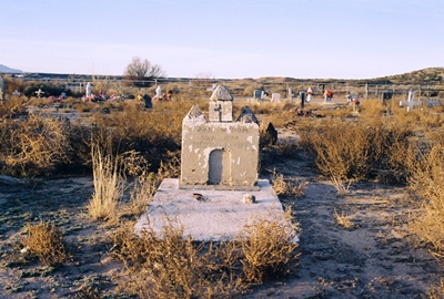
A likeness of the mission church marks a grave in the cemetery.

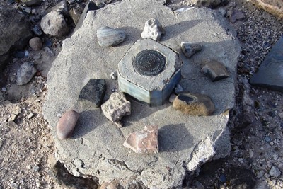
A short hike from the moody cemetery, which features grave markers representing both the San Jose Mission and the mission church at Alamillo, and right beside the Rio Grande, is a feature known as Black Butte, where the New Mexico meridian intersects the principal baseline. Placed here in 1855 by John W. Garretson, a U.S. government surveyor, this is also known as the “initial point,” on which land surveys for New Mexico and southwest Colorado are based. The rocky surroundings of the "initial point" are said to be the preferred home of more than a few rattlensakes, as well.

This area was also where the Piro Indians lived. Juan de Oñate, the Spanish conquistador, encountered them in 1598 as he came north with his expedition. The Piro would scatter during the Pueblo Revolt of 1680 and never return to their former home, but evidence of their Puebloan culture can still be found along the Rio Grande.


If you could read any of the markings on this monument, you'd find "initial point" among them.

Finally, I would be remiss in not mentioning Acacia Riding Adventures, which runs horseback trips out of the old San Acacia schoolhouse, right across from the church. That sounds like a fantastic way to explore this section of Socorro County, and just a lot of fun in general. You can find more info at their WEBSITE.


This grave is marked by a representation of the mission church at Alamillo, which was built in 1928.

I grabbed some information for this post from Paul Harden’s excellent “Mission Churches - Part 2: The Mission Churches in Socorro County." (There’s a Part 1, as well!) You can find a little more about the intricacies of the New Mexico meridian and baseline at WIKIPEDIA.

Alright, that’s all I’ve got for this, the THIRD new blog post since…well, October of last year. But that’s better than the last couple years combined! Thanks again to Ed Baca for his generosity in allowing me to share his story far and wide. I think maybe we’ll go to Cabezón, in the Rio Puerco Valley, next time!


Friday, March 03, 2023

It Was Supposed To Be In New Mexico: Camp Nichols, Oklahoma


During the years of the Civil War, with most able-bodied men sent off to the fray, traversing the Santa Fe Trail became even more treacherous than usual. Without the armed accompaniment that travelers had come to rely on, Native American tribes found it easier to attack settlers and traders moving along the trail, including those on the Cimarron Cut-off, or Dry Route, as it was also called. This alternate route sliced through what is now the western edge of the Oklahoma Panhandle as it entered New Mexico Territory, and while worryingly dry it often was, it was attractive since it cut 100 miles and 10 days off the Mountain Route. At most times it was also considered safer, avoiding the difficult Raton Pass and its steep 7,835' of elevation. But as attacks persisted along the Cimarron Cut-off throughout 1861 and 1862, the military tried to gain control. Among those in the field was Lieutenant Colonel Christopher Carson, also known as Kit, who was sent out to suppress raids by the Comanche and Kiowa, in particular.

Following a reasonably quiet winter of 1863, that spring found the Apache, Arapaho, Cheyenne, Comanche, and Pawnee assembled along the Arkansas River in numbers so large that the trail was actually closed to travel. The following year, in the spring of 1864, both the Cimarron Cut-off and the Mountain Route were back under steady attack. The military had completely lost control by June, and settlers and wagon trains alike were under fierce assault as the tribes tried in earnest to drive them from the land. In the Dry Cimarron Valley, along what is now the Oklahoma-New Mexico border, stone forts were built on mesas with settlers running to them, rifles in hand, whenever a Native American was seen.


Wagon ruts are still visible on the Cimarron Cut-off.

Raids continued into the summer of 1864, and in the second week of August, Comanche killed five men at Lower Cimarron Springs. On the 19th of that month, near one of the Cimarron springs, an entire caravan was wiped out, with ten men lost and 130 mules stolen. Two days later, 10 trains were attacked near the Middle Cimarron Crossing, and over 100 oxen were scattered.

Late that November, in response to the continued raids, Kit Carson’s regiment went to the panhandle of Texas to attack a Kiowa village in the vicinity of Adobe Walls, the ruins of a trading post once operated by William Bent. Some Comanche and Plains Apache joined the Kiowa for a counter-attack, and with a force of 3,000 warriors drove the 372 federal troops back into the shell of the old trading post. But the regiment had a mountain howitzer, and by that evening the warriors had retreated and the village had been burned. This event would enter western legend as the First Battle of Adobe Walls, one of the largest battles to ever occur on the Great Plains. The brutality continued a few days later when, on November 29, 1864, Colonel John Chivington’s Colorado Volunteers massacred 300 men, women, and children living in a Cheyenne and Arapaho village at Sand Creek in southeastern Colorado.


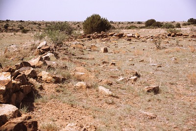
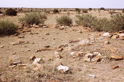
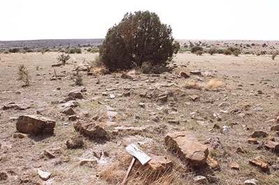
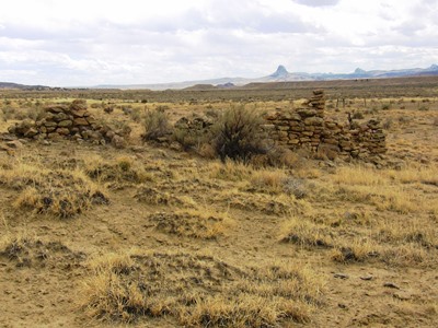
All that marks Camp Nichols are piles of stones.

However, with the ending of the Civil War on April 9, 1865, soldiers were again available to escort travelers over the Santa Fe Trail, and forts began to be constructed to provide supplies and further protection. Fort Dodge was established in April and Fort Aubrey in September. In between, in May 1865, a short-lived stockaded fortification was constructed near Cedar Springs on the Dry Cimarron. This was Camp Nichols, which may have taken its name from Captain Charles P. Nichols of the First California Cavalry.

Camp Nichols was supposed to be in New Mexico Territory, but ended up in what was then mapped as "Public Land" or "Public Land Strip," three miles northwest of present-day Wheeless, Oklahoma. This area, which was home to the nomadic tribes of the Great Plains, was later referred to as "No Man's Land," and wouldn't become Oklahoma Territory until May 2, 1890.

Little remains of the camp now, which was built by Carson at the order of the Military Command of the New Mexico Territory. Intended to be roughly at the halfway point between Fort Union in New Mexico Territory and the Cimarron Crossing of the Arkansas River, not far from Fort Dodge, Kansas, the camp’s sole purpose was to protect travelers from Kiowa and Comanche raids on what had become the most dangerous part of the Cimarron Cut-off.


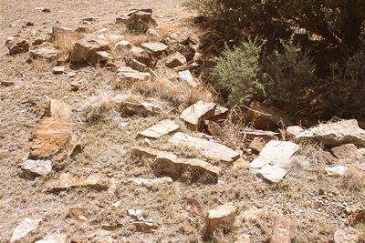
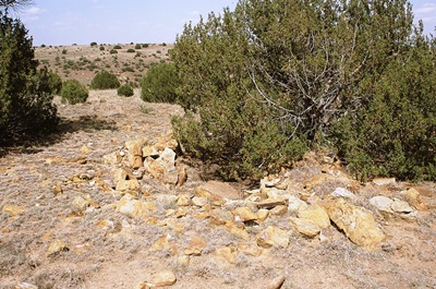
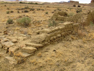
The remains of what may have been lodging for a soldier.

Carson, however, liked the high ground at a location beside South Carrizo Creek, about four and a half miles east of the boundary of New Mexico Territory. Here was built a commissary, two-room hospital, kitchen, and officers' quarters, all dug into the ground and enclosed with rock. These would be the only manmade structures ever built along the Cimarron Cut-off during its active years. Two mountain howitzers stood at the edge of the camp. It was garrisoned by three companies from Fort Union who escorted travelers to Fort Dodge on the Arkansas River or Fort Larned, which was also in Kansas, offered shelter, and generally patrolled the trail.

In fact, following a biweekly schedule, troops from Fort Union also escorted wagon trains east to Camp Nichols, at which point Kit Carson’s soldiers would take them onward. When heading west, Carson’s troops would take the trains from Fort Dodge to Camp Nichols and then hand them off to the men from Fort Union.


This photo was taken from approximately the spot where a map indicates Kit Carson, who was in declining health and would be dead within three years, pitched his tent. It's facing the ruins of quarters occupied by Lieutenant Henderson and Lieutenant Richard Russell, who lived here for a time with his new bride, Marian Sloan Russell. You can read about Russell's experiences in her book, "Land of Enchantment: Memoirs of Marian Russell."

The dimensions of Camp Nichols have been given as 200' x 200' or 200' x 300', the latter of which would have to include some of the structures outside the square boundaries of the fortified camp itself, such as the officer's quarters and the kitchen. But however you look at it, Camp Nichols was not very big, and was never a true fort. It didn't last long either. In mid-October 1865, the Apaches, Arapaho, Cheyenne, Comanche, and Kiowa signed the Little Arkansas treaties and, in exchange for peace, were given a large reservation in the Texas Panhandle. The Texans themselves would refuse to honor this agreement and a new treaty would eventually be required.

But in November 1865, a mere seven months after they’d established Camp Nichols, the 300 California and New Mexico troops stationed there abandoned it and marched back to New Mexico Territory. Local tribes destroyed the camp over the winter, and the site has been unoccupied ever since. In 1966, it was placed on the National Register of Historic Places, but most days is visited only by the wind and perhaps a few cows.


It takes a little imagination to reconstruct Camp Nichols.

A big thank you to the Cimarron Heritage Museum based out of Boise City, Oklahoma, who offer a wonderful tour of this part of the Santa Fe Trail. They provided access to this location, which is on private property, and a number of other rare Santa Fe Trail gems. They do it every June, so if you're interested, get connected with them HERE.

The museum also collected some excellent historical information, including a hand-drawn map, for a handout on the site, which is otherwise spread across numerous sources. Another resource was “Window on the Past: Historical Sites in Oklahoma” by Kent Ruth, which reported the size of Camp Nichols, possibly incorrectly, as 200' x 300'. However, the most scholarly account, and one which adds the most historical context, was found on page 127 of “History of the Cimarron Indians.” This obscure volume was unearthed at the National Cowboy and Western Heritage Museum in Oklahoma City, which has an incredible western history archive. I thank them for their assistance (and for being willing to take a copy of my own book for the archive!). I highly recommend a visit to the museum itself, but you’ll need an appointment to see the archive.

Other useful Camp Nichols references include The Encyclopedia of Oklahoma History and Culture (for both the camp and No Man's Land), The Historical Marker Database (only it wasn't really a fort), Santa Fe Trail Research and, of course, Wikipedia.

Whew. That was a long one! So I'm going to leave it at that for now, except to say that I took all the photos with Fujichrome Sensia 100 35mm color slide film that expired in December 2004. Weird, huh?

Monday, October 10, 2022

Take the Flat Way Home: Tollgate Canyon, NM


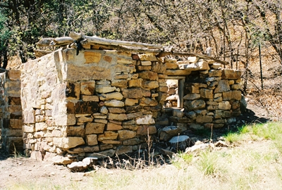
A crumbling stone cabin is now all that welcomes you to Tollgate Canyon.

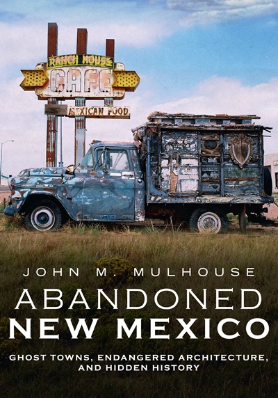
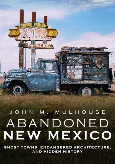
If you’re reading this it means I've managed to successfully upload the first post of new content on City of Dust since January 2018. Wow. It feels like that was a million years ago. Professionally, personally, geographically…globally. Everything is different. Some of that explains my long absence from this blog. However, I hope this marks the return of the long-form (or longish-form, in this case) pieces that I eventually compiled in “Abandoned New Mexico: Ghost Towns, Endangered Architecture, and Hidden History,” the publication of which also pulled me away from the blog. But I ain’t complaining! It’s good to be at least attempting a comeback, and we shall see how things go!

I’ve written a number of times about the Belen Cutoff, the rail line built across east-central New Mexico by the Atchison, Topeka and Santa Fe Railway as a way to avoid the steep grade over Raton Pass. Completed in 1906, the Belen Cutoff provided a much flatter way to get trains through the state and is still being used today. It’s the main reason villages like YESO, TAIBAN, NEGRA, RICARDO, and many others came to exist. Or at least persisted, if only until the trains came to need diesel instead of water in the 1950s.

But the railroad wasn’t the first entity that was often unhappy to be going over Raton Pass, with its difficult ascent and dangerously unpredictable weather. In the 1800s, those traveling the Santa Fe Trail between New Mexico Territory and eastern Colorado by horse, mule, wagon, or foot frequently wished for something less arduous, as well; the Mountain Route of the famed trail went right over the Pass. And so it came to be that Tollgate Canyon was established which, unlike the Belen Cutoff, is now largely forgotten and rarely used by anybody other than local travelers.


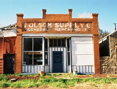
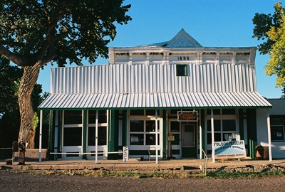
The Folsom Supply Co. building in Folsom, New Mexico.

Somewhere around 1870, Bazil “Baz” Metcalf, after traveling the Santa Fe Trail in an ox-drawn wagon from Missouri several years prior, was hired to work on the Cross L Ranch, then recently established by the Hall Brothers on the Dry Cimarron River. Baz got to thinking that creating a route for wagon freight and travelers along the nearby Santa Fe Trail that avoided Raton Pass would be helpful and possibly quite lucrative. In fact, a short canyon that headed south out of Emory Gap, New Mexico, and into the Dry Cimarron Valley provided a perfect place to build a toll road. Even the military could use this road to move between Fort Union in New Mexico Territory through the new settlement of Granada, Colorado, and into Bent’s Fort.

The road was completed in 1873, and Metcalf installed everything he thought might be useful, which included a store, a saloon, and a chain across the road that stretched between two boulders. If you were traveling by buggy, Metcalf charged 35 cents. A two-horse team ran 40 cents, while a four-horse wagon cost 75. There was a fee for cattle, too, which were sent north to feed the military posts and mining camps. Metcalf’s brother, John, minded the tollgate and watched Baz’s ranch when Baz was trading in the territory.

Native American raids were always a possibility, and in 1874, a year after Baz opened the road, Comanche and Kiowa attackers killed 17 settlers in the Dry Cimarron Valley. The Metcalf brothers survived that incident, and Baz escaped injury during another brush in 1876.


Built in 1896, the Doherty Mercantile now operates as the Folsom Museum, within which treasures await.

For 12 years, from 1873 to 1885, Tollgate Canyon operated as an important conduit for goods and people, largely creating the Fort Union-Granada Road. But in 1885, Metcalf decided to move to the Texas panhandle, where he would fence-in over 30 miles demarcating the northern boundary of the XIT Ranch. He used 5,200+ cedar posts to do it. At over 3,000,000 acres, the XIT would then become the largest fenced ranch in the world. Baz sold his toll road to Mike Devoy, but the clock was ticking on its usefulness, and with the arrival of the Colorado and Southern Railroad in 1888, Tollgate Canyon’s prominence disappeared in the blink of an eye.

The road that led through Tollgate Canyon is now NM Highway 551, just northeast of Folsom, in northwestern Union County, and the place where Baz collected his tolls is about two miles northwest of the intersection with NM Highway 456. All that indicates the location is a state historical marker and the crumbling stone cabin shown at the top of this post.


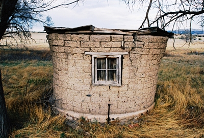
An old chicken coop in Capulin, New Mexico, near Folsom and not far from Tollgate Canyon.

However, you can see the ragged trunk that once held the tolls at the Folsom Museum. In fact, the best online history of Tollgate Canyon--and the one from which I got most of this information--was posted by the Folsom Museum RIGHT HERE. Check it out for more photos, too. You can also see Tollgate Canyon during the museum’s yearly Dry Cimarron River History Tour, which occurs in May and is how I came to visit it myself. For more info on all that, I highly recommend becoming a regular visitor to the Folsom Museum’s WEBSITE.

And there’s the first post in nearly five years! I’ve already got the next one drafted, but I’ll keep quiet as to more specifics so as not to jinx myself. Thanks to everyone that’s supported my endeavors, and I hope ya’ll have been hanging in there as best you can!

Saturday, October 10, 2020

AVAILABLE NOW! Abandoned New Mexico: Ghost Towns, Endangered Architcture, and Hidden History

Alright, following a two-month delay due to Covid-19 and an initial pre-order run to get my process down, I'm very pleased to FINALLY make "Abandoned New Mexico: Ghost Towns, Endangered Architecture, and Hidden History" available to everybody. Yes, that means there is now a City of Dust web store! There you can order a signed copy of the book directly from me, as well as find a book bundle, signed prints, and one-of-a-kind framed photographs. If you're near Albuquerque, Treasure House Books & Gifts in Old Town and Organic Books in Nob Hill have copies. We're working on getting the book into more independent shops throughout the state soon, and Amazon and Barnes & Noble are both shipping it now, as well. I'll happily send copies overseas, but postage is expensive (and the book weighs just over a pound!), so it  might be worth checking Amazon in your country first...if it operates there.

The book clocks in at 40,000+ words and 160 pages, and contains 150 photographs. It's broken into eight sections, which include: 

The Albuquerque Railyards
Central New Mexic
U.S. Highway 6
The Eastern Plains
Route 66
Southwestern New Mexico
The Old New Mexico State Penitentiary
Northeastern New Mexico
 
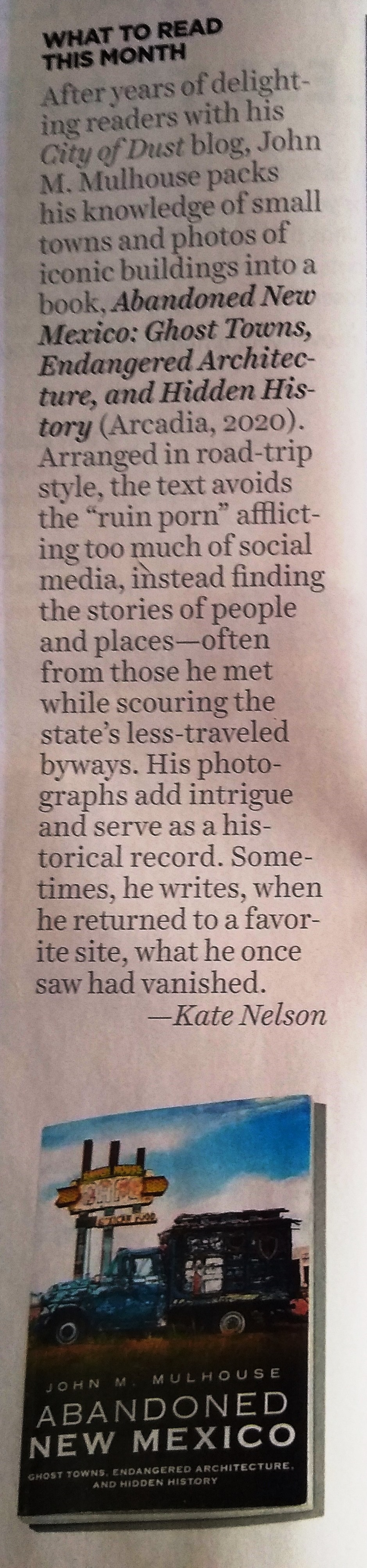
The initial response has been wonderful and I'm very grateful to everyone that has already bought a copy and/or helped spread the word. There has been a fun Q & A in Albuquerque The Magazine, nice review in New Mexico Magazine, and a lovely spread in the Albuquerque Journal's weekly "Venue" supplement.

All that said, please get in touch if you have any questions or would like to order the book via another means (i.e., Venmo, PayPal, Zelle, cash, check, trade...I take 'em all).
 
Also, as the City of Dust blog has been dormant for the two years I've been working on this book (and moving across state lines a couple times, as well), I really, truly hope to resume posting here shortly. 2020 hasn't been kind to plans of almost any type or description, but fingers crossed!
 
And with that...please stay tuned!

Saturday, February 29, 2020

Abandoned New Mexico: Ghost Towns, Endangered Architecture, and Hidden History


Well, it's been just over two years since the last City of Dust blog post. In that time I've moved from New Mexico to northern Nevada, started a new job, and then started another new job. That's all taken a lot of time, but none of it is really why there hasn't been anything new here since January 8, 2018. What's really demanded my creative attention over the last two years is a book project, now officially titled, "Abandoned New Mexico: Ghost Towns, Endangered Architecture, and Hidden History." Coming in at over 40,000 words and with 150 photos (both color and b&w), this project has not let up since the idea first reared its head in late 2017. But I didn't want to mention the book until I was certain it would actually be published. Jinxing myself and all that.

So, finally, I can say that this thing is indeed coming out. The publication date is June 29, 2020 August 29, 2020 (yup, delayed due to Covid-19) and preorders are already available at BARNES & NOBLE and AMAZON. I will also be selling copies myself when the time comes--signed if you'd like--and maybe with some bundles and other goodies offered.
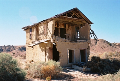


Anyway, I'll be saying more about all this shortly, but for right now I should mention that the book is titled "Abandoned New Mexico" to align with Fonthill Media's current series on ghost towns and derelict buildings called "Abandoned Union." However, the subtitle is much more accurate as while I include true ghost towns, such as Acme/Frazier and Riley/Santa Rita, there are also populated places, including House and Monticello, and historic structures both owned (Melvin Mills Mansion) and operational (St. James Hotel). In the end, I threw in pretty much everything and the kitchen sink, too.

So with that, please stay tuned and I hope to start posting regularly again here soon. I've certainly got plenty of fresh material on hand. But life demands a lot of attention these days, so we'll still have to take it as it comes for now.

Thanks to everyone for their continued interest in City of Dust over the last...nearly 16 years! Even though I wasn't posting I never stopped getting fantastic comments and wonderful recollections from many, many people. Again, thank you!

Monday, January 08, 2018

Music on the Wind: Guadalupe, New Mexico


Since the previous post was a special one on the Río Puerco Valley featuring the recollections of historian and folklorist Nasario García, it only seems appropriate to stay beside the banks of the Puerco and explore the history of Guadalupe, New Mexico, where Mr. García spent his boyhood. This vast, empty landscape, punctuated by mesas, canyons, and volcanic plugs, is one of my favorite areas in the entire state to explore.

The remains of the village of Guadalupe—also known as Ojo del Padre—are south of San Luis on Country Road 279, which intersects Highway 550 north of San Ysidro. It is remote, requiring a drive of many miles down dirt roads in varying states of maintenance to find it. So much the better then! The village was named for the Virgin of Guadalupe, while the earlier moniker, Ojo del Padre (“spring of the Father”), referred to a nearby water source. Oddly enough, when a post office was opened in 1898 the name used was “Miller,” but no one can remember why. That name lasted until 1905, when the post office became Ojo del Padre.


The first thing that one notices upon rounding the corner into Guadalupe, aside from majestic Cabezon Peak looming in the distance, is the wonderful two-story adobe building listing precariously on the side of the road. Built around 1905, this was the home and store of Juan Córdova and it’s often said there was a dance hall behind it. However, Nasario García refers to the lower floor of this ruin as not only a store, but the dancehall itself when the occasion called for it, with Mr. Córdova’s family living upstairs. It’s hard to argue with someone that was there, so perhaps this big adobe, which once had an impressive balcony, served all purposes. However, everyone agrees that the dances at Juan Córdova’s were major events. In the 1920’s, 350 people lived in the immediate area, mostly farming and raising livestock, and these dances, which began at sundown, could go on until four in the morning. Jose Tafoya would play the accordion while his brother Luis handled the guitar.


Yet just a short time later, in the early 1930’s, Guadalupe, like so many parts of the country, was hit by staggering drought. A full half of the cattle died. Then, around 1938, the log-and-brush dam which had captured water from the Río Puerco for local irrigation gave way. The government said rebuilding was too expensive a project for federal assistance and the communities along the Puerco were too impoverished to do it themselves. Then throw in the lasting effects of the Great Depression and the lure of employment in larger cities and Guadalupe didn’t really stand a chance. The school, the post office, and Córdova’s store all closed in 1958 as the last family left.

While a lowered water table and generally challenging landscape have kept people from returning to Guadalupe, you may find a couple folks hanging around. In fact, at least two structures are maintained and lived-in, one being the old schoolhouse. It’s not wise to go roaming around on private property out here, but if you see anyone nearby it’s worth introducing yourself and stating your business. Guadalupe’s few present-day residents are friendly and you’ll usually be given permission to take all the photos you want of the ruins on either side of the road, which include other old adobe homes slowly melting back into the landscape.


And that’s most of what I know about the history of Guadalupe. You can find a chapter on Guadalupe in “Ghost Towns Alive: Trips to New Mexico’s Past,” by Linda Harris and another tidbit or two in "The Place Names of New Mexico" by Robert Julyan. But I would highly recommend October 2017’s City of Dust post, “Nasario García Remembers the Río Puerco,” for some wonderful firsthand accounts. If you want to get deeper into the Río Puerco Valley, Mr. García’s book, ““Hoe, Heaven, and Hell: My Boyhood in Rural New Mexico,” cannot be recommended highly enough.

Speaking of getting deeper into the Río Puerco Valley, that always sounds like a good thing to do and so next time we’ll visit Guadalupe’s movie star neighbor, Cabezón, which sits just below the volcanic plug from which it got its name.

Until then, Happy New(ish) Year!

Sunday, October 08, 2017

Nasario García Remembers the Río Puerco


Over the past few years the Río Puerco Valley has become one of my favorite places in New Mexico. About an hour northwest of Albuquerque, with majestic Cabezon Peak always in sight and miles of the Continental Divide Trail close at hand, here you'll find the villages of San Luis, Cabezón, Guadalupe, and Casa Salazar, some of which are essentially ghost towns. No, there aren’t many people around the Puerco Valley anymore and not a lot of its history has been recorded.

However, one person who has done more than any other to ensure that the Río Puerco Valley is not forgotten is historian and folklorist Nasario García. Raised on the banks of the Puerco, Nasario is the subject of a brand new documentary, “Nasario Remembers the Río Puerco,” and following are four of his stories that do not appear in the film, each recollection inspired by photographs from the area.

I’m very proud to feature these stories here and I want to thank Director and Producer Shebana Coelho for making this happen, as well as Nasario García himself, of course. The broadcast premier of “Nasario Remembers the Río Puerco” will be this Thursday, October 12, 2017, at 7PM on New Mexico PBS/KNME Channel 5. I’ve seen the movie and it’s truly wonderful. I highly recommend it to all. For more information, visit Nasario Remembers.

Now, without further ado, City of Dust presents Nasario García and New Mexico’s Río Puerco Valley:


Sal Lovato General Store. Cabezón, New Mexico.

“This store was owned by the Salomón Lovato family. He is one of the contributors to my book, ‘Recuerdos de los Vijeitos.’ You can see where they had different merchandise: canned goods, dried goods and so forth.

“The kind of merchandise they had in these stores was foodstuff that you could not grow, that you could not raise from the land. Here you came and bought, say, lard, even though that wasn't always the case because there was lard from the matanzas. Baking powder, sugar, salt, and some canned goods started coming into existence, as well as dry cereal such as oatmeal. Also, any number of other things—flour, for example. When corn began to become scarce, people would come in the Lovato Store and buy sacks of flour. Those sacks were very important because once the flour was gone the sacks were used to make blouses for the women, blouses for the young girls. In many cases, a young girl would show up at a dance with a rose on the back of her blouse that came from the flour sack. Nobody really looked at you as being odd. That was the moda—fashionable—among many of the families.

“I imagine the store was especially busy on weekends. Of course, a lot of Navajos came from the reservation on weekends. Probably the high point of trading was during the lambing season through the sheering of sheep, which was in May and June. The selling of cattle—those who had cattle—occurred in late September or in October, perhaps even early November. People would make money selling their cattle, selling their sheep. Naturally, that's when they would come to buy a lot of merchandise. But it didn't matter the time of year because many merchants sold on credit. People would pay their bills, say, once or twice a year, whenever they sold their sheep, their wool, their cattle.”


View from Enchanted Mesa Looking Toward Cabezon Peak and Nasario’s Grandpa’s Corral.

“The Enchanted Mesa was right across the Río Puerco from where we lived. That’s the mesa that my paternal grandmother would tell us never to visit because, if we did, we were likely to be turned into goats. My grandmother referred to it as La Mesa Encantada. Many years later, after I left the valley, archaeologists discovered that it was a Chaco Canyon outlier. Now it’s called the Guadalupe Ruins.

“In the evenings, while we were shucking corn, Grandma Lale—her nickname—would tell us stories with the Enchanted Mesa in sight—stories that had to do with the local culture, the local folklore, such as the white donkey, a rarity among donkeys. As she and my Grandpa Lolo, as we called him, told us, they were coming from the placita at night, perhaps after a dance, when suddenly a white donkey appeared and kept pestering the female horse—la yegua—and my grandmother says, as she's telling the story, ‘Look there, I wonder where it came from.’ My grandpa said, ‘I don't know. I know all the donkeys in the valley and I've never seen a white donkey.’ The donkey kept pestering and pestering. ‘Furthermore,’ says my grandpa, ‘there are no white donkeys around.’ My grandmother says, ‘But I am glad this one's here, because a white donkey means good luck. It doesn't mean evil like a black donkey.’

“She would weave these stories, and, in the meantime, we are on pins and needles wondering what's going to happen next. At the end of the story, my grandmother asked my grandfather, ‘Now, truly, what do you think about this white donkey?’ They said they’d turned their heads and the donkey was gone. They never saw it leave. It was stories like this that she liked to share with us grandchildren. She had many, many others.”


Córdova’s Dancehall. Guadalupe, New Mexico.

“This two-story house was in my village of Guadalupe—Ojo del Padre. The bottom floor was used as a dancehall. This is the only two-story house in the entire Río Puerco Valley that I know of. In fact, today there's probably only a handful left in villages like mine throughout all of New Mexico. This house was built around 1905 by the Juan Córdova family. He was a local merchant. He and his family lived upstairs and downstairs was a store that was periodically turned into a dancehall. There was competition from time to time between this dancehall and the Romero Dancehall. A cousin of mine and I, we were small. I was about seven and my cousin about nine years old. We were supposed to spray water on the dirt floors after every dance because of the dust. Of course, as the men drank more and more and people had more fun, we started bringing in buckets and dousing the floors. By the time the dance was over, these people couldn't move because of all the mud that we had created. My cousin Juan and I had a lot of fun.”


Photo: Shebana Coelho

One-Room Schoolhouse. Guadalupe, New Mexico.

“This was the one-room schoolhouse where I started school. There were about 25 kids from grades one to eight. There were two windows that faced the mesa, but no windows towards the back. That’s where the blackboard was and where the teacher’s desk sat. And towards the middle of the school there was a potbelly stove that the boys had to keep feeding wood into in the winter to keep the room warm. That was our responsibility. The girls had to keep the little barrel of water full. It was wrapped in burlap with a dipper—jumate—hanging from a nail. We all used the same dipper to drink water. We didn’t even wipe it clean the way priests do today when drinking wine from a chalice.

“When I started school here, one teacher taught all the grades and she would line up the boys in one row and the girls in another before entering. There were other times when she would start with the bigger kids. They would walk in first and then the little kids. But most of the time she would line up the younger kids—the first, second and third graders—first, and the older kids were at the back of the room. We had desks that seated two students, usually two boys or two girls.

“The older kids a lot of times would teach the younger how to read, how to do math. So the older kids where helpful. They became teachers. It was very much a communal educational setup. And, believe it or not, we learned. We learned because we learned from one another. Of course, we were supposed to be learning English, but most of us spoke Spanish. When we would read in English we did so with a Spanish accent. We had a book about a dog named Spot. I remember students reading, including myself: “Rrrrrrrrun Espot, rrrrrrrrun.” Because we would pronounce the initial “r” like you would in Spanish and the “s” as in “escribir” —to write. Thus “Rrrrrrun Espot, rrrrrun.”

“And some of the adobes, as you can see, are still here. The school was called, appropriately, “La Mesa School” because of Black Mesa east of the school.”

And so some of the adobes do indeed remain in the Río Puerco Valley, if barely, while many are already gone. Of those shown here, the ruins of the one-room schoolhouse were captured by Shebana Coelho, who was kind enough to allow me to include her shots. Somehow I missed those particular adobe and stone walls myself…for now. Sal Lovato's General Store and Juan Córdova's Dancehall were photographed by me, as were the three views from Enchanted Mesa.

Photo: Shebana Coelho

Sunday, April 02, 2017

Life is Too Short to be Afraid: Ciudad Juárez, Mexico Pt. II


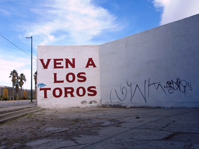
(Ven a los toros - Come to the bulls.)

Blood spills out on the streets
And bodies are missing for weeks
Both sides keeping a close eye
Watching the bullets fly here
On the crystal frontier – Calexico “Crystal Frontier”

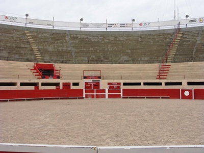
While my first day in Ciudad Juárez started with a stroll through the pocked neighborhoods around the International Bridge, followed by a history lesson on the city and Mexico itself, the second began as countless others in Juárez surely have: with a Bloody Mary. But getting to that Bloody Mary required a walk past the 112-year-old bullring, Plaza de Toros Alberto Balderas, the oldest building in the city. A newer but even more famous bullring, Plaza Monumental, was torn down in 2006 to make way for a Walmart. Is it better for a bull to die in a ring or end up as a frozen patty in a warehouse chain?

I won’t answer that question, but I will mention that during the years of greatest violence in Juárez the Plaza de Toros Alberto Balderas remained shuttered, only opening again in 2012. As we were walking past we noticed a couple workers out front of the Plaza de Toros and my tour guide, Rich Wright, asked if we could poke our heads inside. I can’t deny that crouching under the empty stands to peer across the dirt arena at the bull pen door was evocative, but Ernest Hemingway could probably articulate it better than me.


(Plaza de Toros Alberto Balderas.)

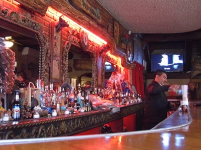
Leaving the bullring, we walked a short distance to an unmarked, entirely non-descript building at the corner of Madero and Dieciseis. Opening the door was like stepping into another world, possibly from 1921, when the El Recreo opened. All carved, dark wood and hushed shade, El Recreo, the second-oldest bar in Juárez, after the previously-described Buen Tiempo, is the kind of place you don’t see much anymore, complete with bartender in suit and bow tie.

While the Bloody Mary was delicious, it’s the sotol that may raise an eyebrow at El Recreo. Currently gaining a reputation as the mysterious cousin of tequila and mescal, sotol is made from the plant of the same name, sometimes known as desert spoon, and comes mostly from the state of Chihuahua. Sotol is not an agave, as is often thought, but a member of the asparagus family. The drink is also hard to find; in a city as big as Juárez you will only encounter it in a couple venues. I believe the brand El Recreo serves is El Oro de Coyame and the taste is rough, with plenty of gravitas, the effect perhaps not unlike inhaling campfire smoke that can numb your tongue.


(El Recreo.)

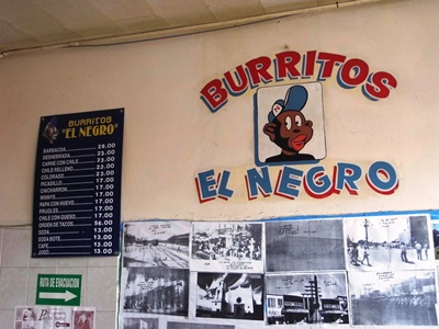
Back out in the glare of midday it was time to put something in our stomachs. Burritos El Negro was recommended by a passerby and turned out to sport a jarring, baseball cap-wearing mascot not far removed from the age of minstrelsy. The restaurant is located in what was once a bustling tourist area, but the tourists stopped coming when the bullets started flying. While the bullets began to slow in 2011, the tourists have not returned. This near-absence of tourism is part of why you can get a massive, phenomenally tasty chile relleno burrito for about a dollar at Burritos El Negro. Follow a Bloody Mary and bit of sotol with two of them and you may regret it.


(Burritos El Negro and its unfortunate mascot.)

As we walked down a crowded street after lunch, the noisy bustling heightened by the crunch of a truck driving into the back of a packed bus, a man brushed past me and, in a stage whisper, trilled, “Gggrrriinnnggooo,” not condescendingly, but apparently amused. I mentioned this to Rich, who told me, “We’re like unicorns down here.” Indeed, in two days in Ciudad Juárez I didn’t see another American that looked much like me, not even one hunting for a cheap dentist or discount pharmaceuticals.

I, however, was a tourist, and as such needed a souvenir. What better than a statue of Santa Muerte, or Our Lady of the Holy Death--who is essentially the grim reaper, sickle and all--from the Mercado Cuahtemoc? Said to currently be attracting more devotees than any other religious figure, Santa Muerte began to gain in popularity as drug violence escalated in Mexico and has found a loyal following among narco-traffickers. Not comfortable praying to the Virgin Mary for your cocaine shipment to arrive safely across the border? Make an offering to Santa Muerte. But Santa Muerte is also for those who feel too dirty and down-and-out to appeal to the usual saints. Or maybe you just want to ask for something that an archangel might frown upon. In fact, the Catholic Church frequently tries to remind people that it considers Santa Muerte blasphemous.
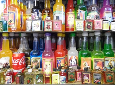
While I wasn't planning to ask much of Santa Muerte, I did want to cover my bases. You can buy statues in various colors depending on what you’re praying for, but I got a tri-colored one. White, gold, and red should, I believe, provide me with health, wealth, and love. Also, while a gringo like me wouldn’t necessarily know that Santa Muerte should come with additional “magic,” Rich luckily did, and made sure I got it. The vendor then proceeded to coat my statue in what appeared to be baby powder before liberally spraying it with something that smelled a little like floral air freshener. The strange, sickly-sweet concoction eventually leaked through two plastic bags and into my backpack, which I found surprisingly disturbing. But I’d been instructed not to release Santa Muerte for 24 hours to ensure the “magic” was properly absorbed, so I didn’t dare transfer Holy Death to a leak-free bag.


(Magic + Coca Cola.)

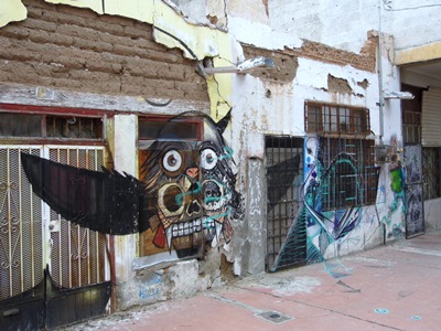
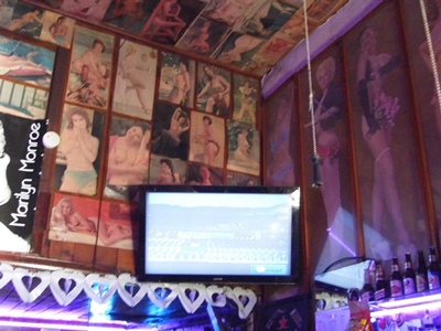
With Santa Muerte in tow we walked through an oddly delightful ramshackle alley devoted to Don Quixote, the walls of the buildings covered in graffiti portraying scenes from the 17th century tragi-comedy. Our last stop was El Club 15, named for the number of people that can fit inside. Like El Recreo, it was dark and cool, sold sotol, and featured a well-dressed bartender. The bartender’s name, Chuy, was constantly being called by patrons wanting to have their drinks freshened. Yet, instead of the ornately carved wood of El Recreo, the entirety of the walls and ceiling of El Club 15 were covered in dozens of vintage pin-up photos, bare-breasted women from forgotten eras smiling coyly from nearly every surface. A television in the corner played Pink Floyd’s Live at Pompeii film. Cognitive dissonance, or was Juárez becoming a little bit of everything?


(Not scenes from Don Quixote.)

You see, Live at Pompeii was the first VHS tape I ever watched on a VCR, and I wondered what the thirteen-year-old me would think if he’d known that decades later there’d be that same shaggy Nick Mason pounding those same massive drums. But this time that boy was watching "Careful With that Axe, Eugene" in a tiny bar in a city that a handful of years earlier had been dubbed the Murder Capital of the World, surrounded by mid-twentieth century porn, pressed in on all sides by friendly locals speaking a language he couldn't understand very well, while sipping a Jack and Coke, now had in honor of the late Lemmy Kilmister. He might be kind of confused as to just what sort of path had led here, but I’m fairly certain he’d think Ciudad Juárez, a city trying hard to rebuild itself after some very dark times, was well worth exploring in 2017.


(El Club 15 and its trio of vices.)

Again, many thanks to Rich Wright, who showed me Juárez as I never could’ve seen it otherwise, even if given many years of roaming the streets on my own. I can’t recommend taking one of his walking tours highly enough. More information on those can be found right HERE.