skip to main |
skip to sidebar
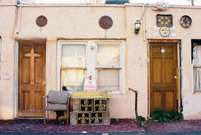
The Aztec Motel, which was until recently located along old Route 66, just east of Nob Hill, deserves two posts. This first will be a synopsis of the physical history of the motel. In the next, I’ll try to say a few words about what made the Aztec (and its back parking lot) one of the strangest and most interesting places I’ve ever photographed. That will be more of a metaphysical history, I guess, with the photographs saying more than words ever could. So, without further ado, the late, great Aztec Motel…
Back in the heyday of Route 66 nearly 100 motels lined the stretch through Albuquerque, also known as Central Ave., running from just west of downtown nearly to the Sandia Mountains. The vast majority of those motels are now gone, the occasional vintage sign left standing as a kind of grave marker. Before it was demolished, the Aztec Motel was listed in the National Register of Historic Places, spotlighted in the National Park Service’s Route 66 travel itinerary, and considered to be among the five most historically important motels left standing on Central Ave. But, as we know, the economics of decay trumps history nearly every time.
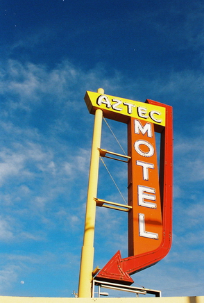 The Aztec Motel was actually the first motel built on East Central Ave. There seems to be some disagreement as to whether it was built in 1931, 1932, or 1933, but it certainly pre-dated Route 66, which was not designated until 1937. Built in a style known as “Southwest Vernacular” and originally called the Aztec Auto Court, the motel had 13 units and three carports. The carports were walled-in sometime in the 1950’s and turned into four additional rooms. This is also when the original neon sign was replaced with the one that can still be seen beside the now-empty lot.
Like so many old motels, the construction of the interstate (I-40, in this case) pulled the rug out from under the Aztec and it declined for many years until it was frequented mostly by drug users, prostitutes, and the down-and-out. Looking at this area now, adjacent as it is to trendy Nob Hill, it’s hard to believe things were ever that seedy.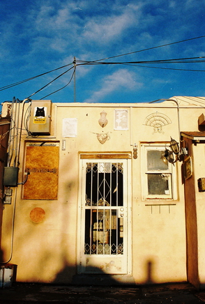 In any case, in 1991, Mohamed Natha bought the motel and worked to bring it back from the brink. In an effort to cut down on visits by hookers and their clients, as well as drug addicts and petty criminals, Natha began to rent only to long-term residents. A short time later the Aztec began to be extravagantly decorated with found items (of which I’ll say more next time) and underwent a kind of renaissance. The long-term residents were chiefly artists, free spirits, and assorted characters-about-town whose personalities became reflected in the motel itself as a genuine community developed.
Thus the Aztec Motel soldiered on for some years, becoming the longest continuously-operated motel in New Mexico. Then, in 2006, a development company bought the motel with the stated aim of renovating it. What they found was that more was being spent on maintenance than was coming in as revenue and structural problems brought the cost of fully rehabilitating the property to a million dollars. And with that, the decision to demolish the Aztec Motel was made. It finally came down in June of this year, somewhere around its 80th birthday.
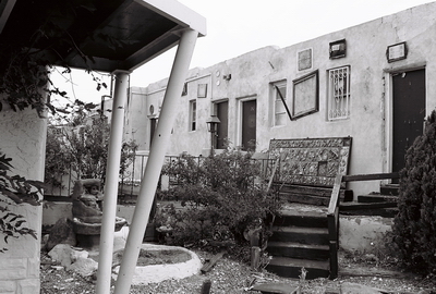
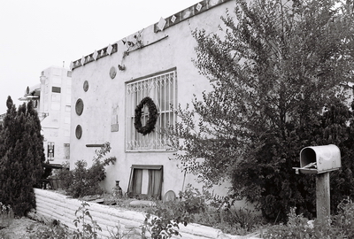
Having only been in Albuquerque two years at this point, I don’t recall ever seeing the Aztec Motel actually open. In fact, a lot of the found art had already been removed by the time I got to the place. On my first visit it did appear that people were still living in some of the units. There were a couple lights on and it seemed that a few of the rooms were being maintained in an interesting kind of way (see photo at top of post), but I assumed these folks were squatters. I regret that I ended up taking only a few photos of the Aztec itself that day as my attention was almost immediately drawn to the back parking lot, which we’ll get to next time. Until then, keep on keeping on.
I got some of the information for this post from the National Park Service, KRQE News, and a cool little website on roadside architecture called "Agility Nut," now long gone.

My favorite place to visit and photograph in all of Albuquerque is the old railyard complex just south of downtown. I did a VERY LONG POST on the history of the place, with plenty of photos, in early 2010. Since then it's become VERY difficult to get a close look at the railyard due to movie shoots and drastically increased security once the city became liable for the property. But lots of people love the railyard and this Thursday, September 15, 2011, a mostly-photographic exhibit dedicated to raising public awareness of this stunning (and imperiled) collection of industrial architecture will open at the Kimo Theatre Gallery, 423 Central Ave. NW. Most--if not all--of the photographers will be present (yes, including me) and the show is free, so come on down Thursday between 6 and 8 PM if you can. All the works will be for sale, as well. The show runs through mid-November, so there's plenty of time to stop by if you can't make the opening. Hope to see you there!
Lots more information on the exhibit, including photos, recollections, and history can be found at the ALBUQUERQUE RAIL YARDS website. In addition to the above-mentioned City of Dust POST, a couple more of my rail yard photos can be found HERE and about, uh, 80 more HERE.
The great photo used for the postcard above was taken by local urban explorer KILLBOX. The photo below is yet another by yours truly.
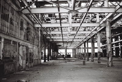
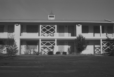
Two venerable old motels in Albuquerque bit the dust this summer. Both were along Route 66 and had long histories serving weary travelers in the city. The Aztec Motel, which was built in the early 1930’s and located near Nob Hill, was one of the quirkiest (and downright strangest) places I’ve ever visited. Its demise has elicited some response around town, including a memorial art show that wrapped up last week. I’ll do a post on the Aztec soon. But I’m going to start with a motel on the other side of town that went down without much of a whimper, the Silver Moon Lodge.
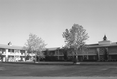
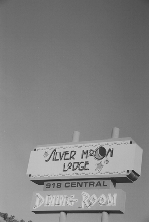
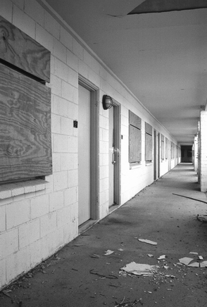 The Silver Moon Lodge, built in 1953, was at 918 Central Ave. SW., not too far from Old Town. The Silver Moon and the Central Park Deli, which was also located on the premises, closed for good on October 15, 2007 after a 54-year run. Then, in the absence of a development plan, the entire complex sat vacant until July of this year. Originally, the place was known as the Desert Skies Motor Hotel. After that, it became the Desert Inn Motor Hotel. Here is (UPDATE: was) a cool POSTCARD from that era. By the 1980’s, a third name change found the hotel billed as the Grand Western Motor Inn. Clyde and Goldie Taylor, who ran the Desert Inn in Santa Fe, owned the business around this time. Here’s one POSTCARD from that period. And here is (UPDATE: was) ANOTHER. I don’t know when the official name switch to the Silver Moon Lodge occurred, but the hotel appears to have sometimes been referred to as the Grand Western Motor Lodge up until it closed.
Peak Hospitality eventually acquired the Silver Moon and, when asked in 2007 if it might be renovated rather than torn down, stated, “We spent $1 million renovating it when we bought it seven years ago. The plumbing and water systems were starting to go. The numbers didn’t work out (on a renovation).”
You know, I understand that economic concerns trump all other considerations when it comes to business. It’s a shame to lose a piece of history, but it’s hard to compete with the Best Western’s and Super 8’s. Of course, once a motel starts to decline, it’s hard to get it back on track. I’ll finish this post with a review from Yelp, posted about nine months before the Silver Moon’s doors were locked:
 “You can't expect very much from cheap motels, but this place was pretty bad (and not super inexpensive). Everything in our room seemed like it was broken -- the bathroom lights, locks, closet hanger rod, toilet, and curtain rod. On top of that, our towels and all the chairs in the room had mysterious stains on it. The only reason why this place gets two stars instead of one is because the staff was so nice and responded quickly when we phoned about broken lights and busted locks. They also provide free shuttling to and from the airport.”
If anyone has other recollections of the Silver Moon to share, please send them in. I’d love to hear ‘em.
Information for this post came from Route 66 News, a great site called Motel Fan done by a motel enthusiast from the Netherlands, and, of course YELP. The postcards were found on 66 Postcards and Card Cow.
I've got a new post just about ready to go, but right now I'm off to South Dakota for the Labor Day weekend. I hope to get some good photos out there on the lone prairie. It's been a solid decade since I've been to South Dakota. In the meantime, for those of you in the Albuquerque area, The Printmakers' Studio is opening a show this First Friday, September 2, featuring work by local photographers. There will be great food, great folks, and great art. I managed to sneak in a couple shots, too. So, even though I can't attend the opening, I'd highly encourage anyone that is interested to stop by. The show will run through the month of September, so if you can't make it down on Friday you'll still have some time to get a look.
(UPDATE: This show has been extended through October.)
The Printmakers' Studio is located at 423-425 San Mateo Blvd NE, ABQ, NM. The open house will run from 5PM-8PM.
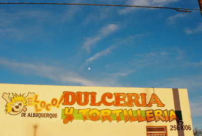
The photo above was taken off Central Ave., not far from The Printmakers' Studio and just down the block from the subject of an upcoming post.
My stated intention awhile back was to produce new posts on a more regular basis but, as seems to always be the case, other things have gotten in the way. This time it was a move which has taken up most of my time over the last month. This was a move just down the street, not halfway across the country as has kinda been my modus operandi to this point. Nevertheless, everything had to be boxed-up, loaded-up, and then dumped into empty rooms to be unpacked. The unpacking is still to come, but I wanted to get something new posted before I lost any more time. With that in mind, we’ll take a short trip to Dawson's neighbor in northeastern New Mexico, Colfax, which, as of a few months ago, is just a ghost of a ghost town.
Originally known as Vermejo Junction, Colfax was established in 1869 and took its name from Schuyler Colfax, Jr., the 17th Vice President of the United States. Colfax served under President Ulysses S. Grant. It’s anybody’s guess as to why the town was named after Schuyler, but what is known is that, unlike other mid-nineteenth century towns in New Mexico, Colfax was promoted not for its mineral resources, but as an ideal place for agriculture. It was largely the St. Louis, Rocky Mountain, and Pacific Railroad, which ran nearby, doing the promoting. Two thousand 25' x 140' lots were laid out and sold for $140 a pop, with discounts for anyone buying more than one. Given the importance of the railroad in those days, there was every reason to expect that people would come to Colfax. But, in the end, not many did. Some would-be residents were even cheated by crooks who did not actually own the plots they sold.
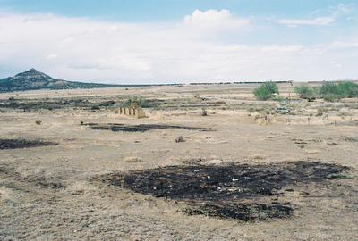
By 1908 Colfax had a post office but it closed in 1921. A school, hotel, mercantile store, and even a gas station survived into the Great Depression. The school, which also functioned as a church, remained open until 1939. But most people coming into the area simply opted to go up the road a couple miles to Dawson to work in the mines or they set up shop in Cimarron. Thus, Colfax seems to have never really gotten off the ground.
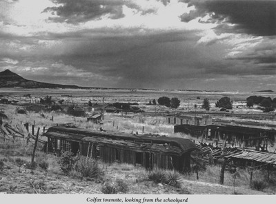
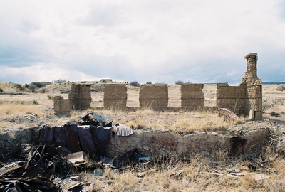
The two-story Colfax Hotel (originally known as the Dickman Hotel) was the major structure in the town, but it eventually went out-of-business and has been gone many, many years. Philip Varney’s guide to New Mexico’s ghost towns contains photos of both the old school and a panorama of what remained of the town about 30 years ago. In the panorama a passenger coach railroad car can be seen, along with some other intriguing structures. I really wanted to have a look at the railcar, in particular. There are great photos of it (and Colfax in general) taken in early 2009 at Rocky Mountain Profiles. And an old car shot through with bullet holes? There was every reason to be excited. But, in the end, it turned out there was almost nothing of Colfax left to be seen except for char marks on the ground where something had stood just weeks, if not days, prior to our visit.
So, what happened? Did someone set the old buildings of Colfax on fire? That’s a likely guess. Most of Colfax's structures were just feet from U.S. 64 and being only 13 miles from Cimarron did leave the place open to mischief. In a way, it's surprising the wooden buildings lasted as long as they did. I tried to recreate Varney’s panorama and, while he was a bit upslope from me, you can still match up the blackened ground with the structures in his photo. Did the railcar burn? What about the assorted outbuildings? The caption of Varney's shot says, "Colfax townsite, looking from schoolyard." I sure didn't see any school. The stone wall at the top of this post is really the only thing left. If only we’d gotten to Colfax just a few weeks earlier in its quiet 142-year history we might’ve caught its last gasp before it finally sank below the roiling waters of time for good.
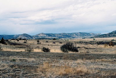
Almost no information on Colfax exists that isn't taken from Philip Varney’s book, although Rocky Mountain Profile's write-up contained a few tidbits, in addition to the excellent photos. I scanned Varney's panorama and posted it here to depict Colfax's almost complete disappearance. Thanks, Mr. Varney, wherever you may be.
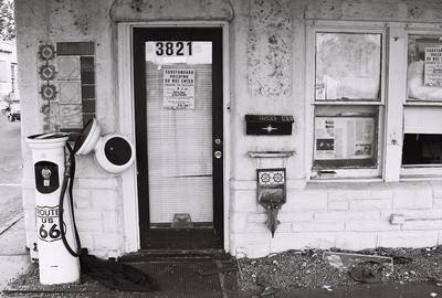
Recently a couple historic motels along old Route 66 in Albuquerque were sadly torn down. Posts documenting the last days of these majestic buildings will be coming soon.
Last year I wrote a POST on Willis Earl Beal, the most talented singer/songwriter I’ve ever had the pleasure of playing music with. Willis had to leave Albuquerque before our little 3-piece band was able to record any material or even play a show, but this week the Chicago Reader published a piece on Willis and his music and I think it’s well worth having a look at it. Just check out this quote: “If all goes well, sometime this Thursday evening he'll perform at the Jackson el stop, either on the Red Line, on the Blue Line, or in the tunnel between them.” There may even be one or two quotes from yours truly. CLICK HERE for the story.
Of course, reading about Willis is interesting, but it’s his music that really speaks volumes. The article mentions a 200-copy "Willis Earl Beal Special Collection" box set + 17-song CD that will be available through FOUND MAGAZINE and, since I don’t know the track listing myself (all Willis told me was “don’t worry, all your favorite stuff is on there”), I’m hesitant to post more music here in case it’s on the disc. So, what I’m going to do is post the lyrics to a song we worked-up and that, as far as I know, Willis has never recorded. Just imagine some Steve Cropper guitar, Booker T. Jones on organ, maybe the Memphis Horns adding a little brass, all over a sweet soul voice. Alright, maybe OUR musical accompaniment wasn’t that good, but Willis deserves that kind of treatment. Seriously.
Same Ol’ Tears
Got my walking boots on, destination in mind;
Said I’m goin’ back east, while I follow the signs;
Hooked into a woman, ‘cause she treats me well;
I come a-runnin’ when she rings the bell.
Hangin’ onto her dress, and I can’t release;
Tryin’ to go to sleep, but I can’t get no peace;
Well, I’m a-gazin’ at the moon while I pedal the bike;
I got a caffeine high but I don’t feel right.
Well, everybody knows somethin’ I don’t know;
That old idiot wind, everywhere it blows;
I feel a change comin’ on, coursin’ through my veins;
Won’t be long ‘til I’m gone and they all know my name.
I shed the same ol’ tears;
I shed the same ol’ tears;
‘Til my eyes don’t cry no more.
Two o’clock in the morning, up the hill I rode;
To shack up on the sly in my woman’s abode;
She goes back to bed but I’m still awake;
I’ve got this feeling of dread that I just can’t shake.
My brain is floating in a tank, being poked with a stick;
All this travelin’ back and forth, y’know, it’s makin’ me sick;
I hope the light don’t come, I hope the sun don’t rise;
I hope the shadow of death will leave and cover the skies.
But if it don’t then I’ll wander ‘til I walk with a cane;
Then I’ll go right insane, ‘cause I will never be tamed.
Shed the same ol’ tears;
I shed the same ol’ tears;
I shed the same ol’ tears;
I shed the same ol’ tears;
‘Til my eyes don’t cry no more;
‘Til my eyes don’t cry no more.
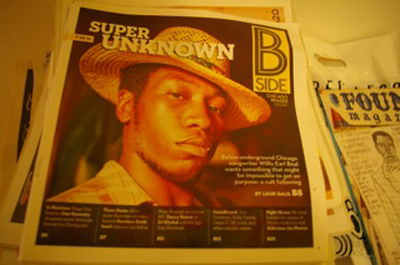
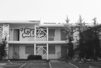
The photograph at the top is of the Aztec Motel, which was built in 1931. That's the Silver Moon Lodge in the middle shot; it was built in the 1950's. Both these motels were along old Route 66 in Albuquerque and now both, like Willis Earl Beal himself (bottom), can't be found in Albuquerque anymore.
My thoughts are getting slow and strange. I can feel my heart pounding in my ears. It’s the heat. You can't fight it. I’ve put my trust in this old truck for more than 20 years and now, like everything else I’ve ever trusted, it’s finally let me down. No one drives these old dirt roads anymore but I’ve always thought it was pretty here on the backside of the mountains. Desolate. I do love this desert but I guess it’s never cared too much about me. High up in the sun-bleached sky I can see a plane. Southwest Airlines. I can tell by the markings. I wonder who’s on that plane. Where are they going? It doesn’t matter. They’re not going where I’m going.
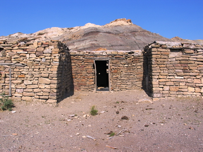
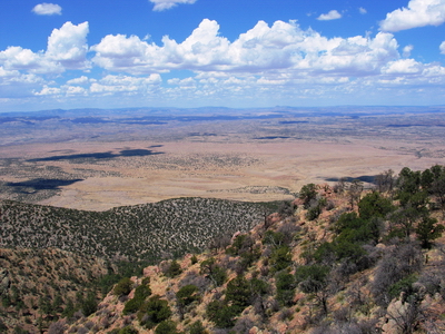
The shot at the top is facing west over central New Mexico after a failed attempt to crest Ladrone Peak. County Road 12, which runs just west of the Ladrone's between Bernardo and Magdalena, would make an appropriate setting for the trouble described above. The bottom photo was taken near the Ojito Wilderness. I might do posts on both these places some day as they're wild and remote even if not exactly abandoned. In the meantime, if anyone knows a good route up Ladrone Peak please let me know. A western approach didn't work and I'm curious as to whether anyone has tried a more southerly route, which appears somewhat promising. I do know there is SOME way up. This is rugged territory.
It's dark as a dungeon and damp as the dew;
Where the dangers are double and the pleasures are few;
Where the rain never falls and the sun never shines;
It's dark as a dungeon way down in the mines.
Dark as a Dungeon, Merle Travis, 1946.
Many towns across the United States have lived and died on mining. In New Mexico, the landscape is pocked with abandoned mine shafts and it seems that countless towns and the lives that were lived in them have come and gone with the minerals. Most of us might be able to think of one or two mining disasters. Twenty-nine people were killed in West Virginia’s Upper Big Branch Mine less than 2 years ago, for example. But not many people have heard of Dawson, New Mexico, of which so little remains that it can barely be called a ghost town now. The disappearance of Dawson, both in the collective memory and literally, is unfortunate because what happened there in the early part of last century was of some importance.
In 1867, J.B. Dawson decided to purchase about 1,000 acres of land northeast of Cimarron for $3,700. In one of those rare errors that actually put the mistaken party ahead it turned out that Mr. Dawson had really purchased 20,000+ acres with a large coal seam to boot. When Mr. Dawson finally sold his property to the Dawson Fuel Company in 1901, it went for $400,000. The Dawson Fuel Company started mining coal in earnest, but sold out in 1906 to the Phelps Dodge Corporation, who built a town with everything a person of the day could want: a bowling alley, schools, theaters, a hospital, an opera house, and a golf course. At its peak, about 9,000 people called Dawson home and men came from all around the world to work in the ten surrounding mines.
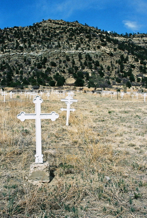 Then, on October 22, 1913, an explosion in Stag Canon Mine No. 2 sent fire spitting 100 feet out of the mouth of the mine. A dynamite charge had been mistakenly set, in breach of safety protocol, and ignited airborne coal dust. A massive rescue effort was undertaken with crews arriving from as far as El Paso, Texas, but only 23 miners survived. The final death toll numbered 263, making the Stag Canon Mine No. 2 disaster the 2nd worst in U.S. history. Two rescue workers were also killed in their efforts. Special white crosses were erected in the Dawson cemetery to mark the graves of those that lost their lives.
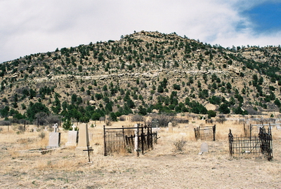
But when mining is all a town knows, it’s not long before the work resumes. And, in a mine shaft, with a return to work comes a return of risk. So it was that on February 8, 1923 a train jumped the track and hit timbers which were supporting Stag Canon Mine No. 1. The impact once again ignited coal dust and 122 more miners were suddenly dead. Many of those killed were sons whose fathers had died in the Mine No. 2 disaster less than 10 years prior. Now many of Dawson’s women had lost both their husbands and their sons to the mines. More white crosses were erected in the cemetery.
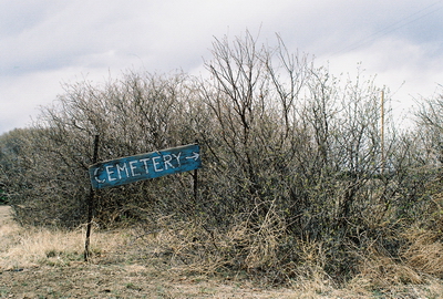
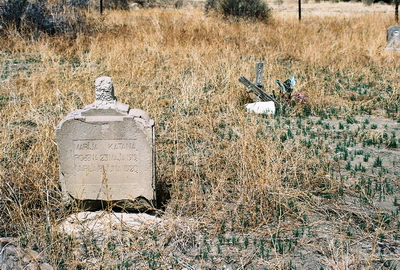
Yet the mines operated until 1950, when a 25-year coal contract with the Southern Pacific Railroad ended and extracting the remaining coal was not profitable. In April of that year, residents were suddenly given 30 days to leave their homes and Dawson was then quickly dismantled and sold. Most of Dawson is now lost to the ages, although the big Phelps Dodge Corporation safe reportedly resides in a museum in Bisbee, AZ. When Philip Varney visited over 30 years ago, he walked down the old dirt road to talk with the then-owners of Dawson and have a look at the very few remaining homes and structures, which included a gas station and some coke ovens (since demolished).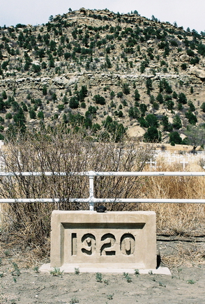 In that time things have changed a bit and I was not about to climb the gate, heavily posted with “No Trespassing” signs, and possibly try my luck with a ranch hand. But the cemetery, which was once just outside of town, is open to the public and is now the only visible remnant of Dawson. Family members still gather at the cemetery to reminisce and remember their loved ones. A number of the graves are well-kept with recently-placed flowers. But other graves are broken and forgotten. There are row upon row of names. Polish, Czech, Italian; many written in the native tongue. One lonely grave is of Marck Zamponi, a member of the “Wagoner 9 Engrs.” The stone simply says “Minnesota” (my home state) and there is an accompanying date of death: June 11, 1927. Did this man leave his family up north behind? Did they even know he was dead, let alone buried below a hill in a sooty coal town in northern New Mexico? After all these years, his story, like so many others, is forgotten and will never be told again.
As usual, I’ve relied heavily on Philip Varney’s New Mexico ghost town guide for this post. The wikipedia entry for Dawson is also quite good.
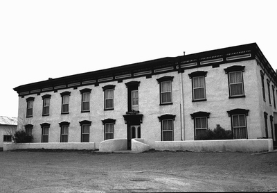
I’ve been trying to get back to the St. James Hotel in Cimarron, New Mexico for over five years now. In the fall of 2005 I was driving from Oklahoma to Taos via U.S. 64 and, on a whim, stopped for a few minutes at the old hotel. I immediately knew I wanted to spend some time there, but the road was calling and soon I had to get going. I bid the place adieu and vowed to return. Back then, I didn’t know that the St. James is considered one of the most haunted hotels in the United States. All I knew was what I’d just read in an article tacked to a wall; that the hotel was built in 1872, that 26 people had been killed in the saloon alone, and that everyone from Jesse James and Buffalo Bill to Clay Allison and Zane Grey had spent the night. As it turns out, not all of those claims are necessarily true, but there’s still more than enough verifiable history in the St. James Hotel to satisfy me.
When I posted about the ghost town of ELIZABETHTOWN, New Mexico awhile back, I mentioned Henri Lambert. Lambert, a Frenchman, had moved from Washington, D.C. to Elizabethtown in 1864 to try his luck at mining. Eventually he gave up on gold, however, and returned to his previous occupation as a chef.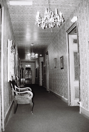 It’s been said that Lambert was Abraham Lincoln’s personal chef, but there is no hard evidence of this. On the other hand, it probably is true that, while living in Elizabethtown, Lambert was presented with a severed head. More on that grim tale can be found HERE. Lambert left Elizabethtown in 1871, moved to Cimarron (Spanish for “feral,” but also meaning “wild” or “fugitive”) and, in 1872, opened a saloon, which became known as Lambert’s Place. Not surprisingly, the saloon did a brisk business and, by 1880, Lambert had made additions, including hotel rooms and a restaurant. Lambert’s Place became the Lambert Inn and, eventually, was re-named the St. James Hotel.
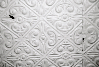
Cimarron was indeed a wild place and the names of most of the people killed in or around the hotel between 1872 and 1884 are known, as are the names of the killers. Henri Lambert himself shot two people and, in the mid 1870’s, it was apparently not uncommon to be asked, "Who was killed at Lambert's last night?" But it is worth considering that the notorious Texas gunfighter, rancher, and outlaw Clay Allison is credited with killing 11 people at the St. James Hotel, which means that, without Mr. Allison, the place would’ve been much less violent. Still, numerous bullet holes remain in the saloon’s tin ceiling to bear witness to the rough times.
If you believe what’s been written, you’d think that many (if not most!) of the major figures of the Wild West stayed at the St. James Hotel. Here it’s often difficult to separate fact from fiction, but I’ll try my best and, if anyone can further verify or deny these claims, please do so. First, it’s said that Jesse James stayed at the hotel, but that’s probably not true as there is no evidence that Jesse James ever came through northern New Mexico. Annie Oakley, also reported to have spent time at the St. James, never visited New Mexico at all. The story is that Annie Oakley was passing through with Buffalo Bill Cody while they worked on putting together a Wild West Show,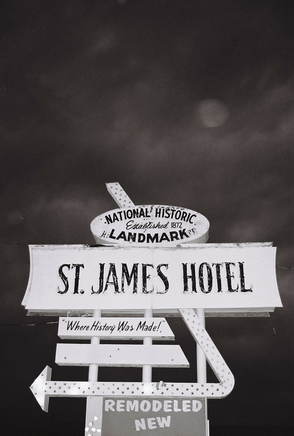 and thus there’s reason to suspect that Buffalo Bill never stayed at the hotel either. On the other hand, Buffalo Bill was said to be a personal friend of the Lambert’s, so the jury might still be out on that one. Legend has it that the Earp brothers and their wives spent three nights at the St James on their way to Tombstone and, you know, that just might be true. Clay Allison most certainly stayed many times, leaving the bodies behind to prove it. Bob Ford, the guy who shot Jesse James? Maybe. Ford is credited with shooting a man named Bob Curren in the St. James in 1882, the same year he shot Jesse. But I wouldn’t doubt that he actually came through later, on his move to Las Vegas, NM in 1884. In the early 20th century, Zane Grey definitely spent time at the hotel, writing some of Fighting Caravans in room 22. Other figures like Black Jack Ketchum and Doc Holliday? They were at times nearby, but your guess is as good as mine as to whether they really visited the St. James.
It’s useful to know who really stayed at the St. James Hotel so that, in the event of a haunting, you can better guess whose ghost you’re dealing with. Jesse James? Not likely. Henri’s wife, Mary Lambert? Quite possibly, especially if you’re in room 17 and there’s an overpowering odor of rose perfume. 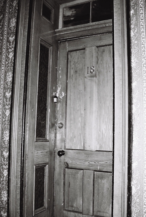 Perhaps the most interesting spectral figure at the St. James is Thomas James (T.J.) Wright. T.J. Wright was reportedly killed upstairs in the card room, following an evening of gambling. One story has Lambert himself shooting Wright in the back as Wright walked away after Lambert had gambled (and lost) his entire hotel to T.J. I doubt that’s accurate, but, whatever the case, Wright was dead at the age of 22. Now, Wright’s violent spirit is said to occupy his old room, number 18. So many guests have reported being tormented by Wright’s ghost, some being physically hurt, that room 18 is now padlocked and guests are not allowed in. Our bartender said that he sometimes goes up to the room and has a glass of whiskey, leaving one behind for Mr. Wright.
We spent the night in the Mary Lambert room, but I didn’t notice any essence of rose. Right across the hall was room 18, and my girlfriend reported hearing creaking floorboards from that direction that kept her up some of the night. She was pretty spooked, actually. Myself? I slept very well, thank you. In the morning I peaked through a crack in the door to get a look at room 18. I could see some torn wallpaper with holes showing through the plaster and plenty of dust. Whatever is going on, that room hasn’t been used for awhile.
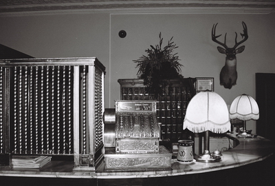
Finally, to wrap up this epic post, the St. James hit hard times when the railroad cut off traffic along the adjacent Santa Fe Trail and the mines began to close. The hotel was bought and sold many times and, by 1985, had fallen into disrepair. But, in 1985, the St. James Hotel was fully restored and now, with a modern wing (those hoping to be haunted shouldn’t stay in this section) and a large restaurant and bar, the place is once again the liveliest thing going in Cimarron. I’ll get back again sometime, I swear.
Wanna stay at the St. James Hotel? Go HERE. But note that they don’t take reservations on-line; you gotta call ‘em. Information from this post came from wherever I could dig it up; pamphlets, fliers, wikipedia, etc. But NOT Philip Varney’s ghost town guide. We’ll get back to that next time.
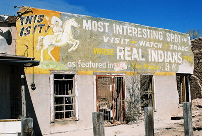
Just north of Albuquerque, a short distance west of I-25 and right off Historic Route 66, sits the old Santo Domingo Indian Trading Post, apparently waiting for its fate to finally be decided. Built by the Seligman Family in 1922, the trading post supplied authentic jewelry made by artists from the Santo Domingo (now Kewa) Pueblo to travelers on Route 66, as well as providing gas and Nehi orange soda. Being on the Atchison, Topeka, and Santa Fe line meant that the Southwest Chief, running between Chicago and Los Angeles, also stopped there, as did John F. Kennedy on at least one occasion.
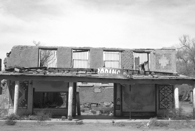
Considered to be of historic significance (“architecture/engineering, event”) and built in a vaguely Mission/Spanish Revival style, the trading post is #97001592 on the National Register of Historical Places. It was added to the New Mexico Register of Cultural Properties in 1997 and, when added to the national register on January 9, 1998, the current function of the building was listed as “commerce/trade.” Now, 13 years later (and 10 years after the building was gutted by fire), its current function is less obvious. However, in July 2010, the trading post received a one million dollar federal restoration grant from the Economic Development Administration to re-open and offer arts and crafts made by residents of the Kewa Pueblo. But clearly that money hasn’t been spent yet. Given the current economic climate, who knows what will happen to the trading post.
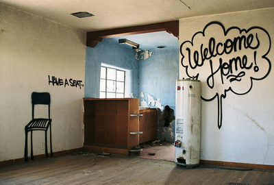
I have to say that I really love this building. For some time before I managed a visit I eyed it longingly from the Rail Runner, which stops just across the street, on trips to and from Santa Fe. A black and white photo of the façade hangs in my office, one of the very few photos which I’ve taken that are actually displayed in my home. I hope it gets rehabilitated someday soon and isn’t left to just collapse into the dust, as seems highly likely. Alas.
Next time...more ghosts.
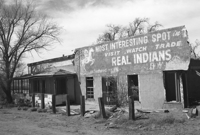
Information for this post came from Only In New Mexico, a blog by former Mayor of Albuquerque Jim Baca, and Route 66 News. The National Register of Historical Places listing can be found HERE. Thanks to Killbox for tracking down the historical register listing.
All photos taken around or inside the trading post and adjacent buildings.
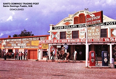
2013 UPDATE: Below is the best picture of the Santo Domingo Trading Post in its heyday that I've ever seen. Apparently it was once known as "Silver Dollar's Indian Trading Post." A sign above the gas pumps, on the left side of the pole, says, "J.F.K. was here. 12/7/62." It's great to put a date to the visit and, judging by the old-style pumps and people's clothes, the shot might well be pre-1970. Thanks to Matt for sending this one in.
JULY 2014 UPDATE: Recently a comment was left by someone with the initials M.W., who said they had grown up in the adobe house to the right of the Santo Domingo Trading Post. They were six at that time and are 51 now. So, I looked through my photos for a shot of that house and, while I don't have a real good one, the house can just barely be seen at the very far right of the picture below. I believe it was torn down when restoration work began on the trading post a couple years ago.
An interview I did a few days ago with Alex over at The American Classic can now be found HERE. I'm flattered that Alex wanted to do an interview and honored that he gave me so much space. Take a trip through his very cool site(s) and learn how to look better and feel good about it.
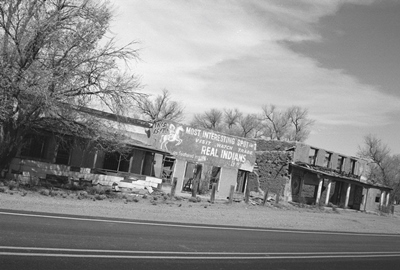
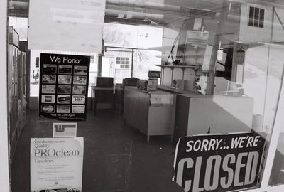
Photo taken at an abandoned gas station in Springer, New Mexico.
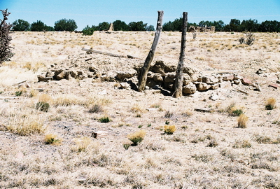
At this point, there’s not much anyone can say about the ghost town of Coyote, New Mexico, and there's even less to see. Like HAGAN, its neighbor just to the southeast, it’s located on land owned by the Diamond Tail Ranch. However, nearly a century after being abandoned, the town has been reduced to just a few piles of adobe behind a fence that it wouldn’t be real wise to try to climb over. But, Coyote is a bona fide ghost town, and so I’ll include it here.
Coyote is about three miles from HAGAN and its fate was very much tied to that town, which had been founded about two years earlier, in 1902. Workers from the Sloan Mine first established Coyote and then waited for the railroad to come through and connect the town with Hagan and other points of commerce. But, as I mentioned in the previous post, two efforts to get tracks to Hagan failed before a third was finally successful in 1924. The tracks eventually came within a half mile of Coyote but by then it didn’t matter because Coyote was already dead and gone. Now all that remains are a few foundations.
The only real historical source I found for Coyote was Philip Varney’s ghost town guide. Even Varney couldn't provide much information about Coyote and, whatever might have unfolded there during the town's brief existence, it seems it will never be known by the likes of us.
The next few posts will be similar to this one: short and sweet. There might be a bit of prose, too. But I’ve got quite a backlog of old New Mexican treasures and I’m accumulating more rapidly. The next post will be about one particular building along old Route 66. Stay tuned.
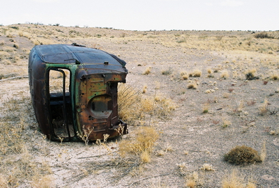
The top photo shows the remains of Coyote, but the truck was photographed literally in the middle of nowhere, Chihuahuan Desert, Socorro County, New Mexico. I dare you to try and find it.
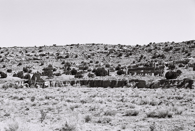
East of I-25, beyond the San Felipe Casino north of Albuquerque and down a dirt county road heading towards Madrid, lay the ruins of Hagan, New Mexico. Established in 1902, Hagan was yet another New Mexican town brought to life by coal, taking its name from mining investor William Hagan. Coal deposits had been discovered along the Una de Gato (Cat’s Claw) Arroyo and, by 1905, about 60 miners were living in Hagan, adjacent to the base of operations.
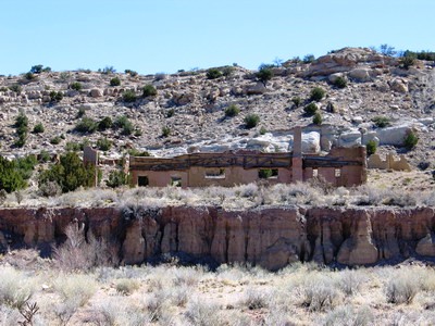
Hagan had to wait a long time for the railroad, the life’s blood of any mining town. Hauling coal by wagon was so expensive that the mines were shut down by 1910. After a line was finally run to the Atchison, Topeka & Santa Fe in 1924, following a couple failed attempts, the town’s population grew to about 500. Soon Hagan had running water, electricity, and toilets and some large structures were built, including Hagan Mercantile (shown above), then the largest adobe building in New Mexico. Cattle ranching and brick-making also became important ways of making a living in Hagan. However, the railroad had been running less than six years when the coal seam started to thin out around 1930. The town died quickly. A few folks stuck around until the very early 1940's, but the post office was already gone by 1931.
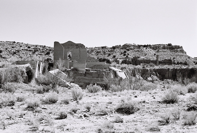
Not much remains of Hagan. There are a couple crumbling buildings, a few foundations, and a slowly capsizing railroad way station (pictured above). However, Hagan’s location is very picturesque and its apparent (if not actual) remoteness makes for some excellent atmosphere. But if you visit, don’t go beyond the overlook beside the road.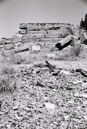 The Hagan property is owned by the sprawling Diamond Tail Ranch and posted as private. As none of our party was able to read the day of our trip, we crossed the arroyo and walked right into what was once the old town. But we got to spend only a few moments taking photos before a representative of NEW MEXICO JEEP TOURS arrived and asked us to leave. He was cordial enough (and, of course, he didn’t need to be) but made it clear that there was no way we were setting foot in Hagan without booking a jeep tour. The jeep tours look very interesting, actually, so perhaps NM Jeep Tours would like to provide me with a promotional discount. I’d certainly like to see a bit more of Hagan and check out the nearby petroglyphs, too.
Hagan has almost completely sunk beneath the sands of time. There is very little information available on the town’s history and much of what is out there is repetitious or, in some cases, probably wrong. So, my synopsis is based on my trusty copy of New Mexico's Best Ghost Towns: A Practical Guide by Philip Varney (1981, Northland Press) and an excellent post (including better photos than I was able to get) by the Torrance County Archaeological Society.
The next City of Dust post will be on Hagan’s ghost town neighbor, Coyote. Also, a stay at the St. James Hotel in Cimarron, New Mexico has been booked. In addition to being one of America’s most haunted hotels, the St. James is rich with history and bullet holes. A post on it will be forthcoming.
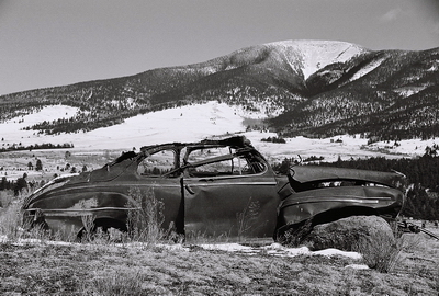
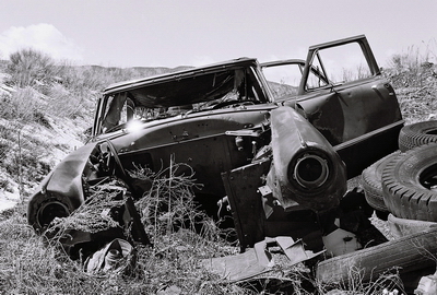
From what I can tell, people who read City of Dust are pretty much split between those who enjoy the historical content and those who prefer the fiction/prose. I like to mix them up myself, but for the next few posts we’ll be firmly in the former category, visiting a few ghost towns around New Mexico. Last post we stopped by Pinos Altos (not REALLY a ghost town) and this time we’ll head in the opposite direction and go to Elizabethtown, which is just north of Eagle Nest, on the "Loop of Enchantment," not too far from the Colorado border. If you aren’t a history buff, you can always just look at the photos. Those are the remains of a ’46 Mercury in the photo above, if you’re wondering.
Elizabethtown is fairly well-known, as far as ghost towns go, and there is even a museum on-site. However, there isn’t much left of the place. Like most ghost towns in New Mexico, Elizabethtown came into existence because of shiny rocks. In 1866, Captain John William Moore helped a wounded Indian get medical attention at Fort Union, near Las Vegas, New Mexico. Later, the Indian returned to Fort Union to trade and ran into Captain Moore whose previous kindness the Indian now repaid with a few decorative stones which Mr. Moore immediately realized bore copper. Moore asked to be taken to the source of the rocks, which turned out to be high on 12,441 foot Mt. Baldy, just across the Moreno Valley from Wheeler Peak which, at over 13,161 feet, is the highest point in New Mexico. Even better than copper, it turned out that the mountains and valleys were rich with gold. And thus another western gold boom began. That's Mt. Baldy in the distance in the shot below.
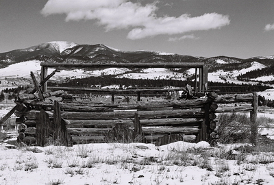
Elizabethtown, named after Captain Moore’s young daughter, was incorporated quickly, becoming the first officially incorporated town in New Mexico, and a post office opened before 1866 was out. By the time Elizabethtown celebrated its first birthday, the population had ballooned to 3,000. Or 5,000. Or maybe 7,000. No one really seems to know for sure, but a lot of people showed up in a short period. Just before 1870, E-town, as miner’s referred to it, boasted over 100 buildings, including a couple hotels, seven saloons (some 200 feet long), three dance halls, and a drugstore.
You don’t have to dig too deep into a town’s past to find something unsavory, and Elizabethtown is no exception. In late 1870, the Ute wife of Charles Kennedy, who lived on the road between E-town and Taos, entered a saloon bleeding and crying. She told those gathered around that her husband had been killing travelers. 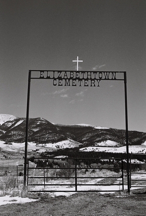 Depending on whom you believe, he may have killed up to fourteen people and might even have killed two of his own children after they got on his nerves. Whatever the case, the last of his kids truly did raise the old man’s ire when Kennedy lured a traveler into his home only to have the man ask if there were any Indians in the area. Kennedy’s son is said to have replied, “Can’t you smell the one papa put under the floor?”, a retort which displeased the boy’s father so much that he shot the traveler immediately and then bashed his son’s head against the fireplace. After that he threw the bodies in the cellar, locked his wife up, and started drinking. Eventually he drank so much that his wife was able to escape up the chimney.
As seems to have happened fairly often in the Wild West, a mob quickly formed and went and found Kennedy drunk at his home, along with some bones, a human skull, and another eye-witness. The mob was led by the notorious (and dangerous) Clay Allison and Kennedy was summarily taken back to Elizabethtown and dragged through the streets with a noose around his neck for a very long time.
It has been said that Allison removed Kennedy’s head and gave it to Henri Lambert, owner of the Lambert Inn (later the St. James Hotel) in Cimarron, now considered one of the most haunted hotels in the U.S. Lambert apparently was told to hang the head outside his establishment as a warning and it eventually mummified on the corral fence before finally disappearing. The St. James Hotel is on the short list of future City of Dust destinations. But as much as I like stories about the St. James Hotel, Lambert was actually living in E-town when Kennedy was killed, not Cimarron, and so, if the story is at all true, the head would’ve surely been placed outside Lambert’s Elizabethtown saloon, not taken to Cimarron.
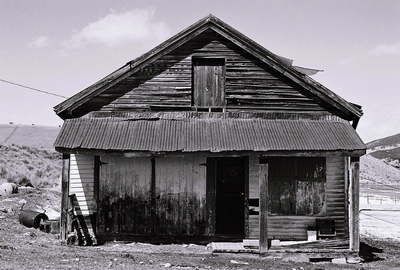
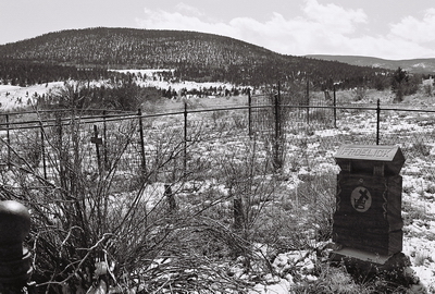
The building in the photo above is considered to be Froelick's Store, which survived a fire and, while slightly modified, is essentially the only original building left standing in E-town. Below is the final resting place of a Froelick.
Aside from the Kennedy affair, E-town was a notoriously rough place. When one defendant was asked to be tried in a different city because he figured he couldn’t get a fair trial in Elizabethtown, some citizens just took the man from the sheriff themselves and hung him, pinning a note to his coat that read, “So much for change of venue.”
By 1875, Elizabethtown was basically abandoned, but the ATCHISON TOPEKA AND SANTA FE RAILROAD (and the newfound ability to both transport ore long distances and commence dredging operations) brought the town back to life. E-town became a musical hotspot, with people traveling from all around to hear fiddle playing on a Saturday night. In 1903, Remsberg’s store went up in flames and a large part of the town went with it. Dredging ended in 1905 and E-town’s massive dredger, named “Eleanor” was left to sink deeper into Moreno Creek with each passing year. It’s still in the creek, but entirely buried now. Then it was a long, slow fade until 1917 or so, by which time hardly anyone was left in E-town. The post office hung on until 1931.
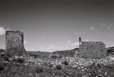
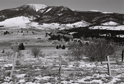
As I said, there’s not a whole lot to see nowadays. The above photo shows the remains of what was a two-story building which some say was the Mutz Hotel. However, Ofelia Barber, who was married in the building in 1872, stated that it was not the Mutz, but another facility, supposedly with rooms to rent on the first floor and a dance hall on the second. However, judging from other photos, even this ruin is a shadow of what it was 7 or 8 years ago. The Elizabethtown Cemetery, however, seems to still be quite active and not surprisingly. Who wouldn’t want their final resting place to be on a hill overlooking the Moreno Valley, with Mt. Baldy to the east and Wheeler Peak to the west? Mrs. Barber left not only her husband there but two daughters as well when she moved from E-town in 1936, one of its last remaining residents.
Once again New Mexico’s Best Ghost Towns: A Practical Guide by Philip Varney (1981, Northland Press) provided not just information but inspiration, as well. LEGENDS OF AMERICA has a pretty in-depth piece on Elizabethtown and some great historic photos, as well. I tried my best to separate fact from fiction based on the accounts I read, but things get hazy down through the ages. If anyone has anything to add, please do.
Next time we’ll go to Hagan. Or what’s left of it.


