skip to main |
skip to sidebar

When it comes to ghost towns, it doesn’t get much better than Cuervo, New Mexico. Its condition is remarkable not just because the town is no secret, as any internet search will attest, but because it’s literally feet from Interstate 40. Clearly, most people on the road between Albuquerque and Tucumcari don’t stop for a visit. Either they don’t know about Cuervo or they don’t care. That’s fine with me, although it doesn’t quite keep all the riff-raff out, as I’ll explain later.
Pulling into desolate, (mostly) deserted Cuervo is like driving into the apocalypse, if the apocalypse happened in 1920. Just forget about the semis whizzing by on I-40 and there are only old cars and older houses, scraps of clothes and newspapers from decades ago, everything in that hauntingly arrested state that all aficionados of the lost desire.

It’s always useful to know the names of places, regardless of the language they’re in, and that’s true in Cuervo. The town’s name means “crow,” (or, alternatively, "raven") and while there may have been many of these dark birds around at one point, not a single one was seen on our visit. Perhaps they were hanging out on nearby Cuervo Hill, the town's namesake. Or, maybe, unlike us, they were simply smart enough to stay out of the relentless heat of the midday sun.
Like so many others in New Mexico, Cuervo was a railroad town, brought to life about 1902 when the Chicago, Rock Island, and Pacific Railroad came through and turned the little outpost into a water stop. Before that, the town site had been on a trade route in use since at least the early 1500’s, but no one had previously thought to try to settle down way out on the wide and lonely plains.

Cuervo started off with a bang as an expansion of cattle and sheep ranching swept through the area in 1910. A couple decades later, Route 66 ran straight through town, easily supporting the few gas stations and hotels that sprang up in its wake. At its height, Cuervo had two of everything a person could want: schools, churches, doctors, and hotels.
One school, built around 1930 and closed in 1958, stands alone in a field of red dirt and was the high point of this visit to Cuervo. It might have been purchased by an elderly lady last fall for $10,250, though I’m not sure if the sale actually went through. That's the old outhouse to the left and classroom above. Also, both churches are extant. The Catholic church on the south side of I-40 was built of red sandstone during WWI. It’s well-maintained to this day. The Getty Memorial Baptist Church, on the north side, represented the low point of our trip. Again, I’ll explain shortly.

As with dozens of towns that owed their existence to the railroad and Route 66, the construction of the interstate system was a death knell. In the case of Cuervo, in the late 1960’s, I-40 was put right through the center of town, probably turning the lives of many residents into something like a John Mellencamp song.
But it’s worth bearing in mind that Cuervo was never a metropolis. Its population in 1946, immediately post-WWII, was only 128. In 1981, Philip Varney reported in New Mexico’s Best Ghost Towns that many homes remained occupied. Its population now may be in the single digits, including the owner of the non-functioning gas station on the north side of I-40. If you came to take pictures, I hear he won’t be happy to see you. He may well have good reason.

Now, over the years, I’ve occasionally gotten letters from people asking how they can access the places I’ve photographed. In every case, I’m careful to point out that I don’t want to encourage people to visit these sites, mostly for their own safety. Save it for people with unhealthy compulsions. Like me. Sometimes there is the problem of trespassing. But, in the case of Cuervo, which, as I mentioned, isn’t exactly unknown to explorers, very few buildings are posted as private property. In fact, aside from falling through a floor or having a roof cave in on you, the main danger in abandoned buildings is other people.

On that note, as of a few weeks ago, I can report that the Getty Memorial Baptist Church (pictured above) contains the most alarming installation I’ve seen since someone hung a rabbit at the Clearwater Textile Mill in 2004. So, if you ever find yourself wanting to check out the old Baptist church, drop me a line and I’ll tell you EXACTLY why you shouldn’t. Sorry, can’t post a photo of this one…or even describe it. Let's just say that there's evidence of return visits and an encounter could well go badly.
Alright, enough of that. I didn't know that Philip Varney recently released a new ghost town book! It was even in the Huffington Post. Of course, his NM ghost town guide was my primary source here. I also got a few tidbits from Ghost Towns Alive by Linda G. Harris. A little more background was plucked from Legends of America. The factoid about the woman who bought the old school came from a website called Topix but it's gone now.
Next time I think we’ll head down old Route 66 a couple miles to Newkirk and Montoya.

NOVEMBER 2014 UPDATE: Since I published this post 16 months ago I've probably answered a couple hundred inquiries about just what was in the Getty Memorial Baptist Church. I even developed a form letter response that I would revise as information came in. But now I can refer people to KRQE News 13 where THIS PIECE illustrates the scenes at two different locations in the area better than I could describe them here. Although things seem much calmer in Cuervo and there is some consistent activity (the school has been restored and has a nice, new roof!), I'm still not going to encourage people to visit because...there is no real end to the story. Also, to answer another common question, yes, the symbol on the wall in this post has been confirmed as Satanic. But that's almost certainly unrelated to what was in the Getty and elsewhere.


These days Vaughn, New Mexico is probably best known for its police force, which consists of a single drug-sniffing dog named Nikka. Last year there was a police chief, but he owes tens of thousands of dollars in child support and was accused of selling one of the town's rifles and keeping the proceeds. A second officer recently pleaded guilty to assault and battery, but he was never officially certified anyway. That leaves Nikka and the Guadalupe County Sheriff’s Department to keep the peace in Vaughn which, despite it being considered a stopover for drug smugglers, probably isn’t that difficult. But Vaughn, with a population of 438 (down from 539 in 2000), wasn’t always as quiet as it is today.
 In fact, Vaughn used to rattle and clack quite a bit. That's because by 1905 it was where the Atchison, Topeka & Santa Fe (ATSF) and El Paso & Southern Railroads intersected, the only place in New Mexico where two major railways crossed. It was also a division point for the railroad, with a roundhouse, multiple tracks, and a railroad office. After the arrival of the automobile, it became the town where three US Highways--54, 60, and 285--met.
But before Vaughn even had a name it was a favored resting place during drives on the Stinson Cattle Trail. Jim Stinson worked for the New Mexico Land and Livestock Company and, beginning in 1882, would bring up to 20,000 head of cattle at a time from Texas to homesteads and forts in the Estancia Valley of east-central New Mexico.

Vaughn got its name from Major G.W. Vaughn, who was a civil engineer for the ATSF. Right off the bat there was a water shortage and, in 1908, the ATSF built a water tank and two underground cisterns to try to collect as much of the precious liquid as they could. Drinking water was brought in by tanker from nearby Willard and Negra. The El Paso & Southern did a little better, having their water transported via wooden pipe from Bonito Lake, 100 miles to the southwest. In 1909, the ATSF figured it would just be easier to pay the El Paso & Southern 24 cents per thousand gallons than try to collect their own water any longer.
 In 1910, the Los Chavez Harvey House opened, named after the Chavez family, who arrived in the area with Don Juan de Onate and the first European settlers in the late 1500’s. The Harvey House in Vaughn served as kind of a minor league team for newly recruited Harvey Girls who were just learning the proper way to look nice and be good. The hotel itself never saw many guests and closed in 1936.
Charles Lindbergh even stopped in Vaughn, but not because he particularly wanted to. In 1928, engine failure forced him to land his plane and wait in town a few days for a replacement part to arrive. He stayed at the Harvey House and, apparently, despite the best efforts of the girls, was not interested in socializing with them in the slightest. To read about another stranded traveler who felt an initial distaste for Vaughn, yet eventually came around, I used to recommend a stop at Viva New Mexico, but it's gone now. However, you can still read the piece if you head over to New Mexico Magazine.

Vaughn wasn’t incorporated until 1919, but by 1920 it had a relatively healthy population of about 1000. However, the number of residents may never have climbed much higher than that. One Harvey Girl, Alice Garnas, said in 1926, “Vaughn was a shocking place. There was no place to go, nothing to do. Just Vaughn and those wide plains on all sides--cattle country. But it was for me.”
 And it might be for you, too. But if, like many, you’re just passing through, try to make a stop at Penny’s Diner. Look for the restaurant at the crossroads that appears to be inside a large aluminum Airstream trailer. Once you enter, it’ll be 1955 all over again and you’ll swear you can hear that clickity-clack as the iron horses rumble through.
Like the previous post, on the town of Encino, most of the hard-to-find information and quotes included here came from Dixie Boyle’s excellent book, “A History of Highway 60 and the Railroad Towns of the Belen, New Mexico Cutoff.” Ms. Garnas' quote came from "The Harvey Girls: Women Who Opened the West," by Lesley Poling-Kempes. I also grabbed a bit from Wikipedia, the aforementioned Viva New Mexico, and the LA Times, believe it or not.
Next time we’re going to one of the best ghost towns I know, Cuervo, NM.

NOVEMBER 2014 UPDATE: A reader recently sent in some postcards and stories about the Sands Motel, which their grandfather built and owned. This history was so extensive that I wanted to present it here. Happily, I was given the go-ahead. So, here's the story of the Sands Motel:
"My name is Dana McElyea and I live in Texas. These pictures are of the Sands Motel in Vaughn that my grandfather Jack Cormany built in the early 1960's. The motel was just as you came into town from the west. We spent every Christmas and summer traveling there when we were young.
"My grandfather was an incredible man that could do anything. He had several inventions and had Dr. Pepper bottling companies at one time before the motel. He moved to Vaughn for the climate and built the motel there due to the intersection of highways. I still have linens and dishes from the motel and the cafe.

"He sold the motel and moved to a 17-room house there in Vaughn that used to be a clinic from what I understand. That was farther down the street, right next to a church that was on the corner. It was a really nice house. They had named each of the 17 rooms, some according to what they had been when it was a clinic; baby room, waiting room, blue room, book room. The house had a beautiful rock fireplace that covered a wall. It really was beautiful inside for Vaughn. ;)
"Me and my two older brothers used to play in the glass enclosed check-in office at night. We would turn out all the lights and when a car drove past on the highway we would see who could 'hit the deck' the fastest before it saw us. Ha! If you look close on the far right side of the motel there’s a cement pad. That is where my brother shot me in my little toe with a BB gun because I wouldn't 'dance' like he told me to. Haha! Many good childhood memories in Vaughn. ;)
"I especially remember how wonderful my grandparents were to anyone staying in the motel. It was more like a bed and breakfast. Sometimes people stayed for days if they were snowed in. I have pictures of the snow up to the roof line and my grandfather having to use his tractor to clear it away.

"My grandfather passed away in the late 1970s. My grandmother continued to live in Vaughn until we moved her to Texas around 2000. She has passed as well.
"I read in the comments where someone inquired about the Cassidy family. My grandparents were very good friends with the Cassidy's and I believe they even traveled together some in my grandfather’s trailer.
"I just thought you might like some history on the motel. It was always so nice when my grandfather had it. I have many fond memories of Vaughn. It's heartbreaking to see the condition of it now."
Many thanks to Dana McElyea for sharing her postcards and memories.
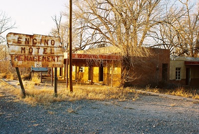
I spend a lot of time on US Highway 60. Not only do I travel the road for work, but I often explore its lonelier byways on my days off. Highway 60 once crossed the entire country and in New Mexico these two lanes of blacktop run through the central part of the state, from Texico to Quemado. US-60 essentially parallels I-40, but it’s usually at least 50 miles south and will take you maybe 5 times longer to travel. Sounds good to me! As one of my favorite stretches of asphalt anywhere, we’ve already visited some places along its route: Taiban, Yeso, Mountainair, and Pie Town among them. So, it’s high time to check out another: the mysterious Encino.
If you drop “Encino” into your Google search engine about all you’re going to learn is that the population was 94 in 2000 and the town encompasses all of 2.0 square miles. Luckily, Dixie Boyle apparently likes Highway 60 as much as I do because she wrote an entire book about the New Mexican portion. Aside from the above facts, which are straight from Wikipedia, everything else in this post is from “A History of Highway 60 and the Railroad Towns of the Belen, New Mexico Cutoff.” Thanks, Ms. Boyle!
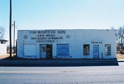
The name Encino, which means “oak” in Spanish, was derived from the scrubby trees that once covered the central plains of New Mexico. As is so often the case, Encino’s location can be traced back to a spring, long a well-known stop for thirsty travelers. Prior to 1900, something like a fort was built nearby to accommodate the dusty and weary for an evening or two.
Bonnie Salas was the first to homestead the land that would become Encino and, at that time, the few people in the area were mostly raising sheep or cattle on a fairly large scale. In 1905, the railroad announced plans to establish a depot in Encino and people took notice. This was another common story out on the plains, and one that usually ended similarly, as we’ll see.
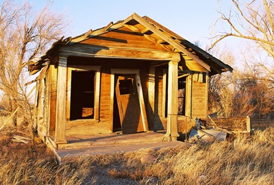
The Bond family bought 40 acres from Bonnie Salas, some of which they’d soon sell to the Atchison, Topeka, and Santa Fe Railway for the depot. That same year they also built the B.G. Bond Mercantile, which doubled as the depot for a bit and remained the only store in Encino until A.R. Cecil established a lumber company in 1908.
Encino’s post office opened in 1904 and both a Protestant and Catholic Church were built in the town, at least one of which doubled as a school. In 1910, the Encino Progress newspaper was founded and quickly went out of business. The Encino Enterprise gave the newspaper trade another shot in the 1920’s and managed to hold on for about a decade. Somewhere in there William’s Mercantile was built along Railroad Street and was later moved to abut Highway 60. Unfortunately, I arrived just a few years too late to photograph the long-vacant store.
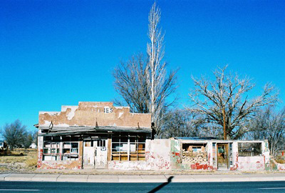
The best known citizen of Encino is undoubtedly R.C. Dillon, elected the eighth Governor of New Mexico in 1927. While Governor Dillon was born in St. Louis and moved to Springer, NM when he was 12, he later worked at B.G. Bond’s Mercantile and eventually opened his own store, R.C. Dillon & Company. The building is said to still be standing and recognizable by its faded sign. But for some reason I didn’t see it. Maybe it, too, is now gone.
Dillon served two two-year terms and would sometimes have political friends over for dinner at his home in Encino. The Governor was also a big proponent of paving roads. Not a surprising interest to have given the muddy, bumpy tracks he would’ve had to travel. Highway 60 was originally a wagon route and it wasn’t until 1918 that it began to see some initial truck traffic. Even once cars became relatively popular, horse and buggy was often still the faster way to travel the area. While US Highway 60 was officially designated in 1926, parts of the route in New Mexico actually remained unpaved into the 1950’s.
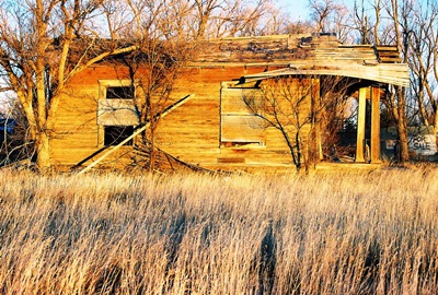
In 1965, Encino’s railroad depot closed and few small towns could weather that blow unscathed. The high school closed in 1982 and many of the town’s adobe buildings are now melting back into the earth. However, it’s said that the old Works Progress Administration-built gymnasium still contains the southwestern-themed murals of Hallie Williams, which she painted for $20 a pop between 1939 and 1942. On my next trip through I may need to see if I can track those down. Can anybody confirm that they’re still there?
So, that’s about all I know about Encino. If you’ve got stories or recollections to pass along, please do! Clearly, much of Encino’s history is fading fast. Next time we’ll go just a few miles east and have a look at Encino’s bigger neighbor, Vaughn.
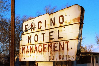
JUNE 2013 UPDATE: I'm pleased to report that Dixie Boyle, whose excellent book on US Highway 60 is referenced above, got in touch with me to provide the latest on the murals in the Encino gymnasium. Unfortunately, the news is not good. Here's what Ms. Boyle had to say:
"The murals are probably no longer standing. The last time I went through there, maybe five-six months ago, the town was tearing down the old gymnasium and school. They had half of it down and were slowly working on the other half. The half with the murals was still standing. I wanted to save those murals as they were so unique, but by the time I discovered them they were too far gone and would have crumbled if moved. I was surprised no one had thought of saving them before. You could check with the city hall in Encino and see if they are still there."
One of the reasons I started this blog was to document the many forgotten places that have attracted me before they disappeared entirely. So, it's pretty painful to realize that I could've seen the murals for myself if I'd just known they were there. I guess I should've read the first edition of her book, “Highway 60 & the Belen Cutoff: A Brief History”, a little earlier. It might well be worth checking with the city, but I'd be surprised if the murals still exist.
Anyway, below are Ms. Boyle's photos of Hallie Williams pieces, each painted around 1940. They are quite beautiful and I know of no one else that has photographed them. So, I give my heartfelt thanks to Dixie Boyle for sharing these.
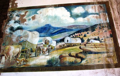
The mural above and the one below were clearly the best preserved of the four murals Hallie Williams painted.
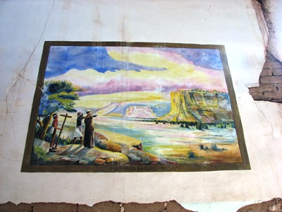
The mural below was already badly damaged several years ago.
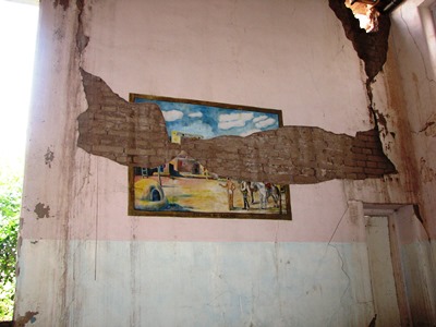
One of the four murals had already crumbled when Dixie Boyle made her visit, so the three above are all that have been recorded. Below you can see the precarious state of the gymnasium and how two murals were placed. Clearly, without expensive preservation efforts, they wouldn't have lasted much longer.
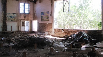
NOVEMBER 2013 UPDATE: I just received a letter from Henry R. that is so interesting that I thought I would post it here. In it, there is reference to the above-mentioned Hallie Williams and another mural that she probably painted which still exists. Hopefully I'll be able to post a picture of that mural here soon. Many thanks to Henry for sharing his knowledge of Encino's history.
"Hallie Williams must be the wife of Ollie Williams that owned a mercantile store on the old main road that fronted the railroad. I remember he had a stuffed buffalo hanging on the wall that stunk to high heaven. He built a smaller store on the North side of Hwy. 60 in the mid '40's. I bought comic book's and candy there. In the early '50's he built the building on the NE corner of Hwy. 60 and Hwy. 3. There is a mural on the inside wall that faces the highway that must have been painted by Hallie as it resembles the murals in the old gym. I have a picture of it somewhere and email it to you when I locate it if you wish. Ollie also owned the old station in Negra that was still standing last year.
My dad Henry "Boots" R. managed the old Rio Pecos Oil Co. station across the street in the '40's and later a Gulf station
on the NW corner of Hwy. 60 and the road that leads to the school. In the late '70's Boots bought the Williams station from Ollie and the sale included several acres on the North side of Hwy. 60, the old rock building/store, and the Harrison house.
After Boots death in 1982 I sold the Williams property to "Buttermilk" Dennison who owned the old Rio Pecos station across the
highway, excluding the Harrison house which I still own along with six prime highway frontage lot's. I attended school with Kenny Harrison and some of his siblings off and on till 1952.
The information above is as I recall it but may be off on dates."
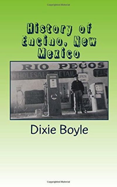
DECEMBER 2016 UPDATE: Dixie Boyle, who wrote "A History of Highway 60 and the Railroad Towns on the Belen, New Mexico Cutoff," has just published a short book compiling much of what can be learned about the history of Encino. Space is devoted to NM Governor and Encino resident R.C. Dillon, artist and teacher Hallie Williams, and the old stores and gas stations of Encino. A few words are even said about nearby Negra. Oh, and City of Dust gets a couple mentions, too! "History of Encino New Mexico" can be bought on Amazon or, better yet, at the recently-opened Encino Firehouse Mercantile & Deli next time you're passing through town. Of course, I highly recommend getting a copy!
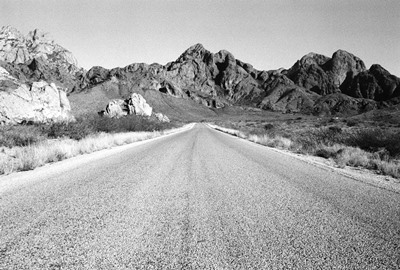
The hike from the Dripping Springs Natural Area visitor center to a cluster of lovely old ruins tucked back in the Organ Mountains is only about 1.5 miles. However, if you arrive on, say, Thanksgiving, and find the access gate locked, your hike will begin with a view something more like the one above. No need to worry. Here at City of Dust we are not discouraged by long, barren stretches of desert road. In fact, we are positively encouraged. Just push your hat down a little farther and bring more water. And, yes, we did still pay the $5 day use fee.
Aptly named for the little spring that dribbles down off a high rock face, this rare water source in the parched mountains of southern New Mexico has attracted both man and beast since time immemorial. Dripping Springs is best known as the site of Major Eugene Van Patten’s Mining Camp, which was really a vacation spot and is sometimes referred to as the Dripping Springs Resort. When the resort closed, Boyd’s Sanitarium was built just around the corner.
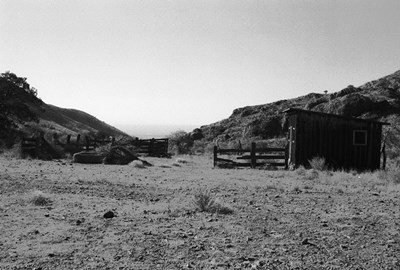
After hiking to the visitor center and then finally starting the 1,500’ climb to the spring itself, which sits at about 6,000’, we came across some old wooden buildings. These were built in the late 1800’s and include a livery, mercantile, and chicken coop. They were used by the resort which, as we shall see, was pretty swank for its day and location. Back then, folks rode the 17 miles from Las Cruces by stagecoach and thus it was handy to have a place to stable your horses and get fresh eggs, too. Local Native American boys took care of the livestock and tended the garden, as well as carrying jugs of water from the spring on long poles and dancing for guests.
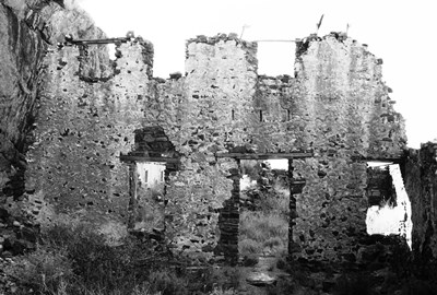
Using local rock from the canyon and mud-mixing plaster, construction of the resort began in 1895. By 1897 it was open and advertising for guests. Comprised of two wings in an “L”-shape, one wing contained the two-story, 14-room hotel and the other a dining hall, dance hall, living quarters for workers, and the all-important roller skating rink. Muslin covered the ceilings of the bedrooms, some of which were brightly wallpapered. A gazebo doubled as a bandstand and the grounds were carefully landscaped. In 1906, 18 more rooms were added to the hotel. The photo above is of the back wall of the old hotel.
Major Eugene Van Patten was a real character. Born November 10, 1839 in Oneida, New York, Van Patten was West Point educated and, as nephew of Colonel Butterfield, helped establish the El Paso leg of the famous Butterfield Overland Mail Company stagecoach route. On February 9, 1860, while traveling from Tucson to Mesilla, Van Patten’s stagecoach was ambushed by Apaches. Van Patten and his passengers had to hide in some rocks until a party of traveling merchants came to their aid.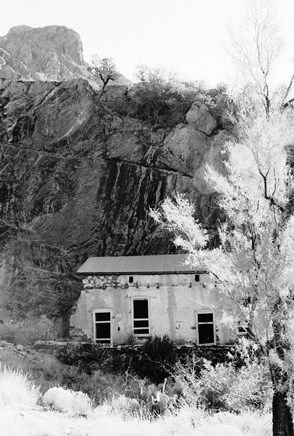 Despite being from New York, Van Patten joined the Confederacy during the Civil War and served on General Stonewall Jackson’s staff. Once the war ended, he professed himself to be a member of Abraham Lincoln’s Republican Party for the rest of his life. In 1865, he married a high-ranking Piro Indian, Benita Madrid Vargas, and became involved in Native American affairs. Through the late 1800’s, he was everything from a county sheriff to a deputy U.S. Marshall to an organizer of the NM chapter of Teddy Roosevelt’s Rough Riders, though he himself did not ride roughly. Financial problems forced him to sell his resort in 1917 to Dr. Nathan Boyd and his fortunes continued steeply downhill from there. He died nearly penniless on February 28, 1926 at the age of 86.
Dr. Nathan E. Boyd had been hanging around Dripping Springs since 1890. Despite being a medical doctor, he was mostly involved in land speculation. In 1892-1893, he began trying to get authority to build a dam across the Rio Grande near Engle, NM, not far from where Elephant Butte Dam is now. The dam was actually begun, but everyone from the Mexican Government to domestic agricultural interests quickly lodged legal complaints. Not surprising, since Boyd wanted ½ of any land irrigated by his reservoir. As a result, Boyd was entangled in legal proceedings until almost 1915. Meanwhile, construction began at Elephant Butte on top of the legal foundation Boyd was laying through his years of litigation.
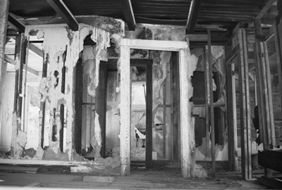
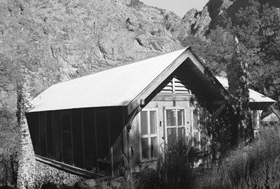
Boyd then got back into finance and real estate, establishing the First National Bank of Las Cruces. But he was soon forced out for making loans to himself. Finally, he returned to the medical profession, buying Van Patten’s property with the intention of building a large tuberculosis sanitarium. In the end, he only built a small sanitarium, depicted in the two shots above and the one below. After three years, he threw in the towel, selling the land to Dr. T.C. Sexton and heading to Washington, D.C. Sexton then ran the sanitarium intermittently.
Nathan’s son, Earl (or Robert, depending on your source), brought the property back into the family in the early 1930’s and lived there until 1940, when he joined the military. Once he left, vandals moved in and the hotel was soon completely scavenged for building material. A.B. Cox added the land to his ranch holdings in 1957 and in 1988 the Nature Conservancy finally bought the property. Since then it’s been mostly tourists making the hike up to what Philip Varney calls, “one of the most beautiful [spots] in southern New Mexico.” I’d have to agree, just don’t expect to get your water from the springs these days or they’ll have to scare away the buzzards to get to your body.
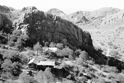
Information for this post came largely from Las Cruces Blog, which posted an excellent three-part series on Dripping Springs. Everything else came from interpretive signs at the natural area. Well, except for Varney’s quote, which came from Varney.
Next time we’ll return to one of my favorite stretches of desert road, US Highway 60, and pay a visit to Encino. It’s not a ghost town, but that doesn’t mean I don’t like it.

Organ, New Mexico isn’t really a ghost town these days, but I’m gonna make it look like one. Sorry, good people of Organ. I’ll explain in a minute.
Organ is named for the razor-spired Organ Mountains visible to the south, which were themselves named because they look like the pipes of…an organ. After being a mining encampment from the 1840’s, the town was officially founded in 1883 as lead, copper, fluorite, zinc, gold, and silver mines were punched into the hill slopes to the northeast with ever-increasing frequency. By the turn of the century, Organ was peaking at about 1,800 residents, seven saloons, two smelters, two general stores, a two-teacher school, a Catholic church, a post office, a hotel, and a jail in a tunnel that had once been a powder magazine.

It seems strange that Organ was not called San Augustin, in honor of the San Augustin Mountains immediately to the northeast, or 7,030-foot San Augustin Peak, which literally towers over the town to the east, or even San Augustin Pass, now part of US Highway 70/82, which, if traveled eastward, will take you down onto a vast plain and the southern extent of the White Sands Missile Range. But, in 1908, long before US 70/82 was named, it was on this same stretch of road, traveling southwestward toward Las Cruces, that Pat Garrett was shot and killed some 28 years after he'd shot Billy the Kid in Fort Sumner, New Mexico. This bit of Organ’s history has remained long after its mines, which filled with water in the 1930’s, have mostly faded from memory.

Because Organ is the closest inhabited place to White Sands Missile Range, it was revived somewhat in the mid-1940’s when work began on the atomic bomb and missile range employees moved-in. Thus, while the population is still only just over 300, there are many well-kept homes and what looks like it would be a very quaint and tasty Thai restaurant. Too bad it was closed during our visit. Philip Varney mentions Bentley’s Store and Assay Office in New Mexico’s Best Ghost Towns and notes that it had become a private residence. This is still true and, in fact, the old building looks to be very well-maintained with lots of tended greenery out front. Varney also mentions the Organ School, notable for its corner bell tower, but I couldn’t find it. I think the tower has been removed and the school probably now just blends in with its older neighbors.

So, you may ask, if there are a few hundred people living in Organ, renovating their historic homes and eating Thai food, why all these photos of derelict buildings? Well, these pictures were taken on the south side of the highway. Those are the Organ Mountains in the background of a couple. As to WHY virtually every commercial enterprise on that side of the road has been abandoned—and apparently long-abandoned—I can’t say. Perhaps people prefer to eat and shop in Las Cruces, 15 miles away. That’s really the only other city in the area, but as New Mexico’s second-largest it would offer some retail competition. Whatever the case, I find it surprising that the spectacular views of the Organ Mountains to the south, San Augustin Peak to the east and Las Cruces to the southwest haven’t had more people stopping for sandwitches. I know I’d stop for a bite.

Next time we’ll go deep into the Organ Mountains themselves and visit Dripping Springs. But first I need to figure out how to make my crummy photos more presentable. Oh, and the photo above is the only shot from the north side of the highway. In the distance are the Doña Ana Mountains and the northern edge of Las Cruces, beyond which lies the Jornada del Muerto ("Journey of Death"), a waterless, 90-mile stretch of El Camino Real. Sounds like fun, huh?
For more information on Organ, consult ghostowns.com,
Wikipedia and, of course, New Mexico’s Best Ghost Towns.

Some ruins draw us in because of what’s left behind, even if we don’t know who was there or what they did. Other times, we may know a little history, making what remains all the more evocative. Then there are those locations where the passage of time has obliterated all evidence and no visible clue to the past remains, even if that past was beautiful and transcendent night after night after night. Such is the case with a small patch of lawn in South Carolina which now contains only a shallow pond and abuts a scraggly woods.
Not far from the Savannah River, on Carolina Springs Road, near Highway 1, you may hear ecstatic ghosts if you listen hard enough. Here stood Palmetto Park and Pond, a two-story, thousand-capacity dance hall and adjacent concrete-lined swimming pool for cooling off before sets, once a major stop on the “Chitlin’ Circuit.” Featuring the very best of African-American entertainment from May 12, 1932 until a final Christmas dance in 1941 (just weeks after Pearl Harbor), the list of musicians that graced its stage makes your head spin. Check a few of these dates:
June 7, 1940: Ella Fitzgerald & her orchestra.
April 20, 1941: Jimmie Lunceford & his orchestra.
May 5, 1941: Ella Fitzgerald & her orchestra.
May 21, 1941: Cab Calloway & his Cotton Club Orchestra.
Aug. 4, 1941: Lil Green with Tiny Bradshaw & orchestra.
Sept. 19, 1941: Louis Armstrong & his band with vocalist Ann Baker.

Also known to have played at Palmetto Park and Pond were King Joe Oliver, Dizzy Gillespie, "Queen of Swing" Edith Curry and her orchestra, Maxine Sullivan ("the Loch Lomond Lassie"), Graham Jackson (an accordionist pictured in Life Magazine weeping as he played “Going Home” while FDR’s body left Warm Springs, GA) and his Seminole Syncopators, Erskine Hawkins and his orchestra, Smiling Billy Seward and his Celery City Serenaders, “Queen of Jazz” Blanche Calloway, Speed Webb and the Hollywood Blue Devils, “The Sensational Harlem Playboy” Willie Bryant, Mitchell “Kid” Harris, Banjo Bernie, Hosea Sapp and his Swing Kings, Desmore and the Rhythm Kings, Al Cutter and his Twelve Knives Band, Zack Whyte, Floyd Ray with Joe Alexander ("Harlem's Bing Crosby") and Eddie Brown (“The World's Greatest Drumming Man”), Clarence Love Orchestra, Wilson's Swing Band, Clarence Moultrie, and Earl “Fatha” Hines, amongst many, many others on countless bills now lost to the ages. Below is a shot of Palmetto Park and Pond in its 1930’s heyday.

We should make a special note of Hamburg, South Carolina-born singer Arthur Lee Simpkins, known as the "Black Caruso," and his Nite Hawks, who, of course, frequented Palmetto Park. With a range from C to F above high C, Arthur Lee sang at the 1964 memorial for soul legend Sam Cooke, whose "A Change is Gonna Come" still knocks me out every time.
Before becoming Palmetto Park and Pond, the site hosted church gatherings. A black social club known as the Dragons began having swing concerts in 1932, which led Duke Lamback, a local BBQ restaurant owner, and Joe Minnick to up the ante considerably in terms of booking (and BBQ, too, apparently). Soon the bills became so awesome that free buses ran from the corner of Laney-Walker and what is now James Brown Boulevard to bring folks over the river from Augusta. Finally, something very rare and special for the time happened: White people began to attend the concerts, were welcomed and, by all accounts, everyone got along just fine. Granted, seating was still segregated, but, at the height of Jim Crow, this clear example of the power of music to break down prejudices should be remembered.

WWII, however, ruined the fun and, with so many men of all races being drafted, Palmetto Park closed and the land was sold. The pond struggled on for awhile after the war as a local swimming hole. Then, for many years, a trailer park was on the site until it became more trouble than it was worth. Now, all is quiet. But, if you listen close, you might still hear that trumpet blow.
If you do a Google search for Palmetto Park and Pond, virtually all roads will lead back to Don Rhodes, who has single-handedly resurrected the memory of this once-grand venue. In fact, through the exhibits committee of the North Augusta Arts and Heritage Center, and with the help of the committee’s chairman, Milledge Murray, and the center’s director, Lauren Virgo, he helped assemble an exhibit in its memory in North Augusta’s Municipal Building. The exhibit in large part can still be seen today at the Aiken (S.C.) Museum of History. So, pretty much everything here comes from Don one way or another and I thank him for telling me about Palmetto Park and then bringing me out there for a visit. I swear you can still feel the energy of the place. Thanks also to the current property owner for not calling the cops on us before Don could introduce himself. The owner provided some excellent history, including pointing out just where the bandstand had been. (It would’ve stood right where the trees are behind the chain link fence in the photo at top and below).

You can read more about Palmetto Park and Pond HERE. If you’d like to read about Arthur Lee Simpkins at Palmetto Park, check out this BOOK by Tom Mack. And if you know anything at all about Palmetto Park and Pond, please leave a comment!
That’s it for now. The next post will have us leaving my former home in the Central Savannah River Area and returning to my current home of New Mexico, where we’ll head south to a little town nestled beside the Organ Mountains.

Back in late 2004, I wrote a post titled “Honky Tonk Hell” about an abandoned Christian mission located on the site of the lost town of Hamburg, South Carolina. The “hell” of the title was in reference to this particular building being the creepiest place I’d explored to that time. All these years later, it has yet to be topped. I’ve been in lots of physically disturbing places, but not many that I’d characterize as psychically disturbing. The “honky tonk” was in reference to a rumor I’d heard that the mission stood where an old club used to be. I still think the pictures and stories accompanying that original post match the title pretty well.
A short time later, the very first comment on that post (left anonymously, naturally) not only re-stated the rumor that a club had once been there, but added that it had been built in the 1950s for the hundreds of workers being brought in to construct the nearby Savannah River Site, a Cold War-era nuclear facility. As if that wasn’t enough, word was that the woman with multiple personality disorder portrayed by Joanne Woodward in Three Faces of Eve used to dance at this place. Three Faces of Eve, fittingly enough, opened at the Miller Theater, across the river in Augusta, in 1957. Without any way to verify this information, I could only hope it was all true.
Flash forward to last fall and some conversations I had with Ramblin’ Don Rhodes, columnist for the Augusta Chronicle and historian par excellence, who finally confirmed that the cinder block mission had indeed been built on the site of a concrete and wood club, which burned in August 1957, the month before Three Faces of Eve premiered. He reckoned that the existing concrete slab might even be the same one the club had stood on. Even better, he knew the name of the place: Club Royal. It was once among the most popular clubs in the region and considered one of the nicest in the South. As if that wasn’t enough, he’d interviewed Eve, whose real name is Christine Sizemore Costner, and heard a bit firsthand about Club Royal.
In the book on which the movie is based, Eve is said to have three distinct personalities. There’s Jane, her relatively stable personality, Eve White, the “good girl,” and Eve Black, the “party girl.” I’ll let you guess which one danced (and even sang) at Club Royal. In the film, there is a scene that takes place at what would have been Club Royal where Eve is dancing for soldiers from then-Camp Gordon. In Don’s interview with Mrs. Sizemore, she said of Club Royal that, “It was huge, and it was nice. I was surprised they let me sing there. Eve Black, though, had a nice voice. What I find interesting is that I can’t carry a tune in a bucket, but she sang so well. And, if she just appeared there as a guest, they would ask her to sing. She loved it, you know.” Interesting, indeed.
This is just the kind of thing we love to get into here at City of Dust. Try Googling “Club Royal” and “North Augusta” or “South Carolina.” You will get no pertinent hits beyond a chapter written by Don for his book, “Mysteries and Legends of Georgia: True Stories of the Unsolved and Unexplained.” Club Royal has nearly sunk entirely into the mists of time.
Nearly, that is, but not entirely. In the last eight years, nature has reclaimed much of the mission. The dolls and women’s clothes that used to litter the floors have somehow disappeared. The roof has totally caved-in. The moldy piles of magazines, some dated from the mid-1950s, before Club Royal was destroyed, have vanished. The tractor trailers out back, once filled with final donations, have burned completely. In short, the place is no longer creepy at all. But I could at least stand on that concrete slab and imagine Eve Black belting it out for the soldiers.

And I learned something else. Facing the mission while taking the photo above had me standing right in the middle of what had once been Market Street, the main street of Hamburg, and the very place where the Hamburg Massacre of 1876 started.
The spooky mission is returning to nature. Once afraid of being stigmatized for her illness, Christine Sizemore Costner has recovered completely, written a couple books, and is now living happily in Florida. The seven victims of the Hamburg Massacre, emblems of the bloodshed and terror that Reconstruction brought to African-Americans, are long dead and almost forgotten (but, again, not entirely). So, you tell me which of the stories surrounding this little patch of ground by the Savannah River is the creepier.
Many thanks to Don Rhodes for sharing what he knows about Club Royal and for his excellent interview with the former Eve. I highly recommend his book. Thanks also to Peter Hughes for recreating some of old Hamburg for me. If anybody out there has stories from Club Royal, I beg you to please send them in!
I leave you with THIS rather apropos musical outro courtesy of Webb Wilder.


