skip to main |
skip to sidebar
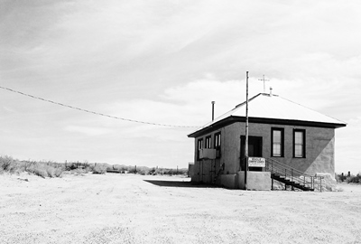
There’s not been much written about Engle, New Mexico over the years. The usual ghost town books I consult only mention the town in the context of its stage and rail connections to other places. But Engle, now not much more than a handful of buildings persisting in the relentless heat of a dusty former rail stop 20 miles east of Truth or Consequences, sits within an area that has played a major role in the histories of Spain, Mexico, and the U.S. Currently, it is the home base for an enterprise owned by a well-known cable television magnate and, in the future, may be passed through by some very wealthy people on their way to…orbit.
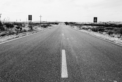
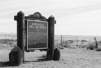
It makes sense to start the story of Engle with the Jornada del Muerto, the “Journey of Death,” which runs through the town. Or, perhaps, a couple hundred feet west, if you want to get technical. Considered the most treacherous part of El Camino Real, this stretch, beginning slightly north of Las Cruces, traversed a desolate wasteland devoid of water, firewood, or shelter. So, if the Apache didn’t get you, the desert itself might. Just imagine traveling over an ancient lava bed by horse in the early 1600’s without a Wal-Mart or 7-11 in sight. It might sound like heaven now, but let’s not romanticize too much. The closest city to the north, a long 90 miles away, was named Socorro (i.e., succor, relief, aid, etc.) for a reason. But, all that aside, plenty of travelers did survive the journey and thus, for many years, one of the most important trade routes in the history of the world passed right outside what would become Engle’s front door.
Founded in 1879, Engle was, like so many other towns in the West, born of the railroad. Named for R.L. Engle, the railroad engineer who supervised construction of the line through town, due to a paperwork error Engle was officially known as "Angle" for its first six months. An attempt to rename the town "Engel" in the 1920's, in honor of Atchison, Topeka, and Santa Fe (AT&SF) vice-president Edward J. Engel, was halted in the 11th hour when "cowboy chronicler" Eugene Manlove Rhodes asked Senator Bronson Cutting to pull some strings.
The railroad soon built a station and Engle thrived as a shipping point for cattle from surrounding ranches. Horses, mules, stagecoaches, and eventually trains transported ore east from the more remote mining towns on the edge of the Black Range, including Cuchillo, Chloride, and Winston (then known as Fairview), and from Engle it all moved on to larger cities, such as El Paso. A post office opened in 1881 and the place was off and running.
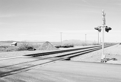
From 1911-1916, the construction of Elephant Butte Dam, about 10 miles west, increased the population greatly. Housing in Engle was convenient and the town was the switching point for the AT&SF spur that carried materials to the dam. The peak at that time was about 500 residents, but with completion of the dam workers left immediately and Engle began its decline. By 1919, 300 people, over half the peak population, had left. Seven years later, only 75 souls remained. In 1945, much of the land to the east and south of town was claimed by the federal government for White Sands Missile Range, snuffing out most of Engle’s remaining light. But not quite all of it.
While the post office closed in 1955, a few people live in Engle yet. The train still rumbles by, however, it doesn’t stop.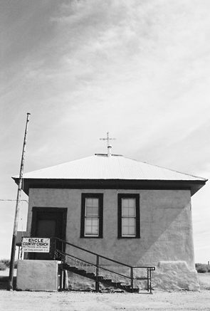 Not many original buildings stand, but one, the old schoolhouse, occupies what would seem to be the spiritual center of town. That’s not just on account of it being the most prominent building you see as you cross the railroad tracks, but because it’s now the Engle Country Church featuring “bible preaching and gospel singing” at 10 AM on the third Sunday of every month. Conveniently, there are some vineyards being tended nearby, too, in case the supply of wine runs low.
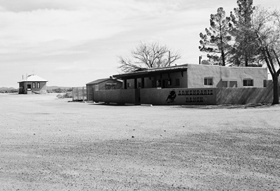
Engle has also become the headquarters of the Armendaris Ranch, a massive 362,885-acre spread owned by Ted Turner of CNN and Jane Fonda fame. Word is that when he comes to town, his entourage lays the necessary groundwork a few days in advance and then Ted blows in, checks on his buffalo, maybe does a little hunting, and is off again. Turner owns two other huge ranches in New Mexico and is the second-largest private landowner in the state.
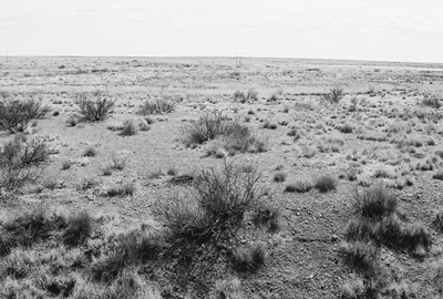
Moving into the totally surreal, Engle is poised to be a way station for those heading to Spaceport America. Anyone not flying directly into and out of the spaceport or coming up from Las Cruces would be obliged to go through Engle. It is strange to imagine that some of the richest, most famous people on the planet might see Engle shortly before they are launched into orbit for a few seconds. On the other hand, those who traveled the Jornada del Muerto hundreds of years ago might well appreciate the irony. For the dusty little patch of Chihuahuan Desert on which Engle persists has a habit of being a quiet witness to great journeys.
It’s not easy finding information on Engle. The usual physical sources overlook it, but on-line you can find most of what seems to exist at ghosttowns.com. Even Legends of America won’t tell you anything about the town. But they will tell you that, in the 1880’s, Bill Hardin, famous gunfighter John Wesley Hardin’s first cousin, was lynched by a mob after killing a man near Engle. Oddly, the “Ghost Towns of Sierra County New Mexico” promotional card is one of the better resources, even at all of five sentences. NM Place Names recounts how Engle came to be called Engle (and then almost wasn't). Otherwise, Wikipedia will tell you about the Jornada del Muerto and Spaceport America will tell you about Spaceport America.
Next time we’ll cross I-25 and move nearer the Black Range to visit the relatively well-known partial ghost town of Hillsboro, NM. Until then, have a happy 4th of July and safe travels, everyone.
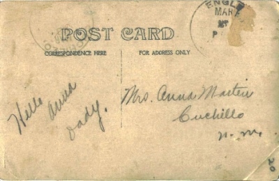
JULY 2014 UPDATE: Mr. William M., former resident and continued aficionado of the wide-open spaces of New Mexico,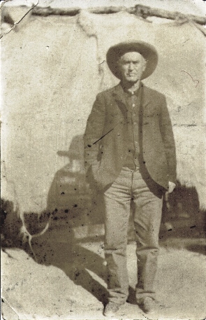 has contributed a very interesting photo postcard. Postmarked from Engle to Mrs. Anna Martin of Cuchillo, NM, William guesses the card is from about 1910. Note the sparse address and even sparser message, which reads, "Hello Anna Dady (sic)." The few words speak volumes about this time and place. We can only assume that the stoic desert fellow pictured is indeed Anna's father, probably captured by a photographer traveling through Engle. William adds, "It was sent from one ghost town to another ghost town – only in New Mexico."
Thanks for the great addition, William!
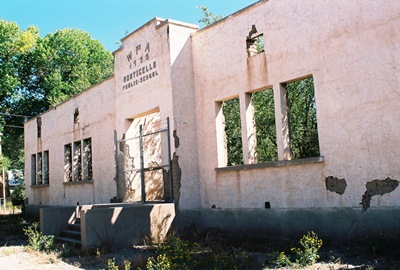
Okay, it’s true that Monticello, New Mexico isn’t a full-on ghost town. Some folks do indeed live there. But it’s got its fair share of old, empty structures, including an impressive adobe school built by the Works Progress Administration (WPA). In 1980, Philip Varney included Monticello in New Mexico’s Best Ghost Towns because of its “extraordinary charm.” Well, in this case, perhaps not much has changed over 34 years because Monticello remains extraordinarily charming. Judging from Varney’s photos, some buildings look better and some perhaps worse. However, if you stopped for a couple hours to eat lunch on the shady steps of the school and listened to the birds sing while the wind blew gently through the tall cottonwoods, as I did, and then explored the rustic little plaza, you might think about buying a secluded retreat in Monticello, as I also did.
Monticello, in southwestern NM, is 25 miles northwest of Truth or Consequences, not far from Cuchillo, and was originally founded in 1856 as Cañada Alamosa. The name honored the town’s cottonwood-lined canyon. The Alamosa River flows alongside. Clearly, in the green, 23-mile-long Monticello Valley within which the town sits, cottonwood trees have always been a big deal.
Early on, Cañada Alamosa was the headquarters of the Southern Apache Agency. By 1870, 500 Apaches lived in the area and Cochise, the Apache leader and namesake of Cochise County, AZ, brought his entire Chiricahua Band in with him in the winter of 1871. But, in 1874, when the agency was moved a handful of miles northwest to the Ojo Caliente Reservation, near present-day Dusty, in what's now known as the Monticello Box Canyon, the Apache were dispersed. Almost 20 years later the town became known by the much less poetic moniker Monticello.
In 2003’s Ghost Towns Alive, Linda Harris says the name change was the result of postal system bureaucracy. The story goes that in 1892, Alphonse Bourguet and his brother, Aristide, French emigrants, wanted to establish a post office in Cañada Alamosa. However, the policy of the day dictated that postal names be a single word. Alphonse had once been postmaster in Monticello, NY and Aristide must've figured that worked pretty well the first time because he submitted Monticello as Cañada Alamosa's replacement. This is all similarly recounted in The Place Names of New Mexico.
But I have read other accounts, including in New Mexico’s Best Ghost Towns, stating that John Sullivan was the town’s first postmaster, also from Monticello, NY, and he made the change. However, I think this is now considered incorrect. Some Bourguet’s and Sullivan's still live in Monticello. Perhaps they can tell us! Whatever his role, John Sullivan’s home was reportedly a stage stop, claimed to be the first in Sierra County. Sullivan’s place still stands off Highway 142, which leads into town and passes the plaza. For some reason, New Mexico True says his home was the San Ignacio Catholic Church!
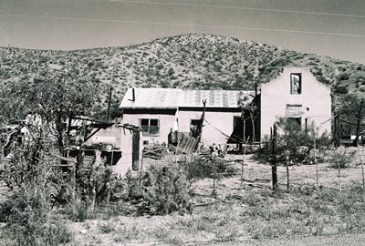
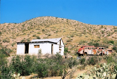
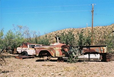
The Monticello Valley has always been a ranching and farming community and it remains so today, producing organic vegetables and award-winning balsamic vinegar. But it’s true that it’s not as bustling as in the past. The large Monticello Public School, mentioned earlier, has been reduced to a picturesque shell. Built in 1935, it's said the school burned down when a student's chemistry experiment exploded. However, that may be nothing more than a rumor propagated by my friend at Viva New Mexico. The plaza, quiet and empty during my visit, once provided a thick-walled adobe fortress complete with gun holes to guard against Apache attacks. A couple homes on the outskirts of town, one fairly large, appear long-abandoned, with vintage vehicles parked outside in various degrees of decay. Of course, I was in heaven.
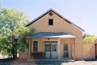
On the other hand, the San Ignacio Catholic Church, built in 1867, is well-maintained and lovely. Located on the north side of the plaza, services are still held there.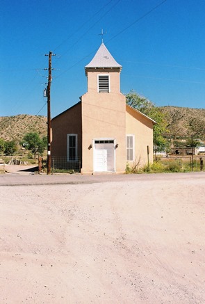 There may yet be a dried-out pump organ in the choir loft. Restored territorial-style homes with corrugated tin roofs peak from behind lush greenery. What appears to have once been an antique store sits silently to the east of the plaza. Quite derelict in a photo in Varney’s book, it’s clearly been restored, even if it’s now vacant again. Within its cool, blue walls are many of the antiques that must’ve once been for sale and the ceiling shows several large, beautiful vigas running lengthwise. Outside are a low, weathered, wooden patio and an old bench. Anybody want to go in on the place with me? That's it below.
In 1910, at its peak, Monticello had 573 residents and there may have once been more than 1,000 families throughout the valley, which includes the adjacent town of Placita. The 2012 census has the population at 135, yet most folks probably don't live in town year-round. I saw only a few people, all of which passed by in cars or trucks as I took photos along the roadside.
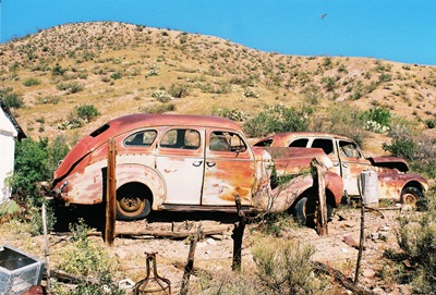
I attempted to get to the cemetery southwest of the plaza, but after crossing the shallow Alamosa River ran into several private property signs without a graveyard in sight. It’s a shame, because I hate to miss an old cemetery. But it does provide an excuse for a return visit. As if I needed an excuse! To further prove that point, as I left, four cow ponies crested the rise beside the cars pictured below. You might be able to make out the hawk soaring through the upper right of the frame. Extraordinarily charming indeed.
Most information for this post came from the NM ghost town books of Varney and Harris, with a bit from The Place Names of New Mexico. Viva New Mexico, and Legends of America were also useful. Ghosttowns.com has a couple interesting tidbits and Bestplaces.net presents demographic info from 2012. The Wall Street Journal did a great piece on the local balsamic vinegar and referenced peak population. New Mexico True, the state's official tourism website, gets much more wrong than right, but at least they tried. Maybe someday I can do a post about the healing waters of Ojo Caliente and the ruins of the Apache agency.
Next time, we’ll cross I-25, head through T or C, and have a look at Engle. Once filled with workers busy constructing Elephant Butte Dam, this dusty railroad wayside is now poised to be the gateway to Spaceport America.
I pretty much can't bear to read articles about myself. Luckily, I don't have to do it very often! In this case, the pain is balanced out by the fact that the piece was written by the excellent Columbia, South Carolina-based author Tom Poland and published at "Like the Dew: A Journal of Southern Culture and Politics." Mostly about my photography in Georgia and South Carolina, it does lead off with a sly reference to a Replacements song they've actually been playing recently (and, no, it's not Left of the Dial). Thanks to Tom for being so kind to myself and City of Dust.
You can find the feature and attendant photos HERE.
I should have a post on Monticello, New Mexico up in the next couple days. I'm pretty happy with some of the photos I took, so that's always a good start. More soon!
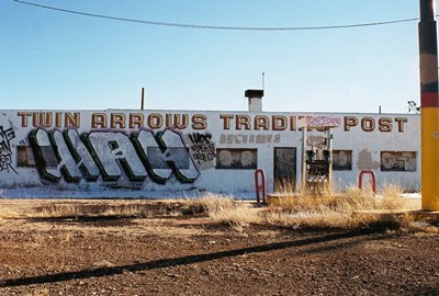
A couple of years ago I wrote about Two Guns, Arizona, an old Route 66 trading post with a history of violence and tragedy dating back to when the Navajo and Apache fought in what is now known as Canyon Diablo. Twin Arrows, christened in homage to Two Guns and just a few miles to the west down I-40, hasn’t got quite as bloody a background, but that doesn’t mean what remains isn’t fit for City of Dust. Surely I haven’t become that macabre, have I?
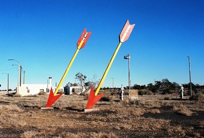
Originally known as Canyon Padre Trading Post and likely built sometime after 1946 (it’s absent from that year’s comprehensive A Guide Book to Highway 66 by Jack Rittenhouse), the roadside stop was named for a nearby gorge. Canyon Padre Trading Post then seems to have remained relatively obscure until its name was changed to Twin Arrows Trading Post and two very tall wooden arrows complete with tips and feathers were installed in the parking lot to guide travelers to the right place.
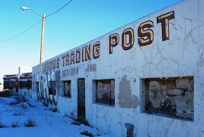
While one could argue that death and sorrow did more damage to Two Guns than the destruction of Route 66 by I-40, it was the interstate that began to put the nails in Twin Arrows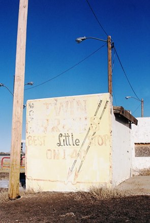 coffin in the 1970’s, even though the trading post was given its own exit. The gas station, diner, and gift shop advertising itself as the “Best Little Stop on I-40” (perhaps once the “Best Little Stop on Route 66”?) was apparently sold and re-sold until 1995, when the towel was finally thrown-in. The state of Arizona then became the owner and probably wasn’t too pleased about it, either. The gas station, diner, and arrows began to deteriorate in the harsh northern AZ desert.
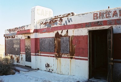
The ruination of the dining car, in particular, is a shame because it’s a Valentine Diner. These were prefabricated restaurants designed and built by Arthur Valentine out of Wichita, Kansas and sold from the late 1930’s to the late 1960’s. Valentine started out as an owner and operator of pre-fab lunchrooms in the early 1930’s and this got him thinking about a more transportable version.
Some of Valentine’s first dining cars were made before the end of the ‘30’s, but he didn’t really get his operation going until material shortages eased after WWII. He then began offering an 8-10 seat restaurant that could be bought from a catalog for $5000 and paid off in monthly installments of $40. Arriving virtually complete with grill, tables, and stools, it was said the Valentine Diner could be set on a concrete slab and made operational in mere hours. I guess those were the days of realistic American entrepreneurship. I’ve heard rumors of them before. The photo below shows that grill, tables, and stools are all gone now.
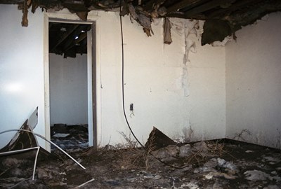
Arthur Valentine died in 1954 and his company was sold to the Radcliff family who continued on for just over a decade, ceasing operation in August 1968. While most of Valentine’s creations have certainly ended up on the scrap heap by now there are still some surviving Valentine Diners around the country. Six can be found along Route 66, although I don’t believe any are open. One from Winslow, AZ was taken to Oregon but I’m unsure of its present status. Albuquerque's has been turned into a police substation on Central Avenue. Magdalena's was moved from west-central NM, up to Edgewood and onto a sleepy stretch of old Route 66, an interesting turn of events. It may still be in the process of being restored.
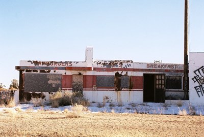
The Twin Arrows Trading Post and its Valentine Diner are not doing well behind a wall of concrete Jersey Barriers. Twin Arrows fate (i.e., prolonged decay) had long seemed assured as absolutely nothing happened at exit 219 for nearly fifteen years. But, in 2009, the arrows were spruced up by the Hopi tribe. Then, almost exactly one year ago, the Twin Arrows Navajo Casino Resort opened across I-40 to the north. The Navajo Nation owns the sprawling monster and its massive parking lot. In 2013, the casino built a huge digital billboard. The Hopi's arrows weren't doing the trick, it seems.
Is additional restoration in the cards then? I wouldn't bet on it. More might've been planned, but some kind of impasse apparently developed between Arizona and the Navajo Nation and the Twin Arrows Casino isn't off to a very profitable start now anyway. I've read that the Hopi Tribe have purchased more land on the south side of I-40 and the Navajo Nation are said to be considering doing the same. So, the site may eventually be bought and become...who knows? In the meantime, you can see for yourself how things have turned out at the old Twin Arrows Trading Post. Arthur Valentine wouldn’t be impressed.
Weird Arizona by Wesley Treat contains much of the basic background on Twin Arrows. If you want to dive into the history of Valentine Diners, the Kansas Historical Society provides a lot of info, as does Legends of America. The Flagstaff Business News mentions Valentine Diners in Arizona and Twin Arrows, specifically. Want more photos? Ghostownaz has some good ones.
Next time we’ll be back in New Mexico to visit Monticello, a picturesque little village not far from Truth or Consequences. Monticello isn’t a true ghost town, but I’ll do my best to make it look like one.
It’s seems like a long time since I last posted on City of Dust but I guess it hasn’t even been a month. I’ve covered some miles since then, so maybe that’s why it feels like I’ve been away awhile. Now we’ve reached our last stop on the Cochise County Ghost Town Trail: Gleeson, Arizona. When the post office opened in 1890, Gleeson was actually known by the somewhat flashier moniker, Turquoise. You can probably guess why it was called that. In fact, turquoise mining in the area goes back to the Native Americans, who collected the mineral from a mountain known later as…Turquoise Mountain. No less than Tiffany and Co. had bought up the turquoise mines by 1890. But it was copper, lead, and silver that brought most Europeans to the area beginning in the 1870’s.
The post office actually closed for a time in 1900 and when it reopened in 1904 the town had moved a few miles closer to water and was known as Gleeson, after miner and Irishman John Gleeson. Gleeson owned a very productive copper mine and had found the water. While the former attribute might've gotten a town named after you in southern Arizona, in this case it was the latter. By this time, Gleeson’s population was about 500.
At first, Gleeson’s main problem was that it kept catching on fire. It burned several times and, on June 7, 1912, the most devastating conflagration incinerated 28 buildings, virtually every structure on both sides of the main street, and was so fast-moving that witnesses believed it had been stoked with oil and matches. While $100,000 in damage had been done, the town was rebuilt and would soldier on for a couple more decades, becoming a bootlegging hot spot when both Arizona and New Mexico banned liquor in 1915 and getting ravaged by the influenza epidemic of 1918.
Later, during federal prohibition, the Musso family, owners of a major mine, were said to have hidden booze below the fish pond in their backyard. In 1980, Philip Varney reported something like a vault below what appeared to be a pond in the back of what remained of the adobe Musso House. I was, sadly, unable to find the place.
Finally, the post office left in 1939 and the last mine shut in 1953.
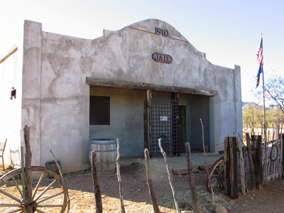
The most obvious feature left in Gleeson is the jail (above), built in 1910 and an exact duplicate of the one in nearby Courtland. But unlike in the total ghost town of Courtland, after years of neglect a couple residents of Gleeson restored their jail, perhaps because they long ago learned not to take it for granted. An early Gleeson jail had a wooden roof and a criminal quickly broke through and climbed to freedom. The town also had a “jail tree” and for a while wrongdoers were simply chained to it.
One day in January 1917, the Gleeson jail held four barrels of bootleg liquor at imminent risk of being “liberated” by an enterprising citizen who’d already tried to drill a hole through the floor of the railroad freight room where the barrels had been stored. This effort to drain the precious liquid failed when the drilling went wide and the hole in the floor was noticed. Then someone (the same person?) tried to break INTO the jail overnight to get the barrels out. Another failure. The whiskey was poured out in front of the jail the next day.
So, I guess it’s understandable that the Gleeson jail has become something like the town’s focal point. In fact, it now looks downright inviting and is apparently filled with artifacts.
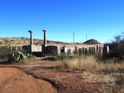
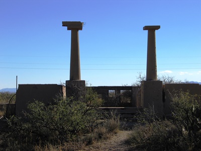
Adjacent to the jail is the old school (above and at top). Philip Varney presents a photo of the pillars flanking the front steps with a narrow, graceful arch connecting them. At some point, the arch clearly fell down but the pillars remain.
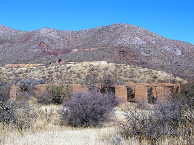
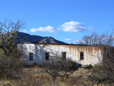
The adobe ruins of the hospital (above) are also identifiable, in the hills behind which were the mines. And while the building that housed the Silver Saloon is apparently standing, I couldn’t be certain of its location. Perhaps it’s the building just down the wonderfully named High Lonesome Road. It makes me happy to know that this road has gone by that name since Gleeson’s early days. I guess some things might not change after all.
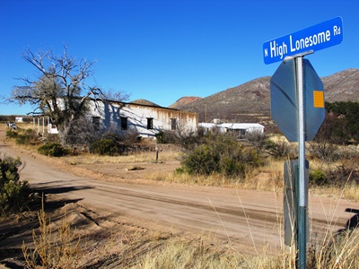
However, High Lonesome Road is also where Royal Richard Lockett, a 66-year-old butcher, was robbed and murdered in 1913 while on his way by wagon from Gleeson to Courtland to meet the El Paso and Southern. Strangled, stabbed, and then dragged behind his wagon at mid-day by two men near “Dead Mexican Canyon,” a name which would seem to indicate previous trouble in the area, Lockett’s assailants were never found. Tracks in the sand showed that Lockett’s dog had followed the killers for some distance, perhaps evidence that the men were known to both Lockett and his canine companion.
And, on that note, we'll leave Cochise County. The road west from Gleeson leads right into Tombstone, but The Town Too Tough to Die will have to wait. Next time we’ll travel way up north to I-40 and visit the neighbor of Two Guns, Twin Arrows.
For more information on the Ghost Town Trail of Cochise County, visit the official website. That’s where I got a lot of information about Gleeson for this post. Gleeson has its own web page with links to stories on bootlegging and influenza in Gleeson, as well as the sad story of Royal Richard Lockett. The Gleeson Jail also has its own page and is open the 1st Saturday of each month and by appointment. Unfortunately, I did not know that until recently. As usual, Philip Varney is worth having a look at, too.
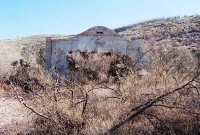
Traveling southwestward down the dusty Ghost Town Trail puts us in the town of Courtland, a ghost if ever there was one. You won’t find the odd holdout or hermit here. There is no one for miles around in this slice of the southeastern corner of the Dragoon Mountains; only the remains of a couple buildings, the most interesting and intact being the old jail, shown above.
Named after Courtland Young, part owner of the Great Western Mining Company, Courtland, Arizona was actually established by his brother, W.J., in 1909. The post office opened quickly, on March 13 of that year. The area was considered to be one of the most promising for copper in the state and soon other mining operators entered the fray, including the Calumet & Arizona, Copper Queen, and Leadville Companies. Within a couple months, 8,000 feet of underground shaft was in place.
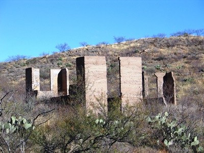
The population eventually reached 2,000 and there were the usual amenities, including saloons, hotels (the “Courtland” and “Great Western” being the most popular), restaurants, and stage stations. The newspaper, the Courtland Arizonan, started printing almost immediately. But there were some unusual things for the time in Courtland, including an automobile dealership, ice cream parlor, movie theater, baseball field, and horse track. Water was also rather unusual in this part of the world and, in 1911, five miles of water main were laid by the Courtland Water and Ice Company for those who didn't drink only whiskey. All this is gone now. Nearly.
For a while Courtland had no jail. Prisoners were held in an old mining tunnel until an unhappy inmate tried to burn the door down by lighting his mattress on fire. The prisoner survived, probably only to languish a bit more in the slammer, and also prompted the construction of a sturdier facility. It must’ve been sturdy indeed, because it is the only feature in Courtland that is not mostly rubble. It also has a twin, in nearby Gleeson. We’ll visit there next.
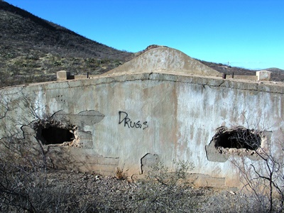
Courtland, like the surrounding area, felt the effects of Pancho Villa and his men as they raided north of the Mexican border until 1916, when General "Black Jack" Pershing pushed them back south for good.
Just before 1920, it became apparent that the copper ore was running out. Tests showed that a limestone bed lay at about 300 feet below the surface. By 1920, mining operations were actually beginning to lose money. The newspaper shut down, and the writing was then clearly on the wall. People fled Courtland en masse. The post office didn’t close until 1942 though. One wonders who was posting letters.
(The photo below shows a store which, when Philip Varney visited in the 1970's, still possessed a front on which faint lettering could be made out. Not anymore!)
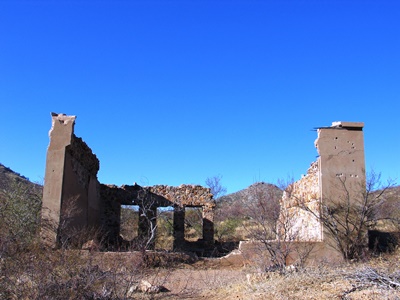
One person who didn't need the post office was Big Nose Kate’s former husband, George M. Cummings, an Irish blacksmith who spent some time in Courtland after Kate divorced him around 1900 for being an abusive drunk. He apparently didn’t think too highly of himself either and committed suicide with a shotgun in Courtland in 1915. “Head cancer” was reportedly one of the causes.
As with our previously featured town, Pearce, Arizona Ghost Town Trails provided the best background on Courtland. Of course, Philip Varney’s account was interesting, too.
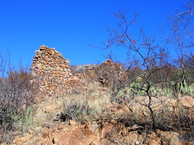
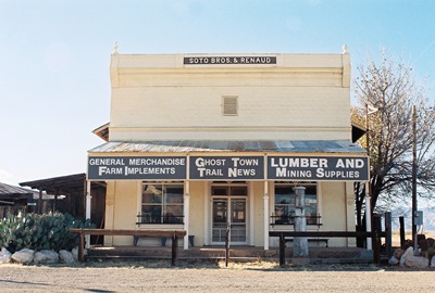
Pearce, Arizona marks the beginning of the Ghost Town Trail. Start heading southwest out of town down the gravel road that goes past Courtland and Gleeson and eventually drops you off in Tombstone and you will find yourself in some very desolate territory. No doubt you’ll encounter someone from Homeland Security, who will laugh at you for wanting to travel over something like thirty miles of rutted dirt with perhaps a few drug runners scattered about in the hills. But all that will come later, as Pearce itself is still occupied by a few folks and is a rather well-kempt little cluster of buildings. It must feel much as it would’ve in the late 1800’s.
Pearce is named for Cornishman James (Jimmie) Pearce, a rancher and hard rock miner from Tombstone who accidentally found gold AND silver while horseback riding in 1894. Jimmie immediately staked a claim, opening the Commonwealth Mine in Fittsburg, a mile east, said to be one of the richest mines ever worked in the state, producing over 15 million dollars in gold. Thus was born Pearce, the last of the Arizona gold rush towns.
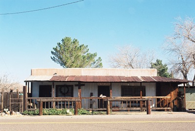
The Pearce family quickly lost their enthusiasm for mining though and before long had sold to John Brockman for $250,000 and a boarding house for Mrs. Pearce to run. The agreement was that Brockman had nine months to mine enough precious metal to cover the cost of purchase or everything, including what Brockman mined, would revert to the Pearce’s. In the end, Brockman covered his payment in six months with gold to spare. Apparently everyone was happy with the deal. Mining then peaked quickly, in 1896, around the time the post office (shown above) arrived and the population really boomed, many people moving their entire homes from Tombstone.
Brockman’s operation suffered a few annoying fires and he sold in 1902. But a couple years before Brockman’s sale, Burt Alvord had turned from Pearce lawman to train robber and the infamous Alvord-Stiles gang set-up in town. However, the gang was mostly dead or in jail by the time the railroad finally arrived in 1903. Before that, to deter theft from folks like Burt Alvord and Billy Stiles, gold coming out of the mine was made into bars too heavy to be transported by horseback alone and taken down the road to Cochise by wagon.
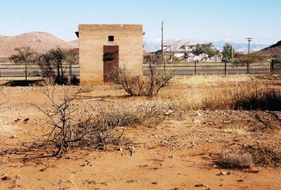
By 1919, 1,500 people lived in Pearce. There was a movie theater, hotels, saloons…the works. But, by the 1930’s, the Commonwealth Mine was played out, the Great Depression was in full swing and almost everyone packed up and left, including the railroad, which took its track with it.
There are a number of very cool old structures remaining in Pearce. Perhaps most striking is the old general store, shown at the top of this post, built by Soto Bros. & Renaud in 1896 out of adobe, wood, stucco and decorative tin. I’ve read that there are many interesting artifacts inside, but when I tried to have a look there was no one around. In fact, the building appears to be for sale,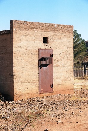 so who knows what the future holds? The post office, just across the street, is a private residence. To the north are two jails: The “old” jail, which has reached such a state that even the least devious among us could easily break out, and the “new” jail, shown here, which was built in 1915 and used until around the time the mine closed in the 1930’s. The “new” jail is constructed of 10” thick poured concrete walls reinforced with rebar and contains two cells. The doors are iron and the only ventilation is through tiny windows at the top. During a summer’s day in southern Arizona this would be a most unpleasant place to find one’s self.
The best and most concise resource on Pearce is probably Arizona Ghost Town Trails. There is some more history and photos of both jails at ghosttowns.com. You can learn a little more about Burt Alvord and his gang HERE. As usual, initial inspiration and direction came from Mr. Philip Varney.
So, of course, we’re going to head down the lonely Ghost Town Trail. Next we’ll have a look at Courtland, AZ.
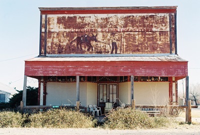
We’ve gotta make a quick stop in Cochise, Arizona. It’s in southeastern Arizona, just below I-10, and, while now quite small, it’s not really a ghost town. However, it has a couple great, old buildings and some real Wild West history. In its heyday, Cochise sat at the junction of the Southern Pacific and Arizona Eastern railroads, which serviced the many mining towns nearby.
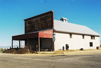
The Cochise Country Store, shown at top and below, was built in 1913 and open until probably fairly recently. It fronts what used to be the railroad stop and folks could step right off the train into the sweltering Arizona heat and get something to eat and drink. Now the trains just whistle right on by.
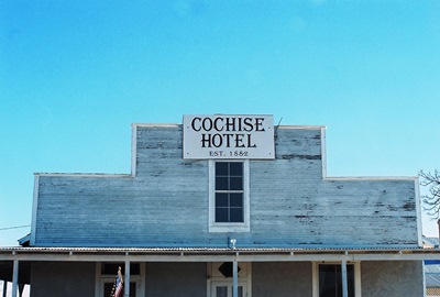
Directly across the street and similarly oriented is the Cochise Hotel, listed on the National Register of Historic Places in 1976. Opened in 1882, guests could still spend the night until July 2007. That’s 125 years of continuous service. The hotel was built by John Rath, a railroad telegrapher, who ran it with his wife, Lulu.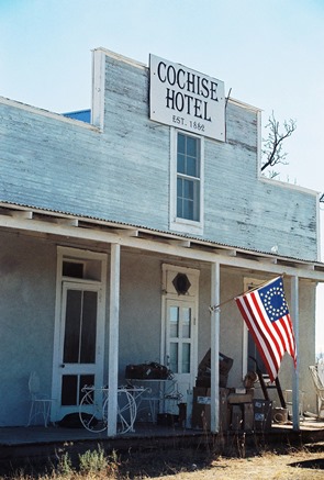 It also served as a telegraph office, naturally, as well as a Wells Fargo office and mail stop. In 1980, after mentioning the Green Cattle Company Safe in the old office, the harness house out back, and the sofa in the parlor rumored to have once belonged to the Swedish Nightingale, opera singer Jenny Lind, Philip Varney wrote in Arizona’s Best Ghost Towns, “Quite simply, the Cochise Hotel is one of the most interesting buildings in the West.” Of course, in typical fashion, I showed up years too late to see most it. It's clearly still well-cared for, but when I was there cardboard boxes were sitting on the porch waiting to be moved…somewhere. Whether any Wild West treasures were inside I can't say.
The Cochise Hotel is where Big Nose Kate came to work for a year or so around 1899 or 1900, years after her common-law husband, Doc Holliday, had died, and shortly after her wedded husband, George Cummings, had finally pushed his alcoholic abuse too far. He would later shoot himself in the nearby ghost town of Courtland (just wait, we’ll get there). Apparently guests at the Cochise were never privy to the identity of their (in)famous host.
By most accounts, Big Nose Kate was a prostitute in her early days, but she spent the last of her 90 years writing letters to her long-time friend, Arizona Governor George Hunt, giving him a piece of her mind about various goings-on at the Arizona state legislature. There may or may not be a lesson there but I believe you’ll be running some risks if you try to learn it firsthand.
Kate said that she watched the Gunfight at the O.K. Corral from Doc Holliday's room at Fly’s Boarding House. That has been disputed, but she may well have been in Tombstone, where she'd operated a bordello, on that fateful late-October afternoon in 1881. She claimed Doc Holliday sat at the foot of his bed afterward, weeping. “That was awful," he reportedly told her. "Just awful."
Next time it’ll be down the road south just apiece, to Pearce, AZ, and the start of the Ghost Town Trail.
Information for this post came largely from Philip Varney and the Wikipedia entry for the Cochise Hotel with Texas Escapes filling in the details on Mary Katherine Horony aka Big Nose Kate.
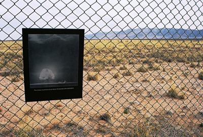
The war was almost over but we didn’t know it yet. I was still in bed. It was dark, but there was already a thin ribbon of yellow forming on the horizon, I knew. I could hear our cow lowing. I should’ve been in the barn fifteen minutes earlier, milk pinging against the dented metal bucket. My father was already out in the fields. Suddenly there was a flash and my room lit up like lightning had come right through the window. I felt the ground tremble beneath my bed. Then it all faded away and the world was still. What birds had started to sing went quiet. Even the air seemed to have frozen.
I got up and went to the kitchen. My mother was looking out the window to the south, toward Carthage, where we all knew the government was working on some new weapon to use against the Japanese now that Germany had surrendered. My father came in, already sweating a little. “There’s a big cloud in the sky,” he said. “Whatever they were doing—all those explosives—they must’ve accidentally blown them up. Good God almighty, it must be bad down there.”
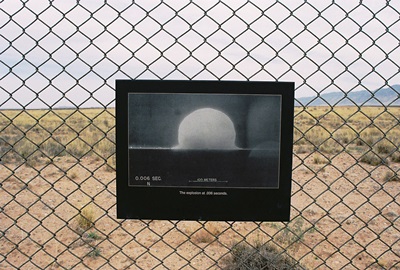
After that, we didn’t hear a thing from anyone. No Army men came to offer an explanation and our neighbors—those few that hadn’t been bought out by the government—didn’t know anything either. We speculated about the “accident” for a couple weeks. Then it suddenly became clear that what had happened that morning a few dozen miles south of our farm was no accident at all.
That was just before the monsoons came. I was 19 years old. Now I wonder if there was something about the bomb that made it rain like that. Out here we’re used to getting good, hard rains day after day in the late-summer. Every living thing in the desert needs the monsoon and welcomes it. Back then, those years when it didn’t come could be read in the clenched jaws and sunken eyes of the men at the Texaco Station looking for work or a ride out farther West. But that year the rain seemed angry, like it was throwing itself at the earth. Every afternoon the acequias would spill over and cars would slip off muddy roads and into flooded ditches. More than one person was swept away and drowned while crossing through the canyons and arroyos. Our fields lay under an inch of water and my father would sit at the kitchen table smoking cigarettes and listening to the radio, idled. Generations of experience had taught everyone to get their crops in before late-July, so at least our livelihood wasn’t wiped-out.
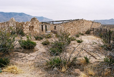
Then August was nearly over. People were euphoric now that the war was won and the men were coming home. The monsoon tapered off and the sky brightened. The air was crisper with fall approaching. Billy and Janie were my best friends. We’d all grown up together. First as kids in grade school, then teenagers, and now as young adults trying to grow into a strange new world. I guess it’s common to get crushes for the girls you grow up with, but I was probably 16 when I realized that I might really be in love with Janie. I was 17 when I figured out that Billy probably was, too. I’d lie in bed at night, sometimes for hours, rehearsing how I was going to tell her what I felt. I was certain she felt the same and believed that her every word and look contained some hidden message meant only for me. But there was Billy to consider. And I was young. And I was scared.
Eventually I started to notice that something was changing between Billy and Janie. She’d grab his arm and look at him in a way that was new to me. He’d hand her his cigarette and she’d inhale deeply, then giggle and give it back to him. He’d grin madly and then glance over at me and that grin would fall off his face. I started feeling a jealousy that went beyond what I’d known on the ball fields and playgrounds. Once I asked him if he was going steady with her and he looked at me strangely and said, “Naw, naw. We’re just good friends. Like you and her, too.” But I guess I knew. I stopped rehearsing my romantic soliloquies.
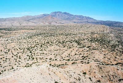
Now that the monsoons were lessening, we decided to spend the night up at the old cabin Janie’s father had built when she was a baby. It had been cut-off while the arroyos were flooded and we could use going up there to check on things as an excuse for getting away. It was nice in the forest, surrounded by pinyon and juniper, the hills rolling on every side, the air fresh and clean like you don't feel it anymore.
We went up in Billy’s 1938 Ford sedan. He’d bought it used from a neighbor with money he’d saved for years working on farms and doing odd jobs. He was proud of it, mainly because it wasn’t a pick-up truck, I think. More than any of us, Billy wanted to get out of the country and into the city. Not just Albuquerque, but Chicago, New York, Los Angeles. “That’s where things are really happening,” he’d say.
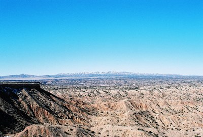
The only way to Janie’s cabin was by following the sandy arroyo beds, sometimes deep below their steeply cut banks. The arroyos were dry now and the Ford bumped along as we laughed and joked. Billy had brought some whiskey and I was surprised to see him pass it to Janie. But she took a swig and coughed, then laughed happily as she handed it back to me. It burned as it went down, but in the last year I’d grown to like that feeling. I passed it back to Billy as the warmth spread through my stomach.
When we neared the cabin we saw flashes on the horizon. A faint throb of thunder echoed through the canyons. We all looked at the sky and even over the taller hills we could see the thunderheads. “I hope no one has any plans for the evening,” Billy said. Janie giggled and I laughed, too. I liked the idea of spending a night in front of the fire with my friends as the rain beat against the cabin's tin roof.
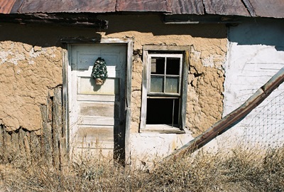
The cabin had weathered the monsoon just fine and we loaded in some food and extra blankets. It was starting to get colder now, especially in the early morning hours. There was still plenty of firewood stacked along the side of the cabin and as the first big droplets of rain began to fall we brought some of the wood inside and started a fire.
The rain grew steadily harder as the sun started to set. We ate some dinner and talked about what we hoped to achieve for ourselves during the fall. But, slowly, the conversation died as the rain kept coming. I looked out the front window and saw the arroyo starting to run. I suddenly felt unsettled. Janie was sitting close to Billy and while they weren’t talking now or even looking at each other, I became angry.
I opened the door and walked outside to stand under the awning and watch the rain. In a few minutes, Billy came out. “Janie wanted me to ask you what’s wrong,” he said. I looked at him and then looked back at the steadily filling arroyo. “I’m fine.” A bolt of lightning flashed and thunder rolled. “You aren’t afraid?” he laughed. I looked at him again but didn’t say anything. Billy glanced up at the darkening sky and then back at the arroyo. “I hope that’s down by tomorrow,” he said. “My dad will kill me if I’m not back in time to go with him to the lumber yard.” I lit a cigarette but didn’t say a word. Finally, Billy said, “She makes her own decisions, you know.” I held the smoke in my lungs and it started to burn. “I never told her how to feel.” Then he went inside and I exhaled quickly, feeling sick to my stomach.
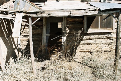
As it got dark the rain began to taper off but the arroyo ran deeper and faster with run-off from the hills. Things felt tense in the cabin and I was uncomfortable. I wondered what they’d said about me, if Janie knew I loved her, and, if so, how long had she known. Did they take it seriously? Did they laugh at me when I wasn’t around? I couldn’t say. But no one was laughing as we quietly watched the fire burn to embers.
“Janie, why don’t you go get some more wood for the fire?” Billy finally asked. Janie looked at him like he was crazy. “I’m not getting any wood. It’s cold and wet and muddy out there. You’re the men, you guys get it.” Billy hesitated a moment and then said, “Us men need a minute or two to talk something over.” I couldn’t put words to what I saw flash in Janie’s eyes, but she stood up, put on her jacket and walked out the door.
When the door closed, Billy ran a hand through his greased-back hair. “Listen, I think you should know what Janie…” Suddenly we heard Janie scream and we both jumped up and were out the door in an instant. We got to the side of the house in time to see the biggest diamondback rattlesnake I’d ever seen slither across the wet sand and away into the clumps of grama grass. It was almost dark now, but there was light from the cabin windows and open door. Janie was lying on the ground holding her wrist, crying and moaning. Billy and I bent down to look. He pulled Janie’s hand away and we could see the two punctures, the flesh already turning reddish-purple around the bite. “The snake was in the woodpile…” I said, but Billy was running inside to get the car keys.
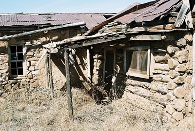
We helped Janie into the car. Already she couldn’t move her legs very well and her face had turned white. Her breathing was shallow. She’d stopped crying, but that didn’t seem to be a good thing. I could see that the arroyo was almost over its banks.
“Billy,” I said, “How are we getting out? The arroyo is flooded.” “I’ll have to drive along the bank. She won’t make it very long.” I nodded and began to get in the car but Billy stopped me. “You stay here,” he said. “We’ll get you tomorrow.” I felt as if the entire world was suddenly falling away. “You’re not leaving without me!” I yelled, making a step back toward the car. But before I knew it, Billy had drawn his fist back. I felt it connect, but that was all.
I came to on the ground and although it must’ve been cold and muddy and wet, I felt warm. I couldn’t seem to wake up, like when you’re in a comfortable bed on a cold winter’s day and your eyes just won’t stay open. I struggled and slowly the intense burn that ran from my jaw to my temple brought me around. I sat up and saw the red and white tail lights of the Ford bumping slowly along the bank of the arroyo, Billy trying to navigate around the larger trees and bushes. Suddenly the tail lights tilted and the sodden bank started to crumble. Then one red arrow was on top of the other and then they changed positions and disappeared as the car flipped and went under the water.
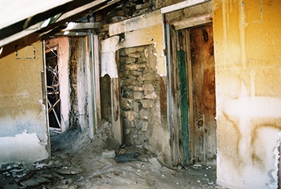
I got up and ran as fast as I could, slipping in the mud. It took only a couple minutes to get to the car. The wheels were still turning and steam was rising from the exhaust. Billy’s door was pinned up tight against the opposite bank. Nothing seemed to be moving inside. I jumped onto the underside of the car, just inches above the rushing torrent, and leaned over, trying to find the latch on Janie’s door. The water was frigid and the current strong. I couldn’t reach the handle so I lowered myself over the side. It was so cold it took my breath away. I could feel my heart beat in my throat and I struggled to keep from passing out. My feet touched the sandy bottom and, holding onto the undercarriage with one hand to keep from being swept away, I found the door handle and pulled with all my strength. It wouldn’t open. I pulled and pulled. Maybe the top of the door was stuck in the sand. Janie was probably unconscious by then. I didn’t know what had happened to Billy. There was no sound at all from inside the car. I kept pulling but soon I couldn’t feel my hands or feet.
I don’t know how long I was in the water, but when I hauled myself out I was crying. I began to shiver uncontrollably. At that point I knew that, surely, both Billy and Janie were drowned. I stumbled back to the cabin, knowing I’d go hypothermic if I didn’t get warm quickly. I had to get more wood from the woodpile. Then, shivering uncontrollably, my skin blue, I lit a fire and took off my clothes. I wrapped myself in a blanket and waited for the life to come back into me. I’m not sure it ever did.
When I was warm enough I started walking, still wrapped in the blanket, past the car, the wheels stopped and the engine cold now, following the churning muddy arroyo carrying twigs and debris toward the highway. It took almost two hours and when I got to the road it was still dark and there wasn’t much traffic. I waited on the shoulder as the sun broke over the horizon. Finally, a farm truck approached and I waved the man down. I have no idea what I said to him, but before long groups of men were running along the muddy bank of the arroyo, a beat-up tow truck following behind as others cleared a path.
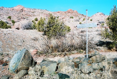
I was taken to the hospital and soon my family was there, saying, “Poor, sweet Janie.” “This was no one’s fault,” my father said in a thick, stern voice. My mother, crying while she looked down at me in the bed, her tears falling on my own face, said that Billy was very brave. No one ever asked me why I wasn’t in the car with them.
Things went about as you’d expect after that, although they never did haul Billy’s car out of the woods. After a few days men started to come and take what they could. Wheels, axles, the transmission. I didn’t blame them. I never moved away, although I guess I should have. This land is in my blood, for better or worse. I did get married. I had two kids, a boy and a girl. They’re grown and moved away with their own families now. My wife, Maggie, has been dead three years. It’s been mostly a good life, but I don’t know that I ever loved my wife as I should’ve. I don’t necessarily believe that Janie and I would be together today. Maybe Billy would’ve married her. I know he understood that if he let Janie die he wouldn’t have wanted to go on living. But I don’t understand why he didn’t see that I would feel the same way. In the end, I lost both of them and something else, too.
I guess that’s why I’m up in this arroyo again. No one could count the hours I’ve spent here. The old cabin fell into disrepair years ago. The roof caved in sometime in the ‘70’s. Billy’s mangled Ford is still nearby, too. It eventually slid back down the sandy embankment and with every monsoon season it gets shoved a bit farther downstream. Some seasons I lose it for a while, but I always find it eventually. I admit that I’ve occasionally had the notion that it leads me back to itself. Right now it’s on a sandbar, hidden behind a clump of juniper, rusted and beaten past recognition. I know I shouldn’t be here, but there are things that happen in your life and sometimes you can’t really get beyond them. Not ever.
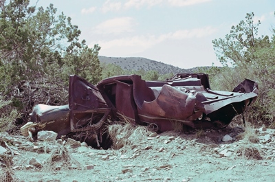
For once I don't owe Phil Varney a thing. All information for this post came from me and the wilds of the great state of New Mexico.


