Monday, April 27, 2015

Postscript-Maize and the Mexican Mafia: The Graffiti of Fierro, NM


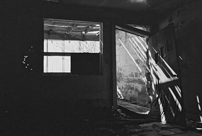
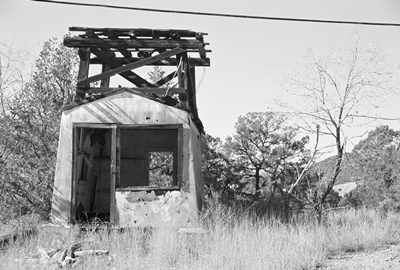
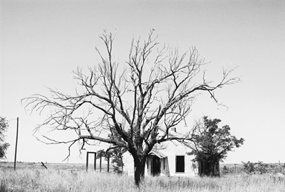
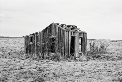
Yesterday’s post on the ghost town of Fierro, NM was heavily historical. In the introduction, I painted a portrait of Fierro as entirely vacant, quiet as a stone, a place where humans rarely tread these days. While that is relatively true, it’s not the entire picture, even aside from services at St. Anthony’s Mission Catholic Church and the occasional family reunion. Fierro does get visited and, judging by the evidence, its visitors are an interesting bunch. So, I thought it would be worth taking a look at who’s been there recently and what they’ve left behind. There might even be something here that'd be useful to know if you’re thinking of making the trip yourself.
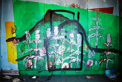


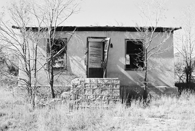
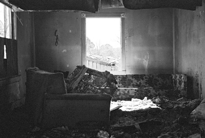
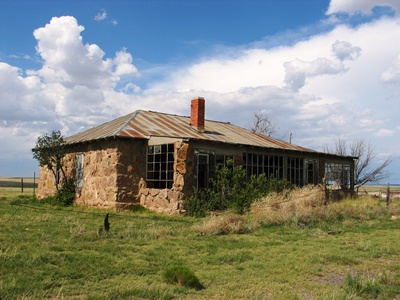
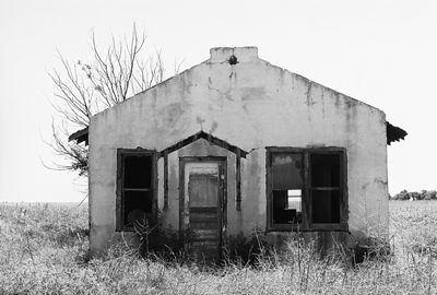
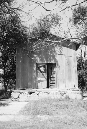
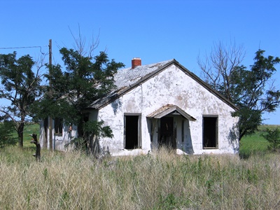
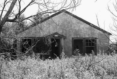
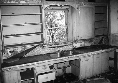
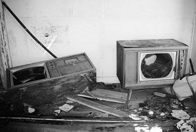
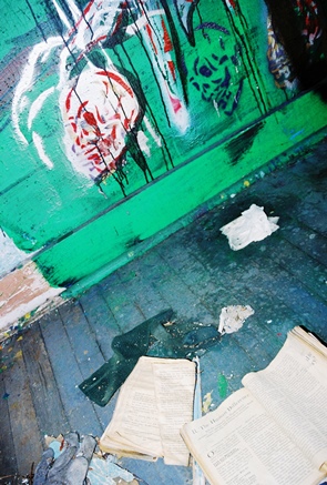
Most of the graffiti in Fierro is in the house shown at bottom, which was last owned by the Araujo family, who also operated Araujo’s Grocery in the building next door. The Araujo’s rented the home out, but one person that probably didn’t sign a lease was whoever painted the green wall of skulls and maize set against the backdrop of a mountain shown above. The artist clearly spent some time in Fierro and, in fact, the room was swept clean and full of the evidence of a fairly prolonged stay. That evidence included some unusual reading material, such as a book about the influence of computers on society which lay open to a chapter titled, “The Human Difference.”
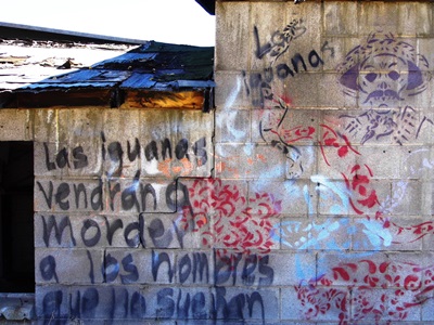


Judging by the stencils, it’s possible the same person wrote this stanza on the back of Araujo’s Grocery itself: Las igyanas (sic) vendrán a morder a los hombres que no sueñan. This is a slight rearranging of a line from Federico Garcia Lorca’s poem, Ciudad sin sueño (Nocturno del Brooklyn Bridge), written in 1929-1930. The translation is: “Iguanas will come to bite the men who do not dream.” Lorca’s work is often pretty surrealistic, but, to me, he is inciting his reader NOT to sleep, but to do, in which case being bitten by iguanas is, in fact, a worthy and motivating experience.

Lorca was executed by a firing squad loyal to Spanish fascist dictator Francisco Franco in 1936, and appears in The Clash tune Spanish Bombs. (“Federico Lorca is dead and gone.”) The Pogues composed an entire song to him, "Lorca’s Novena," in which his corpse walks away. Seeing Lorca’s words as graffiti in a ghost town is quite rare.
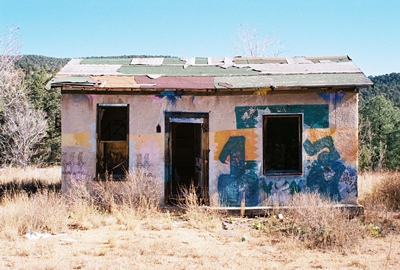


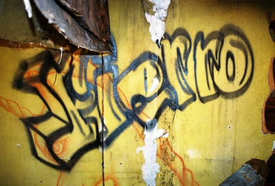
Other visitors to Fierro would seem to include members of Sur 13, the Sureños, a prison gang allied with the Mexican Mafia, MS-13, and the Crips. Their tag is visible in the shot above, as well as elsewhere inside the house.
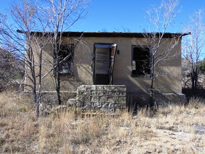


So, while for many ghost towns it is their history that compels, it’s also true that these places have a present and a population of sorts, even if transient. As always, it is only the future which remains uncertain.

Sunday, April 26, 2015

Iron Town: Fierro, New Mexico


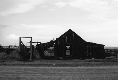
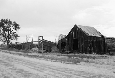
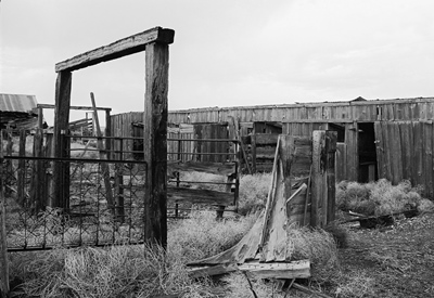
I might as well stop saying that I’m going to post more often because the more I say it the less I actually post. Maybe I’ll just say that I would like to post more often and leave it at that. Could this be seen as a quality over quantity issue instead? Well, whatever the case, after a couple quiet months let’s finally pay a visit to Fierro, New Mexico, in the southwestern part of the state, a few miles due east of Pinos Altos. For a true ghost town, it’s still got a good number of buildings which, while certainly falling, aren’t completely down and out yet, and it has plenty of lonely charm. All you’re likely to hear while exploring is the occasional sound of wood scraping tin when the breeze picks up and maybe the caw of a crow or two flying overhead.

Fierro is an archaic form of hierro, the Spanish word for “iron,” and iron is the reason the town was born in the first place. The mining history goes back to 1841, when Sofio Henkle (or Hinkle), a German immigrant living in Mexico, went looking for copper deposits. He found both copper and iron on a mountain a few miles north of the big copper mine in Santa Rita and named the mountain and its new mine Hanover, after his former home. The town just a couple miles south of Fierro would also be called Hanover (we’ll go there next time).


Henkle, however, was soon driven out by Apaches and lucky to escape with his life; he’d been warned of an imminent attack by a friendly Apache woman. Henkle returned years later after New Mexico became a U.S. Territory, believing that he’d be alright now that the army was guarding mines. But then the Civil War required most Federal soldiers to head east and Apaches and Confederates started raiding. So Henkle gave up for good and lived the rest of his life in the Mesilla Valley to the south.

As the 19th century wound down, with the threat of Apache raids gone, and the railroad already having arrived at Silver City—about 15 miles southwest—by the early 1880’s, Colorado Fuel and Iron (CF&I) took an interest in the iron ore deposits of Fierro. A post office was established in 1899, about when the railroad reached Fierro itself, and as much as ten carloads of ore started getting shipped out each day to Pueblo, Colorado, where CF&I were based.


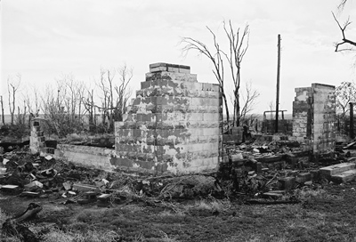
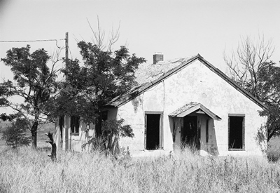
(Above is a home I believe was originally owned by the Bacon family and then the Drakes. Its last owners were the Araujo family, who rented it out.)

The population of Fierro was 750 in 1920 and probably never much over 1,000, even during the peak years between WWI and the start of the Great Depression, by which point six million tons of iron had come from Fierro’s mines. Seventy-eight percent of Fierro’s population was of Mexican descent in 1920, and that percentage increased, reaching the high nineties once the mines closed.

The mines shut down in 1931, although the large Continental Mine ran intermittently and, tragically, in 1947 four miners were killed near it in a “short fuse” accident. While the Cobre Mining Company resumed operations, now with an emphasis on copper, and some residents stayed at least into the 1990’s, Fierro never recovered from the economic blows of the early 1930’s, when people began to leave quickly, many for gold mines in California.


The Gilchrist and Dawson Store, Mrs. Rel’s Rooming House, Filiberto’s Variety Store, McCoy’s Store and post office, John Oglesby’s silent movie house, Sheriff Mac Minter’s pool room; these places were frequented by the miners and their families. Now they’re all gone. Some of them burned in a fire in 1923 when a miner from Mogollon went to sleep at Mrs. Rel’s following a fandango next door and kicked over a kerosene lamp in his room. Without a fire department, and with some buildings even having sidewalks made of wood, much of Fierro’s early commercial district burned fast.

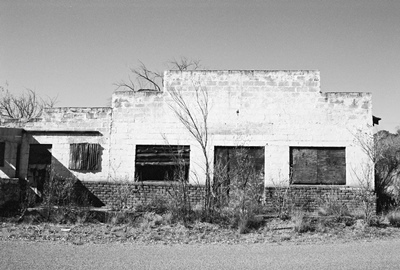
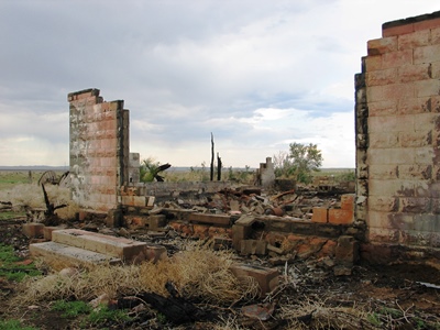
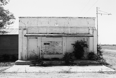
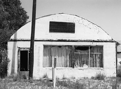
(Below is the Phoenix Mercantile (aka La Tienda del Finicas), which even sold fine furniture. Later it became Araujo’s Grocery and housed the post office. Sitting on the steps waiting for the mail was a common pastime in Fierro.)


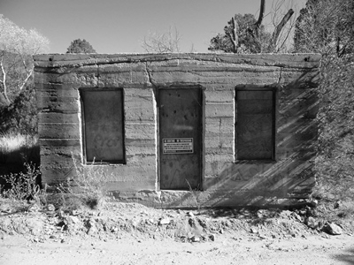
Another building of interest is the little jail by the railroad tracks, near the arroyo that runs through the town (pictured below). In Black Range Tales, James McKenna recalled visiting Fierro in the 1880’s and noted that mining towns punished wrongdoers by tying them to a thick log which had been sunk in the earth with eight feet remaining above ground. Normally prisoners would be released once they’d sobered up and/or calmed down. That could easily take all night. Fierro reportedly did away with its log in the early years, even though the sturdy concrete jail probably never held any true desperadoes.


Fierro was known for its love of baseball, with three different fields being used during the town’s history. In the late 1930’s, the team went by the seemingly unusual name “Peru Miners.” Basketball was also popular, with games being played on the school’s dirt court until it was paved in the 1930’s. Fierro even had a Boy Scout troop as late as the 1940’s.

One interesting tradition in Fierro was El dia de las Travesuras, The Day of Pranks, which was a replacement for Halloween. On that night there was no trick-or-treating in Fierro. Instead, kids played pranks, the most common of which was to tip over outhouses. One man spent a night in his outhouse with a shotgun to prevent any hi-jinks, only to have his bathroom toppled anyway when he went back to his house at 2AM for a quick cup of coffee. This never happened to the managers of CF&I as they had indoor plumbing and even electricity. Later, it’s said that a popular prank was swapping around railroad and highway signs, which might cause problems regardless of income bracket.


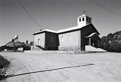
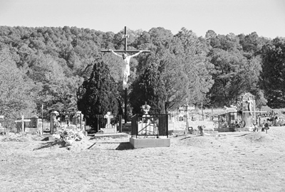
While Fierro is a ghost town now, two places that are very much alive are St. Anthony’s Mission Catholic Church (above), built in 1916 and later enlarged, and, ironically enough, the cemetery, which covers four acres and is lovingly maintained these days. Aside from regular services, a celebration and mass is still held each year on June 13th, the Feast of St. Anthony, and many of those for whom Fierro remains important meet to reminisce and once again walk the quiet streets of the old place.

AUGUST 2017 UPDATE: A Facebook page has been started to document the history of Fierro and the lives of its residents, both through photos and stories. If you're interested in Fierro I highly recommend giving it a look and a "like." The page can be found HERE. As if that wasn't enough, a wonderful photo video showing much of Fierro as it looks today can be found HERE on You Tube. A second video, focused on the shrine behind St. Anthony's Church, is HERE.

Some information for this post came from "New Mexico’s Best Ghost Towns," “Ghost Towns Alive,” and "The Place Names of New Mexico," but the best place to learn about Fierro is “Remembering Fierro (Again) (Revised Edition)" by Frank Ramirez, now available only at the Silver City Museum. It’s not very often that an out-of-the-way ghost town has an entire book dedicated to it, but I’m certainly pleased on the rare occasions when it happens. Mr. Ramirez passed away in 2011 and this post is dedicated to him.


Next time we’ll go back just a couple miles south and check out Hanover, NM. (Well, after this little POSTSCRIPT on the graffiti of Fierro.)

Tuesday, February 24, 2015

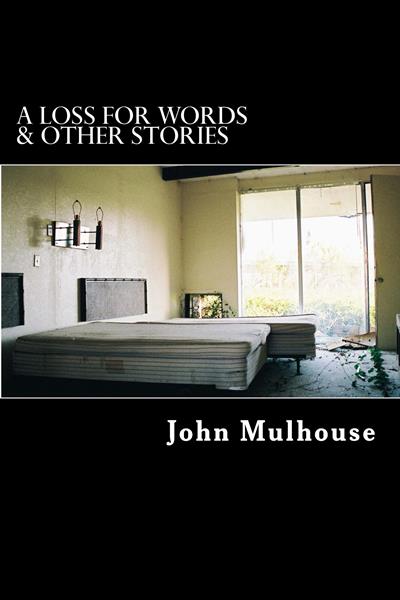
A Loss for Words & Other Stories: Excerpts from 10 Years of City of Dust

I decided to start 2015 off here at City of Dust by collecting all of the NON-HISTORICAL posts from the last 10 years and putting them in a book. While I hoped to actually START 2015 this way, I found it's a bit challenging to compile a book. So, now I'm ALMOST starting 2015 with this anthology.


A Loss For Words & Other Stories: Excerpts from 10 Years of City of Dust, collects all the fiction, random stories, and vignettes that I've published here since 2004 (although the first of these didn't appear until 2005) and puts them in one place, rescuing them from obscurity, if you will. Here's the jacket description:

"A well-known novelist in free-fall returns to his former life only to play a role in its final, heart-rending destruction. What he does next throws his own survival into question, and may decide the fates of near-strangers that he has quickly grown to care about. A disturbing episode in a crowded Waffle House pushes a faltering relationship past its breaking point. An elderly man pays yet another visit to the site of a tragedy that has colored his entire life. A Loss for Words & Other Stories collects 10 years' worth of such tales, often depicting the human side of decay and abandonment. A journal of the author's frequently harrowing experiences while performing vegetation surveys throughout the remote Cumberland Plateau region of eastern Tennessee is also included.

"In 2004, John Mulhouse started the City of Dust blog, dedicated to photo-documentation of the numerous derelict historic buildings and abandoned places along the Georgia-South Carolina border. Over time, occasional fictional (and not-so-fictional) pieces began to make their way onto City of Dust. The majority of these are contained in this anthology."

Copies of the book can be obtained for $15.00 + shipping through AMAZON. You can also get it for KINDLE. I do have copies to distribute myself, as well, and if you'd like a signature and/or inscription I'd be happy to do that. I can also sell a bit cheaper than other sources. Books directly from me are $15.00 with shipping included. If you're interested in going that route, just drop me a line at: jmhouse(at)cityofdust(dot)com.

Thanks everyone for your continued interest over the years. Here's to another ten!

Sunday, January 25, 2015

A Tale of Three Lucy's: Lucy, NM


Let’s start 2015 by getting back on Highway 60 and driving just a little bit west of Negra to the ghost town of Lucy, New Mexico. Like Negra, Lucy is on the south side of the highway, tucked back beyond the railroad tracks, so you could drive past day-after-day and never even know it’s there.

There are three versions of how Lucy got its name and no one knows which is correct, although they all involve the railroad. The first is that Lucy was named for the wife of James Dunn, chief engineer of the Atchison, Topeka & Santa Fe (AT&SF). The second is that it was named after the mother of an attorney for the AT&SF. The third is that the town’s namesake is Lucy Myers, daughter of railroad construction engineer Frank Myers. Maybe they're all true. Oddly enough, despite these three stories, Lucy’s original name was the Spanish Lucia and the town only became Lucy in 1914, nine years after it had been established by homesteaders. Makes a person wonder who Lucia was, doesn’t it?


By 1916, Lucy had a post office (est. in Lucia in 1908), two general stores, a one-room schoolhouse, a 16’ x 40’ Santa Fe depot, and almost ten homes. A four-room hotel was built in the fall of 1917. Lucy actually had three schoolhouses over the course of its life, the first being used only until 1910. A second school operated into 1920 and had an average attendance of 18 pupils, all the children within a radius of nine miles. Or, at least, the children that wanted to go to school. The last school was fairly large and used from 1920 into the 1940’s. These schools were the center of community in the town.

Church was also held in the schools and often the congregations of Lucy--Methodist and Baptist--had to lead their own services, ministers not making it to town every Sunday. It’s said there was a lot of singing in town and much of the population would head down to the depot to see the passenger train come through from the east once each day. Flour sacks often provided material for clothing Lucy’s citizens.


But by the 1920’s and 1930’s, it started to get more difficult to make a living in Lucy. Families began leaving and during the Dust Bowl it became nearly impossible for farmers to tough it out. Often a homestead would be abandoned in the middle of the night, the residents unable to pay their debts. This was quite a blow to store owners, who had extended credit in many cases and now had to try to absorb the losses. Other homesteaders sold to ranchers.

By 1940, there were no longer enough students to justify keeping the Lucy school open and soon the few children in the area began to be bussed to nearby Willard. The post office closed in 1942. The rail depot was moved to Estancia and later ended up on a local ranch. The last event of real note in Lucy was a train wreck on April 14, 1979, in which 42 cars derailed, spilling Lincoln Continentals and Ford Broncos all over the tracks.


I got to Lucy in the summer of 2014, just in time to realize that I was a bit late. The beautiful skeletal concrete remains of the 1919-1940’s school had been taken down by a new property owner. Also, the A.D. Formwalt home, at the north end of town, had recently burned. I don’t know what caused the blaze, but there was very little left of what looked like a once-wonderful old farmstead.

One of the worst things that can happen to a ghost town hunter is to find they’ve missed the opportunity to visit some historic structures. Most houses in town were built on a foundation of rock or even bare ground and not a trace of them remains. Luckily, the large, wooden Lucy Ranch was still standing and very photogenic. Also, the Lucy Cemetery has recently undergone an extensive and loving restoration, so there is activity yet in this little ghost town, one of the many forgotten places along Highway 60.


There’s not much information out there on Lucy, but what exists can be found in the rather spendy “Torrance County History” and Dixie Boyle’s excellent and much-less-expensive (UPDATE: Not anymore!) “Highway 60 & the Belen Cutoff.”

Next time I believe we’ll go way down to the southwestern part of the state and visit Fierro, a mining ghost town in Sierra County. See ya then!

Wednesday, December 10, 2014

Paying a Visit to the Williams: Negra, NM


It’s time to head south out of House, New Mexico, drop down off the Llano Estacado, and into the town of Taiban, home of one of the most photogenic churches I’ve ever encountered. From there, we travel Highway 60 west for quite a stretch, past Fort Sumner, Yeso, Vaughn, and Encino. But then, five miles past Encino, we find Negra. So, at the gravel road, let’s turn south and have a look.

Negra, in Torrance County, was established, as were a number of other towns along Highway 60, when the Atchison, Topeka, and Santa Fe Railroad (AT&SF) constructed the Belen Cut-off. This enabled trains to pass through the flat plains and avoid climbing into the northern mountains through Raton Pass. The cut-off came through about 1905 or 1906 and Negra’s post office was established in 1909. However, the post office didn’t last long. It shut down in 1918 with mail to those few still in Negra even then going to Encino


There are a couple stories about how Negra (“black” in Spanish) got its name, including one about a black dog hanging around the early townsite. Robert Julyan suggests the town got its name because of the black soil in the area and mentions the presence of a black water tank. The tank is notable because Negra must’ve had good water and plenty of it. For instance, Encino once got their water from Negra. I was told that a man named Tenorio used a small tanker truck to haul water to town and sell it to the residents. Of course, the steam-powered locomotives would’ve stopped in Negra to get water, as well. After the conversion to diesel engines, Vaughn bought four wells near the tracks from the railroad and, at some point, even Duran, 20 miles away, got water from Negra.

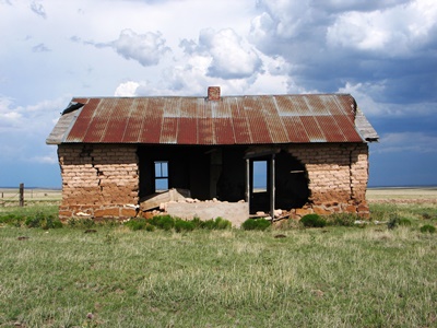
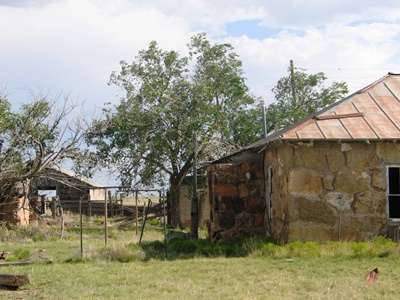
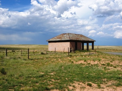
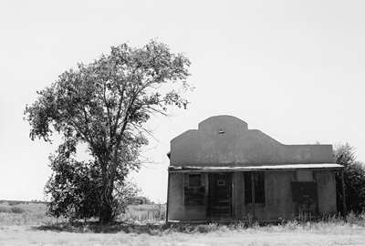
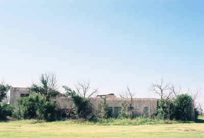
Beyond the above, there’s not much information available on this little town. Nearest the highway is a vacant but nicely intact filling station that might be from as early as the 1920’s. It’s pictured below. (Note “U.S. POST OFFICE” written near the roof. Perhaps this was salvage material.) Behind it is an old tourist court. Both were built by C.E. Davenport, Negra’s first postmaster. A working ranch--the Davenport Ranch--is adjacent to the south. Even farther to the south, across the still-active railroad tracks, there’s a cemetery. To the west, where most of the community once was, only a couple buildings remain. Two, which are not much more than piles of sticks now, were an old school and a teacher’s residence. An adobe structure with a big hole in the middle (shown above) might’ve been a more recent school.


But the gem of Negra is the wonderful rock house, built on the site of an old grocery store, and its attendant barn and outbuildings. Despite the paucity of historical documentation, in a happy twist of fate it’s known who once called this lovely place home. In my post on Encino, I mentioned that there were once four beautiful murals on the walls of the high school gymnasium, which had sadly been torn down. Those murals were done in the very early 1940’s by Hallie Williams, and it is she and her husband Albert (nickname "Ollie") who lived here. Hallie also painted at least one other mural and I’ve been told it still exists, in a store built by Mr. Williams in the 1950’s, also in Encino.


Mr. Williams ran a filling station in Negra—likely the vintage one just mentioned. He also operated a mercantile that fronted the railroad tracks in Encino. This store contained a reportedly very smelly stuffed buffalo head on a wall. Later, in the mid-1940’s, Mr. Williams built a smaller store on the north side of Highway 60. His third store in Encino, then, would be the one containing the mural.

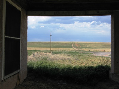
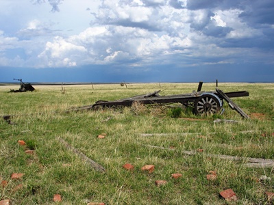
Now, there are some abandoned places that legitimately feel creepy and leaving them brings with it an undeniable sense of relief. Then there are other locations, like the Williams’ homestead, that are peaceful, if not downright soothing. With the sun and clouds playing across the flat land of the eastern plains and a cool breeze rustling the grass, I could’ve stayed there—and, indeed, in all of what remains of Negra—for many more hours than I did. I hope to return soon. I feel like there’s more to be learned out there.


About the only published documentation of Negra that I’ve come across is Dixie Boyle’s "A History of Highway 60 and the Railroad Towns on the Belen, New Mexico Cutoff” It’s a fantastic source for all kinds of info on the towns along the highway. Of course, Robert Julyan’s “The Place Names of New Mexico” handled the naming story, per usual. I even got a few facts, particularly about water, from comments left on the City of Dust Facebook page. Finally, Henry R. sent me a fascinating message about Encino and Negra, as well as background on Mr. Williams, his various stores, and his buffalo. As Henry R. was there back then, his is a fantastic first-person account. His full letter can be read as an update on my post on Encino, which I first published in 2013. Photos of Hallie Williams' now-destroyed murals can be found there, too.


Alright, we won’t have far to go to get to Lucy, the next stop on our never-ending journey.


DECEMBER 2014 UPDATE: As she did by contributing her photos of Hallie William's murals to my post on Encino--the only known shots of those murals, I might add--Dixie Boyle has significantly increased the worth of this post by sending in two great old photos and providing a bit more information on Negra, and the Williams family, in particular:

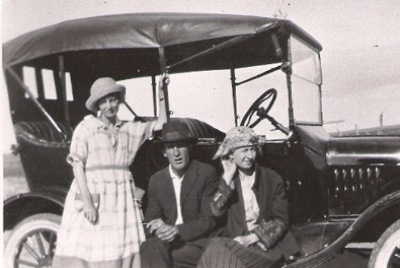
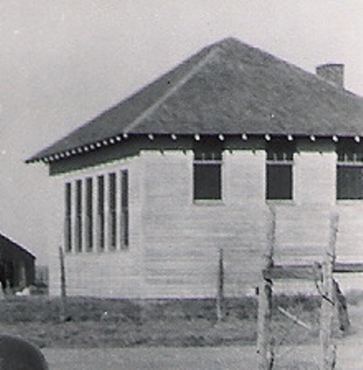
"Hallie and her sister, Carrie Walker, taught at the Negra School (pictured below) when it was first built, and then in later years Hallie taught music and art classes at her house, which was across the road from the school. The kids would walk across the street to her home for classes. The pile of wood in the middle of the others was the Negra School. During this time the kids made up a wonderful puppet show that Hallie and her students took to other schools. Her daughter, Carrie, still had the puppets when I interviewed her.

"Carrie and Hallie actually moved from Texas to Negra to homestead land together. They built a shack to the south of the school somewhere. Ollie also moved to Negra to homestead. Hallie had a degree from Baylor University and had taught in Texas a few years before arriving in Negra. You can find Hallie and Ollie in the Encino Cemetery.

"In front of the car (above) it's Carrie, Ollie, and Hallie. I just love this picture of them."

Many thanks to Dixie Boyle for yet again providing photos and information that are nearly impossible to find elsewhere. The best place to get this stuff is directly from Dixie's books, in this case, particularly "A History of Highway 60 and the Railroad Towns on the Belen, New Mexico Cutoff", which would almost surely be of interest to anyone reading this post.

Thursday, November 06, 2014

On the Edge of the Staked Plain: House, NM


The more I learn about the Llano Estacado, or Staked Plain, the massive tableland that covers over 37,000 square miles of west Texas and eastern New Mexico, the more fascinating and evocative I find it. We’ve visited Causey and Pep, both on the western edge of the Llano Estacado, so let’s visit one more Llano town. This one is right beside the Mescalero Escarpment, a long cliff averaging about 200’ high which forms the border on the New Mexico side of the tableland. The Mescalero Escarpment could be (and probably was!) seen as an excellent defense against enemies below. House sits perhaps 15 miles northeast of where this escarpment descends from Taiban Mesa into the wonderful semi-ghost town of Taiban, NM.

Near House is another simply-named town called Field and while the origin of Field’s name is officially obscure, it would seem kind of obvious to anyone passing through. Likewise, you might think that perhaps House was named for a…house. But, in fact, it was named for John L. House and his family, who settled on the current townsite in 1902. John built the first store in 1904 and within two more years House had a post office, with Lucie Jordan House as the first postmistress. I've heard that settlers often arrived by train from Tucumcari and made the surely difficult journey up the escarpment to House on foot where an agent would assign them land to homestead.


(The building above was once a hardware store.)

Below the soil of much of the Llano Estacado is caliche, a hard mineral here known as caprock. In fact, the entire top of the plateau is often referred to as "The Caprock", or even just "The Cap". To make things more confusing, the towering escarpment on the Texas side is the Caprock Escarpment. Anyway, this Caprock Caliche can keep soil depth relatively shallow and, without any features to block wind, the Llano was one of the two regions most devastated by the Dust Bowl, particularly in Texas. Southeastern Colorado-Southwestern Kansas was the other hard-hit region. I wonder how House fared.

There are no descendants of the House family in the area any longer, but the town that bears their name persists. In fact, House is not a ghost town by any stretch. While the population as of the 2000 census was 72, House feels somewhat larger. There are many well-kept homes and gardens and it comes across an active place. So, I apologize to the residents of House for making their home look a little like a true ghost town. I guess it’s just what I do.


(Above is the Sunshine Grocery. Inside were copies of U.S. News & World Report from the early '60's. A quick glance at an issue showed that while the world is very different it's also just about the same.)

While not a ghost town, House has changed considerably over the decades. Its history is difficult to uncover, but someone whose family settled near House in 1906, who began attending House Public School in 1948, told me that the town once had 4 service stations, 3 churches, 3 grocery stores, 3 mechanic shops, 2 hardware stores, 2 feed stores, 1 appliance store, 1 barber shop, 1 blacksmith shop, 1 cafe, 1 school, 1 pool hall, 1 movie theater, a post office, and a potato grading shed. Now, beyond the post office and school, virtually none of it remains.

In 1948, 325 kids attended 1st-12th grade in House and almost every 1/4 section was occupied by a family. But just a handful of years later there were 125 students in the entire school. Much of this decline occurred in the 1950's, when New Mexico suffered a terrible drought and people left the farms around House en masse.

Now, that's about all I could learn about House itself. However, I would be remiss in not mentioning Glen Franklin, born March 18, 1936 in House. Mr. Franklin was world tie-down roping champion in 1965, 1967, and 1968 and was inducted into the ProRodeo Hall of Fame in 1979. It’s said that Mr. Franklin carried a rope while still in diapers and was soon looping every dog, chicken, or human that crossed his path. He rode a horse called Red Light that received its share of credit for Mr. Franklin’s achievements. However, Mr. Franklin didn’t want to travel constantly and retired from rodeoing to ranch near House, which he is still doing to this day.


If I got any geology wrong, I apologize. Please correct me! I used Wikipedia and LlanoEstacado.org as my two primary sources on the Llano and its escarpments. Since there’s not much out there on House, Robert Julyan’s The Place Names of New Mexico tells you more than any other published source just by describing how the town got its name. There’s about as much info on Mr. Glen Franklin at the ProRodeo Hall of Fame site as there is on any other aspect of House! Without the help of Robert W., who has deep roots in House, this post would be much poorer. Michael K. contributed the bit about folks hiking up the escarpment after getting off the train. I thank them both very much!

Next time I believe we’ll head back west down my ol’ friend Highway 60 and visit Negra, New Mexico.

Sunday, October 12, 2014

A Lively and Energetic Place: Pep, New Mexico


The first thing that strikes one about Pep, at least before visiting, is its name. It might seem a little unusual, except that there’s another town called Pep 60 miles dead east in Texas. In fact, it’s been said that Pep, New Mexico got its name directly from Pep, Texas. It’s also been said that Pep was named for a fortified breakfast cereal popular during the Depression. Neither of those stories is true though and, really, Pep was probably named for the reason you’d guess at first glance.

The place that would become Pep was settled in the fall of 1925 by Edward Cox, who established the first residence and store. T.M. Pearce, who wrote New Mexico Place Names, concluded that Pep got its name because Cox expected it to be a “lively and energetic place.” Apparently Pep was a word used often during the Depression to instill enthusiasm. That’s how Texas got its Pep, too.


I’ve been told that there was a big party to get the town going, including a baseball game and rodeo. The post office opened in 1936--possibly beating Pep, TX to the name--and remains in operation to this day, despite the fact that there are only a handful of residents left. The post office also serves the ranches and farms of the surrounding area, of course, but is now only open in the morning and mail is not delivered every day.

Pep is in Roosevelt County, on the western edge of the legendary rangeland known as the Llano Estacado, or “Staked Plain.” I described the 30,000 sq. mi. Llano Estacado a bit in the last post when we explored nearby Causey. There’s a lot of folklore surrounding why this formidable mesa is known as the Staked Plain. The term is perhaps better translated as “Palisaded Plain,” the “palisaded” likely referring to the high, rocky escarpments that border the tableland, particularly to the east, where one, the Caprock Escarpment, reaches 300 feet tall. A common but probably less accurate explanation is that the “stakes” are really the dried shoots of yuccas, which can rise a few feet above ground and thus appear as scattered stakes as you look out over the landscape. My favorite is that early settlers “staked” their trails with buffalo bones and skulls so that they could follow them back out if they got lost, like macabre bread crumbs. Recently the Hillsboro Historical Society told me that Robert Julyan believes “estacado” may be incorrect and that the original Spanish word could’ve been “estancada” or, “ponded.” Indeed, after a rainfall water collects in the small depressions across the plains and thus “Ponded Plain” might be fitting. Which is right? I’d do like everyone else does and just go with whatever you like best!

As for personages, science fiction author Jack Williamson was from Pep. Known as the “Dean of Science Fiction,” he published in every decade from the 1920’s to the 2000’s. He also built a little wooden cabin near his parent’s house so that he could write undistracted. I don’t know exactly where it is and I’ve heard it’s decaying…but still standing! I’d sure like to get a photo of it.

So why did Pep not live up to its name? Initially Cox, who owned all the land in town, may have tried to sell it at too high a price during a bad economic time for the country. Maybe it was the name in the first place; Pep, Texas has wound up in a similar state. But the record on Pep is spare, to say the least.


While it’s difficult to uncover the history of the little town, let alone the stories of the people that lived there, that does not make Pep unimportant. In fact, I would argue, quite the opposite. A couple months ago I posted a photo from Pep on the City of Dust Facebook page. After it had been shared around a bit, I found a comment which says more in a few words than I probably have in this whole piece. I don’t know the commenter, but I’d be happy if they somehow stumbled across this post so that I could give them my thanks for such a beautiful sentiment. Hopefully they wouldn’t mind that I’ve used their quote to end this latest installment!

“This post may be the only place in the entire world where the old community of Pep is being discussed. Pause for a moment, if you will, to honor those who gave their all here -- gambling on a new life -- in the Great American Desert.” G. L.

Information for this post came from almost nowhere. Robert Julyan provided the lion’s share in a single paragraph in The Place Names of New Mexico. I cobbled together some of the text on the Llano (or, yar-nah, if you like) from V.H. Whitlock’s book, Cowboy Life on the Llano Estacado. Various other bits were taken from personal correspondence and whatever else I could dig up. I learned a little bit about Pep, TX, the town from where F. Stanley published all those yellow “New Mexico Story” pamphlets, from THIS PAGE. Thanks again to G.L.

Now we’ll go a little bit west and somewhat more north to the also memorably-named town of House.


OCTOBER 2015 UPDATE: As of late September 2015, the entire town of Pep is up for sale. For somewhere around $300,000 you will get 318 acres, a (habitable) residence, a post office, and a community center, as well as everything shown in this post. Interested? Contact Wayne Baker at Master Realty in Portales, NM (575-356-6607). I was tempted to make an offer but my financial planner told me my portfolio is looking a little too thin right now.


MARCH 2016 UPDATE: Well, I finally made it back to Pep to see Jack Williamson's writing shack, which he built with his own hands in the 1930's. There's even a small tub--more of a shallow metal box, really--inside so that he could bathe and continue writing with minimal interruption. I thank the Williamson family for graciously inviting me out to their ranch and also providing a wonderful lunch! I'm very grateful to have been able to photograph this important piece of New Mexico literary history.

Monday, October 06, 2014

In the Shadow of the Buffalo Hunters: Causey, New Mexico


We’re about to start a run of posts featuring towns out on the eastern plains of New Mexico, some not far from the Texas state line. A few of these aren’t absolute ghost towns in the sense that the populations range from perhaps a couple individuals to around 70. But they’re all pretty obscure. So obscure, in fact, that in many cases all I can find on them, historically-speaking, is what Robert Julyan has to say in The Place Names of New Mexico. But, to me, these are fascinating, picturesque, and photogenic places, each persisting as best it can, whether populated or not, on the lonesome, windswept prairie.


Let’s start with Causey, New Mexico, located in Roosevelt County at the crossroads of NM 114 and 321, 35 miles southeast of Portales and about a mile from Texas. Despite some previous conjecture that the moniker was intended to flatter a railroad VP and get a line through Causey, it now seems agreed that the town was named for at least two of the Causey brothers, T.L. “George” and John. The brothers were buffalo hunters, working in the southeastern part of the state and George, in particular, established a reputation for being one of the most successful in the history of the American West. Estimates by outside observers put the number of buffalo he personally killed at around 40,000. One of George’s hunting companions, George Jefferson, known as “Old Jeff,” said “Causey killed more buffaloes in one winter…than Buffalo Bill Cody killed in his entire lifetime.”

The problem with shooting that many buffalo is that eventually you run out. Of course, that’s how it went and, after hunting through the 1870’s, by 1882 Causey had shot the last of the wild buffalo on what is known as the Llano Estacado, or “Staked Plain,” of eastern New Mexico.


While George Causey generally operated to the south, the town of Causey is on the west central part of the Llano Estacado, one of the largest tablelands in North America, the majority of which is in northwest Texas. Coronado had this to say upon stumbling onto the Llano in 1541:

"I reached some plains so vast, that I did not find their limit anywhere I went, although I traveled over them for more than 300 leagues...with no more land marks than if we had been swallowed up by the sea...there was not a stone, nor bit of rising ground, nor a tree, nor a shrub, nor anything to go by."

To translate for those of us no longer using leagues, Coronado covered more than 1000 miles.


Thus turning to ranching on the Llano, George Causey established himself south of Lovington, maybe 60 miles from present-day Causey. Mr. Causey promoted the suitability of eastern New Mexico for ranching and farming and, as one of the earliest settlers in the area, opened it up for those who followed, not least by being the first to discover the rich supply of groundwater in the region.

In 1902, Causey was thrown from a horse during a mustang round-up, badly injuring his spine. After traveling all over the country depleting his finances in a failed effort to find medical relief for his severe headaches, and increasingly disenchanted with the rapidly changing West, Causey sold his ranch to pay off debt, married his nurse, and moved near Kenna, 30 miles southwest of the town that bears his family name. He shot himself in his bed on May 19, 1903, his body discovered by his nephews, Vivian and Ralph, who’d heard the report of their uncle's gun. I don’t know if the town of Causey had been established by that time or not; the post office didn't open until 1907.


The earliest date I can put on Causey is 1907, when the post office opened. It remains operational to this day. The townsite was actually moved by Ezra Ball sometime after WWI and is now three miles north of where it was first established. These days you will find some well-kept homes and a few residents. The population as of the 2000 census was 52 and I imagine that’s decreased a little. There is also the ruin of a massive WPA-built school which is collapsing and disappearing into the overgrowth. It was surprising to me that such a large school existed in Causey, but F. Stanley reported in “The Causey (New Mexico) Story,” published in 1966, that there were at least 150 students attending the school in 1942. That's more than I would've guessed. Here’s a taste of how things were back then:

"The Causey school has over fifty in high school and over one hundred in grade school, Supt. L. E. O'Hare stated last weekend. The attendance has been good. The school board has not decided when it will dismiss school for crop gathering, but Supt. O'Hare is of the opinion it will be about the first of next month. There have been no resignations of teachers so far." (Sept. 7, 1942) The school is pictured below.


Also, in 1960, the senior class was said to have visited the "Insane Asylum" in Las Vegas, NM as part of a long field trip. I wonder if the kids lobbied to put that on the itinerary.

Stanley himself said of Causey that, “The most surprising thing is the school system and the fire house, worthy of larger cities.” He went on: “Time is unimportant to the teachers. They give so much of it to the school. Many a trip took me through Causey and teachers would be noted at their desks far into the night. There may be a thousand reasons for this; there may be none save that they love their work.”


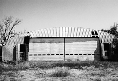
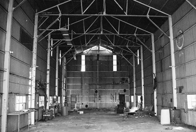
Next to the school is a massive metal, armory-like structure with a caved-in roof. I've heard this was the school gymnasium and also held the agricultural shops. Someone else told me they’d played basketball inside the school, which would indicate the gym was there. Heck, maybe there were gyms in both places. (UPDATE: There were two gyms! I've been told the bigger was the "New Gym," probably built in the mid-to-late 1960's. However, it may not have been used as such for long because the school closed sometime in 1970-1971.) Inside the armory were a couple bedraggled pick-up trucks and the first abandoned semi tractor I’ve ever seen, now crushed under the huge roof.

F. Stanley noted in 1966 that, “Causey had a long, hard road to travel, but it has made the grade and the future looks good.” It is referred to as “one of the business centers of Roosevelt County,” with a population of 234 as early as 1920. Like so many small towns, the future Stanley spoke of appears to have, in the end, been at least as hard as the past.


Information for this post came from the aforementioned The Place Names of New Mexico, as well as F. Stanley’s long out of print “The Causey (New Mexico) Story.” Some biographical information on George Causey can be found at the Texas State Historical Society. Wikipedia will give you demographics. If you get really into George Causey and the Llano, you will want to read Cowboy Life on the Llano Estacado, written by his nephew, V. H. Whitlock aka Ol’ Waddy. Roosevelt County History and Heritage, by Jean M. Burroughs, wife of former NM governor John Burroughs, documents the county, but doesn’t say a whole lot about Causey.

Next time…Pep, NM!


Friday, September 19, 2014

Back from the Dead: The Murray Hotel, Silver City, New Mexico

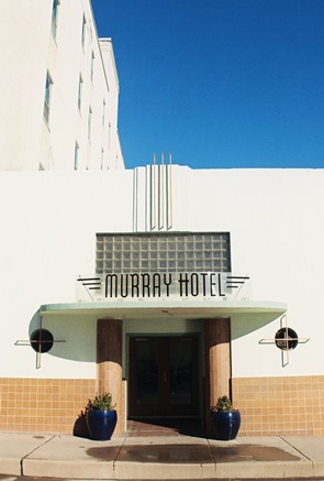
It’s been awhile since we’ve visited an operating historic hotel, but over the last couple years we've seen the Express St. James in Cimarron and the Schaffer Hotel in Mountainair. So, it's fitting that we also take a look at the recently restored Murray Hotel in downtown Silver City, NM. A beautiful Art Deco building, it was constructed on the site of the Broadway Hotel, which was torn down in 1925. Across the street is the Palace Hotel, another lovely place, which opened March 1, 1900 in the former Meredith and Ailman Bank building, built 1882.
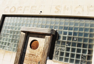
Construction on the Murray Hotel began in 1937 and, with the country still reeling from the Great Depression, it was no trouble to get very skilled craftsmen to build the joint, which was originally designed to have 52 rooms, three retail stores, a restaurant, a coffee shop, a bar, and a luxurious lobby. Steam closets and low shower heads were even installed in the bathrooms so that women would be able to get the wrinkles out of their clothes while cleaning up after a long, hot, bumpy, and rumple-inducing journey.


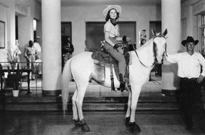
Below is an iconic photo of 16-year-old Martha Ryan, granddaughter of the hotel’s developer and NM state senator W.D. Murray, on her horse in the terrazzo-floored lobby. It was taken to promote a Fourth of July Rodeo in 1938, before the hotel was even finished. Incidentally, W.D.’s grandson, Murray Ryan, was a long-time NM state representative. The Murray officially opened in October ’38 with a grand celebration. Anyone who was anyone in southern New Mexico turned out, including hotel magnate and Paris Hilton antecedent Conrad Hilton.


In 1949, as the American economy boomed post-WWII, another 48 rooms were added to the Murray in a north tower, making an even 100, and a spring-suspended maple-floored ballroom was installed. The parties held in the ballroom remain legendary among local old-timers. The hotel also took on a more explicitly Western vibe and the bar, which had gone by the mining-themed moniker Copper Lounge, became the Branding Room, where ranchers and businessman wheeled and dealed beside a large mural depicting local ranch brands.


For decades the Murray was perhaps the social center in Grant County. However, by the late 1970’s a lot had changed and the hotel was struggling to stay afloat. Area mines had closed, travelers were staying elsewhere and, by the early 1990’s, the once-grand hotel was shuttered and appeared abandoned. Eventually, local residents decided that the iconic building should be saved, but it would change hands several times in the ensuing years before anyone could figure out quite what to do with it.

Finally, in 2005, the Murray was bought by the Albershardt’s, who began a long and expensive restoration. Extensive cleaning was required as the hotel had seen its share of vandals and homeless residents and it was a given that the original Art Deco design elements needed to remain intact. The hotel re-opened for business in spring 2012 and, at this point, I believe as many as 82 rooms have been restored, as well as the ballroom and various banquet and meeting rooms.

My visit to the Murray Hotel occurred last Christmas during a freak (well, this is southern New Mexico) blizzard that earlier had me cut-off from my desired route to Silver City through Hillsboro, Kingston, and the Black Range. The Murray, however, was warm and inviting and sipping complimentary herbal tea in the lobby, which looks just as it did when Martha Ryan parked her horse there, was…well, not exactly a rugged, Western way to spend a holiday evening. But I can’t ever complain when in Silver City, even if snowbound and unable to brave the elements for just the short walk to Billy the Kid’s childhood cabin. The rooms were likewise cozy and still have a vintage feel to them, despite the extensive updates.
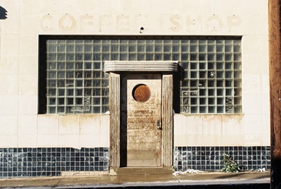
Obviously, I highly recommend a stay at the Murray Hotel, which has been so faithfully restored as to leave one pretty convinced they’ve entered an Art Deco time portal back to the late 1930’s. Now if they would just re-open the Branding Room and maybe book a Duke Ellington gig.

Information for this post came mostly from the Murray Hotel itself. Check out their website and Facebook page for reservations, correspondence, and all that kind of thing. A tour of the hotel can be found on You Tube.


Alright, enough of the shiny and new(-looking). Next time it’ll be back to some abandonment. We’ll travel way across the state and return to the eastern plains near the Texas border to hit some little-known towns that I can barely dig up any information on. So, those of you who have been fervently wishing for less time-consuming posts will be sighing with relief. I’ll be sighing with relief myself, actually.