Monday, October 10, 2022

Take the Flat Way Home: Tollgate Canyon, NM


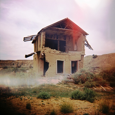
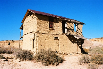
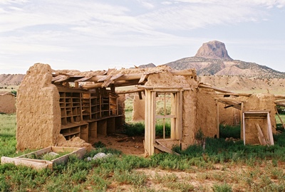
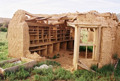
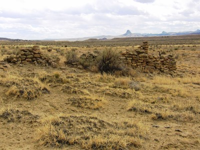
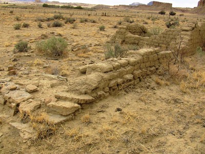
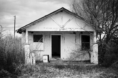
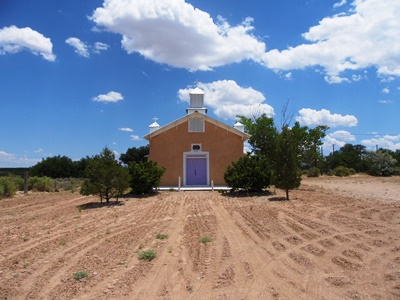
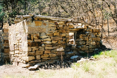
A crumbling stone cabin is now all that welcomes you to Tollgate Canyon.

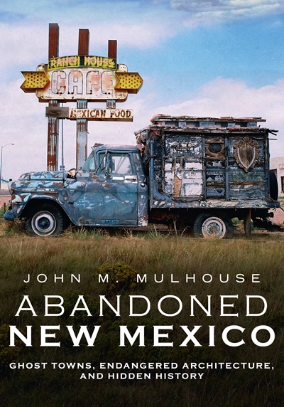
If you’re reading this it means I've managed to successfully upload the first post of new content on City of Dust since January 2018. Wow. It feels like that was a million years ago. Professionally, personally, geographically…globally. Everything is different. Some of that explains my long absence from this blog. However, I hope this marks the return of the long-form (or longish-form, in this case) pieces that I eventually compiled in “Abandoned New Mexico: Ghost Towns, Endangered Architecture, and Hidden History,” the publication of which also pulled me away from the blog. But I ain’t complaining! It’s good to be at least attempting a comeback, and we shall see how things go!

I’ve written a number of times about the Belen Cutoff, the rail line built across east-central New Mexico by the Atchison, Topeka and Santa Fe Railway as a way to avoid the steep grade over Raton Pass. Completed in 1906, the Belen Cutoff provided a much flatter way to get trains through the state and is still being used today. It’s the main reason villages like YESO, TAIBAN, NEGRA, RICARDO, and many others came to exist. Or at least persisted, if only until the trains came to need diesel instead of water in the 1950s.

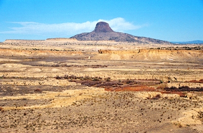
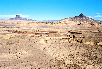
But the railroad wasn’t the first entity that was often unhappy to be going over Raton Pass, with its difficult ascent and dangerously unpredictable weather. In the 1800s, those traveling the Santa Fe Trail between New Mexico Territory and eastern Colorado by horse, mule, wagon, or foot frequently wished for something less arduous, as well; the Mountain Route of the famed trail went right over the Pass. And so it came to be that Tollgate Canyon was established which, unlike the Belen Cutoff, is now largely forgotten and rarely used by anybody other than local travelers.
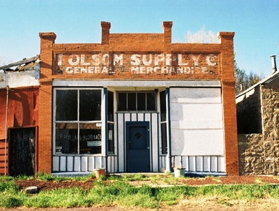


The Folsom Supply Co. building in Folsom, New Mexico.

Somewhere around 1870, Bazil “Baz” Metcalf, after traveling the Santa Fe Trail in an ox-drawn wagon from Missouri several years prior, was hired to work on the Cross L Ranch, then recently established by the Hall Brothers on the Dry Cimarron River. Baz got to thinking that creating a route for wagon freight and travelers along the nearby Santa Fe Trail that avoided Raton Pass would be helpful and possibly quite lucrative. In fact, a short canyon that headed south out of Emory Gap, New Mexico, and into the Dry Cimarron Valley provided a perfect place to build a toll road. Even the military could use this road to move between Fort Union in New Mexico Territory through the new settlement of Granada, Colorado, and into Bent’s Fort.

The road was completed in 1873, and Metcalf installed everything he thought might be useful, which included a store, a saloon, and a chain across the road that stretched between two boulders. If you were traveling by buggy, Metcalf charged 35 cents. A two-horse team ran 40 cents, while a four-horse wagon cost 75. There was a fee for cattle, too, which were sent north to feed the military posts and mining camps. Metcalf’s brother, John, minded the tollgate and watched Baz’s ranch when Baz was trading in the territory.

Native American raids were always a possibility, and in 1874, a year after Baz opened the road, Comanche and Kiowa attackers killed 17 settlers in the Dry Cimarron Valley. The Metcalf brothers survived that incident, and Baz escaped injury during another brush in 1876.
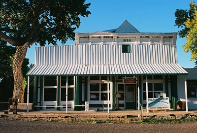


Built in 1896, the Doherty Mercantile now operates as the Folsom Museum, within which treasures await.

For 12 years, from 1873 to 1885, Tollgate Canyon operated as an important conduit for goods and people, largely creating the Fort Union-Granada Road. But in 1885, Metcalf decided to move to the Texas panhandle, where he would fence-in over 30 miles demarcating the northern boundary of the XIT Ranch. He used 5,200+ cedar posts to do it. At over 3,000,000 acres, the XIT would then become the largest fenced ranch in the world. Baz sold his toll road to Mike Devoy, but the clock was ticking on its usefulness, and with the arrival of the Colorado and Southern Railroad in 1888, Tollgate Canyon’s prominence disappeared in the blink of an eye.

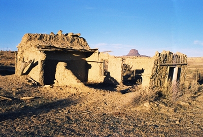
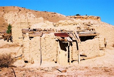
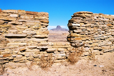
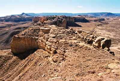
The road that led through Tollgate Canyon is now NM Highway 551, just northeast of Folsom, in northwestern Union County, and the place where Baz collected his tolls is about two miles northwest of the intersection with NM Highway 456. All that indicates the location is a state historical marker and the crumbling stone cabin shown at the top of this post.
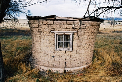


An old chicken coop in Capulin, New Mexico, near Folsom and not far from Tollgate Canyon.

However, you can see the ragged trunk that once held the tolls at the Folsom Museum. In fact, the best online history of Tollgate Canyon--and the one from which I got most of this information--was posted by the Folsom Museum RIGHT HERE. Check it out for more photos, too. You can also see Tollgate Canyon during the museum’s yearly Dry Cimarron River History Tour, which occurs in May and is how I came to visit it myself. For more info on all that, I highly recommend becoming a regular visitor to the Folsom Museum’s WEBSITE.

And there’s the first post in nearly five years! I’ve already got the next one drafted, but I’ll keep quiet as to more specifics so as not to jinx myself. Thanks to everyone that’s supported my endeavors, and I hope ya’ll have been hanging in there as best you can!

Saturday, October 10, 2020

AVAILABLE NOW! Abandoned New Mexico: Ghost Towns, Endangered Architcture, and Hidden History

Alright, following a two-month delay due to Covid-19 and an initial pre-order run to get my process down, I'm very pleased to FINALLY make "Abandoned New Mexico: Ghost Towns, Endangered Architecture, and Hidden History" available to everybody. Yes, that means there is now a City of Dust web store! There you can order a signed copy of the book directly from me, as well as find a book bundle, signed prints, and one-of-a-kind framed photographs. If you're near Albuquerque, Treasure House Books & Gifts in Old Town and Organic Books in Nob Hill have copies. We're working on getting the book into more independent shops throughout the state soon, and Amazon and Barnes & Noble are both shipping it now, as well. I'll happily send copies overseas, but postage is expensive (and the book weighs just over a pound!), so it  might be worth checking Amazon in your country first...if it operates there.

The book clocks in at 40,000+ words and 160 pages, and contains 150 photographs. It's broken into eight sections, which include: 

The Albuquerque Railyards
Central New Mexic
U.S. Highway 6
The Eastern Plains
Route 66
Southwestern New Mexico
The Old New Mexico State Penitentiary
Northeastern New Mexico
 
The initial response has been wonderful and I'm very grateful to everyone that has already bought a copy and/or helped spread the word. There has been a fun Q & A in Albuquerque The Magazine, nice review in New Mexico Magazine, and a lovely spread in the Albuquerque Journal's weekly "Venue" supplement.

All that said, please get in touch if you have any questions or would like to order the book via another means (i.e., Venmo, PayPal, Zelle, cash, check, trade...I take 'em all).
 
Also, as the City of Dust blog has been dormant for the two years I've been working on this book (and moving across state lines a couple times, as well), I really, truly hope to resume posting here shortly. 2020 hasn't been kind to plans of almost any type or description, but fingers crossed!
 
And with that...please stay tuned!

Saturday, February 29, 2020

Abandoned New Mexico: Ghost Towns, Endangered Architecture, and Hidden History


Well, it's been just over two years since the last City of Dust blog post. In that time I've moved from New Mexico to northern Nevada, started a new job, and then started another new job. That's all taken a lot of time, but none of it is really why there hasn't been anything new here since January 8, 2018. What's really demanded my creative attention over the last two years is a book project, now officially titled, "Abandoned New Mexico: Ghost Towns, Endangered Architecture, and Hidden History." Coming in at over 40,000 words and with 150 photos (both color and b&w), this project has not let up since the idea first reared its head in late 2017. But I didn't want to mention the book until I was certain it would actually be published. Jinxing myself and all that.

So, finally, I can say that this thing is indeed coming out. The publication date is June 29, 2020 August 29, 2020 (yup, delayed due to Covid-19) and preorders are already available at BARNES & NOBLE and AMAZON. I will also be selling copies myself when the time comes--signed if you'd like--and maybe with some bundles and other goodies offered.


Anyway, I'll be saying more about all this shortly, but for right now I should mention that the book is titled "Abandoned New Mexico" to align with Fonthill Media's current series on ghost towns and derelict buildings called "Abandoned Union." However, the subtitle is much more accurate as while I include true ghost towns, such as Acme/Frazier and Riley/Santa Rita, there are also populated places, including House and Monticello, and historic structures both owned (Melvin Mills Mansion) and operational (St. James Hotel). In the end, I threw in pretty much everything and the kitchen sink, too.

So with that, please stay tuned and I hope to start posting regularly again here soon. I've certainly got plenty of fresh material on hand. But life demands a lot of attention these days, so we'll still have to take it as it comes for now.

Thanks to everyone for their continued interest in City of Dust over the last...nearly 16 years! Even though I wasn't posting I never stopped getting fantastic comments and wonderful recollections from many, many people. Again, thank you!

Monday, January 08, 2018

Music on the Wind: Guadalupe, New Mexico


Since the previous post was a special one on the Río Puerco Valley featuring the recollections of historian and folklorist Nasario García, it only seems appropriate to stay beside the banks of the Puerco and explore the history of Guadalupe, New Mexico, where Mr. García spent his boyhood. This vast, empty landscape, punctuated by mesas, canyons, and volcanic plugs, is one of my favorite areas in the entire state to explore.

The remains of the village of Guadalupe—also known as Ojo del Padre—are south of San Luis on Country Road 279, which intersects Highway 550 north of San Ysidro. It is remote, requiring a drive of many miles down dirt roads in varying states of maintenance to find it. So much the better then! The village was named for the Virgin of Guadalupe, while the earlier moniker, Ojo del Padre (“spring of the Father”), referred to a nearby water source. Oddly enough, when a post office was opened in 1898 the name used was “Miller,” but no one can remember why. That name lasted until 1905, when the post office became Ojo del Padre.


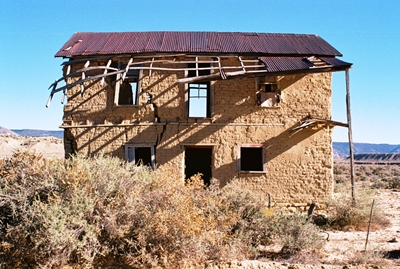
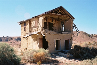
The first thing that one notices upon rounding the corner into Guadalupe, aside from majestic Cabezon Peak looming in the distance, is the wonderful two-story adobe building listing precariously on the side of the road. Built around 1905, this was the home and store of Juan Córdova and it’s often said there was a dance hall behind it. However, Nasario García refers to the lower floor of this ruin as not only a store, but the dancehall itself when the occasion called for it, with Mr. Córdova’s family living upstairs. It’s hard to argue with someone that was there, so perhaps this big adobe, which once had an impressive balcony, served all purposes. However, everyone agrees that the dances at Juan Córdova’s were major events. In the 1920’s, 350 people lived in the immediate area, mostly farming and raising livestock, and these dances, which began at sundown, could go on until four in the morning. Jose Tafoya would play the accordion while his brother Luis handled the guitar.


Yet just a short time later, in the early 1930’s, Guadalupe, like so many parts of the country, was hit by staggering drought. A full half of the cattle died. Then, around 1938, the log-and-brush dam which had captured water from the Río Puerco for local irrigation gave way. The government said rebuilding was too expensive a project for federal assistance and the communities along the Puerco were too impoverished to do it themselves. Then throw in the lasting effects of the Great Depression and the lure of employment in larger cities and Guadalupe didn’t really stand a chance. The school, the post office, and Córdova’s store all closed in 1958 as the last family left.

While a lowered water table and generally challenging landscape have kept people from returning to Guadalupe, you may find a couple folks hanging around. In fact, at least two structures are maintained and lived-in, one being the old schoolhouse. It’s not wise to go roaming around on private property out here, but if you see anyone nearby it’s worth introducing yourself and stating your business. Guadalupe’s few present-day residents are friendly and you’ll usually be given permission to take all the photos you want of the ruins on either side of the road, which include other old adobe homes slowly melting back into the landscape.


And that’s most of what I know about the history of Guadalupe. You can find a chapter on Guadalupe in “Ghost Towns Alive: Trips to New Mexico’s Past,” by Linda Harris and another tidbit or two in "The Place Names of New Mexico" by Robert Julyan. But I would highly recommend October 2017’s City of Dust post, “Nasario García Remembers the Río Puerco,” for some wonderful firsthand accounts. If you want to get deeper into the Río Puerco Valley, Mr. García’s book, ““Hoe, Heaven, and Hell: My Boyhood in Rural New Mexico,” cannot be recommended highly enough.

Speaking of getting deeper into the Río Puerco Valley, that always sounds like a good thing to do and so next time we’ll visit Guadalupe’s movie star neighbor, Cabezón, which sits just below the volcanic plug from which it got its name.

Until then, Happy New(ish) Year!

Sunday, October 08, 2017

Nasario García Remembers the Río Puerco


Over the past few years the Río Puerco Valley has become one of my favorite places in New Mexico. About an hour northwest of Albuquerque, with majestic Cabezon Peak always in sight and miles of the Continental Divide Trail close at hand, here you'll find the villages of San Luis, Cabezón, Guadalupe, and Casa Salazar, some of which are essentially ghost towns. No, there aren’t many people around the Puerco Valley anymore and not a lot of its history has been recorded.

However, one person who has done more than any other to ensure that the Río Puerco Valley is not forgotten is historian and folklorist Nasario García. Raised on the banks of the Puerco, Nasario is the subject of a brand new documentary, “Nasario Remembers the Río Puerco,” and following are four of his stories that do not appear in the film, each recollection inspired by photographs from the area.

I’m very proud to feature these stories here and I want to thank Director and Producer Shebana Coelho for making this happen, as well as Nasario García himself, of course. The broadcast premier of “Nasario Remembers the Río Puerco” will be this Thursday, October 12, 2017, at 7PM on New Mexico PBS/KNME Channel 5. I’ve seen the movie and it’s truly wonderful. I highly recommend it to all. For more information, visit Nasario Remembers.

Now, without further ado, City of Dust presents Nasario García and New Mexico’s Río Puerco Valley:


Sal Lovato General Store. Cabezón, New Mexico.

“This store was owned by the Salomón Lovato family. He is one of the contributors to my book, ‘Recuerdos de los Vijeitos.’ You can see where they had different merchandise: canned goods, dried goods and so forth.

“The kind of merchandise they had in these stores was foodstuff that you could not grow, that you could not raise from the land. Here you came and bought, say, lard, even though that wasn't always the case because there was lard from the matanzas. Baking powder, sugar, salt, and some canned goods started coming into existence, as well as dry cereal such as oatmeal. Also, any number of other things—flour, for example. When corn began to become scarce, people would come in the Lovato Store and buy sacks of flour. Those sacks were very important because once the flour was gone the sacks were used to make blouses for the women, blouses for the young girls. In many cases, a young girl would show up at a dance with a rose on the back of her blouse that came from the flour sack. Nobody really looked at you as being odd. That was the moda—fashionable—among many of the families.

“I imagine the store was especially busy on weekends. Of course, a lot of Navajos came from the reservation on weekends. Probably the high point of trading was during the lambing season through the sheering of sheep, which was in May and June. The selling of cattle—those who had cattle—occurred in late September or in October, perhaps even early November. People would make money selling their cattle, selling their sheep. Naturally, that's when they would come to buy a lot of merchandise. But it didn't matter the time of year because many merchants sold on credit. People would pay their bills, say, once or twice a year, whenever they sold their sheep, their wool, their cattle.”


View from Enchanted Mesa Looking Toward Cabezon Peak and Nasario’s Grandpa’s Corral.

“The Enchanted Mesa was right across the Río Puerco from where we lived. That’s the mesa that my paternal grandmother would tell us never to visit because, if we did, we were likely to be turned into goats. My grandmother referred to it as La Mesa Encantada. Many years later, after I left the valley, archaeologists discovered that it was a Chaco Canyon outlier. Now it’s called the Guadalupe Ruins.

“In the evenings, while we were shucking corn, Grandma Lale—her nickname—would tell us stories with the Enchanted Mesa in sight—stories that had to do with the local culture, the local folklore, such as the white donkey, a rarity among donkeys. As she and my Grandpa Lolo, as we called him, told us, they were coming from the placita at night, perhaps after a dance, when suddenly a white donkey appeared and kept pestering the female horse—la yegua—and my grandmother says, as she's telling the story, ‘Look there, I wonder where it came from.’ My grandpa said, ‘I don't know. I know all the donkeys in the valley and I've never seen a white donkey.’ The donkey kept pestering and pestering. ‘Furthermore,’ says my grandpa, ‘there are no white donkeys around.’ My grandmother says, ‘But I am glad this one's here, because a white donkey means good luck. It doesn't mean evil like a black donkey.’

“She would weave these stories, and, in the meantime, we are on pins and needles wondering what's going to happen next. At the end of the story, my grandmother asked my grandfather, ‘Now, truly, what do you think about this white donkey?’ They said they’d turned their heads and the donkey was gone. They never saw it leave. It was stories like this that she liked to share with us grandchildren. She had many, many others.”


Córdova’s Dancehall. Guadalupe, New Mexico.

“This two-story house was in my village of Guadalupe—Ojo del Padre. The bottom floor was used as a dancehall. This is the only two-story house in the entire Río Puerco Valley that I know of. In fact, today there's probably only a handful left in villages like mine throughout all of New Mexico. This house was built around 1905 by the Juan Córdova family. He was a local merchant. He and his family lived upstairs and downstairs was a store that was periodically turned into a dancehall. There was competition from time to time between this dancehall and the Romero Dancehall. A cousin of mine and I, we were small. I was about seven and my cousin about nine years old. We were supposed to spray water on the dirt floors after every dance because of the dust. Of course, as the men drank more and more and people had more fun, we started bringing in buckets and dousing the floors. By the time the dance was over, these people couldn't move because of all the mud that we had created. My cousin Juan and I had a lot of fun.”


Photo: Shebana Coelho

One-Room Schoolhouse. Guadalupe, New Mexico.

“This was the one-room schoolhouse where I started school. There were about 25 kids from grades one to eight. There were two windows that faced the mesa, but no windows towards the back. That’s where the blackboard was and where the teacher’s desk sat. And towards the middle of the school there was a potbelly stove that the boys had to keep feeding wood into in the winter to keep the room warm. That was our responsibility. The girls had to keep the little barrel of water full. It was wrapped in burlap with a dipper—jumate—hanging from a nail. We all used the same dipper to drink water. We didn’t even wipe it clean the way priests do today when drinking wine from a chalice.

“When I started school here, one teacher taught all the grades and she would line up the boys in one row and the girls in another before entering. There were other times when she would start with the bigger kids. They would walk in first and then the little kids. But most of the time she would line up the younger kids—the first, second and third graders—first, and the older kids were at the back of the room. We had desks that seated two students, usually two boys or two girls.

“The older kids a lot of times would teach the younger how to read, how to do math. So the older kids where helpful. They became teachers. It was very much a communal educational setup. And, believe it or not, we learned. We learned because we learned from one another. Of course, we were supposed to be learning English, but most of us spoke Spanish. When we would read in English we did so with a Spanish accent. We had a book about a dog named Spot. I remember students reading, including myself: “Rrrrrrrrun Espot, rrrrrrrrun.” Because we would pronounce the initial “r” like you would in Spanish and the “s” as in “escribir” —to write. Thus “Rrrrrrun Espot, rrrrrun.”

“And some of the adobes, as you can see, are still here. The school was called, appropriately, “La Mesa School” because of Black Mesa east of the school.”

And so some of the adobes do indeed remain in the Río Puerco Valley, if barely, while many are already gone. Of those shown here, the ruins of the one-room schoolhouse were captured by Shebana Coelho, who was kind enough to allow me to include her shots. Somehow I missed those particular adobe and stone walls myself…for now. Sal Lovato's General Store and Juan Córdova's Dancehall were photographed by me, as were the three views from Enchanted Mesa.

Photo: Shebana Coelho

Sunday, April 02, 2017

Life is Too Short to be Afraid: Ciudad Juárez, Mexico Pt. II


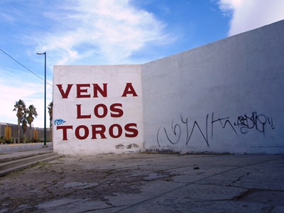
(Ven a los toros - Come to the bulls.)

Blood spills out on the streets
And bodies are missing for weeks
Both sides keeping a close eye
Watching the bullets fly here
On the crystal frontier – Calexico “Crystal Frontier”

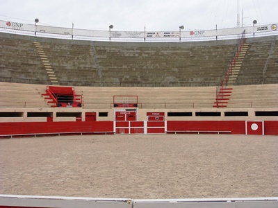
While my first day in Ciudad Juárez started with a stroll through the pocked neighborhoods around the International Bridge, followed by a history lesson on the city and Mexico itself, the second began as countless others in Juárez surely have: with a Bloody Mary. But getting to that Bloody Mary required a walk past the 112-year-old bullring, Plaza de Toros Alberto Balderas, the oldest building in the city. A newer but even more famous bullring, Plaza Monumental, was torn down in 2006 to make way for a Walmart. Is it better for a bull to die in a ring or end up as a frozen patty in a warehouse chain?

I won’t answer that question, but I will mention that during the years of greatest violence in Juárez the Plaza de Toros Alberto Balderas remained shuttered, only opening again in 2012. As we were walking past we noticed a couple workers out front of the Plaza de Toros and my tour guide, Rich Wright, asked if we could poke our heads inside. I can’t deny that crouching under the empty stands to peer across the dirt arena at the bull pen door was evocative, but Ernest Hemingway could probably articulate it better than me.


(Plaza de Toros Alberto Balderas.)

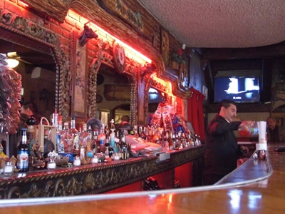
Leaving the bullring, we walked a short distance to an unmarked, entirely non-descript building at the corner of Madero and Dieciseis. Opening the door was like stepping into another world, possibly from 1921, when the El Recreo opened. All carved, dark wood and hushed shade, El Recreo, the second-oldest bar in Juárez, after the previously-described Buen Tiempo, is the kind of place you don’t see much anymore, complete with bartender in suit and bow tie.

While the Bloody Mary was delicious, it’s the sotol that may raise an eyebrow at El Recreo. Currently gaining a reputation as the mysterious cousin of tequila and mescal, sotol is made from the plant of the same name, sometimes known as desert spoon, and comes mostly from the state of Chihuahua. Sotol is not an agave, as is often thought, but a member of the asparagus family. The drink is also hard to find; in a city as big as Juárez you will only encounter it in a couple venues. I believe the brand El Recreo serves is El Oro de Coyame and the taste is rough, with plenty of gravitas, the effect perhaps not unlike inhaling campfire smoke that can numb your tongue.


(El Recreo.)

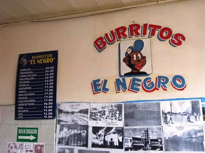
Back out in the glare of midday it was time to put something in our stomachs. Burritos El Negro was recommended by a passerby and turned out to sport a jarring, baseball cap-wearing mascot not far removed from the age of minstrelsy. The restaurant is located in what was once a bustling tourist area, but the tourists stopped coming when the bullets started flying. While the bullets began to slow in 2011, the tourists have not returned. This near-absence of tourism is part of why you can get a massive, phenomenally tasty chile relleno burrito for about a dollar at Burritos El Negro. Follow a Bloody Mary and bit of sotol with two of them and you may regret it.


(Burritos El Negro and its unfortunate mascot.)

As we walked down a crowded street after lunch, the noisy bustling heightened by the crunch of a truck driving into the back of a packed bus, a man brushed past me and, in a stage whisper, trilled, “Gggrrriinnnggooo,” not condescendingly, but apparently amused. I mentioned this to Rich, who told me, “We’re like unicorns down here.” Indeed, in two days in Ciudad Juárez I didn’t see another American that looked much like me, not even one hunting for a cheap dentist or discount pharmaceuticals.

I, however, was a tourist, and as such needed a souvenir. What better than a statue of Santa Muerte, or Our Lady of the Holy Death--who is essentially the grim reaper, sickle and all--from the Mercado Cuahtemoc? Said to currently be attracting more devotees than any other religious figure, Santa Muerte began to gain in popularity as drug violence escalated in Mexico and has found a loyal following among narco-traffickers. Not comfortable praying to the Virgin Mary for your cocaine shipment to arrive safely across the border? Make an offering to Santa Muerte. But Santa Muerte is also for those who feel too dirty and down-and-out to appeal to the usual saints. Or maybe you just want to ask for something that an archangel might frown upon. In fact, the Catholic Church frequently tries to remind people that it considers Santa Muerte blasphemous.
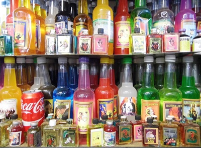
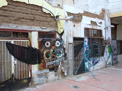
While I wasn't planning to ask much of Santa Muerte, I did want to cover my bases. You can buy statues in various colors depending on what you’re praying for, but I got a tri-colored one. White, gold, and red should, I believe, provide me with health, wealth, and love. Also, while a gringo like me wouldn’t necessarily know that Santa Muerte should come with additional “magic,” Rich luckily did, and made sure I got it. The vendor then proceeded to coat my statue in what appeared to be baby powder before liberally spraying it with something that smelled a little like floral air freshener. The strange, sickly-sweet concoction eventually leaked through two plastic bags and into my backpack, which I found surprisingly disturbing. But I’d been instructed not to release Santa Muerte for 24 hours to ensure the “magic” was properly absorbed, so I didn’t dare transfer Holy Death to a leak-free bag.


(Magic + Coca Cola.)

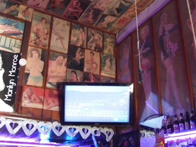
With Santa Muerte in tow we walked through an oddly delightful ramshackle alley devoted to Don Quixote, the walls of the buildings covered in graffiti portraying scenes from the 17th century tragi-comedy. Our last stop was El Club 15, named for the number of people that can fit inside. Like El Recreo, it was dark and cool, sold sotol, and featured a well-dressed bartender. The bartender’s name, Chuy, was constantly being called by patrons wanting to have their drinks freshened. Yet, instead of the ornately carved wood of El Recreo, the entirety of the walls and ceiling of El Club 15 were covered in dozens of vintage pin-up photos, bare-breasted women from forgotten eras smiling coyly from nearly every surface. A television in the corner played Pink Floyd’s Live at Pompeii film. Cognitive dissonance, or was Juárez becoming a little bit of everything?


(Not scenes from Don Quixote.)

You see, Live at Pompeii was the first VHS tape I ever watched on a VCR, and I wondered what the thirteen-year-old me would think if he’d known that decades later there’d be that same shaggy Nick Mason pounding those same massive drums. But this time that boy was watching "Careful With that Axe, Eugene" in a tiny bar in a city that a handful of years earlier had been dubbed the Murder Capital of the World, surrounded by mid-twentieth century porn, pressed in on all sides by friendly locals speaking a language he couldn't understand very well, while sipping a Jack and Coke, now had in honor of the late Lemmy Kilmister. He might be kind of confused as to just what sort of path had led here, but I’m fairly certain he’d think Ciudad Juárez, a city trying hard to rebuild itself after some very dark times, was well worth exploring in 2017.


(El Club 15 and its trio of vices.)

Again, many thanks to Rich Wright, who showed me Juárez as I never could’ve seen it otherwise, even if given many years of roaming the streets on my own. I can’t recommend taking one of his walking tours highly enough. More information on those can be found right HERE.

Sunday, February 26, 2017

Life is Too Short to be Afraid: Ciudad Juárez, Mexico Pt. I


(La vida es muy corta para tener miedo - Life is too short to be afraid.)

Juárez, I had a dream today
The children danced, as the guitars played
And all the violence up and slipped away
Goodnight, Juárez, Goodnight - Tom Russell "Goodnight Juárez"

Tom Russell recorded Goodnight Juárez in the fall of 2010, and by the end of that year 3,111 people would be murdered in a city of about 1.4 million. Ciudad Juárez was already coming to be widely known as the Murder Capital of the World and tourism from the north, for many decades so lively, if admittedly often bacchanalian, had effectively ceased in the few years since cartel activity had begun to spike in 2007.

However, 2010 would represent the bloody peak of brutality and, by 2015, there were just over 300 homicides. While it can’t be said that the violence has up and slipped away--and 2016 did see an uptick in killings--Ciudad Juárez is not the place it was several years ago. Yet most of the world hasn’t heard that, or at least doesn’t believe it, which makes Juárez an utterly fascinating, enchanting, and still, at times, sobering city to visit now.


(Groceries - The Shrapnel.)

This story starts when, while visiting El Paso in 2013, I ran into a man setting the old clock in San Jacinto Plaza. He told me that he’d given walking tours of Juárez for years and was thinking it was finally safe enough to resume them. On a subsequent visit I tried to see if the tours were being offered and, sure enough, there was a webpage touting guided trips to downtown Juárez. “Entertaining! Educational! Fun!” the ad read. And, in the biggest, boldest letters: “SAFE!” That was more than good enough for me. Sadly, it would take another couple years to get myself back again to actually take a tour, but in that time Juárez’s reputation for violence seemed to change almost not at all, even as the death toll continued to decrease.

As it turned out, Rich Wright, who has been running these tours, was not the man I met in the plaza. But he’s been going to Juárez his entire life, including during the years of greatest bloodshed, and, with a mutual acquaintance or two in the Minneapolis music scene of the ‘90’s, I couldn’t have asked for anyone more simpatico. Did I mention my Spanish is hardly serviceable?


(Taqueria el Tropíco.)

We paid our 50 cents to cross the Paso del Norte International Bridge and off we went, stopping to note a spray-painted marker on a train bridge below. This was for Sergio Adrian Hernandez Guereca, a 15-year-old shot there by the U.S. Border Patrol in 2010. A case to decide whether his family can sue is now at the U.S. Supreme Court, and the scrawled “Sergio” was an immediate reminder that battles do continue to rage, even if in 2017 some of the fiercest may be fought in hushed courtrooms and the shadowed halls of government.

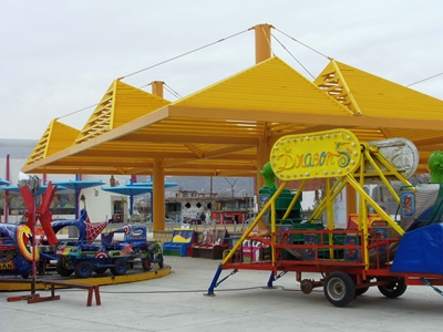
Once in Juárez, our first stop was Ignacio Mariscal Street, long known as the infamous red-light district, La Mariscal. Rich pointed to an open plaza temporarily filled with brightly-colored amusement park equipment and recalled it lined with ancient bars, a scene now hard to imagine. The demolition is part of a widespread government effort to destroy the haunts of the cartels and generally clean things up, a process which has seen many historic babies going out with the druggy bathwater.


(Amusement of a less traditional sort at La Mariscal.)

Stunning murals covered many of the walls surrounding the plaza, but just before noon on a Friday the amusements were quiet and the plaza itself deserted. So we crossed the walkway to a neighborhood that had not yet been subject to razing or revitalization, which pleased me greatly as among the abandoned buildings was the former home of a brothel called White Lake. It was immortalized in Cormac McCarthy’s “Cities of the Plain,” if moved to a somewhat fictionalized location in the city. Nearby a man lay in a crumbling, concrete doorway sleeping, only his feet protruding into the gathering daylight.


(Former location of White Lake brothel.)

The next stop was the Museo de la Revolución en la Frontera, a wonderful museum housed in the grand old customs building. Tracing the turbulent history of Mexico through the early years of the 20th century, it depicts the frequently harrowing tales of men of great and sometimes dubious intent such as Porfirio Díaz, Pancho Villa, Emiliano Zapata, and Pascual Oruzco, many of which were photographed in the very same building that now describes their legacy.


(Museo de la Revolución en la Frontera.)

While much has changed in Juárez, some things have not, and just past noon we found ourselves in Buen Tiempo on Vicente Guerrero, a bar operating continuously since the early 1920’s and thus now the oldest in Juárez, if only barely. With lime-colored walls and No Fumar signs that were hardly being taken as even a remote suggestion, the tequila came in chipped votive candle holders with little crosses on the bottoms and the Indio was cold. People I didn’t know asked me questions I couldn’t always understand and earnestly shook my hand. It all seemed right and proper. From there we headed to Mercado Cuahtemoc and then upstairs for a less liquid lunch. The chips and salsa verde were delicious, as were the chile relleno burritos. At this point, since entering the Buen Tiempo, we probably hadn’t spent 15 Yankee dollars between the two of us.


(El Buen Tiempo, the oldest bar in Juárez.)

The afternoon ended with the obligatory stop at the Kentucky Club, said to be the place where the margarita was invented. Once the haunt of the likes of Marilyn Monroe, John Wayne, and Steve McQueen, the Kentucky Club bills itself as world famous and is sometimes referred to as the oldest bar in Juárez. However, it seems that much that is reportedly true about the Kentucky Club may not be quite so and, in fact, the current building is not the original circa-1920 bar. That one was on Dieciseis, over by the train tracks, and not as close to the border. The margarita was good, no doubt about that, but I was perhaps more impressed by the $2.25 price tag.

After giving away whatever coins we had left to people gathered around the bridge, we paid our four pesos to get back to America with plans to return the following day for a “less-structured” tour, part of a lucrative syndication package City of Dust has worked out with El Chuqueño, Rich Wright’s excellent blog on El Paso, its environs, and desert living in general. Details of that second trip across the border will be coming up next.


(Los perros de Juárez.)

Sunday, December 11, 2016

A Little Piece of Quiet: Lingo, New Mexico


I might as well stop pretending that I’m going to post more regularly and admit that, modern life being what it is, time is always tight, and seemingly ever-increasingly so. However, one way to get new posts written is to take to my sick bed and thus find myself confined to the small space between the bedroom and kitchen table. As such is the case today, let us leave the hustle and bustle of modernity behind once again and step back into the past, this time to visit Lingo, New Mexico.

The little village of Lingo, which can still claim at least one family as residents, is on the eastern edge of New Mexico, just five miles from Texas. It’s a tiny dot on the map at the western extremity of the staggeringly vast Llano Estacado/Staked Plain plateau. As such, it sits among some other places we’ve visited in the region, such as Pep, Causey, House, and Highway.


Jean M. Burrough’s “Roosevelt County History and Heritage” leads off with a handwritten letter about the Bilberry family’s arrival in what was not yet Lingo. They lived in a “two-room shack, dirt floor” and Finis Bilberry farmed and raised sheep. School was first held in 1916, the schoolhouse being a one-room dug-out at a place regrettably named Nigger Hill. Also known as Dead Negro Hill, this was where, in July 1877, a group of African-American soldiers and buffalo hunters abandoned their pursuit of some Comanche who had stolen stock and killed one hunter. Desperate and dying of thirst in the summer heat, the men began to search for water, some going 86 hours without a drink. Five would die in this incident, which was sometimes remembered as the “Staked Plains Horror." Finally, in 2005, the name of the rise was officially changed to Buffalo Soldier Hill.

Speaking of place names, in “The Place Names of New Mexico,” Robert Julyan notes that Lingo was known as Need in 1916, becoming Lingo in 1918. No one knows why it was originally called Need, but in 1918 the postal authorities thought the name too close to Weed, a settlement down south in Otero County. At that point, not only did Need become Lingo, but the post office got moved three miles to the north. I don’t know why the post office also had to move. Anyway, it’s been speculated that Lingo took its name from the way the people spoke (i.e., “the jargon, slang, or argot, of a particular field, group, or individual”), but more probably it references a family, now forgotten.


Now, I often feel like City of Dust is in a race against dusty oblivion as so many of the buildings documented on this blog are disappearing fast, and those in Lingo are no different. But unlike Lucy, NM, where I got there too late to photograph the old school or the Formwalt house, in this case I arrived just in the nick of time. Shown above and at left is the post office, where around 1953 a Mrs. Balko was postmistress. Mrs. Fanny Brown took the position on April 20, 1968, staying until the post office closed in 1984 (possibly on November 2). I visited on December 12, 2015 and on Valentine's Day 2016 the old PO burned to the ground. Apparently someone was driving a pick-up with a BBQ grill in the back and hot coals became airborne. Numerous blazes were started, consuming a total of 1,083 acres in southeastern Roosevelt County, but at least no one was hurt and no other structures were damaged.
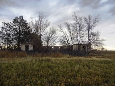
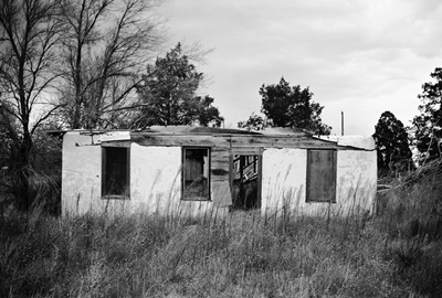
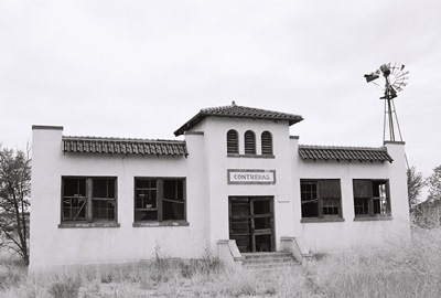
Below is the crumbling Lingo Baptist Church, reportedly also used by other denominations on occasion, possibly after a second church in town closed. The general store is shown at the top of this post. Other buildings included a café, hardware store, basketball gym, and a shop in a Quonset hut, none of which still stand.


Fish fries and dances were held at the high school, which was across the street from the post office. The dances were a big deal as such stuff was not allowed in nearby Causey. However, Causey was where you would go to get your hair styled by the much-loved Lingo resident Edna Ashbrook. Lingo’s last graduating class was in 1945 and numbered five: Meryl Terry, Pete Rogers, Billy Joe Cunningham, Otis Foster, and Gene Collins. You can still find the blacksmith shop, but it’s fallen into a jumbled heap. Things are certainly much quieter than when Lingo could boast of the Hair twins--Judson and Jettie--and the Henry triplets--Anna, Bunna, and Lanna--although, you know, sometimes quiet can be nice.

Now I must return to my Theraflu.


The only published sources of information on Lingo that I could find were Burrough’s “Roosevelt County History and Heritage” and Julyan’s “The Place Names of New Mexico.” Wikipedia has a long entry on the “Buffalo Soldier tragedy of 1877.” Everything else for this post came from the many good people that left their recollections of growing up and living in Lingo on a series of photographs on the City of Dust Facebook page. Those photos and the accompanying comments can be found HERE, HERE, HERE, and HERE.

Sunday, July 31, 2016

Empty Desks: Contreras, New Mexico


In Socorro County, New Mexico, tucked off a side road that parallels I-25, not far from a muddy stretch of the Rio Grande, is the little village of Contreras. This was where a man named Matías Contreras once raised cattle and sheep and gave his name to a small community. A post office opened in 1919 but closed in 1935.

Not far south of Contreras is La Joya, the literal end of the road, and, in fact, a map from 1918 has Contreras as Los Ranchos de la Joya. La Joya’s recorded history post-European contact goes back much farther, to 1598, when Juan de Oñate's expedition found a Piro Indian pueblo there and called it Nueva Sevilleta because the setting reminded the Spanish explorers of Seville, Spain.


To me, the most striking building in Contreras is the old, long-empty school, naturally. I don’t know much about it, but I do know that students were attending classes there in the 1930’s. So perhaps it's one of the many Works Progress Administration (WPA) structures built in the area around the time of the Great Depression. Nearby Alamillo has a WPA school that became (and might still be) a residence, although it looks quite different.

There used to be a plaque to the right of the front doors (see top photo), which I somehow managed to miss. Later I was told it commemorated some local folks involved with the school, but before I could get back to look more closely it had been removed. I don’t think it was stolen though; probably it was taken off because the building is in such poor condition. Maybe whoever has it will read this and tell us what it says! I should mention that I photographed the school a few years ago and not only is it in worse shape now, it's also been fenced-off.


Otherwise, the San Jose Catholic Church, part of Our Lady of Sorrows Parish, is well-maintained and hosts a fiesta in March. There are no going commercial or civic concerns, but there are some well-kept homes and, if you visit whilst under the vengeful eye of the relentless afternoon sun on a parched, triple-digit day, plenty of dust. Of course, as this is the blog for connoisseurs of dust, everything is as it should be with this trip to Contreras, New Mexico.


There’s not a lot out there on Contreras, so pretty much all the historical information for this post came from Robert Julyan’s trusty “The Place Names of New Mexico.”

I have a backlog of so many small towns and villages in New Mexico that I may well never get to them all at this rate. But I can keep trying! Next time I’ll just reach my hand into the hat and see what I pull out.

Tuesday, May 31, 2016

The Ruins by the Rails: Ricardo, New Mexico


MARCH 2023 UPDATE: I am beyond thrilled to be able to make available here one of only two known firsthand descriptions of life in Ricardo, New Mexico. This account, spanning from 1908-1916, is contained within Zorene Thompson's wonderful memoir, "OUR LITTLE HOUSE ON THE PRAIRIE." In addition, there's an ADDENDUM TO CHAPTER 5, which goes deeper into the story of Della Carley, who shot two people at the Ricardo post office in 1912. To download the PDF's, just right-click on the file names above and do the ol' "Save Link As..." trick. A big City of Dust thank you is due to Zorene Thompson's son, Ray Mack Thompson, for assembling his mother's rare story and making it available to all, a true labor of love! Thanks also to Jacalyn Carley, the granddaughter of Della Carley, for generously providing a chapter from her own family's history in Ricardo!

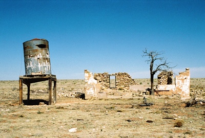
Ricardo, New Mexico, is yet another of the many towns that came to life seemingly overnight as the Atchison, Topeka & Santa Fe Railroad (AT&SF RR) built the Belen Cut-off through the east-central part of the state. Located in De Baca County, a few miles south of Highway 60, the recorded history of Ricardo appears to be scant at best. The village’s name is thought to have been that of a railroad official, and Ricardo, right along the tracks, was an AT&SF RR section house and water station.


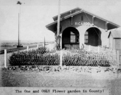
Sadly, on the night of May 6, 1908, a massive fire started in the large Grosh and Strayhorn store, spreading to the Ricardo Hotel, the barbershop, and most of the town. The Santa Fe New Mexican said that Ricardo was "reduced to ashes." However, rebuilding commenced, and the post office opened the same year, doing business until 1956, after which point the mail went to Fort Sumner. There was also a schoolhouse, which I’ve been told was comparable in size to the First Presbyterian Church of Taiban. In the late-1950s, the school was purchased and hauled away so the lumber could be reused. A vintage photo of the train depot would seem to indicate that Ricardo at one point had "the one and ONLY flower garden" in De Baca County.

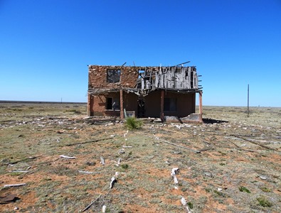
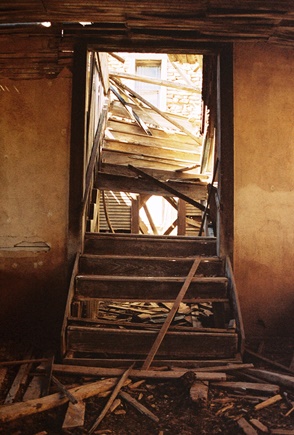
While virtually none of Ricardo is as it was (the post office became part of a ranch home; a general store collapsed), one gem does persist—at least for now—and that is a wonderful and spacious two-story rock and plaster structure, which may have been contructed in 1908 as a tuberculosis sanatorium that never held any patients. In the late 1920s, it's said that locomotive firemen who provided assistance shoveling coal to get freight trains up the long hill to Vaughn were briefly stationed here. It was headquarters to the adjacent ranch, as well. A later renovation for a family home was found to be impossible and now it is quite near collapse. However, having become the lone sentinel over this small part of the eastern plains, much of its old charm and majesty somehow remains. It’s not hard to imagine a family tending the stone walkway, or perhaps lounging on the porch of a fine spring morning, the wildflowers blooming way-off into the distance. If you’re quiet, beneath the prairie wind you can almost hear boots slowly climbing the shattered wooden stairs.
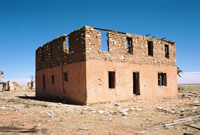


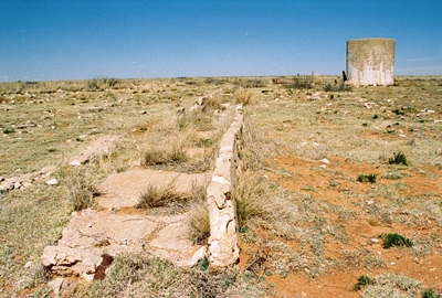
You don’t have to be quiet to hear cows though, a couple dozen of which may be quite excited to see you until they learn you have no food. Then they just seem vaguely hostile. I assume the concrete structure below was once used to water such cattle, but I’m not certain. Perhaps someone can provide some insight.

I should also mention that not only is Ricardo remote, it's on private ranchland. At one time I thought it might've been owned by the railroad, but that's not the case. So unless you have an invitation and a way with cows, it is best not to just show up on the porch of the last house in Ricardo.


And that's all I know about the ghost town of Ricardo. I would love to hear more from anyone that might have something to tell, so please leave a comment if you do. For now, “The Place Names of New Mexico” has the most to say, and I picked up a bit more info from some knowledgeable viewers of the City of Dust Facebook page. The short news piece, "Fire Wipes Out Ricardo," was published by the Sante Fe New Mexican on May 8, 1908. I got the vintage photo from NM ghost town photographer Beata Certo, but no one knows the original source. Anyway, thanks, folks!

Next time I believe we’ll visit Contreras, down in Socorro County.